You may also like

2022
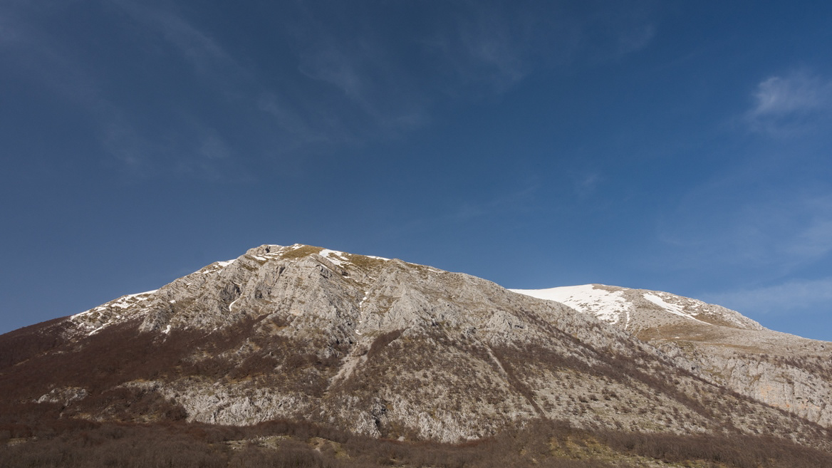
Abruzzo, Italy. Spectacular landscapes
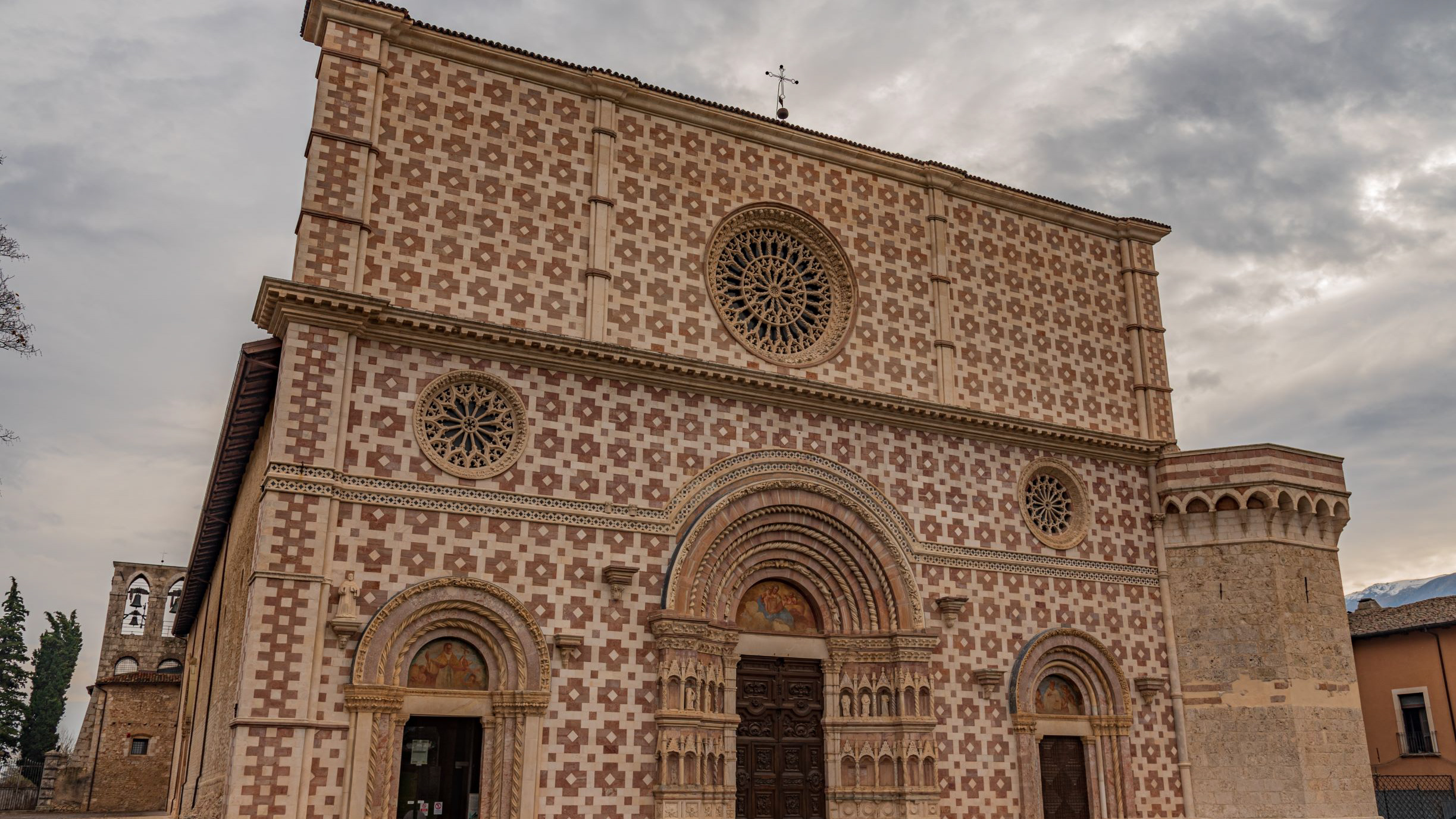
Abruzzo is an Italian region located east of Rome, between the Adriatic and the Apennines. The hinterland is mostly made up of national parks and nature reserves. The region also includes medieval and Renaissance villages perched on the hills. The regional capital, L'Aquila, is a city surrounded by walls, damaged by the earthquake of 2009. The Costa dei Trabocchi, with its sandy coves, takes its name from the traditional fishing jetties.
2023
Fara San Martino. The Gorges of San Martino
the Gole di San Martino opens with a narrow passage from the high rocky walls on the eastern slope of the Maiella, just outside the town of Fara. This is the beginning of the gorge-like valley that leads to the highest peak of the Maiella, Monte Amaro (2793 m), and includes the wildest territories of the entire massif with a 14 km long route and a difference in height of 2300 m . It can be divided into three parts: the Valle di S. Spirito, the Valle di Macchia Lunga and the Val Cannella. The latter ends with a glacial cirque in the center of which is the Manzini refuge. According to popular tradition, these suggestive gorges, just 2 m wide and about 30 m long, were opened by San Martino with the strength of his arms to allow the people of Fares to access the high pastures of the Majella more quickly. After walking a few meters, you can see the monastery of San Martino in Valle which an archaeological excavation has recently brought to light. In reality, this remarkable scenario was produced by the erosive and incessant action of the torrential waters coming from the melting of the surrounding snowfields during the Quaternary, in particular during the glaciations. With an evident franapoggio stratification that highlights the oldest terms as you go up, the oldest rocks of the Maiella emerge here, represented by beige-hazelnut platform limestones dating back to the lower Cretaceous. They contain fossil remains of algae and benthic foraminifera. Near the monastery, it is possible to observe an outcrop full of rudists, lamellibranchs who build cliffs now extinct but clearly visible in Maiella on Cima Murelle.
2018
Rocca Calascio (AQ)
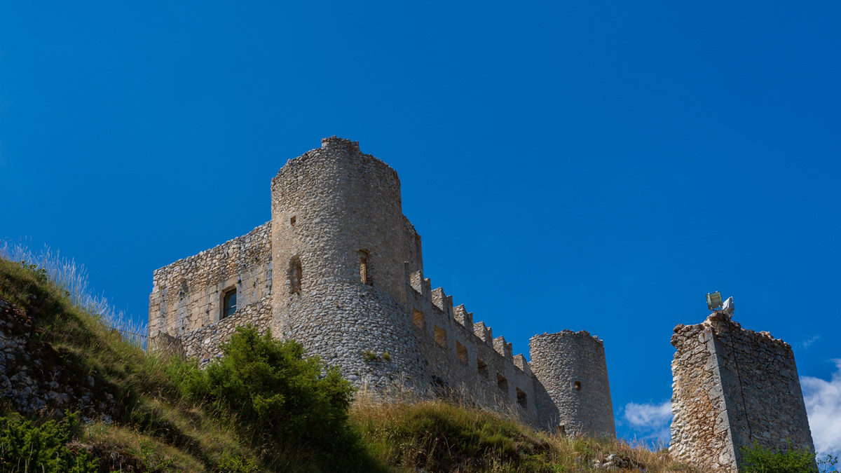
Rocca Calascio is a fortress located in Abruzzo, in the province of L'Aquila, in the territory of the municipality of Calascio, at an altitude of 1450 meters above sea level, just above the town. It is included in the Gran Sasso and Monti della Laga National Park. It is known for the presence of the castle, one of the highest in Italy, and the ancient medieval village below, still inhabited by some inhabitants. The Rocca is considered one of the symbols of Abruzzo. The foundation of the fortress is probably due to the will of King Ruggero d'Altavilla after the Norman conquest of 1140 with a prevalent sighting function, even if the first historical document attesting its presence is dated 1239. It was part of Calascio, Castelvecchio Calvisio, Carapelle Calvisio and Santo Stefano di Sessanio of the famous Barony of Carapelle, whose historical events he followed until 1806, the year of the abolition of feudality. Over the centuries, the Pagliara, Plessis, Colonna, Celano, Caldora, Accrocciamuro, Todeschini Piccolomini, Del Pezzo, Cattaneo, Medici and Bourbon families followed one another in the domain. In particular, in 1463 it was granted by King Ferdinand to Antonio Todeschini of the Piccolomini family who modified the fortification by equipping it with a pebble wall and four cylindrical towers for military use, with a Ghibelline battlements. In 1703 it was devastated by a violent earthquake following which the highest area of ​​the village was abandoned and a large part of the population moved to the nearby town of Calascio. In the twentieth century, even the last remaining families left the village and the fortress remained uninhabited. At the end of the century, however, also in the wake of the success deriving from the setting of some films (above all Lady Hawke of 1985 and The Name of the Rose of 1986), some houses were recovered and others were converted to accommodation facilities; Furthermore, the castle has undergone an important restoration and consolidation operation and is now one of the main tourist attractions in the area, thanks to the work of two spouses and their family who have opened a widespread hotel just below the castle.
2023
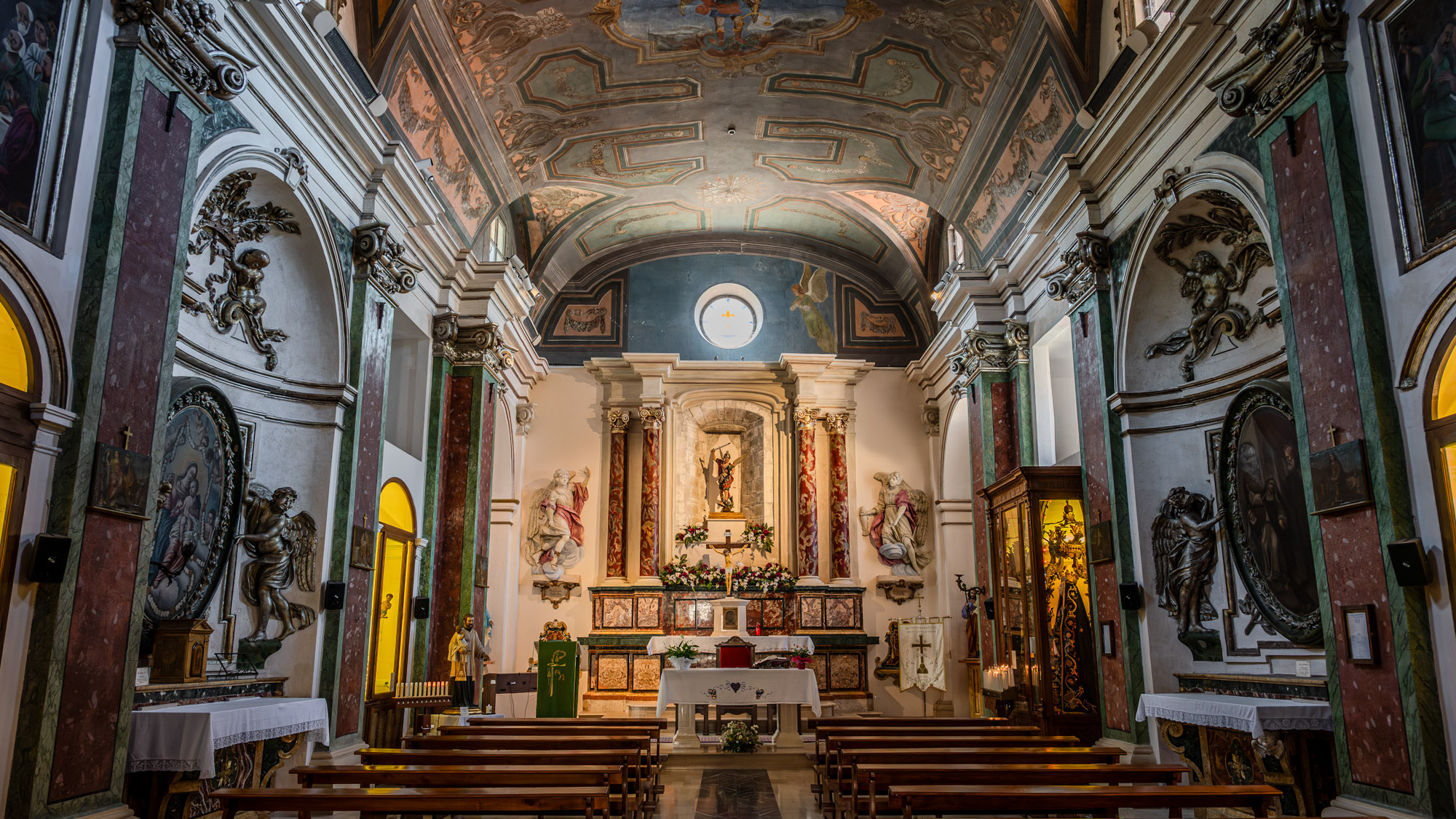
Scanno. The Church of San Rocco
The Church of San Rocco, known as the Madonna del Carmine is located in Scanno. It is also called the Madonna del Carmine, because since 1784 it has been the seat of a confraternity of the same name
2023
Pescara. Church of the Sacred Heart
It was built in 1886 in neo-Romanesque style. It has a main façade characterized by brick cladding. The interior has three naves, in neo-Romanesque style.
2021
La Camosciara Nature Reserve.
La Camosciara is an extensive nature reserve with trails for experienced hikers and beginners, suggestive views and wildlife. It is an integral part of the Abruzzo, Lazio and Molise National Park
2017
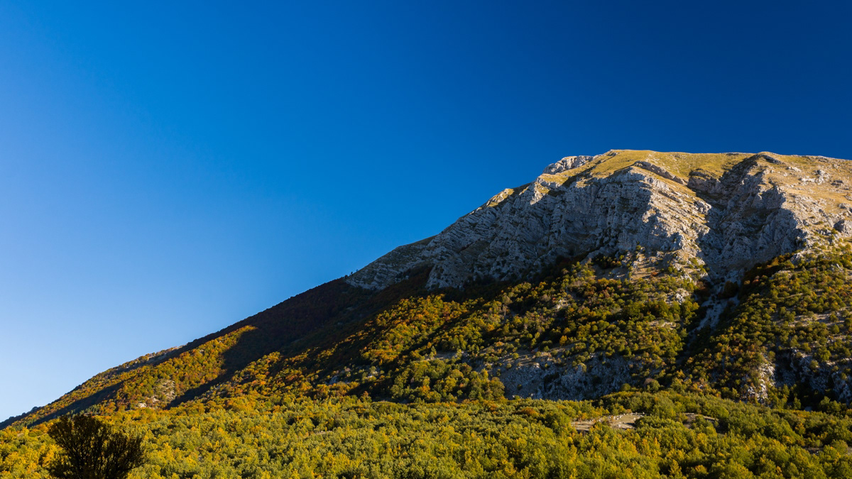
Mainarde
Mountain range which, compared to the Abruzzo National Park, extends from north to south and whose crests delimit the border between Lazio (west) and Molise (east). Due to its importance both from a naturalistic and faunistic point of view, the mountain range was inserted by presidential decree in the Abruzzo National Park in January 1990. It includes high altitude peaks that are around 2000 meters: Monte Meta (2241), Monte Metuccia, Coste dell'Altare, Monte Mare (2020), Monte Cavallo (2039), Monte Forcellone (2030). The Mainarde, like the rest of the Apennine mountains, are very ancient and of limestone origin. On them the erosion of winds and waters has left clear traces in gorges, gullies and beautiful potholes of the giants, the latter very clearly visible by anyone who looks out from the viewpoint of San Michele. Covered by dense arboreal vegetation (beech groves) up to an altitude of 1800-1900 meters, the Mainarde - beyond this altitude - offer a spectacular turf, ideal habitat for particular types of endangered fauna such as the Abruzzo chamois the Marsican brown bear, the Apennine wolf and the lynx.
2017
Opi (AQ)
Opi (Opjë IPA: [ˈopjə], in Opian dialect) is a town of about 408 inhabitants in the province of L'Aquila in Abruzzo. Its medieval village is included in the protected area of ​​the national park of Abruzzo, Lazio and Molise. It is one of the most beautiful villages in Italy. The town is located in the middle of the mountainous group of the Marsicani Mountains, in the center of a mountainous amphitheater formed to the north-east by Monte Marsicano (2,245 m asl) and to the south-east by Monte Amaro (1,862 m) and Monte Petroso (2,249 m asl) . The main watercourse that crosses the municipal territory is the Sangro river that rises on the slopes of Mount Morrone del Diavolo (1,602 m a.s.l.), in the locality of Gioia Vecchio di Gioia dei Marsi. The Sangro, after crossing a flat area called Le Prata, enters a gorge between the Opi hill (1,250 m a.s.l.) and Monte Marrone (1,354 m a.s.l.) from where it continues its path along the upper Sangro valley. The Fondillo stream, one of the first tributaries of the Sangro river, which gives its name to the valley of the same name, arises from one of the numerous karst springs present in the Opiano territory. The rugged nature of the wooded mountains has allowed the survival of a rich and varied fauna.
2016
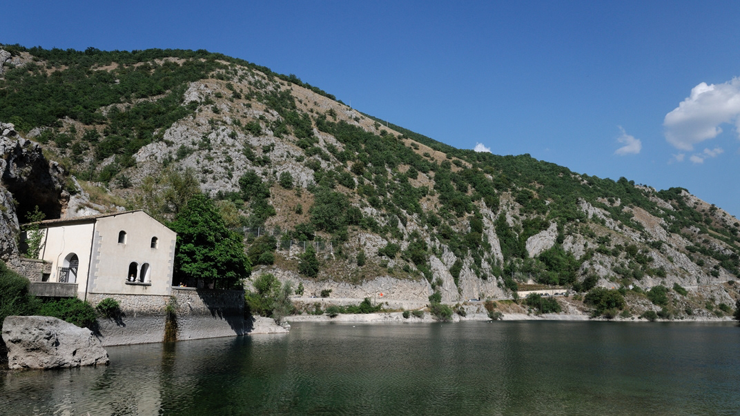
Villalago (AQ) - Hermitage of S. Domenico
The hermitage of San Domenico is a small church, located in the territory of the municipality of Villalago (AQ), in the Sagittario valley, on the shore of the homonymous Lake of San Domenico. It includes a cave dug into the limestone, in which according to tradition, around the year 1000 the Benedictine monk San Domenico lived. San Domenico came from Sora, and was housed in the Benedictine monastery of San Pietro de Lacu, which has now disappeared; later he also went to nearby Cocullo, where he healed a girl bitten by a snake. At the road he also tamed a wolf, who had kidnapped an infant from the cradle, while his parents were chopping wood in the woods. And the miracle will be reproduced on votive canvases on the porch of the hermitage. The actual hermitage was built around the fifteenth century, when the cult of St. Dominic spread. Before the construction of the dam and the consequent formation of the lake, in 1929, the hermitage had a different exterior, with a mullioned portico and a recessed facade with a large window, and was accessible from a medieval bridge in a serious state of conservation. With the dam, the new stone bridge was built in a fake medieval style and the facade of the hermitage was rebuilt.
2018
Barrea and its lake (AQ)
Barrea is located in a mountainous area overlooking the Sangro Valley and the Barrea Lake. The inhabited center, located at an altitude of 1,060 m a.s.l., occupies a ledge at the eastern end of the lake enclosed by the steep sides of the Meta mountains to the south and Mount Greco to the north. Its territory is included in the national park of Abruzzo, Lazio and Molise. The lake was formed in 1951 by the damming of the Sangro river and is used for the production of electricity. The Wetland of Lake Barrea, managed by the Abruzzo, Lazio and Molise National Park Authority, has been on the list of areas provided for by the Ramsar Convention since 1976.
Back to Top