Molise, Italy. Landscape on a late summer afternoon
2022
Molise is an Italian mountainous region with a stretch of coast overlooking the Adriatic Sea. It includes a part of the Abruzzo National Park in the Apennine mountain range, with a rich wildlife.
You may also like
2024
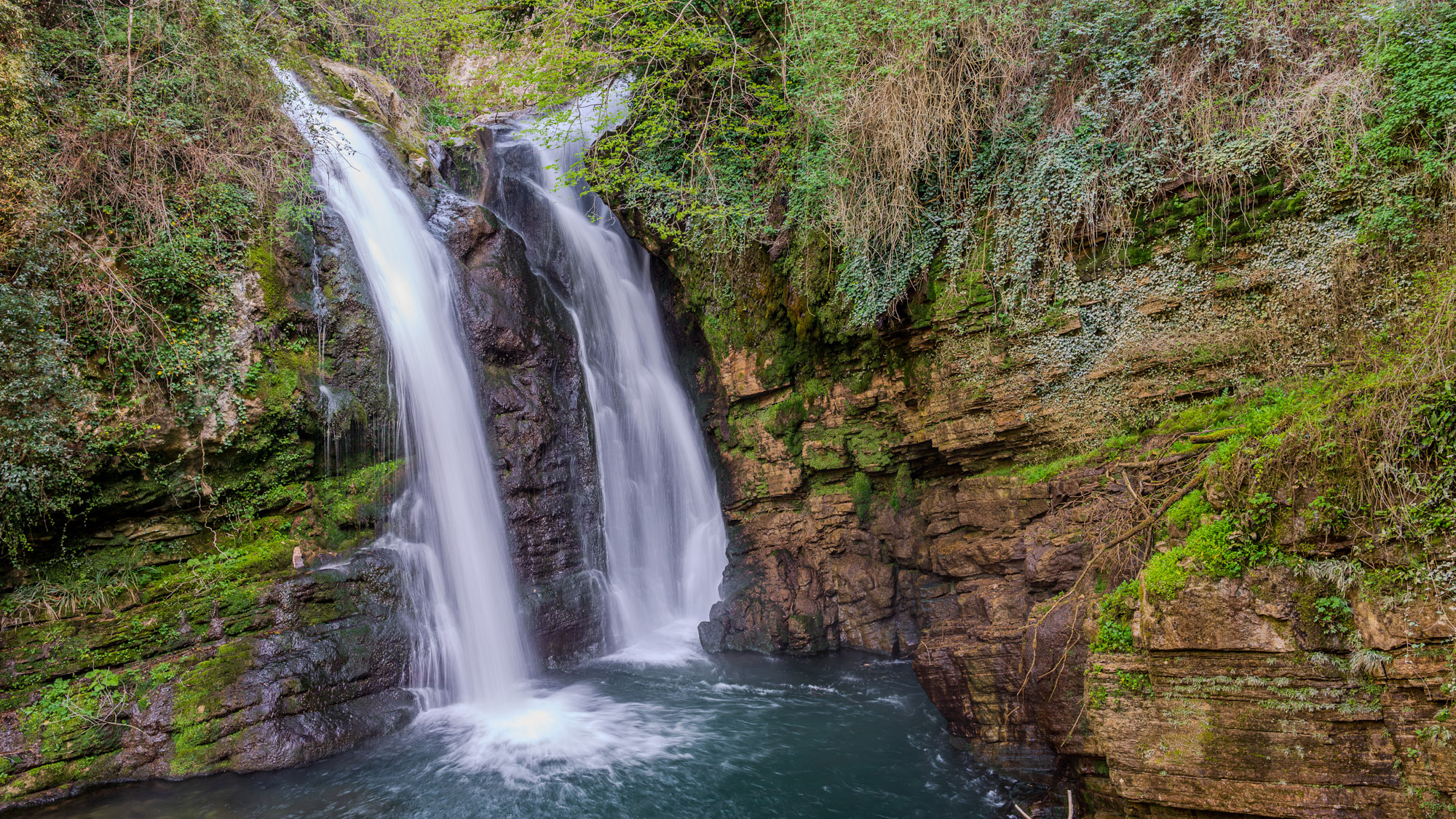
Carpinone. The waterfalls. Spring 2024
In the heart of a very small village in Molise, immersed in an enchanted forest and floral nature, stands the Carpinone waterfall, one of the most fascinating natural spectacles of the place. The rush of foaming water, which rushes downwards, pervades you as soon as you take the path and when you finally reach it you have a fantastic visual effect of light and roar. The Carpinone waterfall is becoming one of the major natural attractions of Molise, thanks also to a group of volunteers who, for some years, have been taking care of its appearance to make it accessible to everyone and not just to the few enthusiasts or those who despise the danger... She's too beautiful to leave there alone! It was born as a gift from nature and can be reached by following various paths, all immersed in the bright greenery of Molise and all marked with hand-made wooden signs, so as not to affect the suggestive panorama. As you walk, you feel a very pleasant emotion thanks to the direct contact with nature, the breathing of healthy, clean air and the sight of wonderful floral species that make everything fairytale-like.
2022
Rocchetta al Volturno
Rocchetta a Volturno is an Italian town of 1 098 inhabitants in the province of Isernia in Molise. The Municipality of Rocchetta al Volturno is made up of two nuclei: the original village, called Rocchetta Alta, or Rocchetta Vecchia, still perched in a defensive position on the mountain, and Rocchetta Nuova, which is located at a lower altitude. The new Rocchetta was born because, at the end of the 19th century, the slope that connected the southern part of the ancient town with the opposite hill was deforested and the land began to show serious subsidence from 1890 due to the progressive sliding of the superimposed layers of clay and sandstone, increased by water infiltrations, both rain and spring. In 1905, following further disastrous events, the population moved for the most part downstream, where there was a hamlet called Case Sparse. The modern town is developed today in the center of a plateau, bordered to the west by the terminal part of the Mainarde chain and to the east by a depression, at the bottom of which the Volturno flows; about two kilometers away are the sources of the river. Its name characterizes the toponyms of other nearby municipalities such as Colli a Volturno and Cerro al Volturno.
2015
Miscellanea
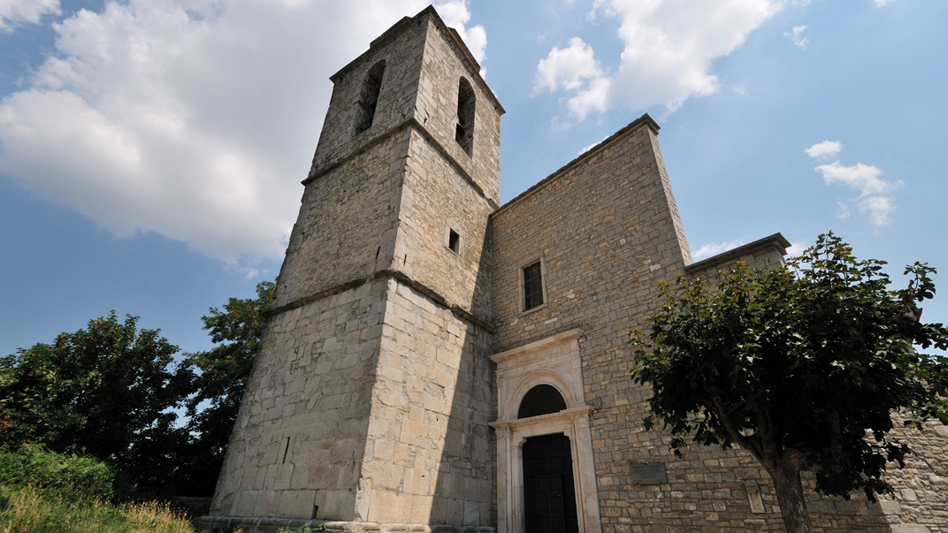
Agnone (Agnèune in dialetto locale) è un comune italiano di 4 957 abitanti della provincia di Isernia in Molise. Fino al 1811, per circa 600 anni, Agnone e il suo circondario sono sempre stati parte integrante del Giustizierato d'Abruzzo e dell'Abruzzo Citra, nel distretto di Lanciano. Antica città sannita, è sede del più antico stabilimento al mondo per la fabbricazione delle campane (Pontificia fonderia di campane Marinelli), fondato intorno all'anno 1000 e tra i pochi che possano fregiarsi dell'onore di utilizzare per i propri prodotti lo stemma pontificio. Agnone è una cittadina di circa 5000 abitanti ubicata nell'Alto Molise. Si trova a 830 m di altitudine sul livello del mare, circondato da un paesaggio montuoso rivestito da boschi e praterie.
2018
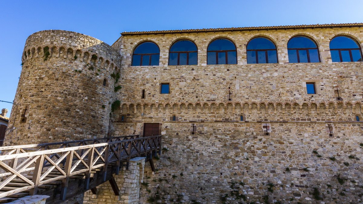
Civitacampomarano (CB), il Castello Angioino
Il castello è il principale monumento della città. Si erge nella parte centrale del paese su un crinale di arenaria, fra i torrenti Mordale, che attraversa la Cavatella, e il Vallone Grande, uno degli affluenti del fiume Biferno. Si sostituì ad una più antica torre di avvistamento, databile probabilmente intorno alla seconda metà del XII secolo e di cui si può ancora vedere il perimetro, messo in evidenza durante gli imponenti lavori di restauro della fine del secolo scorso. L'impianto così come lo vediamo oggi, invece, secondo gli studiosi dovrebbe risalire al XIII secolo, presentando l'edificio degli elementi architettonici tipici dell'epoca, sotto la dominazione angioina. Originariamente di fronte ad esso era posta la chiesa madre, crollata nel 1903 a seguito di uno sfaldamento del costone sul quale si ergeva. Di essa ora resta visibile solo il basamento, mentre il campanile è intatto e funzionante ed è provvisto anche di un orologio i cui rintocchi risuonano ogni quarto d'ora.
2024
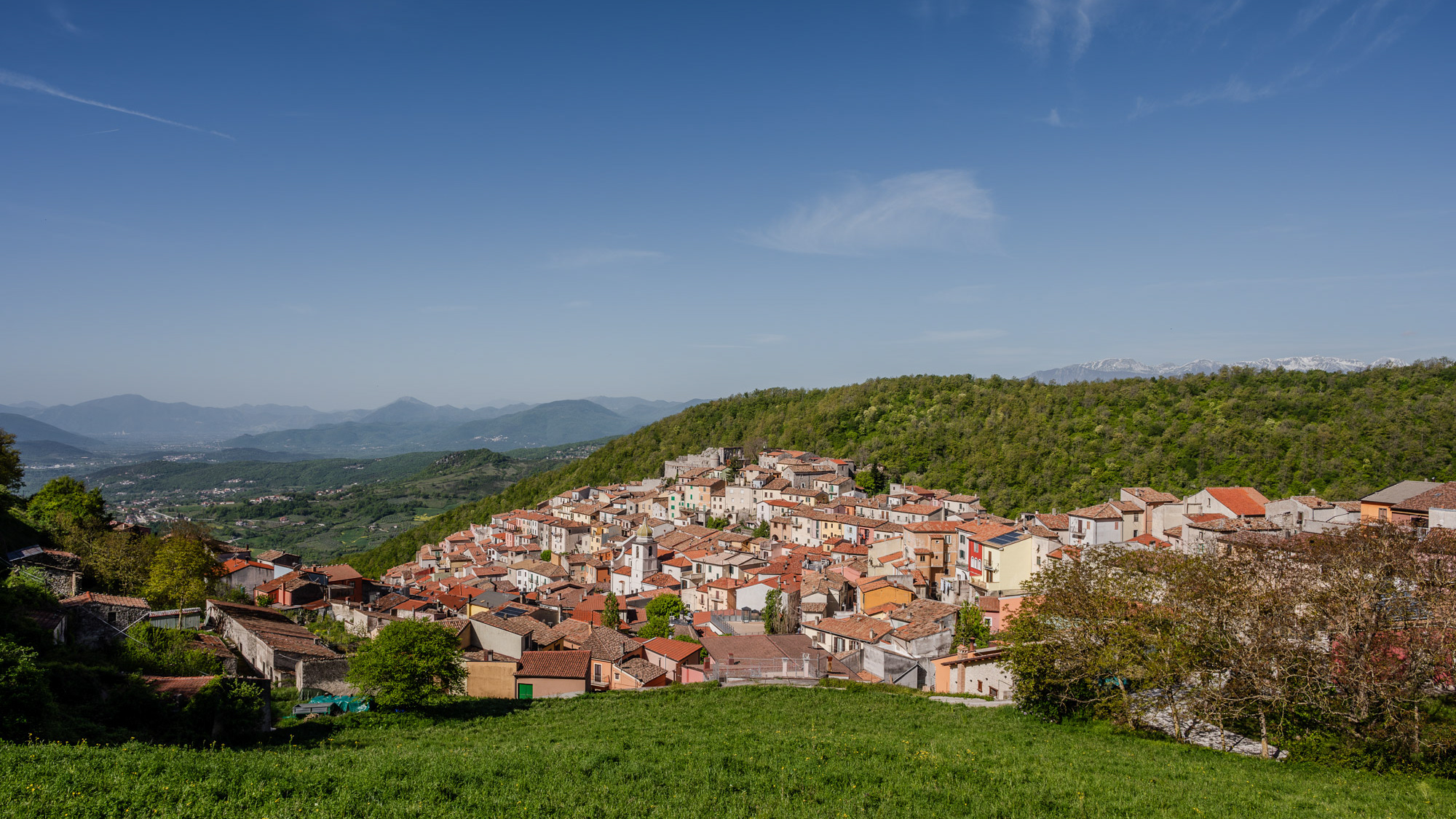
Miranda 2024
Miranda is an Italian municipality of 952 inhabitants in the province of Isernia in Molise. A first settlement of the current municipality probably dates back to the 11th century, as evidenced by the Norman facies of the castle that stands on the previous promontory, of which however few survive architectural elements. The original nucleus of the town is structured around it, interspersed with various walls that identify the subsequent residential layers built starting from the primary fortress. The scant documentation relating to the Miranda fiefdom testifies to a frequent transfer of ownership between various noble families, including the Di Somma Neapolitans, whose family coat of arms consisting of two towers standing on the seabed is still the official symbol of the municipality today.
2023
Vastogirardi, novembre 2023
Physical geography
It is located at 1200 m above sea level. in the part of Molise bordering Abruzzo. The territory of Vastogirardi (IS) extends over an area of 60.72 km² and borders the municipalities of Capracotta to the north, San Pietro Avellana, Castel di Sangro (AQ) and Rionero Sannitico to the west, Forlì del Sannio, Roccasicura and Carovilli to the south, Agnone to the east. From a morphological point of view, the territory is separated from that of Capracotta by reliefs of Monte Capraro, which oscillate between 1300 - 1350 m, which descend steeply to Piano S. Angelo and Difesa Grande and Capo di Trigno (ancient lake basin ) at an altitude of 1100 m from which the Trigno river originates, one of the two most important Molise rivers which flows into the Adriatic Sea and gives its name to the road of the same name which reaches up to San Salvo (CH), i.e. the Trignina. To the west are the mountains of Montagnola (1292 m) and Monte Miglio (1350 m), to the south is Monte Pizzi (1373 m), while to the east are the mountains of Montagna Fiorita with Montarone (1278 m). Vastogirardi develops close to a hill at the top of which are the castle and the ecclesiastical complex of San Nicola di Bari. Inside the walls is the village, which appears well preserved in its original defense function, as evidenced by the cylindrical towers incorporated in factories and the supports between building blocks. The result of subsequent expansions, the churches of S. Rocco and S. Maria delle Grazie were built at the beginning of the 18th century and incorporated into the third urban expansion dating back to the 18th - 19th century. Over the course of the last century the town no longer followed the aggregation trend of stepped bands, according to the morphological trend of the site, but developed along via Garibaldi c.da Difensa (towards Castel di Sangro) and via Re d'Italia (direction Isernia).
Origins of the name
It is assumed that the name Vastogirardi originates from the name of a crusader captain, Giusto Girardi. In the past it also took the name of Castrum Girardi due to the castle (other attested toponyms are Castel Girardo, Rocca Girardo, Guasti Belardi, Guardia Giraldo and Guardia Gerardo) and subsequently its current name, deriving from an alliteration of Lombard jargon.
2022
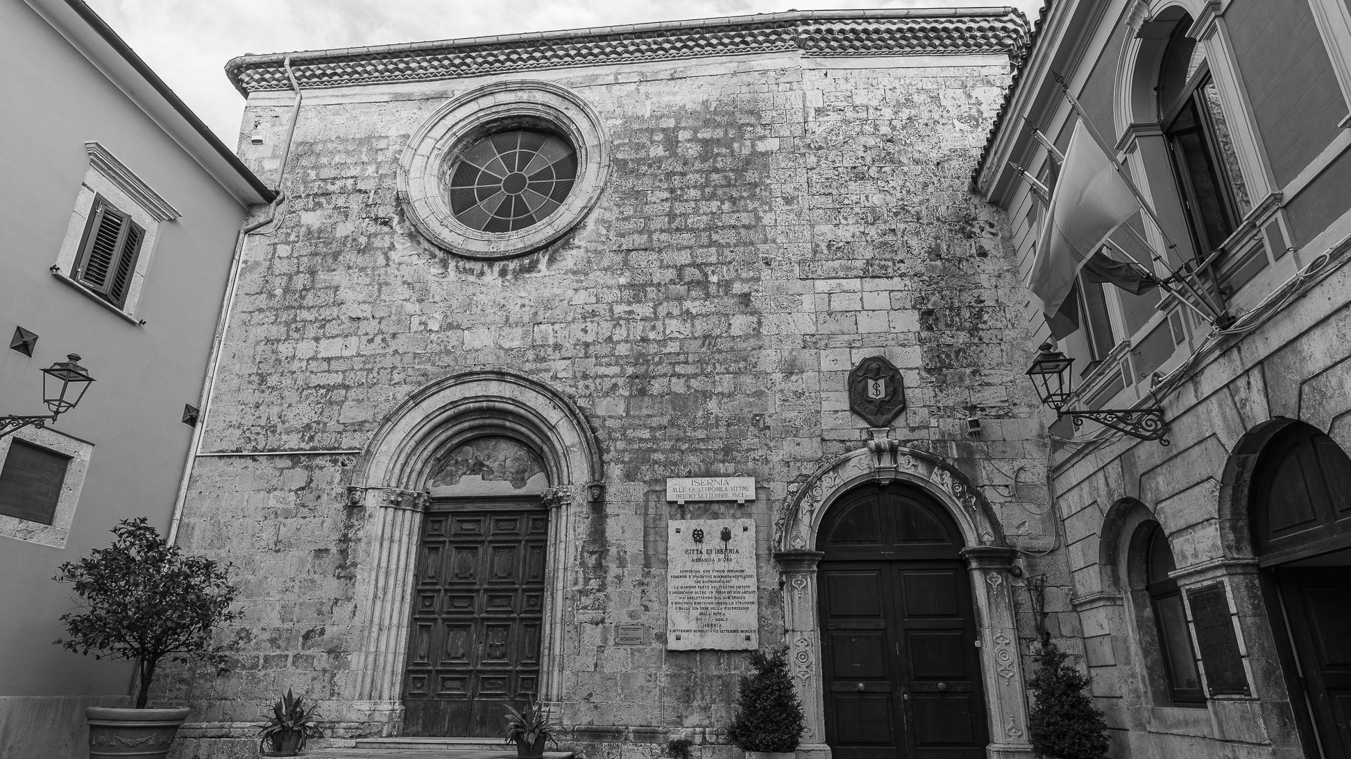
Isernia. The Church of S. Francesco
The Church of S. Francesco, with the adjoining Monastery of the Conventual Fathers, was built in 1256 and completed in 1267.On the left there is the chapel of S. Antonio, built in 1450.
2022
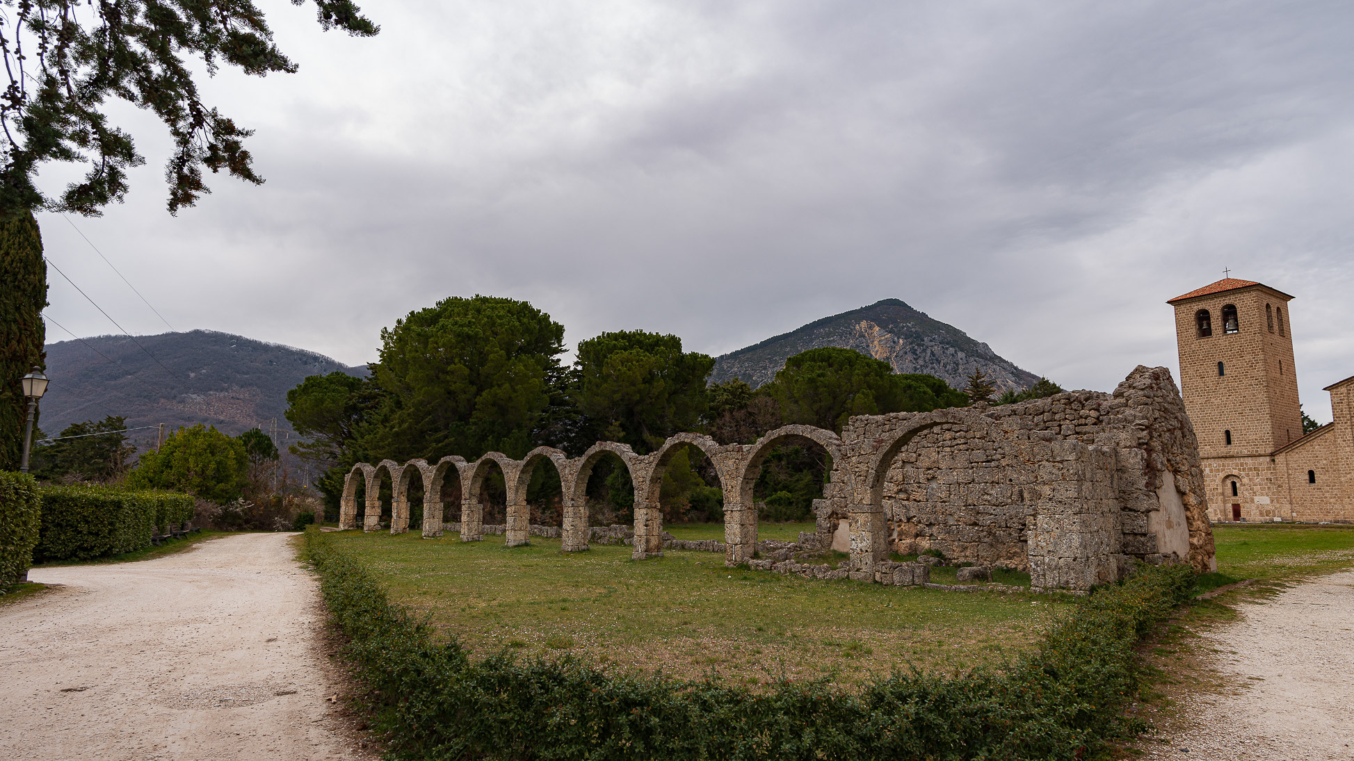
Benedictine Abbey of S. Vincenzo al Volturno
The Benedictine Abbey of San Vincenzo al Volturno is located about two kilometers from the sources of the river of the same name, in a favorable position on the fertile Piana di Rocchetta, defended by the Mainarde and Meta ranges to the west and the Matese massif to the south. On the affairs of the monastery we are informed by the Chronicon Vulturnense, an illuminated manuscript written in 1130 by a monk named Giovanni, who had in turn used internal sources of the VIII-XI century monastery. According to the Chronicon, the foundation dates back to the beginning of the 8th century and was due to three nobles from Benevento, Paldo, Taso and Tato, and to their search for a place to devote themselves to the ascetic life. The chosen area was frequented in late Roman times as shown by the remains of a church and a sepulchral area from the 5th-6th century AD
2022
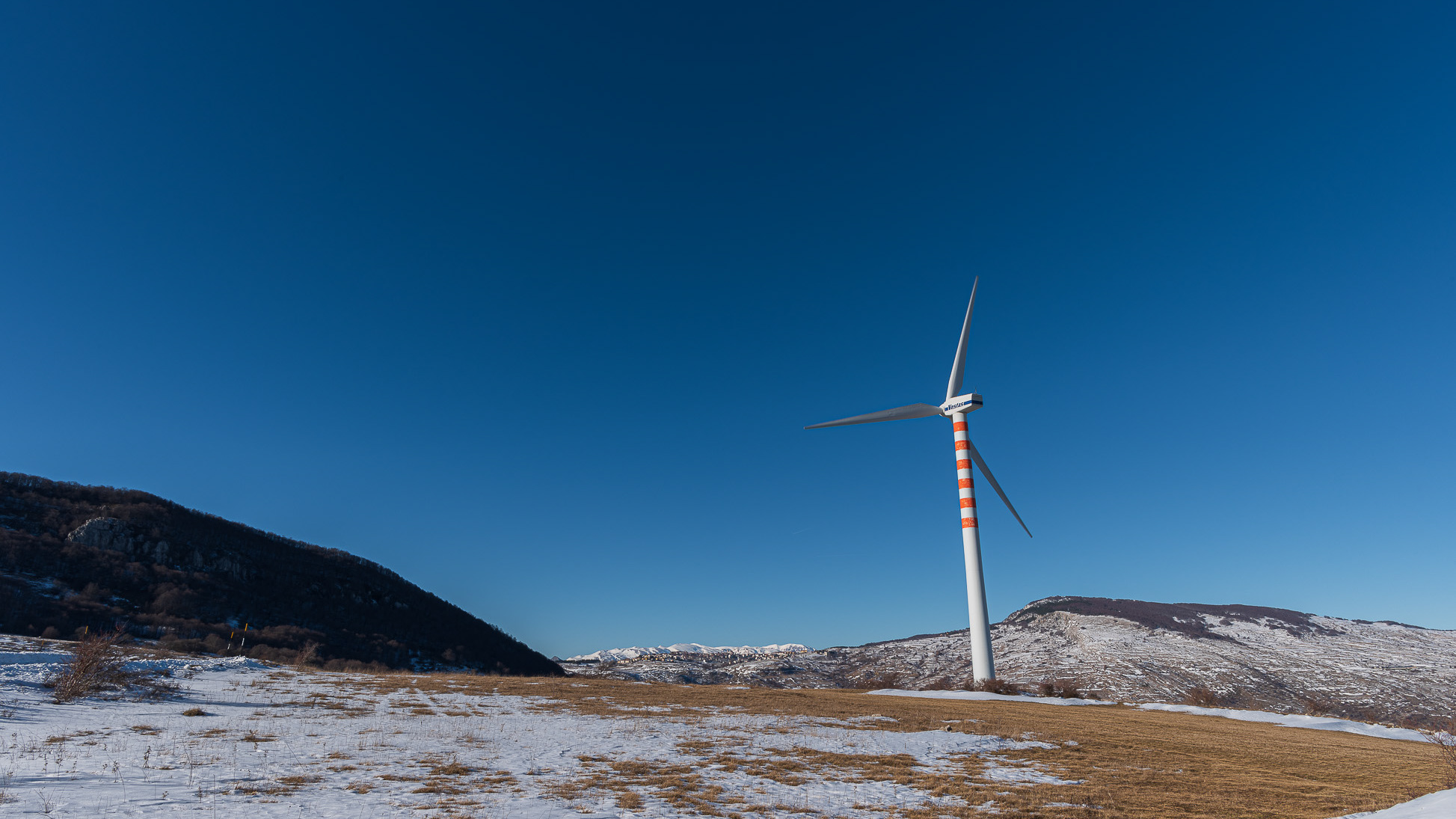
Spectacular winter panorama 2022
2025
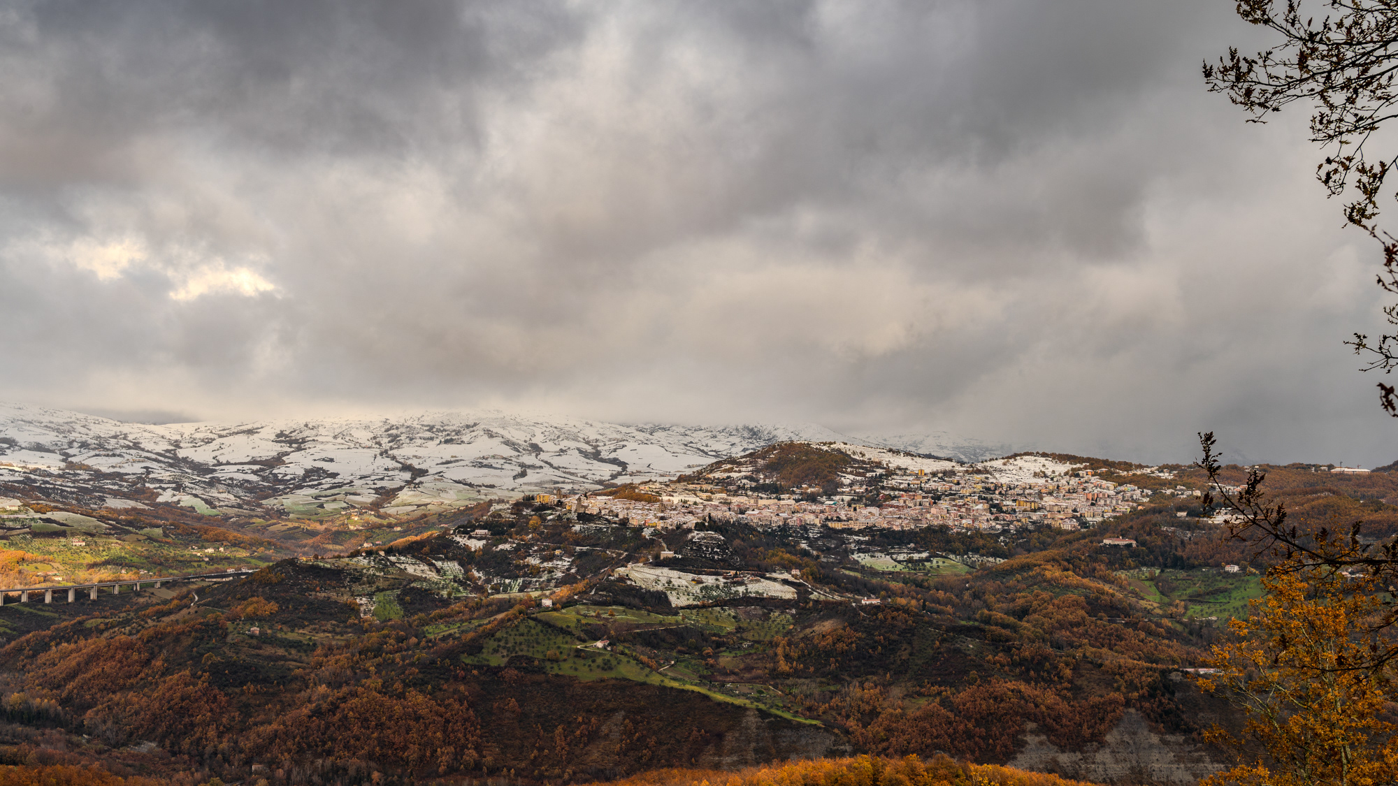
Agnone. Winter landscape 2024
