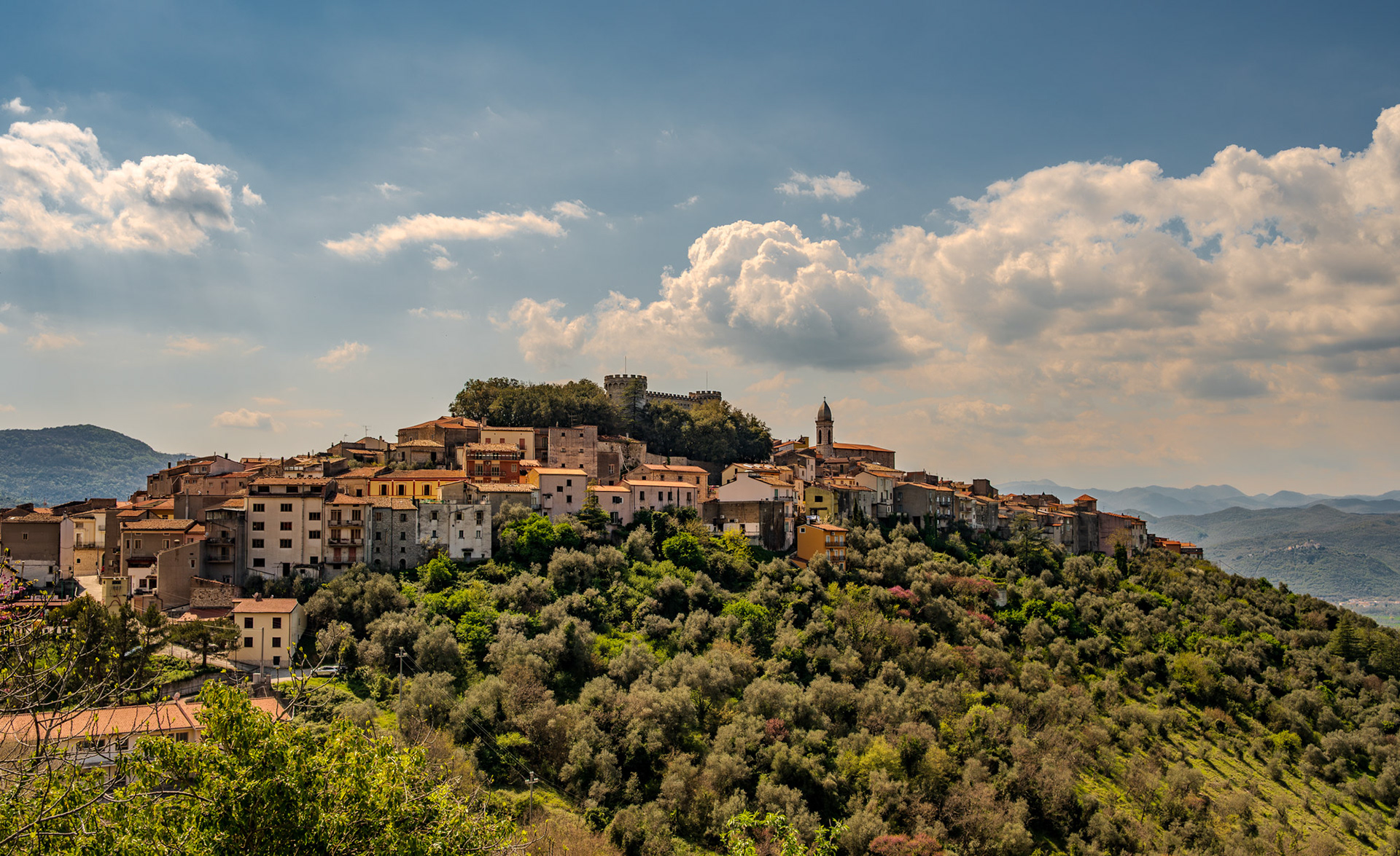
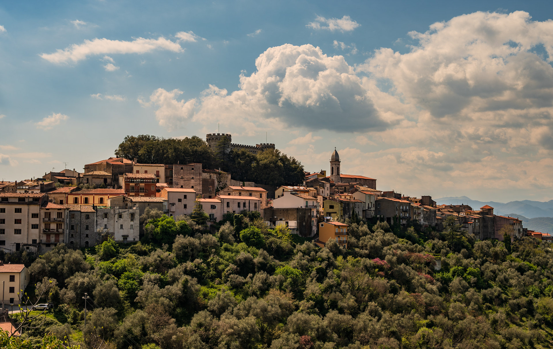
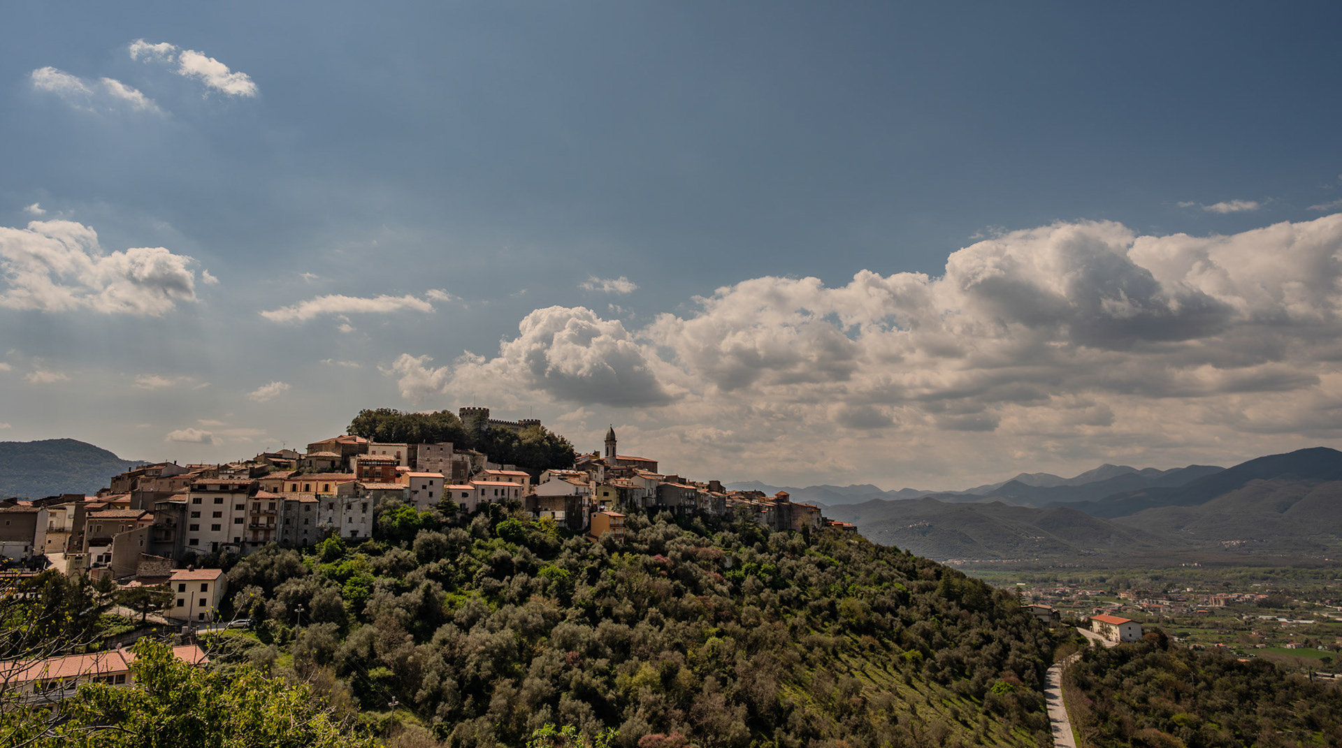
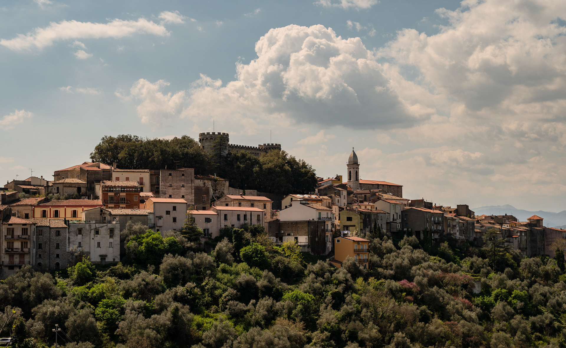
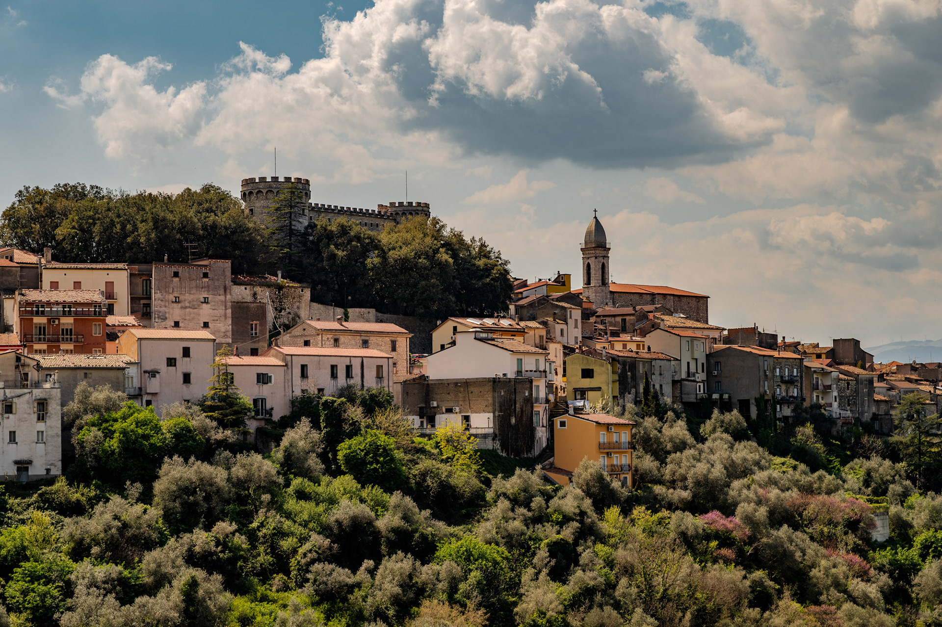
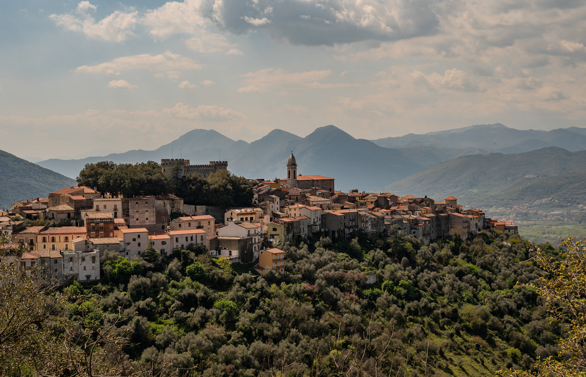
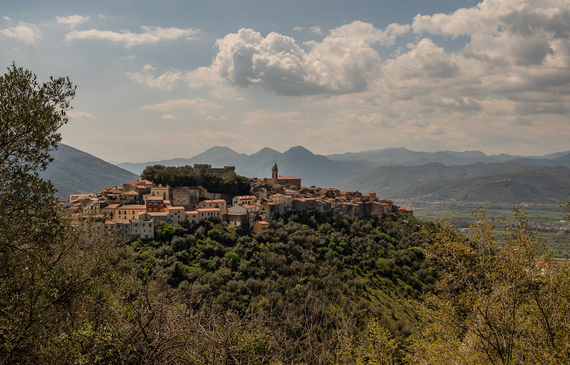
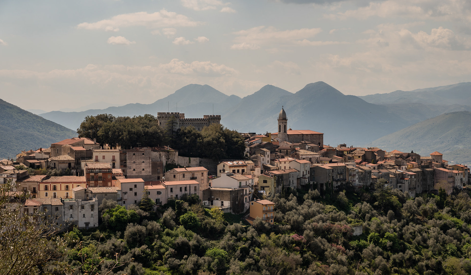
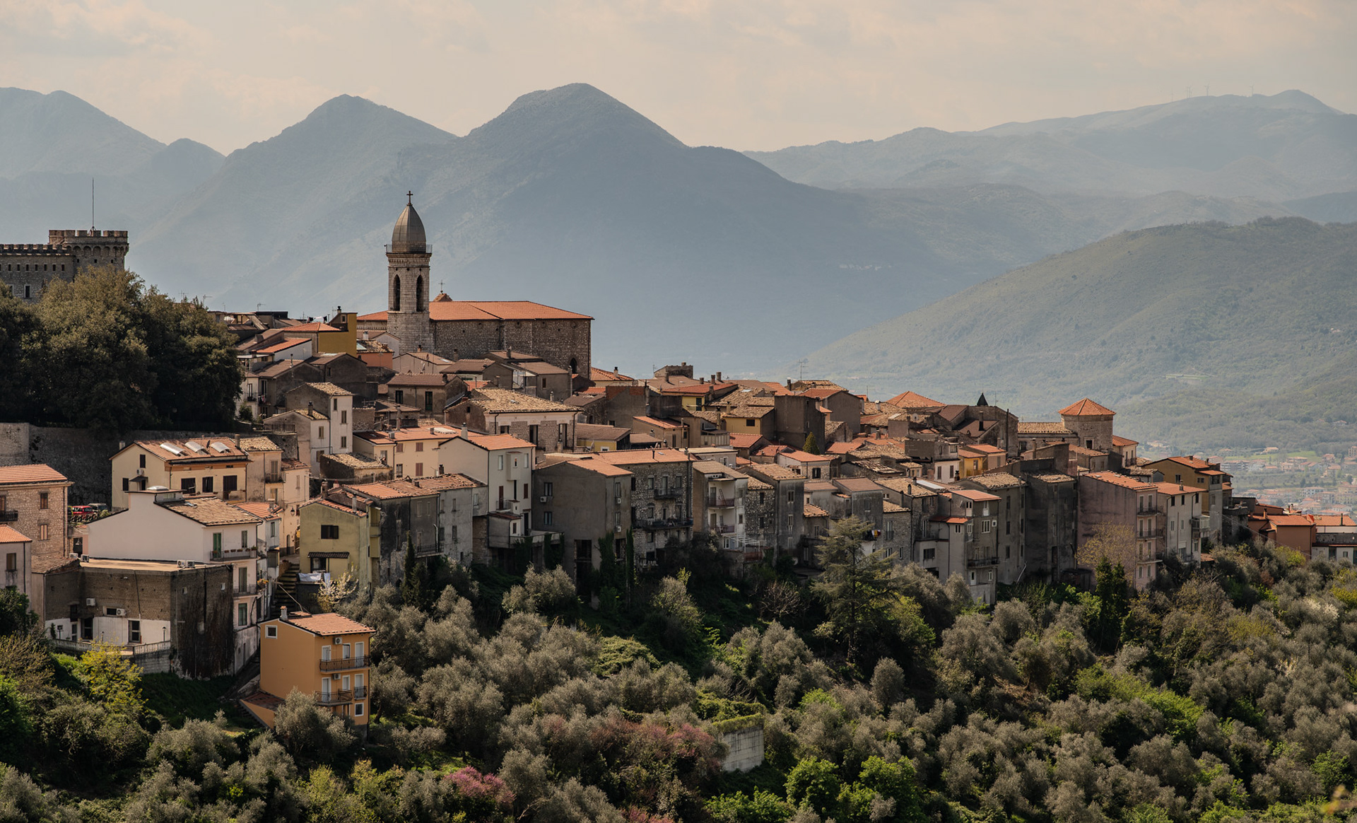
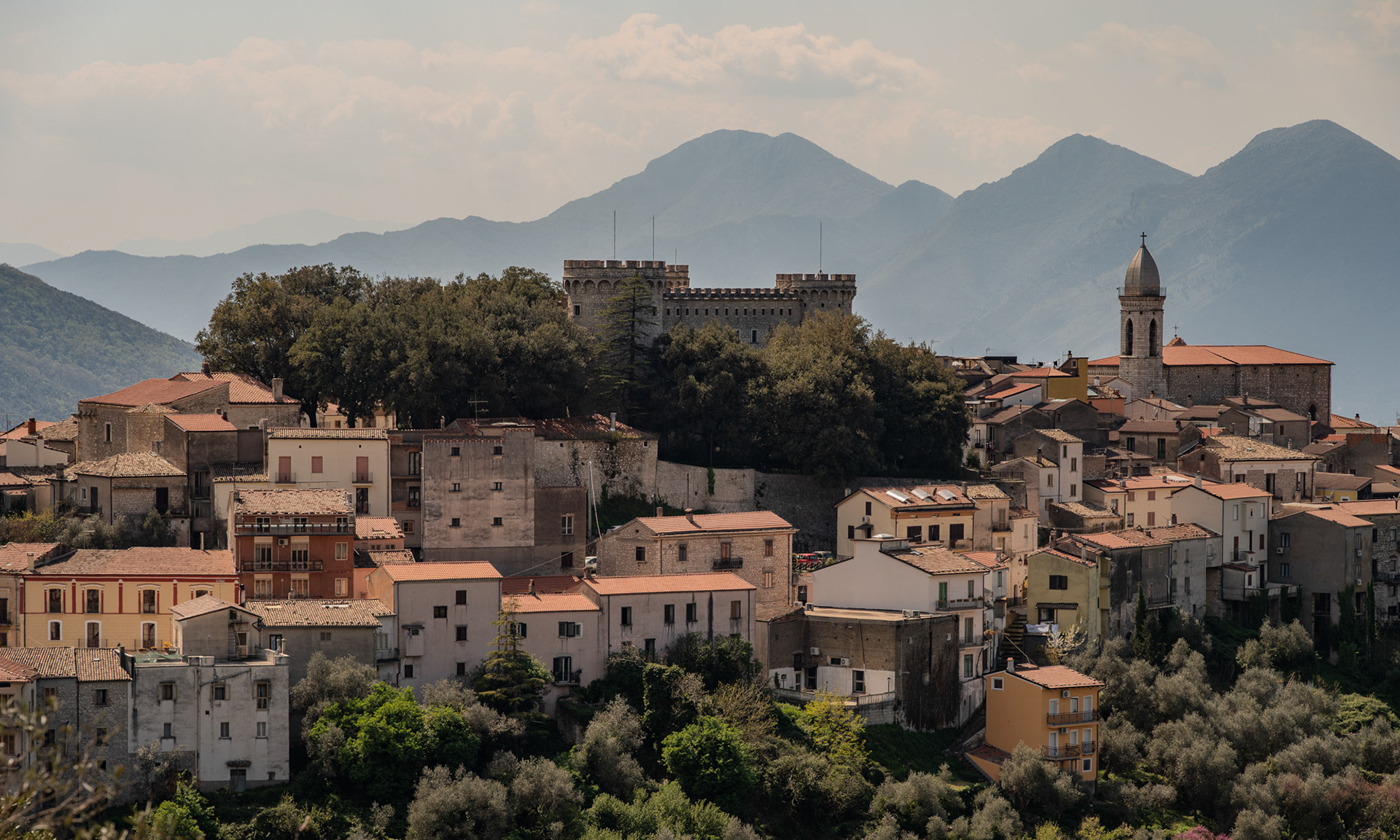
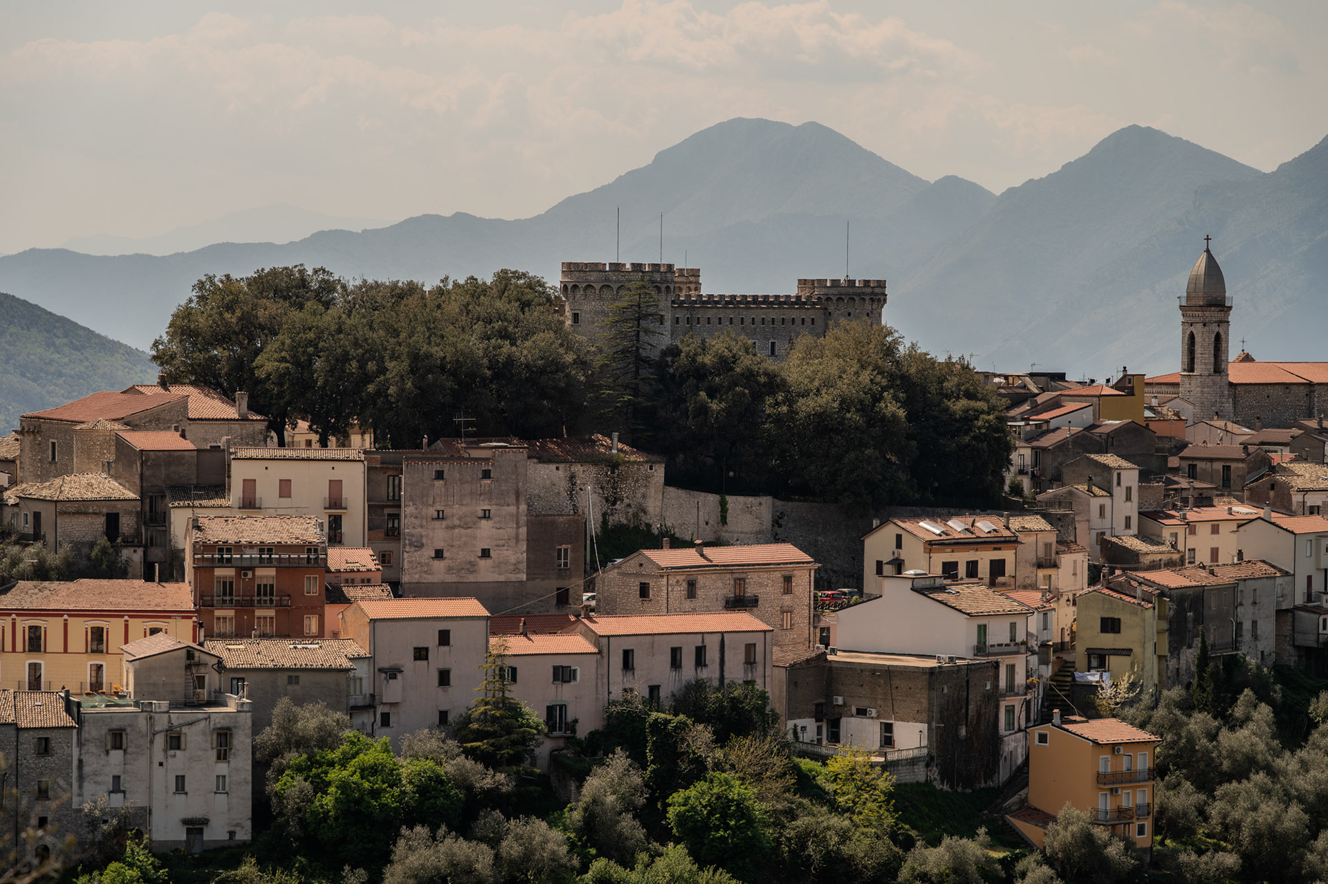
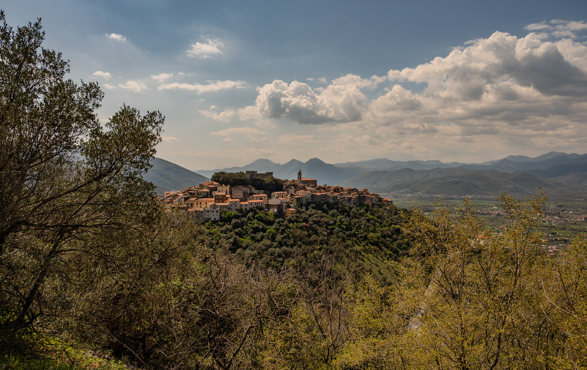
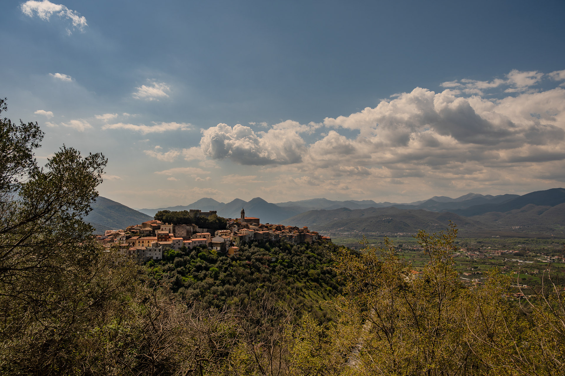
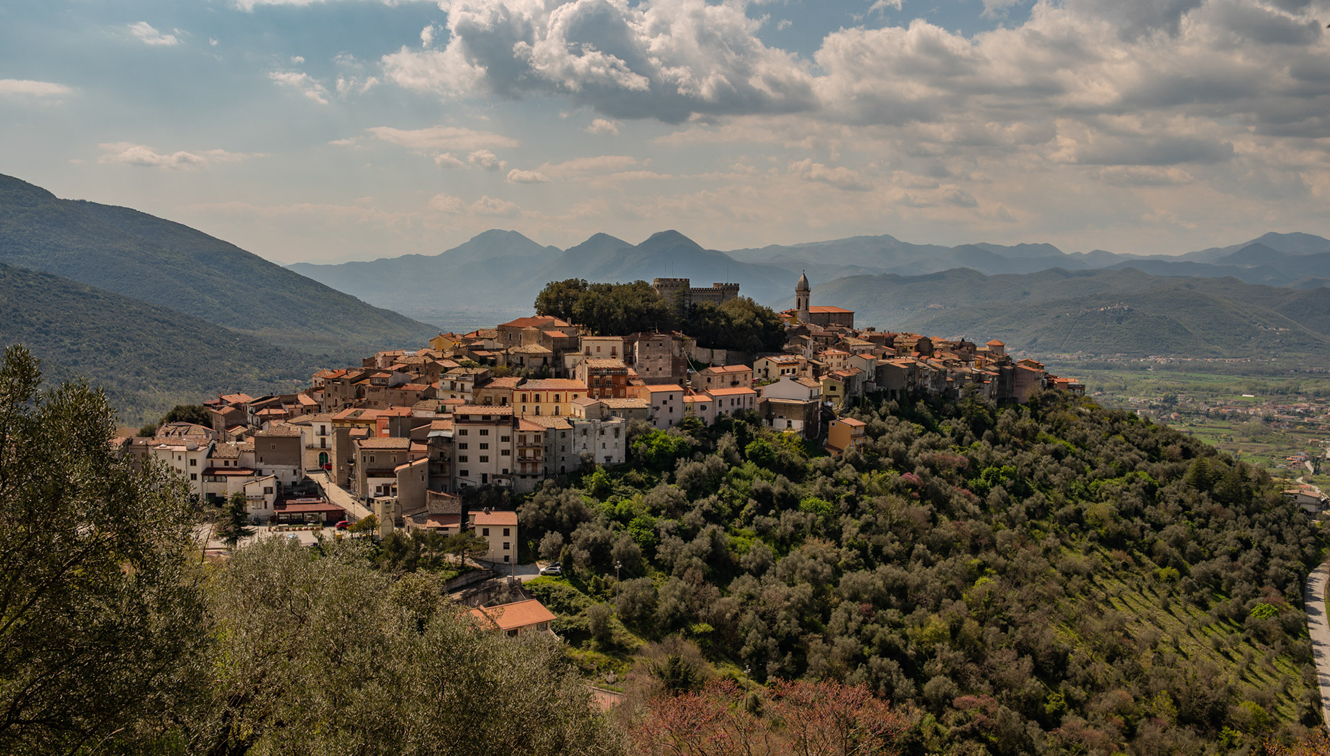
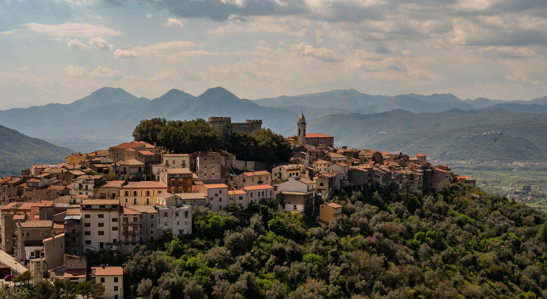
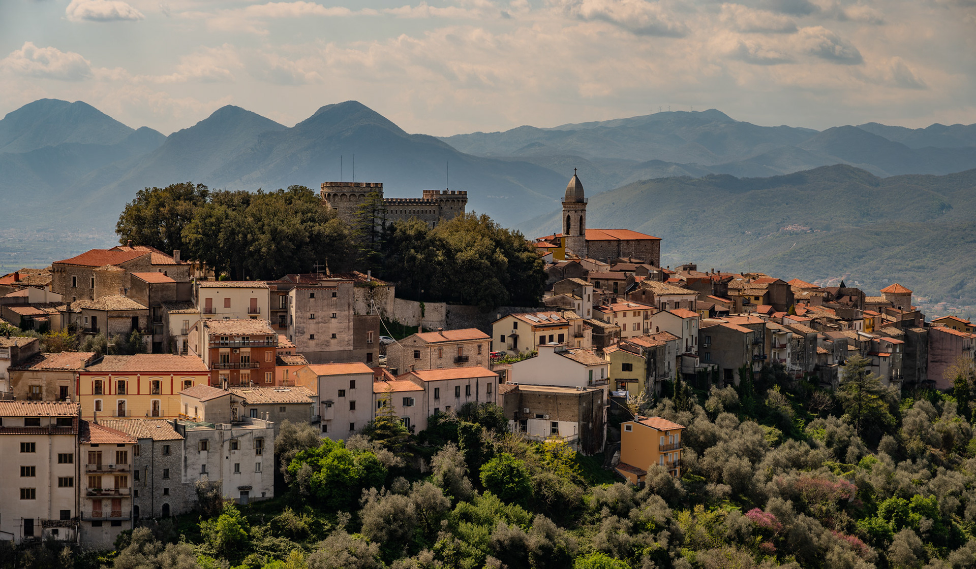
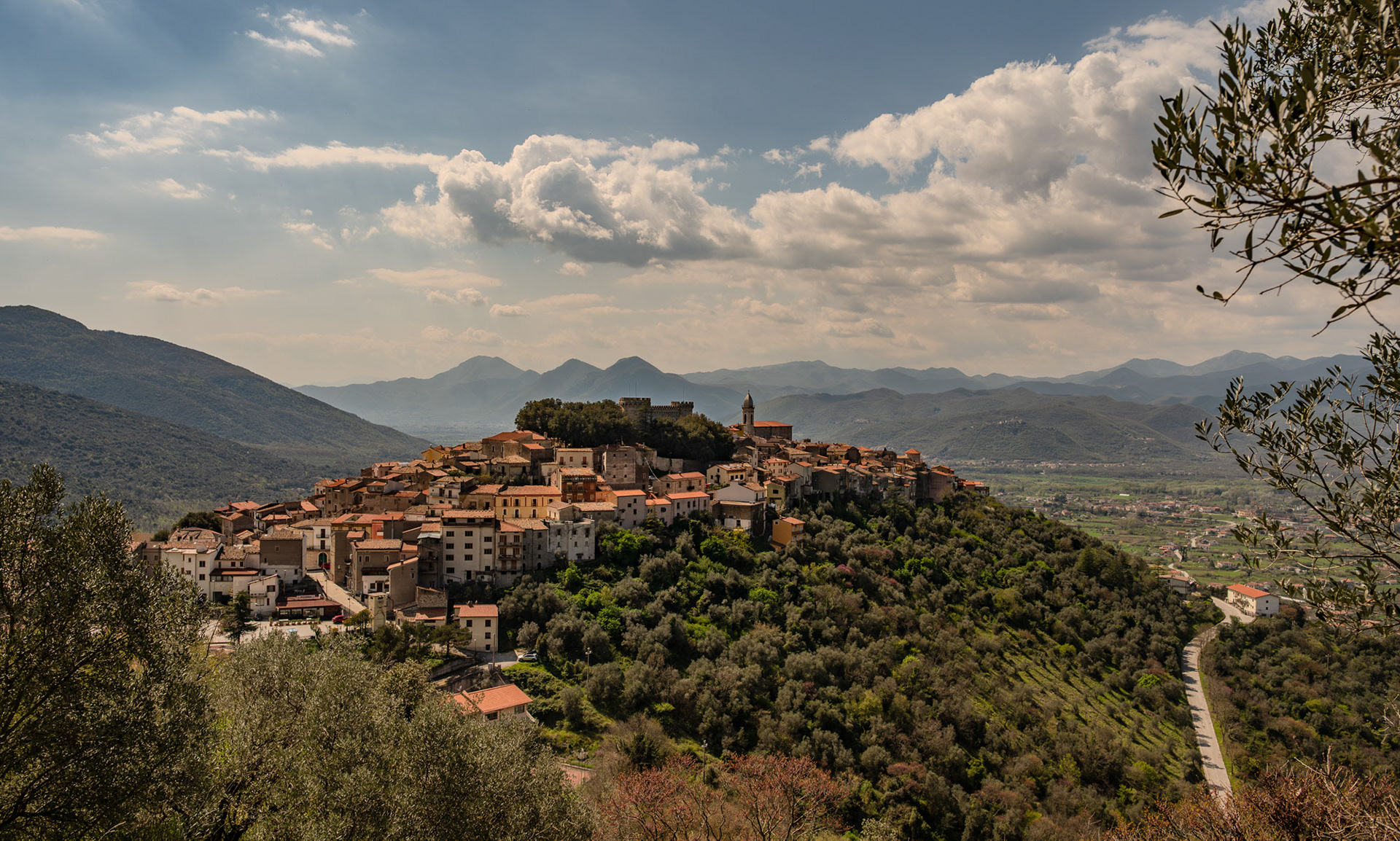
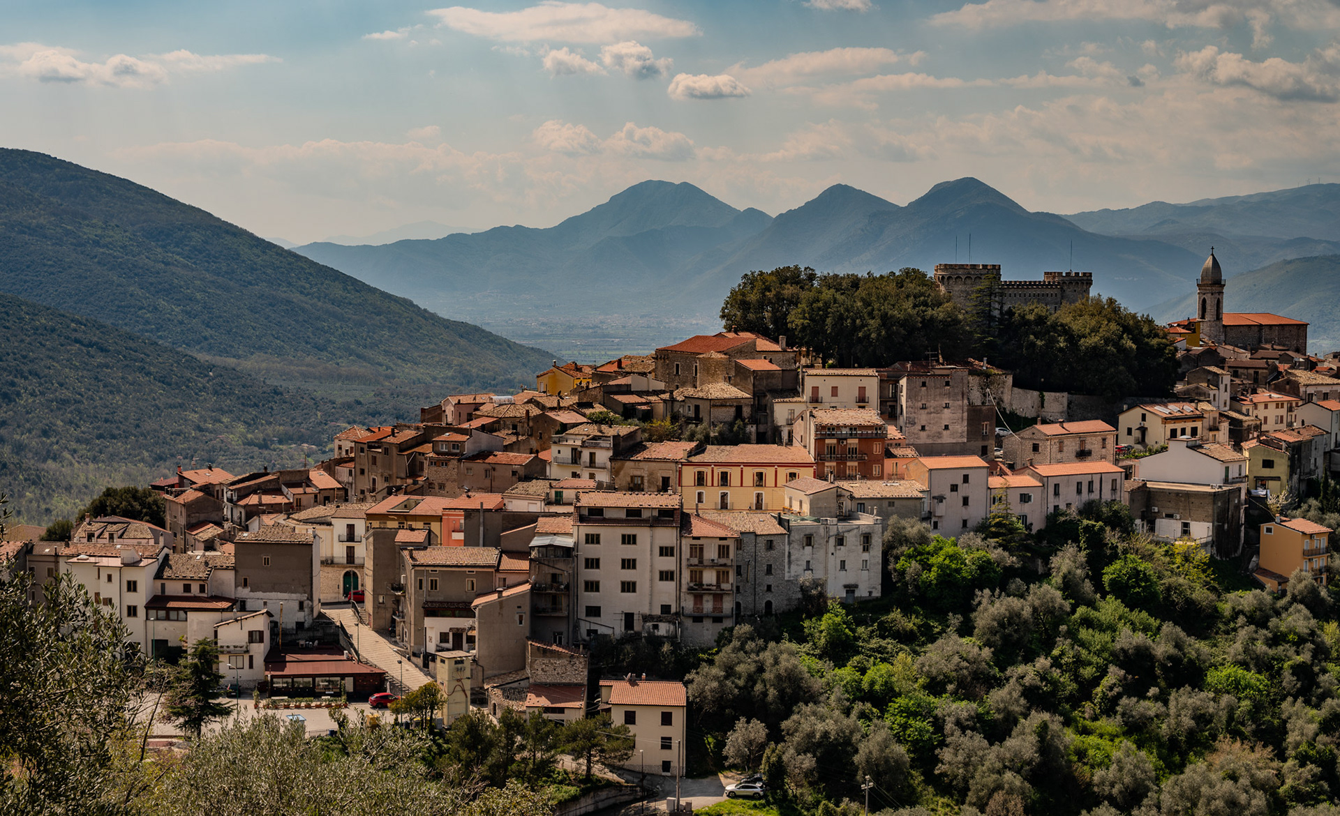
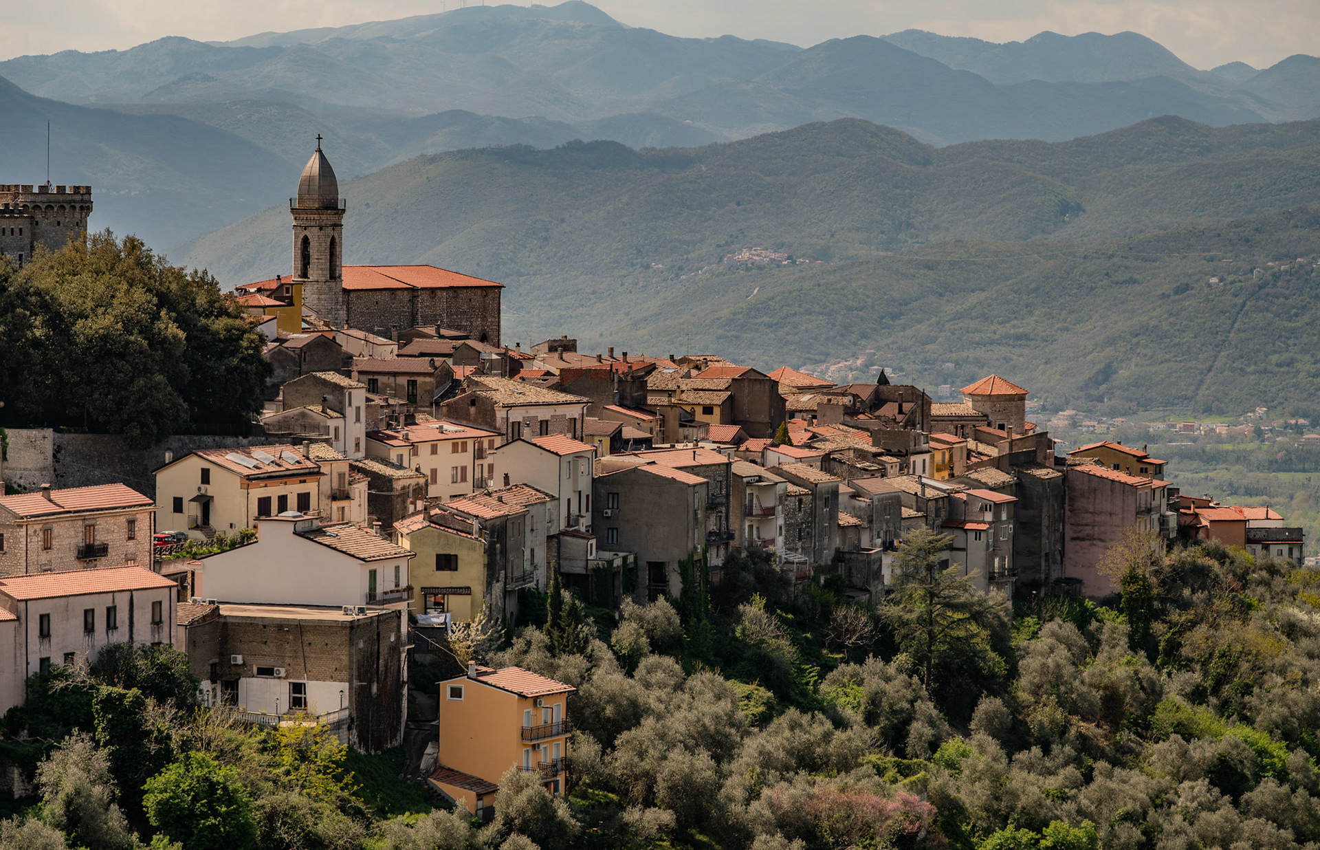
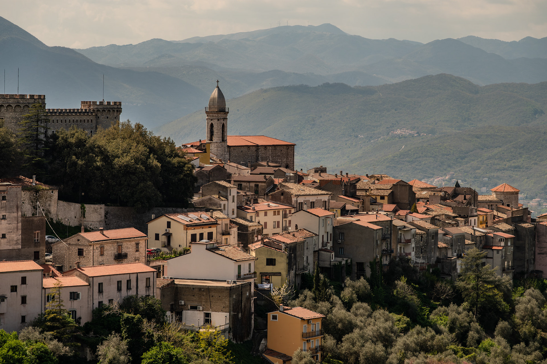
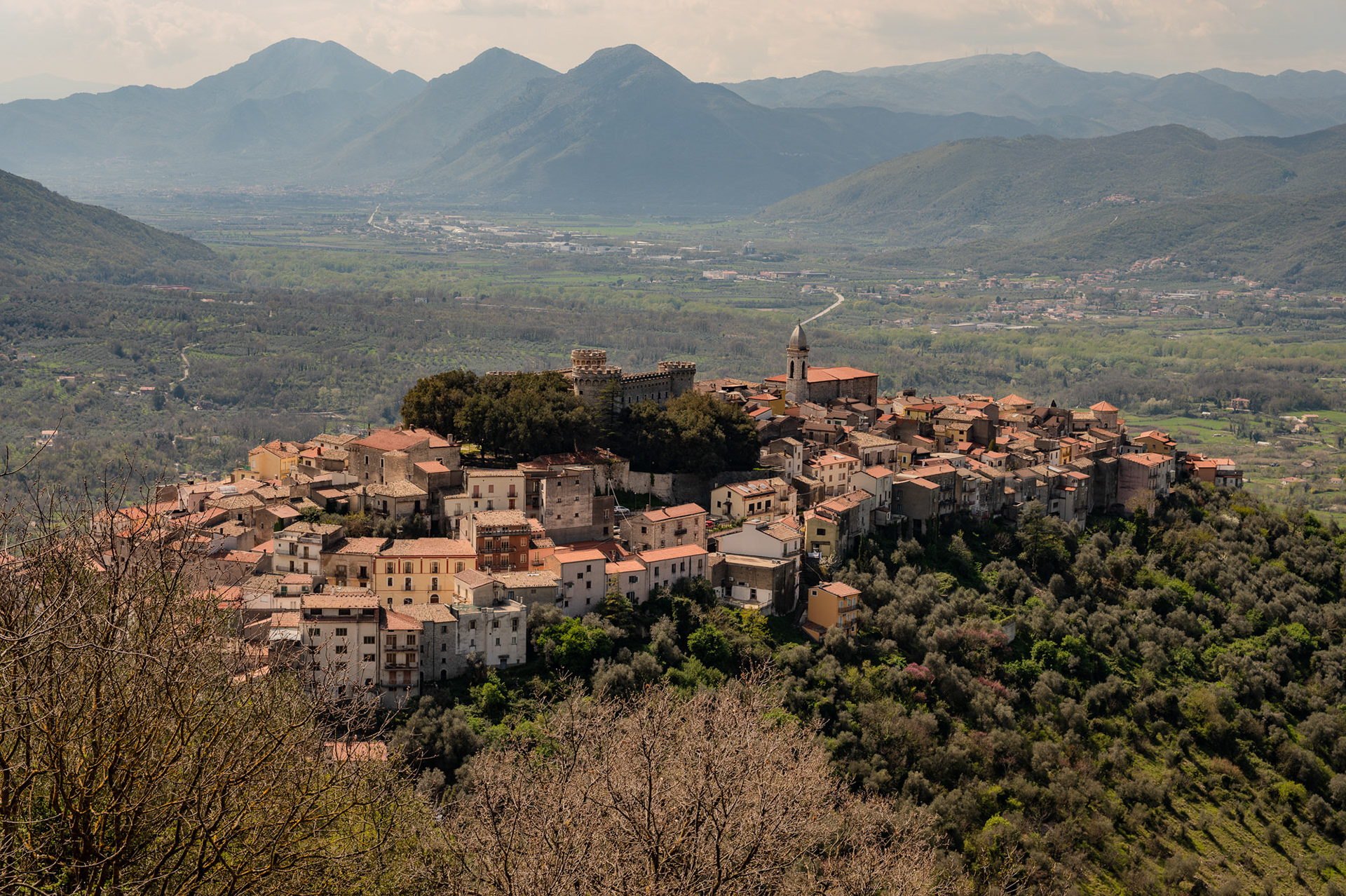
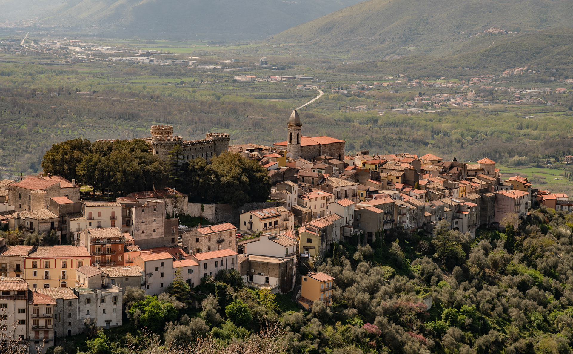
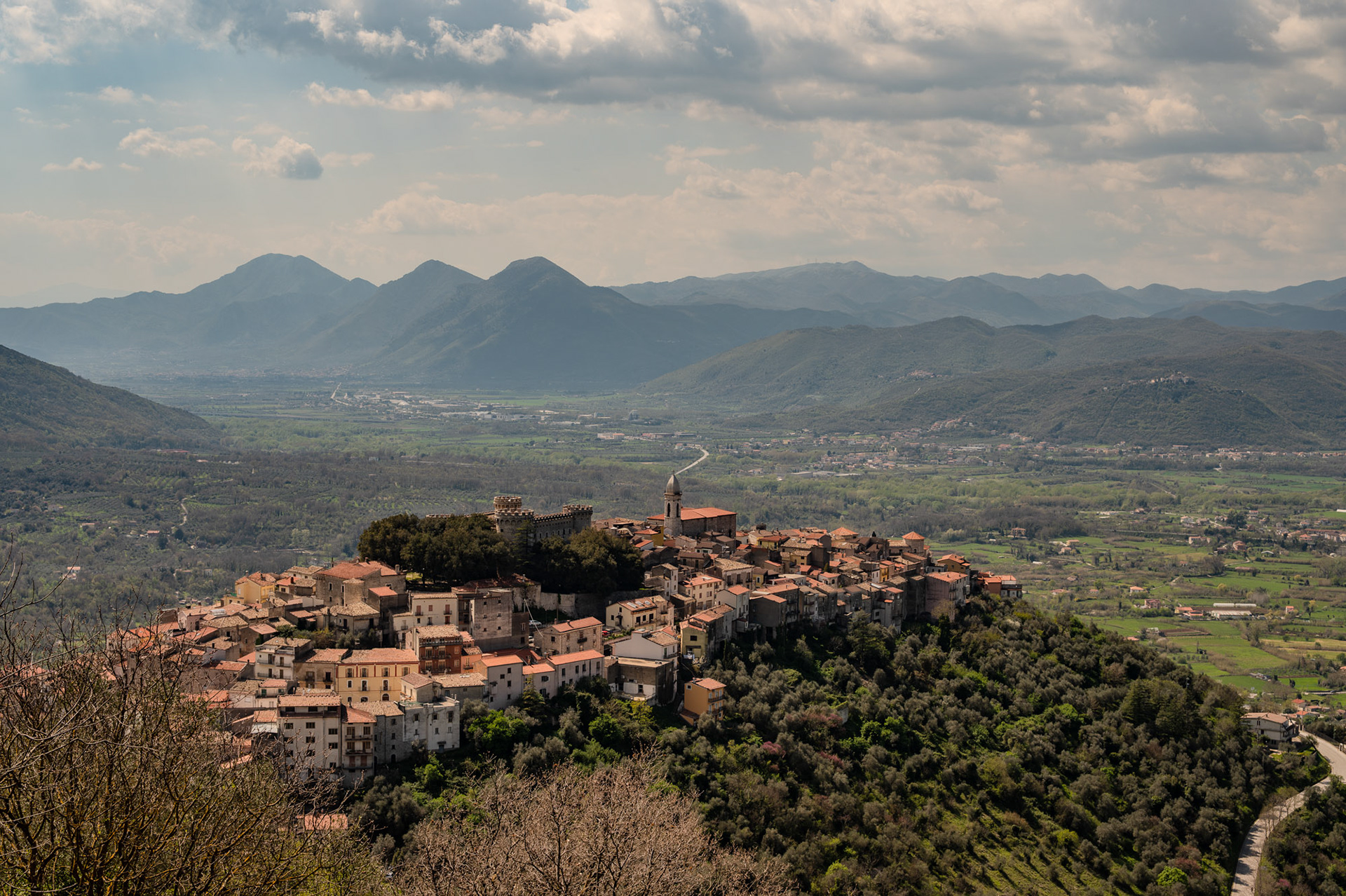
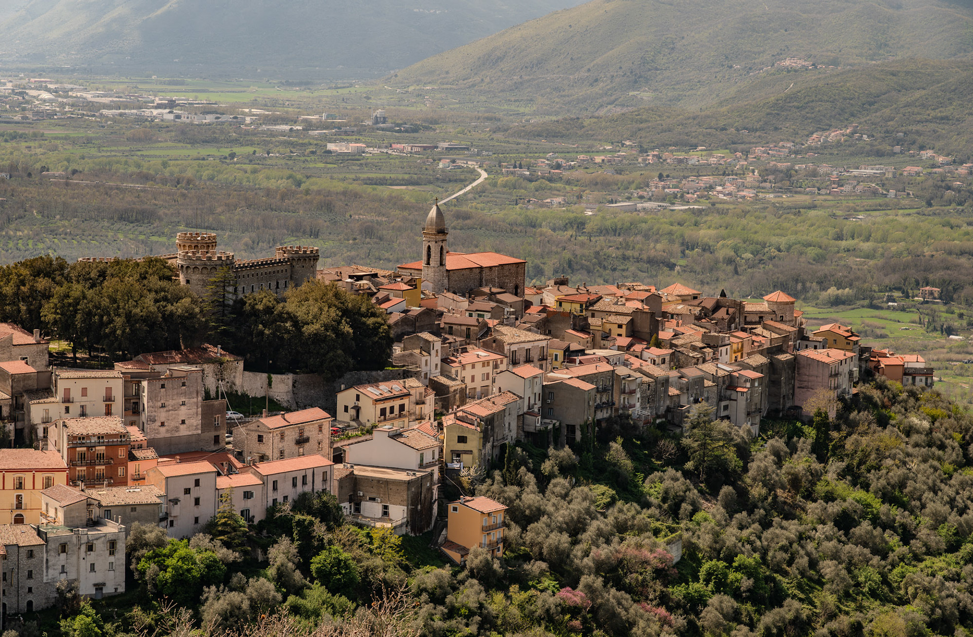
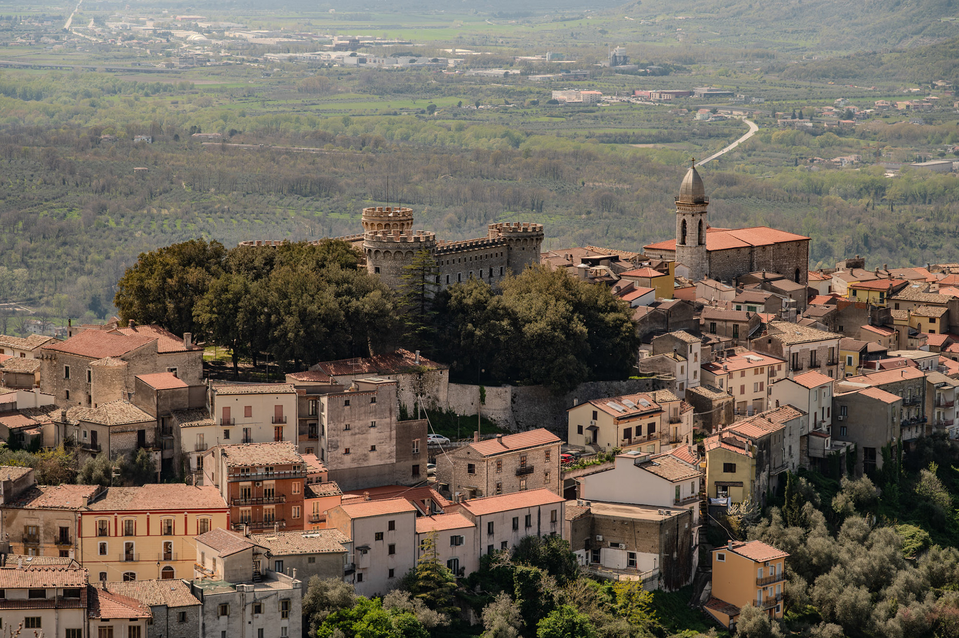
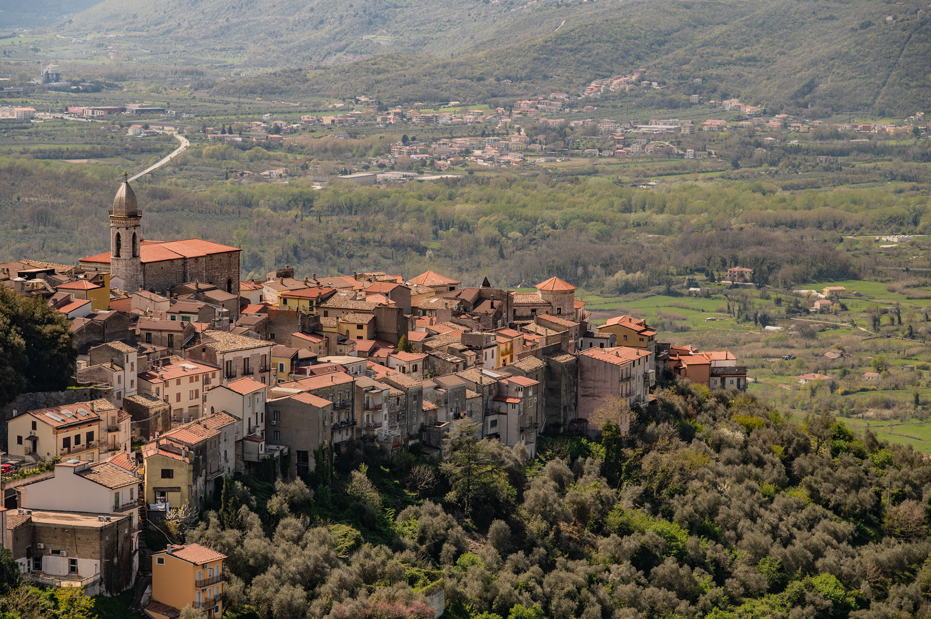
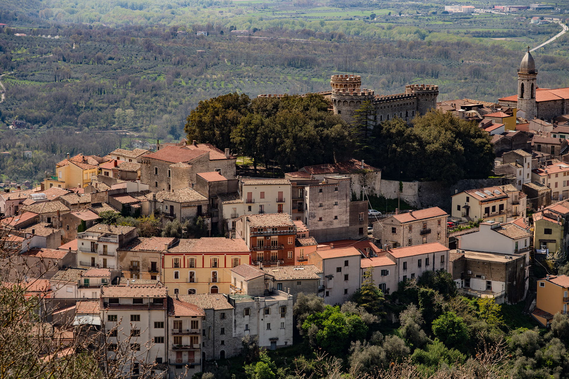
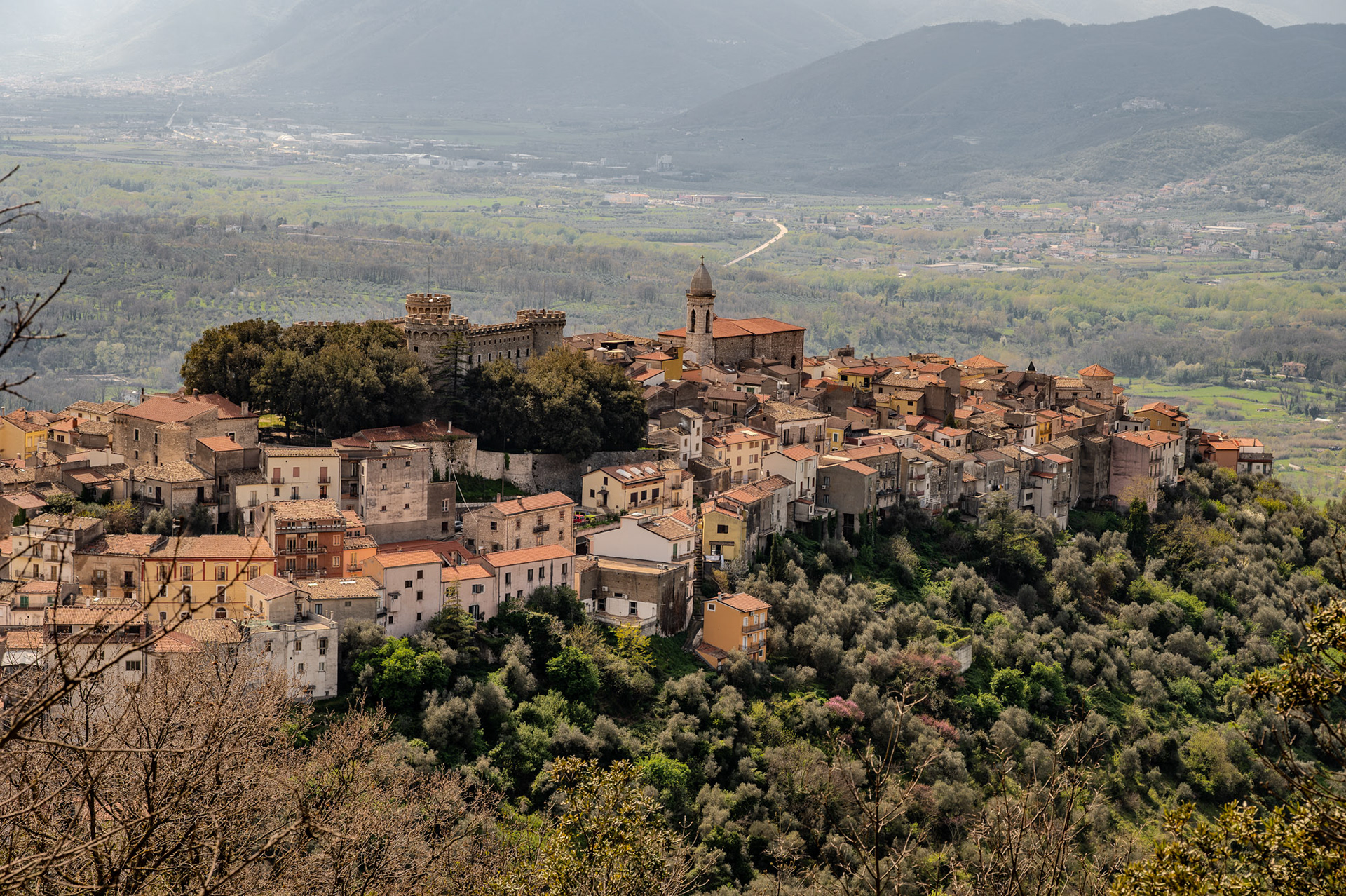
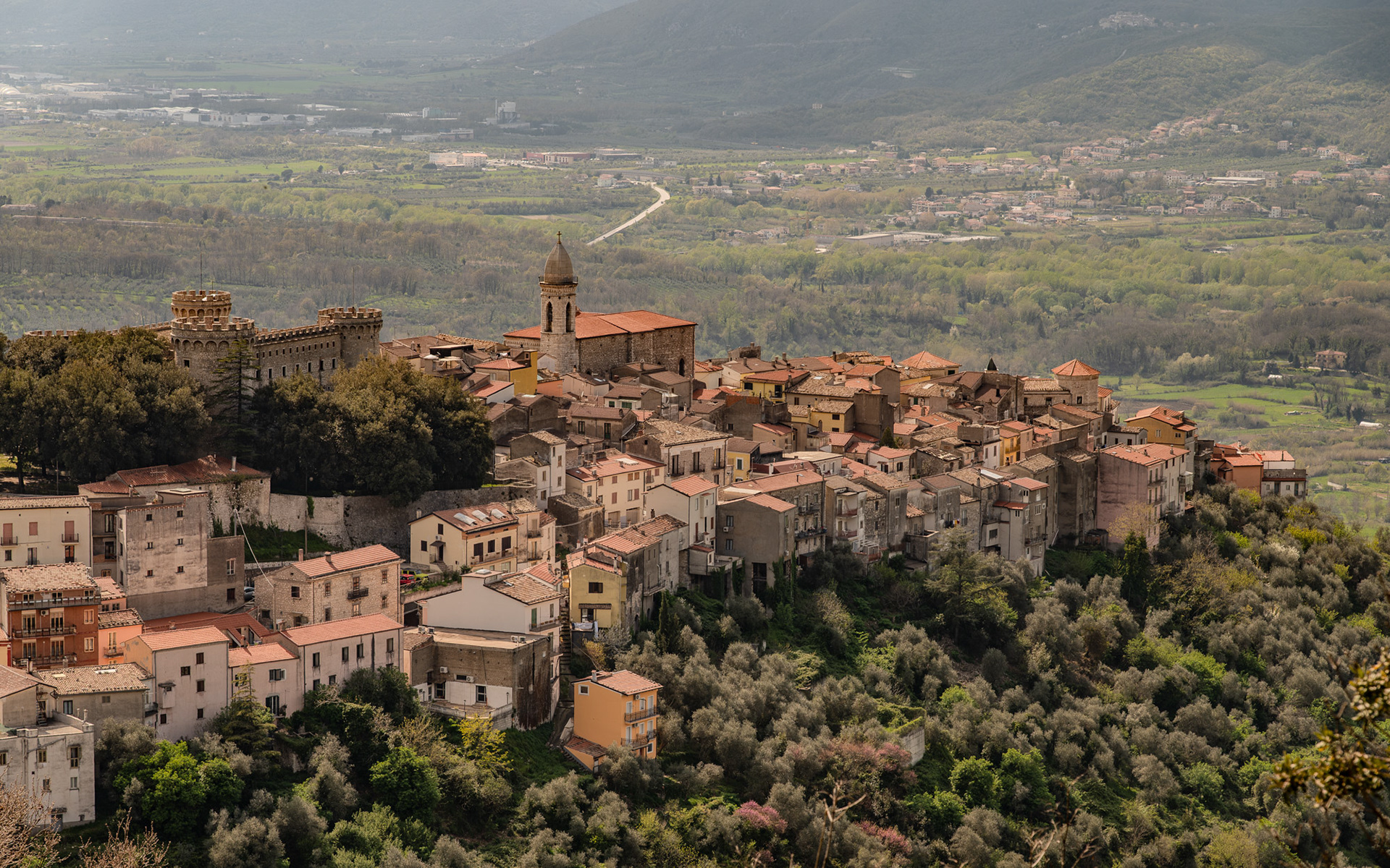
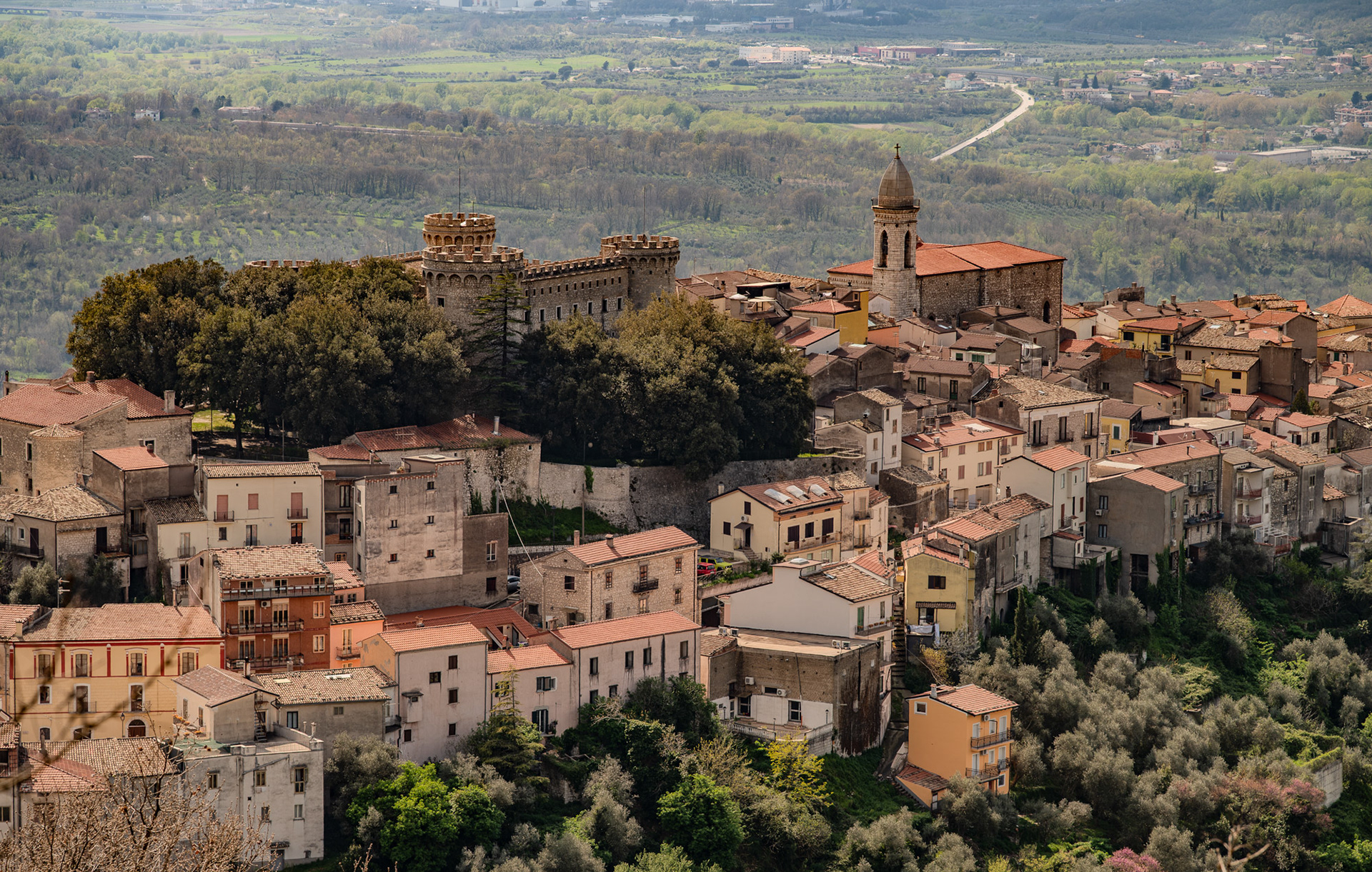
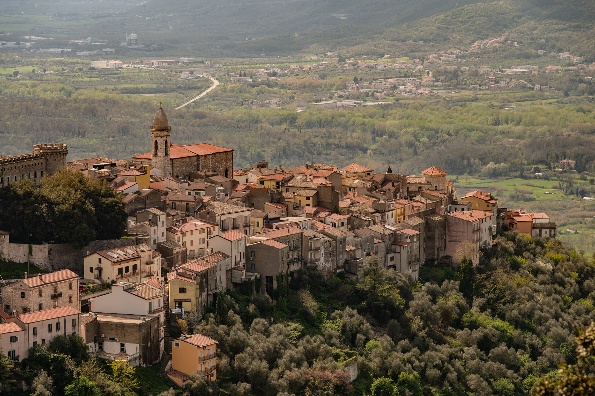
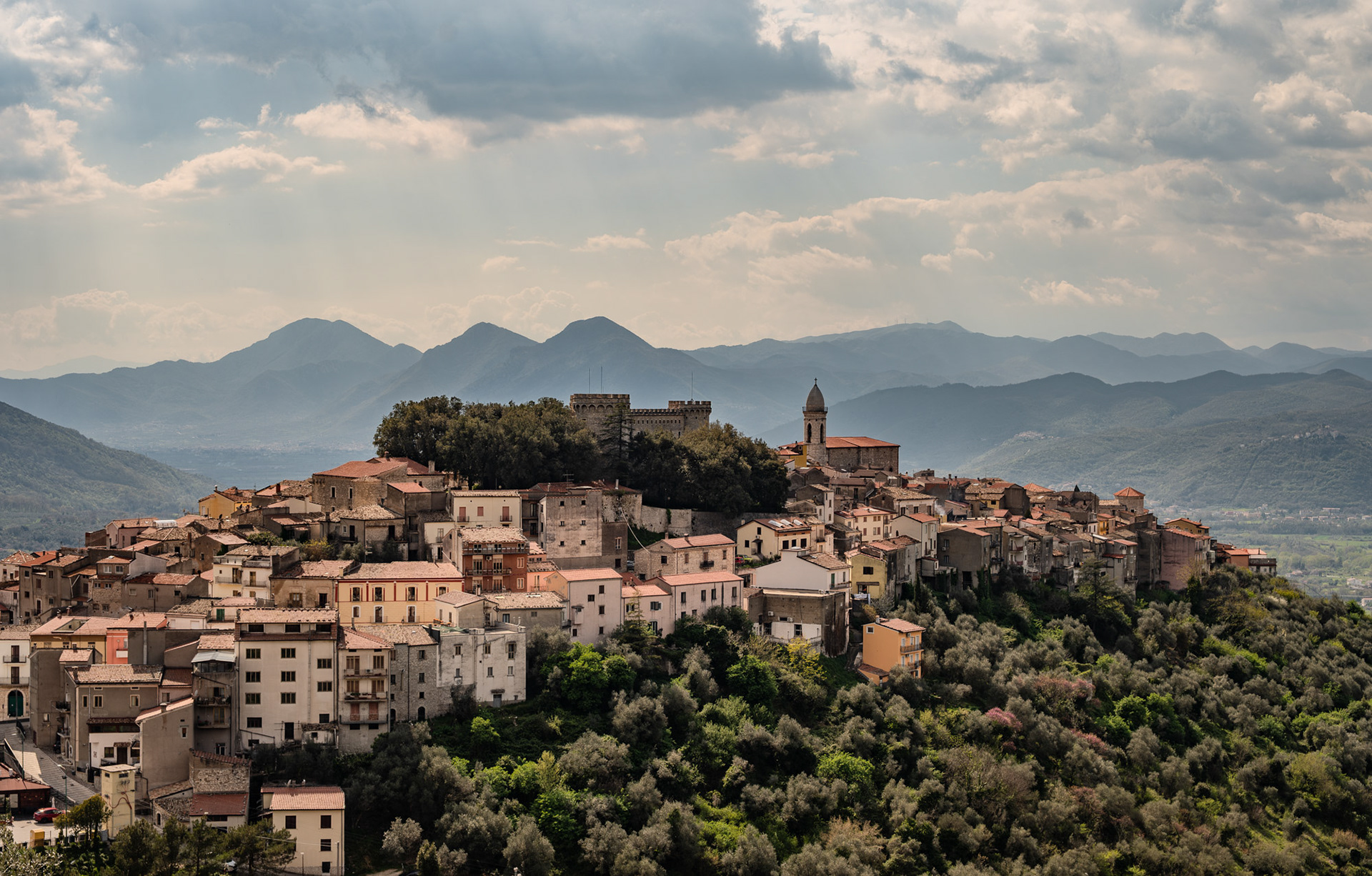
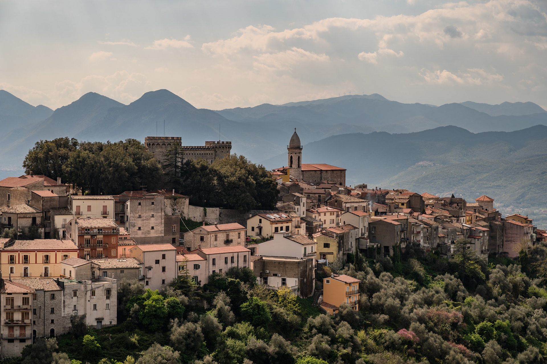
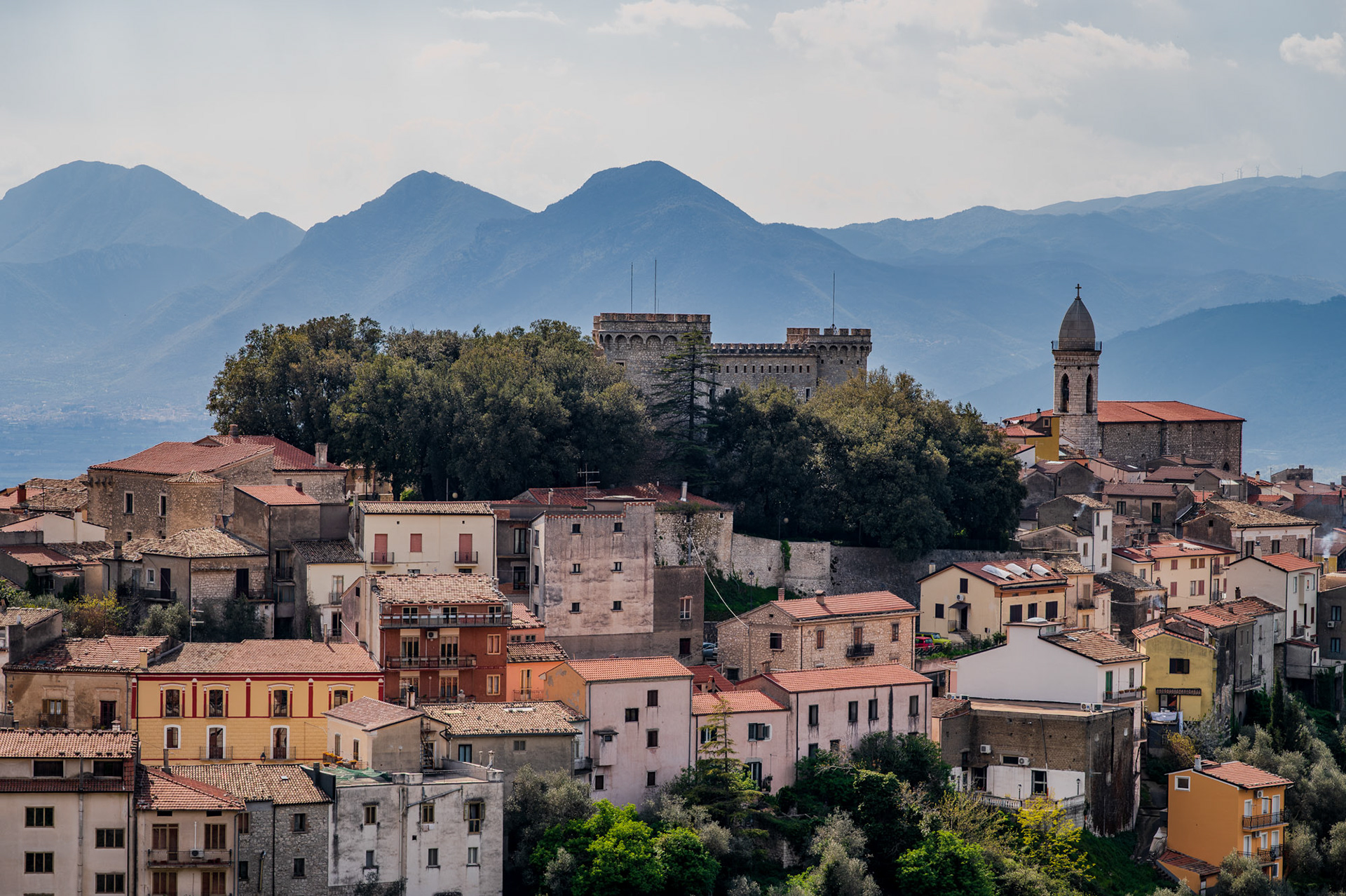
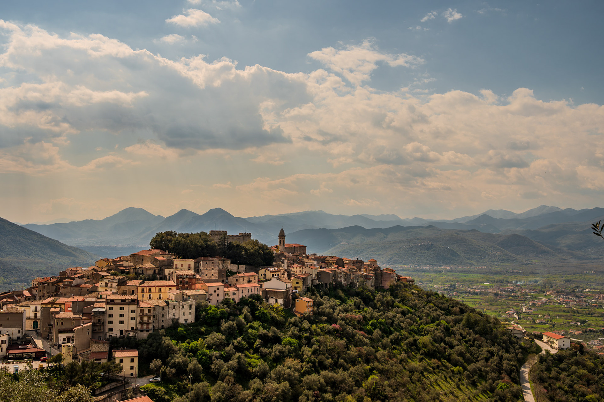
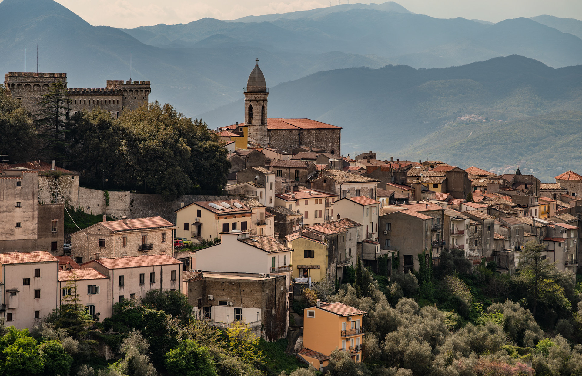
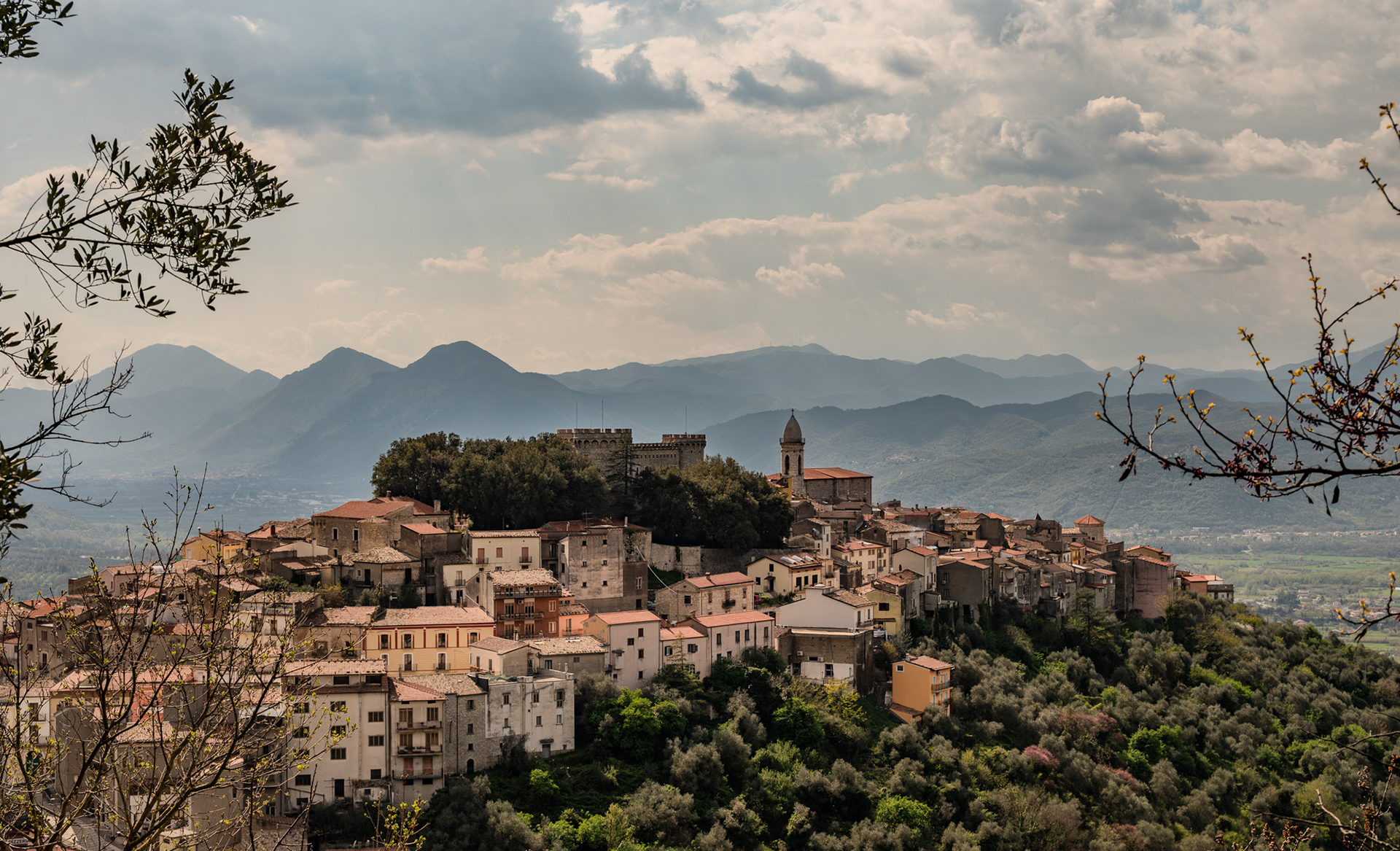
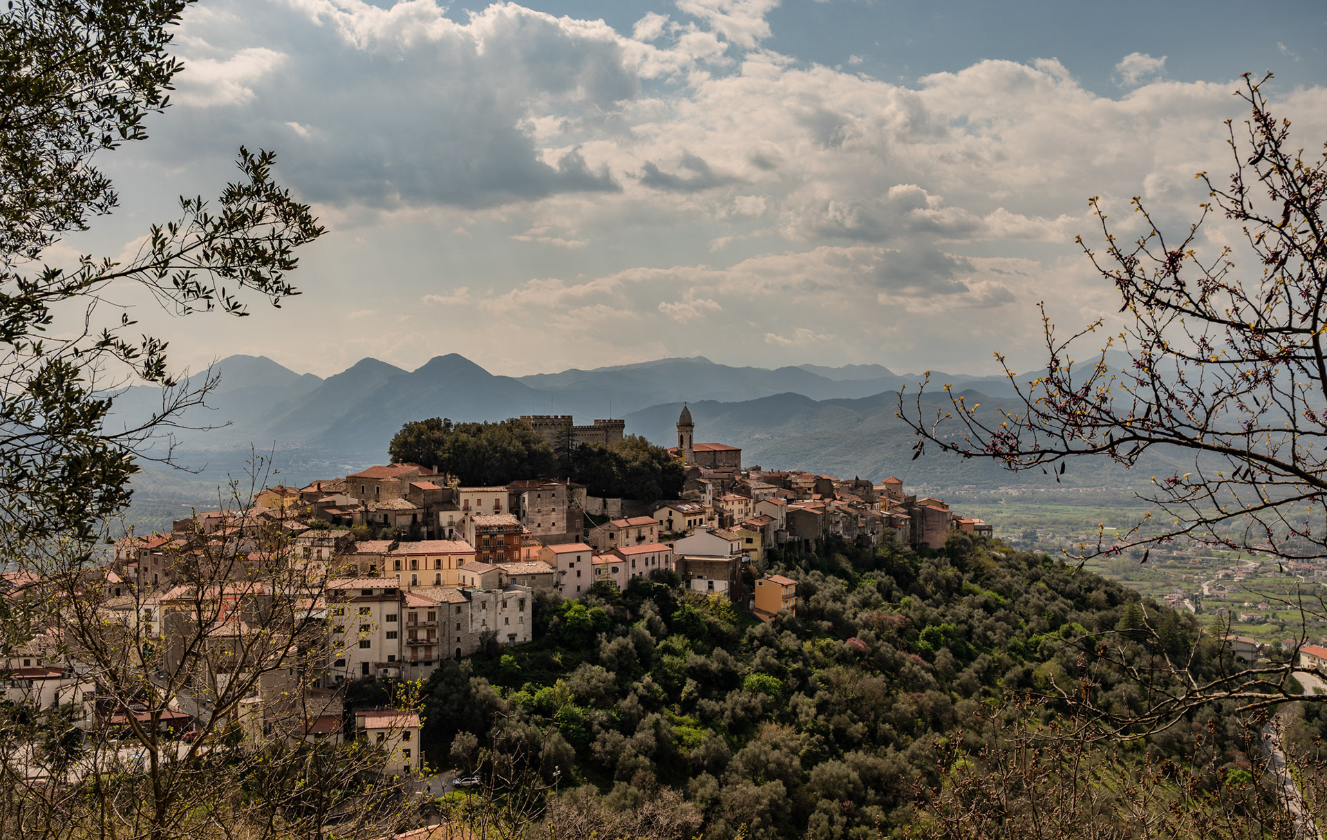
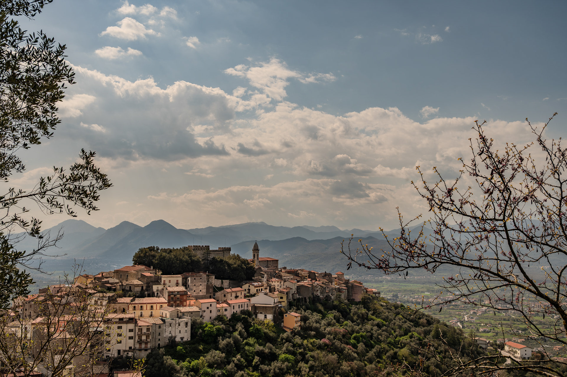
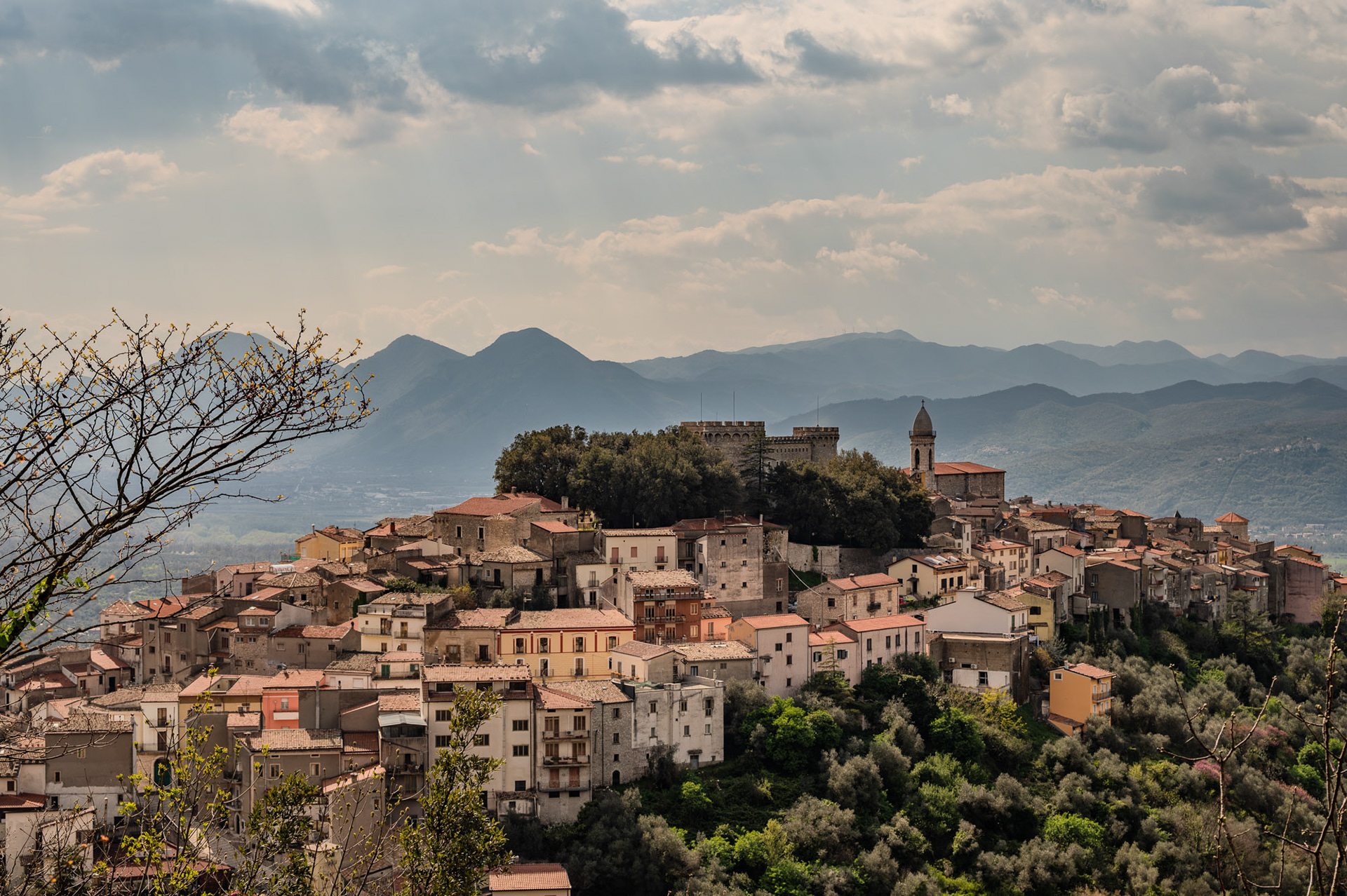
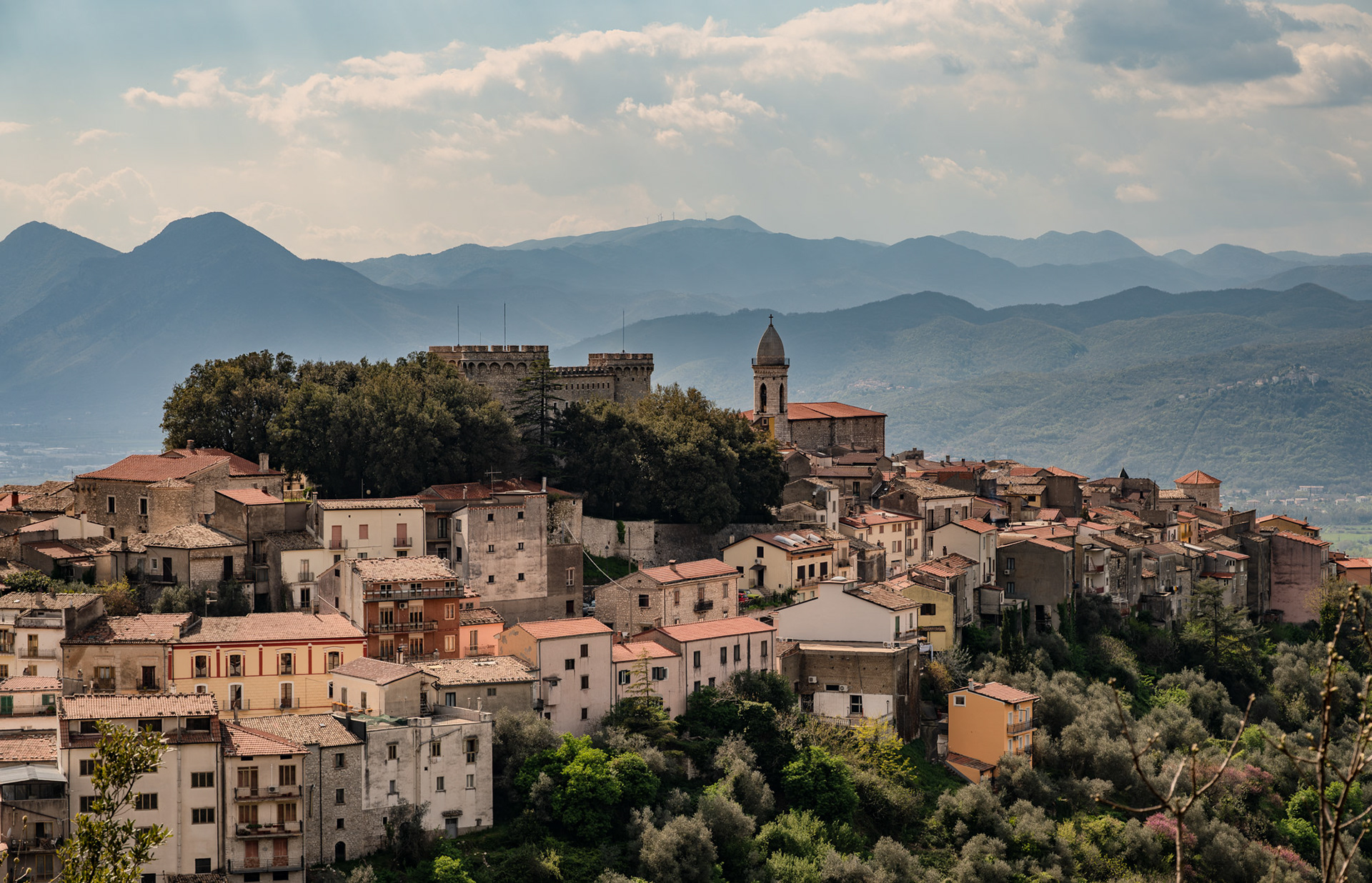
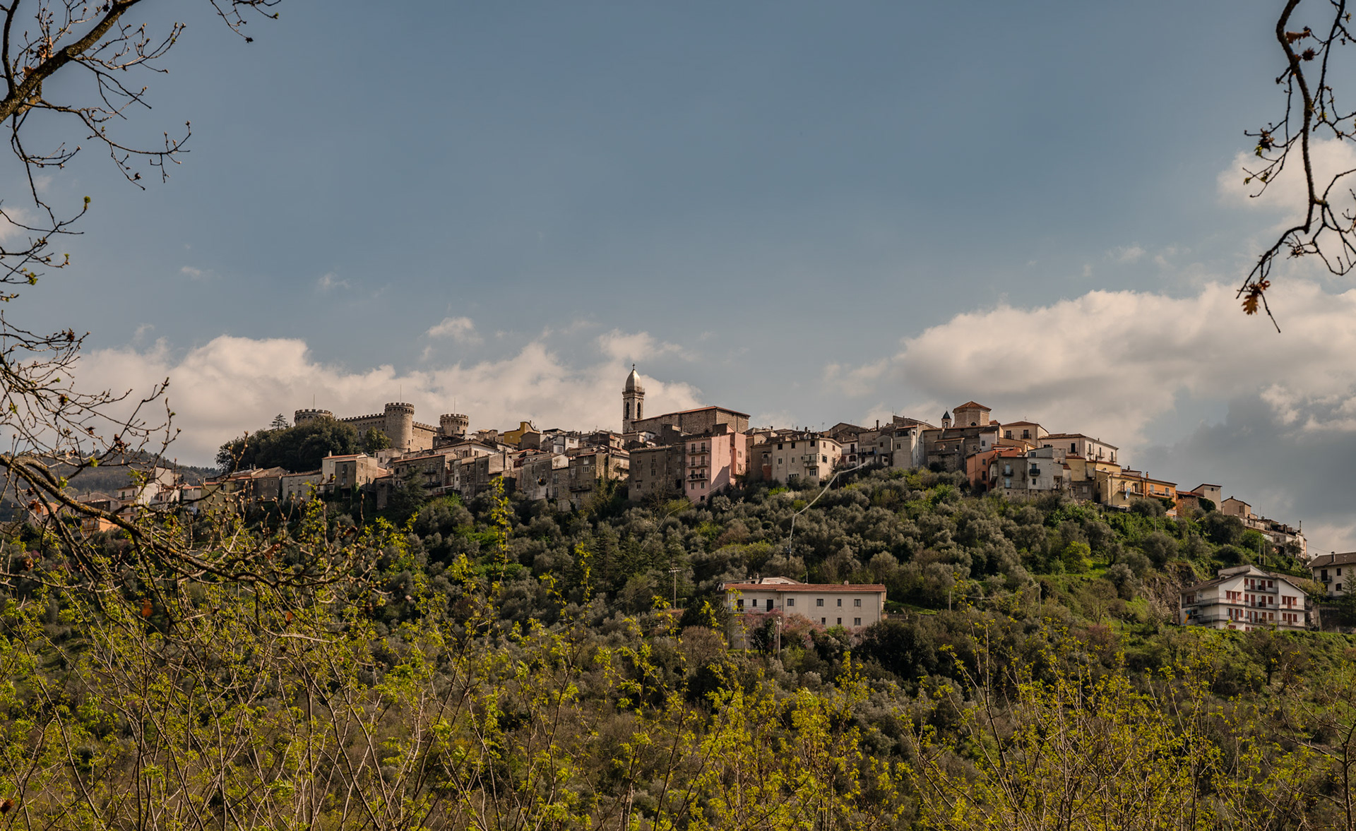
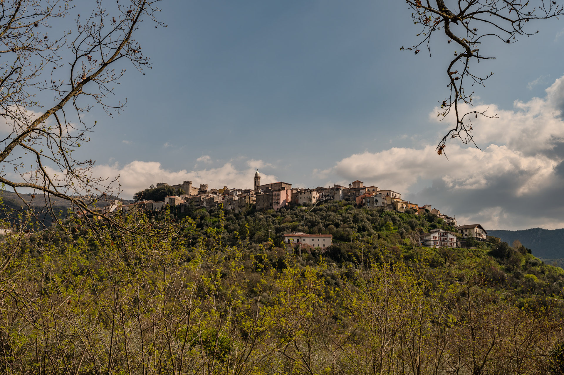
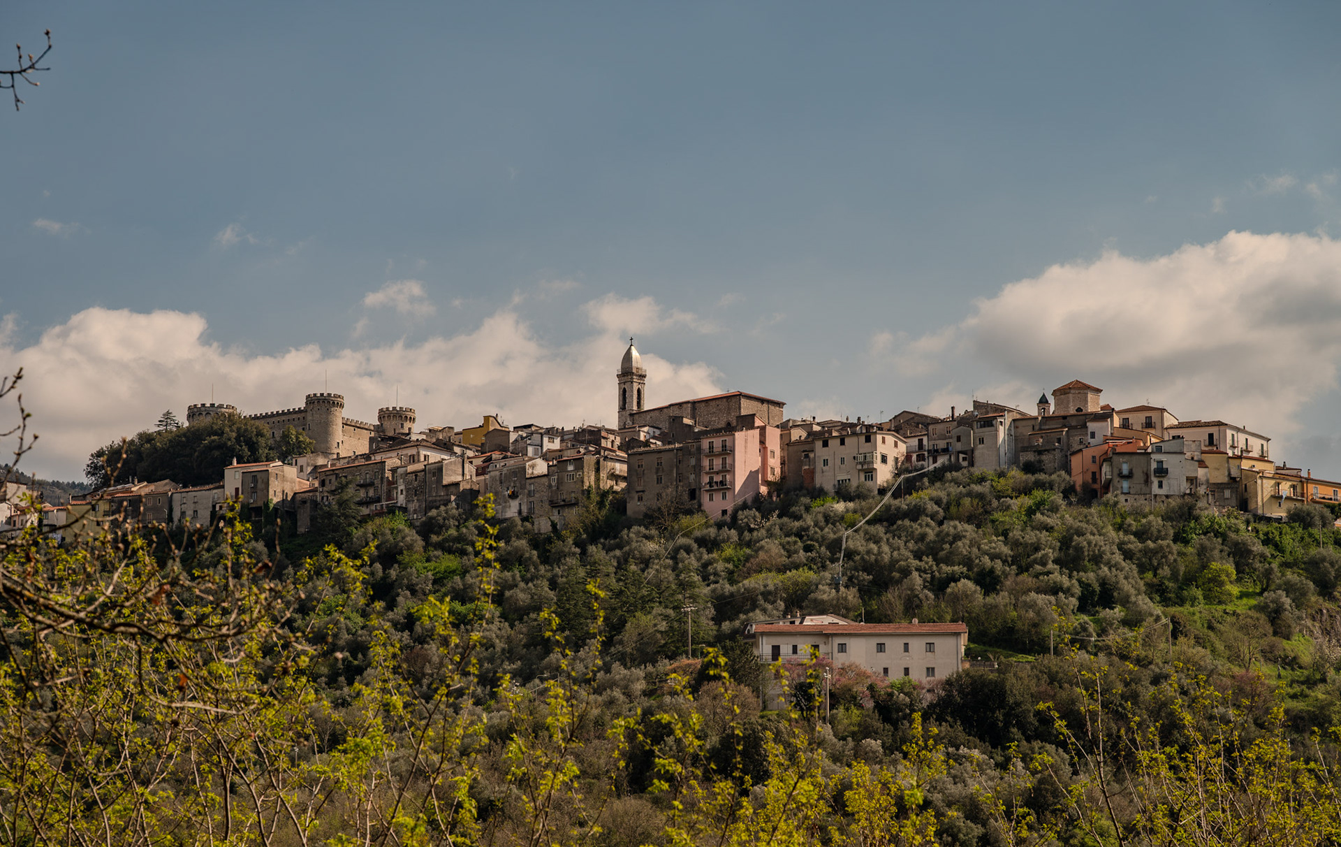
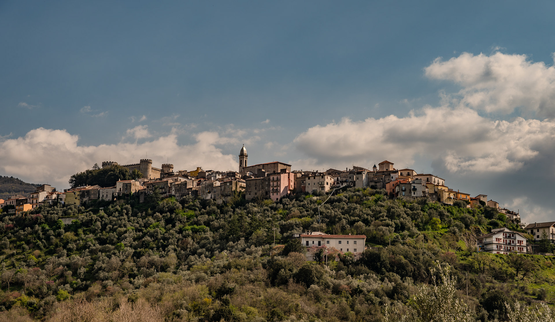
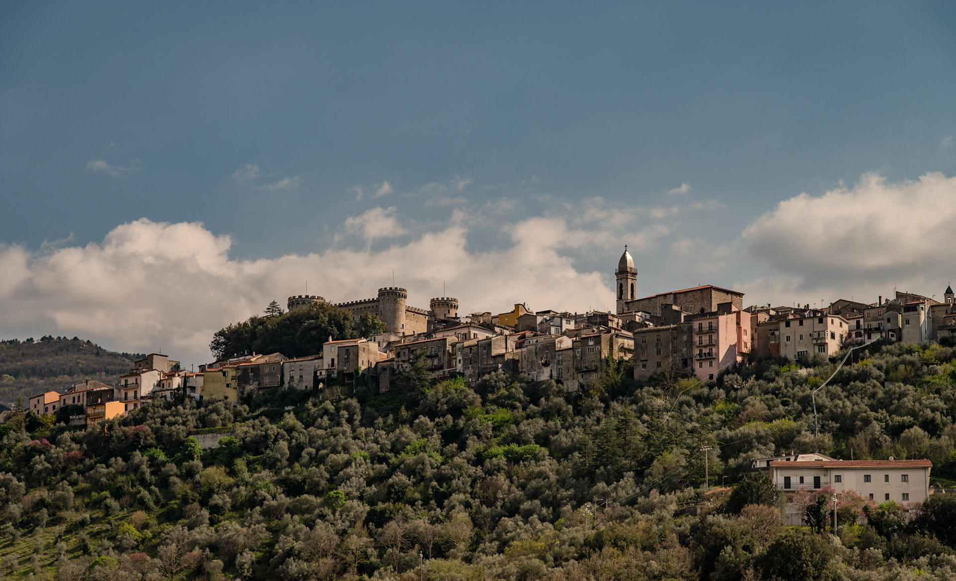
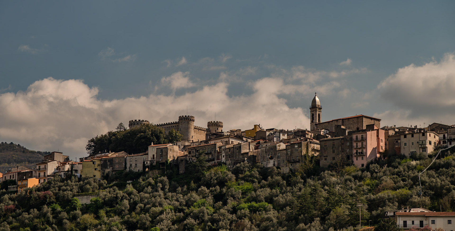
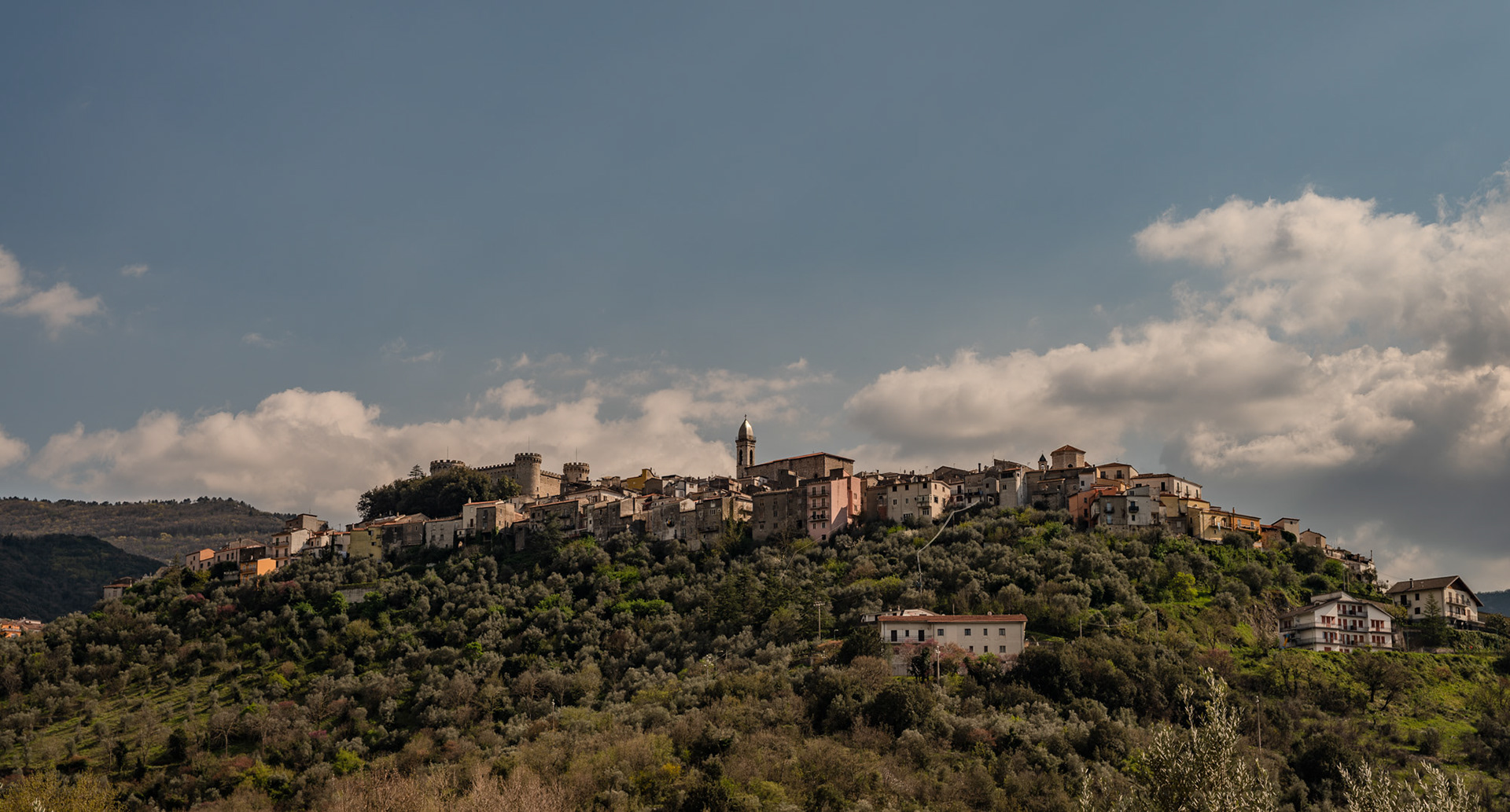
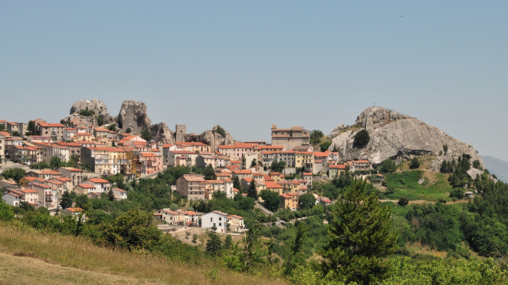
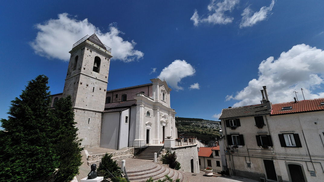
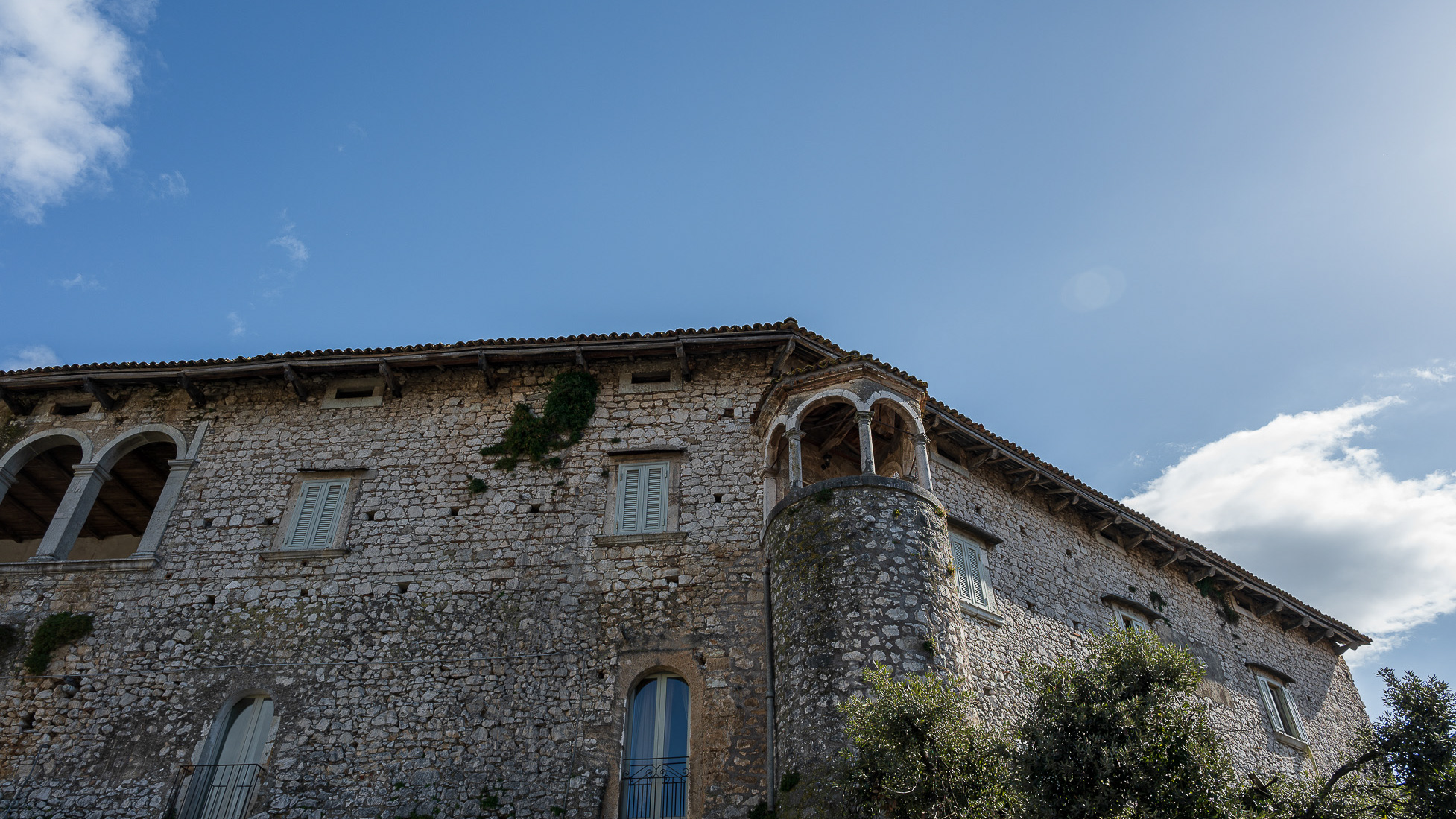
You may also like

2021
Isernia, scorci
2022
Colli a Volturno. Winter 2022
Colli a Volturno (Cuòglië in Molise) is an Italian town of 1 312 inhabitants in the province of Isernia in Molise. The municipal territory extends into the Volturno Valley on the border with the national park of Abruzzo, Lazio and Molise. Colli a Volturno (also called simply Colli), rises on three wooded hills, at an altitude of about 400 m a.s.l. (max. 1 013, min. 236 a.s.l.). The municipal area borders the municipalities of Fornelli, Rocchetta a Volturno, Montaquila, Scapoli, Cerro al Volturno, Macchia d'Isernia, Filignano and Monteroduni. The Collese area, as the name suggests, is mainly hilly interspersed with wide flat spaces. The climate is mild, the average annual temperature is 18.2 ° C, the average rainfall is 862 mm. Summers are warm and temperate, winters are cold but not particularly harsh, sporadic snowfalls, exceptionally abundant those of February 1956, January 1985 and February 2012. In autumn, rainfall is abundant, in August, the hottest month. of the year, the average temperature is 22.4 ° C; in August 2017, an exceptional heat wave caused the mercury column to reach 43 ° C. January is the coldest month, with an average temperature of 5.4 ° C. The driest month is July with an average of 32mm of rain. The month of November is the one with the highest rainfall, having an average of 118 mm. Gusts of wind are not infrequent, even of particular intensity. Temperatures vary by around 17 ° C throughout the year.
2015
Molise - Pietrabbondante (IS) Il Teatro Italico
Il teatro e tempio italico di Pietrabbondante fanno parte di una vasta area archeologica ricadente nel territorio comunale di Pietrabbondante, in provincia di Isernia, nella regione Molise. Ubicati a circa m. 966 di altitudine s.l.m. essi occupano un ripido declivio che si affaccia sulla valle del Trigno, in località Calcatello, a circa un chilometro di distanza, in linea d'aria, dalla vetta del monte Saraceno. La zona non è attraversata da alcun tracciato stradale di grande comunicazione; sono individuabili tracce di un antico sentiero esistente tra il moderno abitato di Pietrabbondante ed il vicino monte Saraceno, già praticato in antico, una direttrice stradale che ancora oggi segue l’andamento del ripido pendio e, costeggiando il lato orientale del monte, rappresenta l’unica via di accesso all'area fortificata posta in vetta. L’area sacra rappresenta, per le sue caratteristiche architettoniche e per la sua monumentalità, la testimonianza archeologica di maggior rilievo della cultura della popolazione italica dei Samnites Pentri, e la sua esplorazione sistematica ha consentito di ricostruire le vicende storiche del territorio attraverso i secoli ed ha fornito una quantità rilevante di dati sul più importante luogo di culto dello stato sannitico.
2025
Sant’Elena Sannita. Spectacular spring views
2022
Rocchetta a Volturno. Winter 2022
Rocchetta a Volturno is an Italian town of 1 098 inhabitants in the province of Isernia in Molise. The Municipality of Rocchetta al Volturno is made up of two nuclei: the original village, called Rocchetta Alta, or Rocchetta Vecchia, still perched in a defensive position on the mountain, and Rocchetta Nuova, which is located at a lower altitude. The new Rocchetta was born because, at the end of the 19th century, the slope that connected the southern part of the ancient town with the opposite hill was deforested and the land began to show serious subsidence from 1890 due to the progressive sliding of the superimposed layers of clay and sandstone, increased by water infiltrations, both rain and spring. In 1905, following further disastrous events, the population moved for the most part downstream, where there was a hamlet called Case Sparse. The modern town is developed today in the center of a plateau, bordered to the west by the terminal part of the Mainarde chain and to the east by a depression, at the bottom of which the Volturno flows; about two kilometers away are the sources of the river. Its name characterizes the toponyms of other nearby municipalities such as Colli a Volturno and Cerro al Volturno.
2015
Vastogirardi (IS)
Vastogirardi (Rë Uàštë in molisano) è un comune italiano di 690 abitanti della provincia di Isernia nel Molise. Si presume che il nome Vastogirardi tragga origine dal nome di un capitano crociato, Giusto Girardi. In passato assunse anche il nome di Castrum Girardi per via del castello (altri toponimi attestati risultano Castel Girardo, Rocca Girardo, Guasti Belardi, Guardia Giraldo e Guardia Gerardo) e successivamente il nome attuale, che semplicisticamente si attribuisce alla felice posizione geografica del paese, dalla cui sommità è possibile godere di un vasto panorama, ma molto più scientificamente da un'allitterazione di gergo longobardo. Il patrimonio archeologico-architettonico di Vastogirardi annovera i resti di un santuario sannitico del II secolo a.C. in località S. Angelo e l'eccezionale complesso del castello fortificato, corte interna e complesso parrocchiale. Portali in pietra delle abitazioni, le stesse in pietrame a pezzatura irregolare, e aperture incorniciate da blocchi lapidei e mensole in pietre sagomate rappresentano invece il carattere dell'edilizia minore. Il castello fu costruito nel XIII secolo dagli Angioini sopra il colle montuoso del borgo. Successivamente appartenne ai Caldora e poi a famiglie del regno di Napoli, tra i quali i Caracciolo. Il castello fu oggetto di consolidamento nel XVIII secolo e con tale restauro fu trasformato in residenza gentilizia. Il castello è inglobato nelle mura di cinta della parte più alta del borgo, includendo la piazza e la chiesa parrocchiale di San Nicola. Si accede da un arco a tutto sesto. Della fortificazione angioina resta una torre circolare, e del periodo Caldoresco un loggiato nella parte all'interno del borgo prospiciente la piazza. Il castello assieme al borgo forma una ellisse. La Chiesa di S. Nicola di Bari risale al XV secolo ma l'edificio risulta integralmente restaurato nel 1702, come attesta un'iscrizione murata nel portale d'ingresso. Ad una sola navata, al cui interno è presente un antico ostensorio in argento, vi si accede attraverso un porticato a sua volta accessibile da una doppia rampa. Al suo fianco vi è un campanile in pietra.
2025
Guardialfiera. Ancient Cathedral of Santa Maria Assunta
The ancient parish church of Guardialfiera, whose origins date back to the 11th century, is located at the top of the town. Romanesque and Gothic elements adorn the external walls
2025
Larino. Co-Cathedral of Santa Maria Assunta
The Larino Cathedral, or the co-cathedral basilica of Santa Maria Assunta and San Pardo, is located in the city of the same name in the province of Campobasso.
2022
Carpinone.
Carpinone is an Italian town of 1,075 inhabitants in the province of Isernia in Molise. The name derives from the Carpino river that runs along the center, or from the Carpinus plant.
2022
Castel San Vincenzo. The lake. Winter 2022
Castel San Vincenzo, Isernia, Molise, Italy. The lake. It is an artificial reservoir built at the end of the fifties for hydroelectric purposes. It occupies an area of 6.140 km². The lake of Castel San Vincenzo is an artificial reservoir built in the late 1950s for hydroelectric purposes. The lake occupies an area of 0.614 km² and has a useful capacity of 10 million cubic meters. The waters that feed the lake come mainly from the streams of the Montagna Spaccata in the nearby municipalities of Alfedena and Barrea. The waters of these streams feed the Enel power stations in Pizzone, Rocchetta a Volturno and Colli a Volturno. Although artificial, the lake is well harmonized with the surrounding landscape of mountains and woods. The aquatic fauna consists mainly of salmonids. Near the lake, where it is possible to engage in fishing and other water sports, there is an area equipped for camping and a riding stable.
Back to Top