You may also like

2022
The Church - cave of St. Michael the Archangel
The Grotta di San Michele Arcangelo, rebuilt and enlarged in 1890 on the remains of the ancient church. In it the pilgrim can experience the link between man and nature.
2025
Agnone. Winter landscape 2024
2015
Vastogirardi (IS)
Vastogirardi (Rë Uàštë in molisano) è un comune italiano di 690 abitanti della provincia di Isernia nel Molise. Si presume che il nome Vastogirardi tragga origine dal nome di un capitano crociato, Giusto Girardi. In passato assunse anche il nome di Castrum Girardi per via del castello (altri toponimi attestati risultano Castel Girardo, Rocca Girardo, Guasti Belardi, Guardia Giraldo e Guardia Gerardo) e successivamente il nome attuale, che semplicisticamente si attribuisce alla felice posizione geografica del paese, dalla cui sommità è possibile godere di un vasto panorama, ma molto più scientificamente da un'allitterazione di gergo longobardo. Il patrimonio archeologico-architettonico di Vastogirardi annovera i resti di un santuario sannitico del II secolo a.C. in località S. Angelo e l'eccezionale complesso del castello fortificato, corte interna e complesso parrocchiale. Portali in pietra delle abitazioni, le stesse in pietrame a pezzatura irregolare, e aperture incorniciate da blocchi lapidei e mensole in pietre sagomate rappresentano invece il carattere dell'edilizia minore. Il castello fu costruito nel XIII secolo dagli Angioini sopra il colle montuoso del borgo. Successivamente appartenne ai Caldora e poi a famiglie del regno di Napoli, tra i quali i Caracciolo. Il castello fu oggetto di consolidamento nel XVIII secolo e con tale restauro fu trasformato in residenza gentilizia. Il castello è inglobato nelle mura di cinta della parte più alta del borgo, includendo la piazza e la chiesa parrocchiale di San Nicola. Si accede da un arco a tutto sesto. Della fortificazione angioina resta una torre circolare, e del periodo Caldoresco un loggiato nella parte all'interno del borgo prospiciente la piazza. Il castello assieme al borgo forma una ellisse. La Chiesa di S. Nicola di Bari risale al XV secolo ma l'edificio risulta integralmente restaurato nel 1702, come attesta un'iscrizione murata nel portale d'ingresso. Ad una sola navata, al cui interno è presente un antico ostensorio in argento, vi si accede attraverso un porticato a sua volta accessibile da una doppia rampa. Al suo fianco vi è un campanile in pietra.
2018
Boiano (CB)
Bojano è un comune italiano di 8 097 abitanti della provincia di Campobasso. Importante città dei Sanniti, fu conquistata dai Romani nel III secolo a.C. a seguito della battaglia di Boviano. Nel VI secolo vi fu fondata la diocesi, collegata a Campobasso; facente parte del Ducato di Benevento, nel XIII secolo divenne la capitale del ducato omonimo, per poi entrare a far parte del Contado di Molise. Divenuta possesso dei vari signori campani Pandone, Carafa, De Capua, Bojano attraversò duri periodi a seguito del terremoto del 1805 prima, e della seconda guerra mondiale poi.
2022
Isernia. The "Fraternal Fountain"
2022
Rocchetta a Volturno. Winter 2022
Rocchetta a Volturno is an Italian town of 1 098 inhabitants in the province of Isernia in Molise. The Municipality of Rocchetta al Volturno is made up of two nuclei: the original village, called Rocchetta Alta, or Rocchetta Vecchia, still perched in a defensive position on the mountain, and Rocchetta Nuova, which is located at a lower altitude. The new Rocchetta was born because, at the end of the 19th century, the slope that connected the southern part of the ancient town with the opposite hill was deforested and the land began to show serious subsidence from 1890 due to the progressive sliding of the superimposed layers of clay and sandstone, increased by water infiltrations, both rain and spring. In 1905, following further disastrous events, the population moved for the most part downstream, where there was a hamlet called Case Sparse. The modern town is developed today in the center of a plateau, bordered to the west by the terminal part of the Mainarde chain and to the east by a depression, at the bottom of which the Volturno flows; about two kilometers away are the sources of the river. Its name characterizes the toponyms of other nearby municipalities such as Colli a Volturno and Cerro al Volturno.
2021
Molise, Italy. Glimpses of summer.
Molise is an Italian mountainous region with a stretch of coast overlooking the Adriatic Sea. It includes a part of the Abruzzo National Park in the Apennine mountain range, with a rich wildlife.
2024
Macchiagodena. Church of San Lorenzo.
The church of San Lorenzo is located near the Castle. Initially the structure was used as a convent, until it was abolished in 1866.
2025
Sant’Elena Sannita. Church of St. Michael the Archangel
2023
Vastogirardi, novembre 2023
Physical geography 
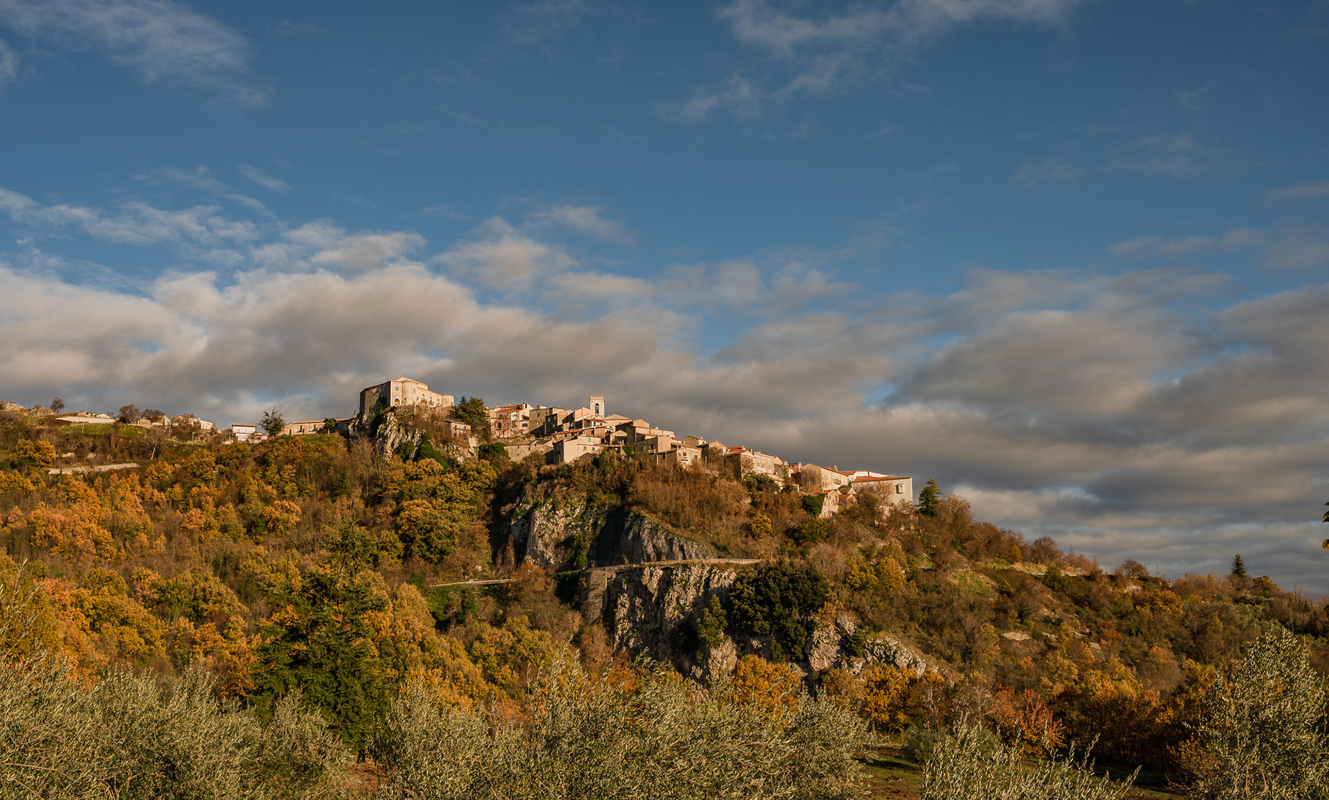
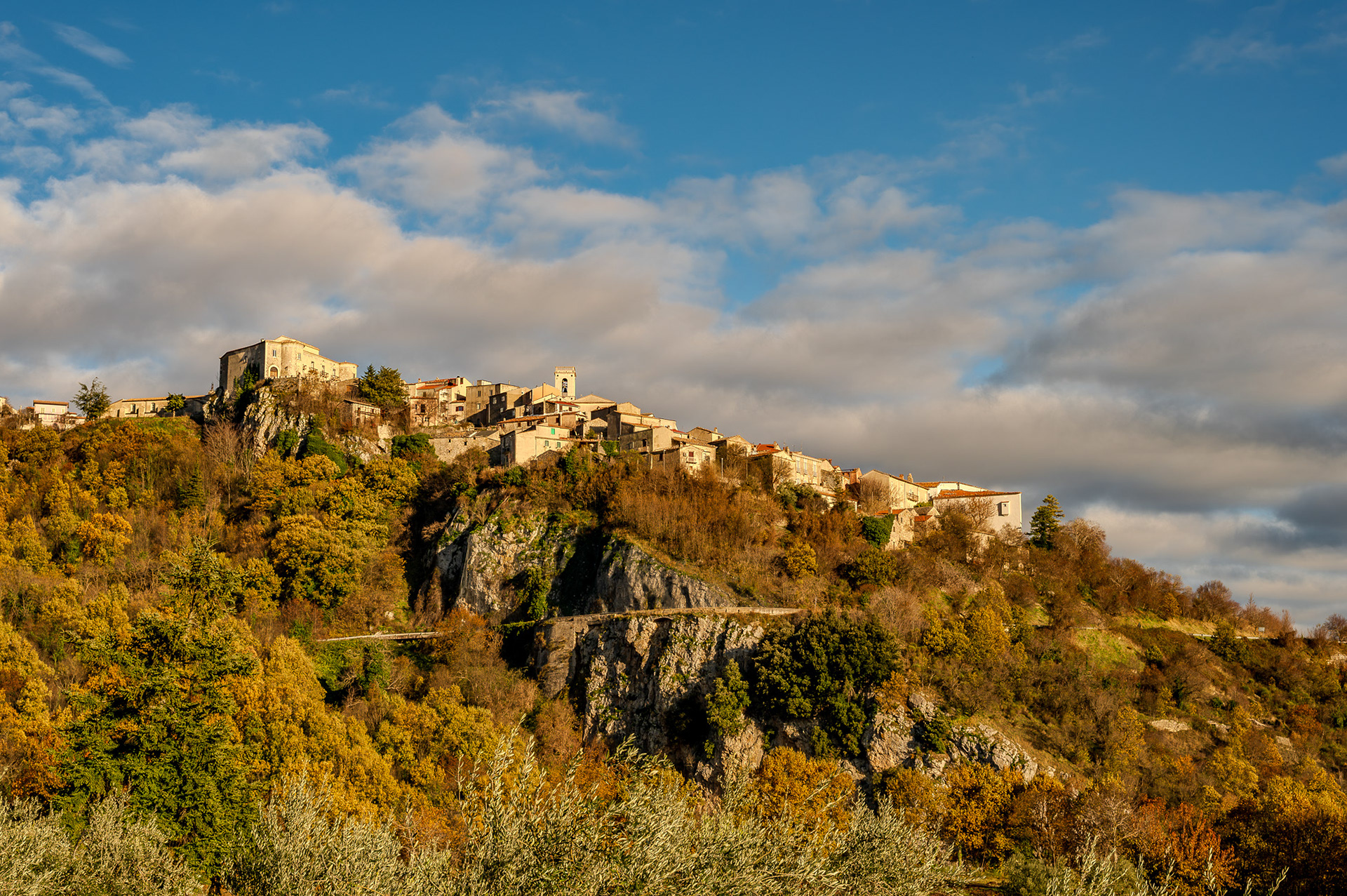
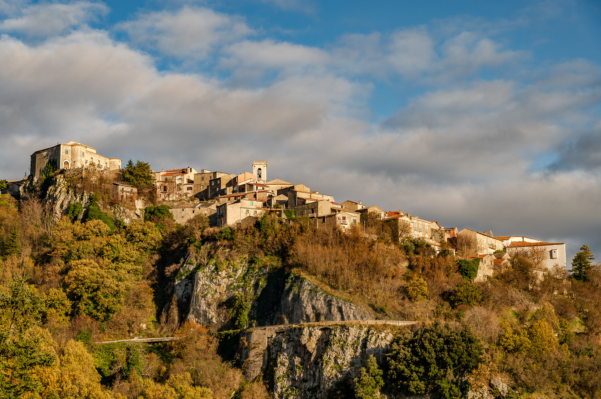
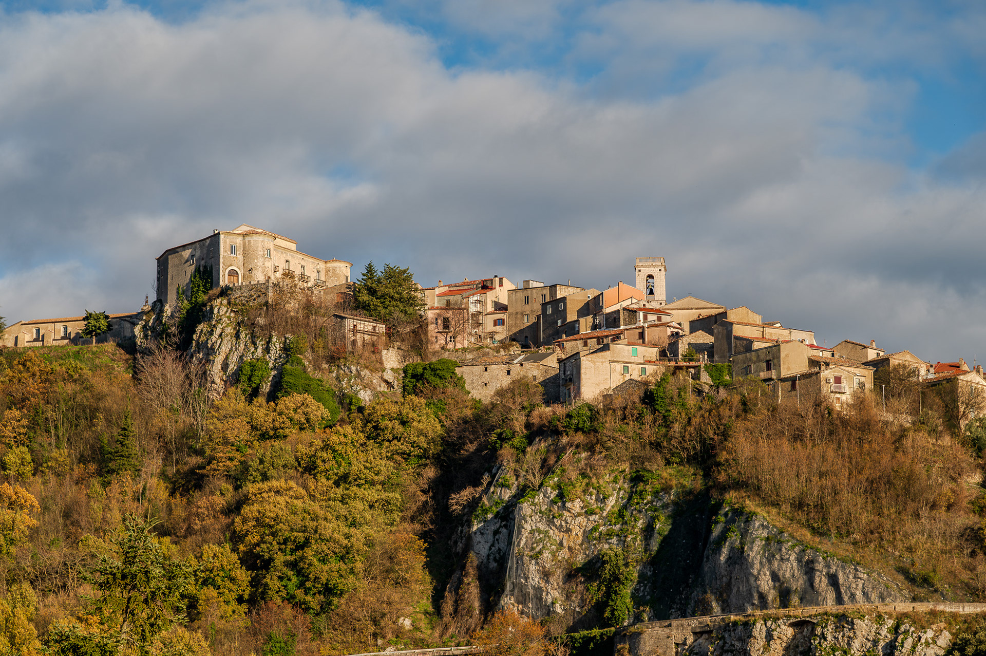
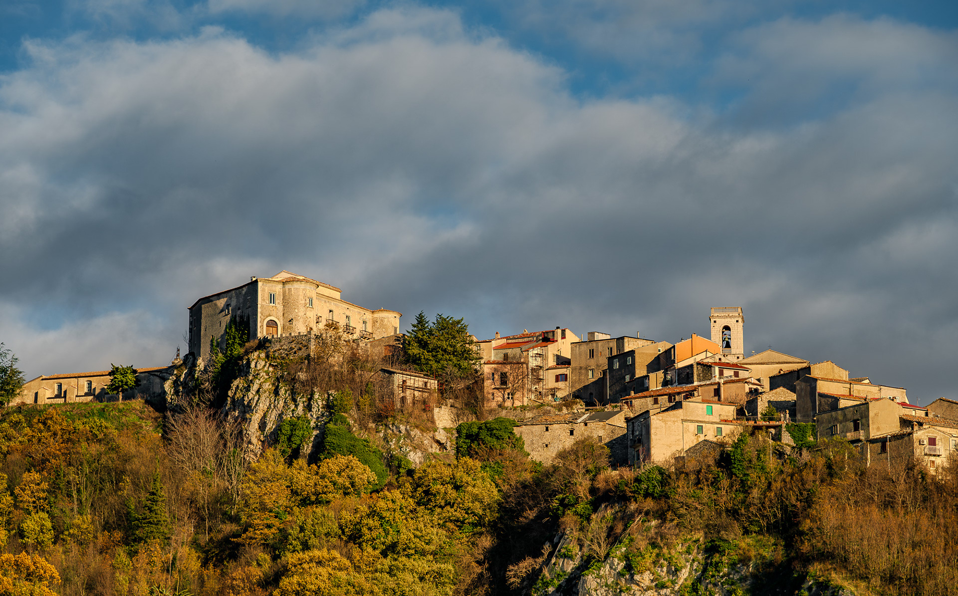
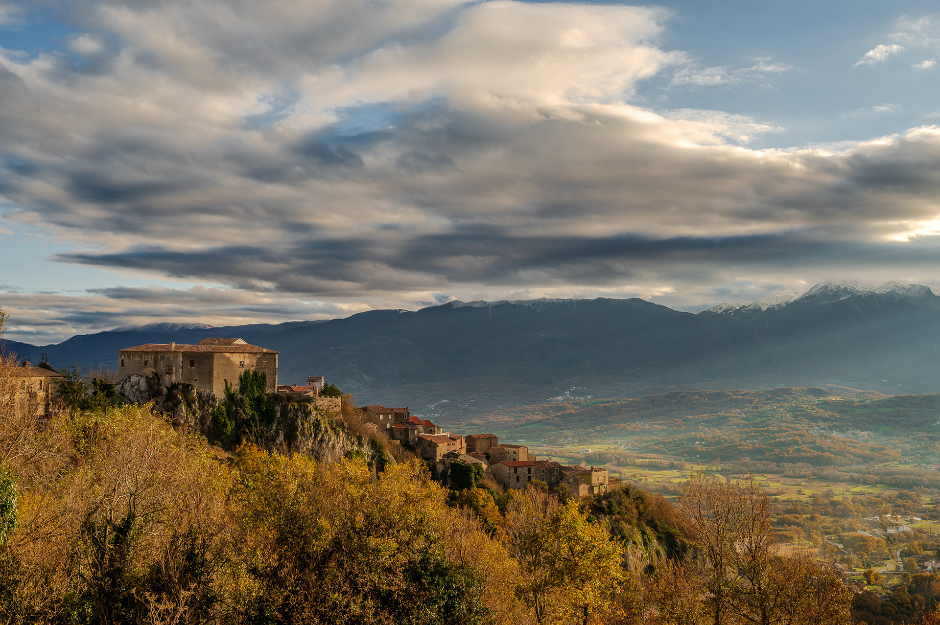
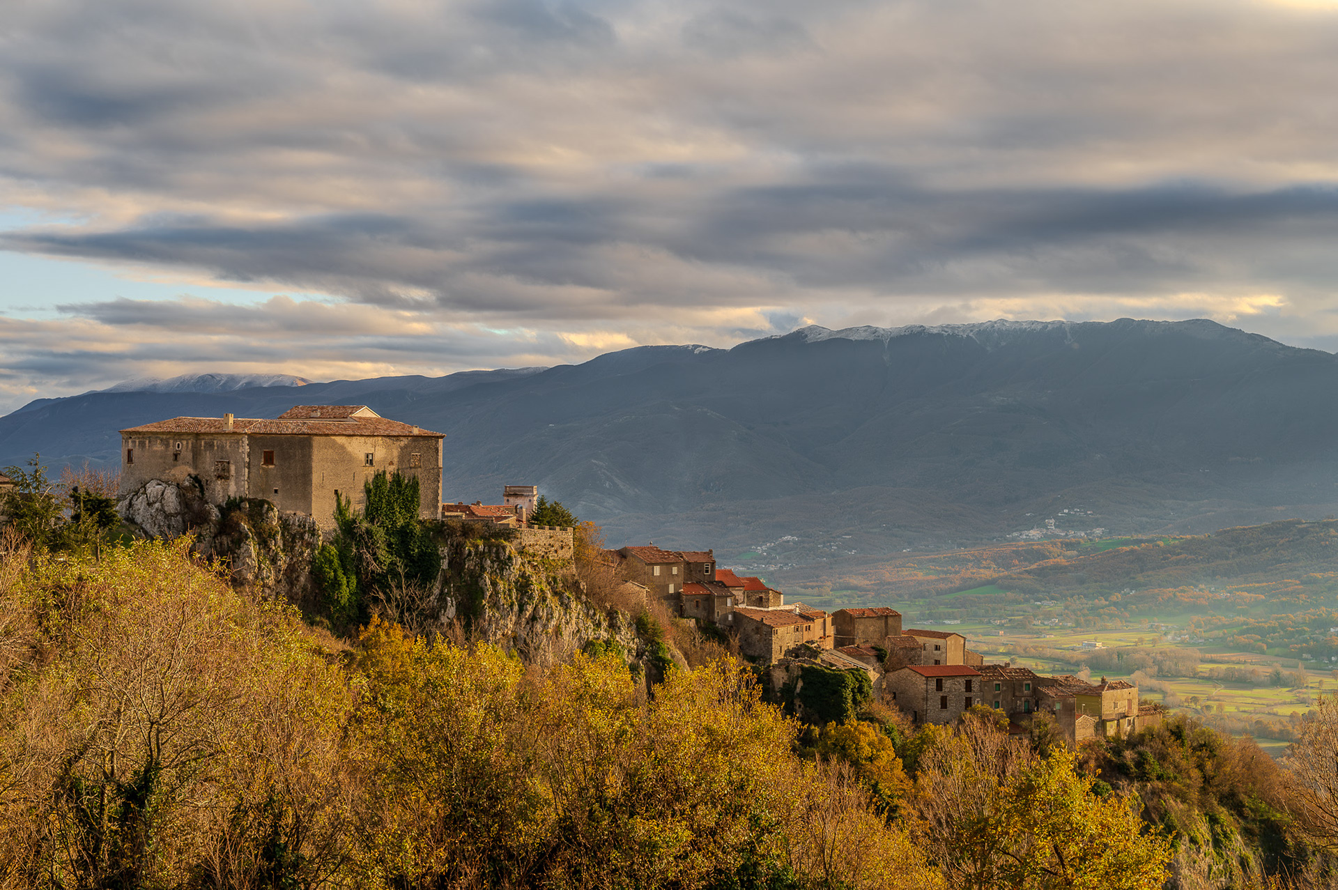
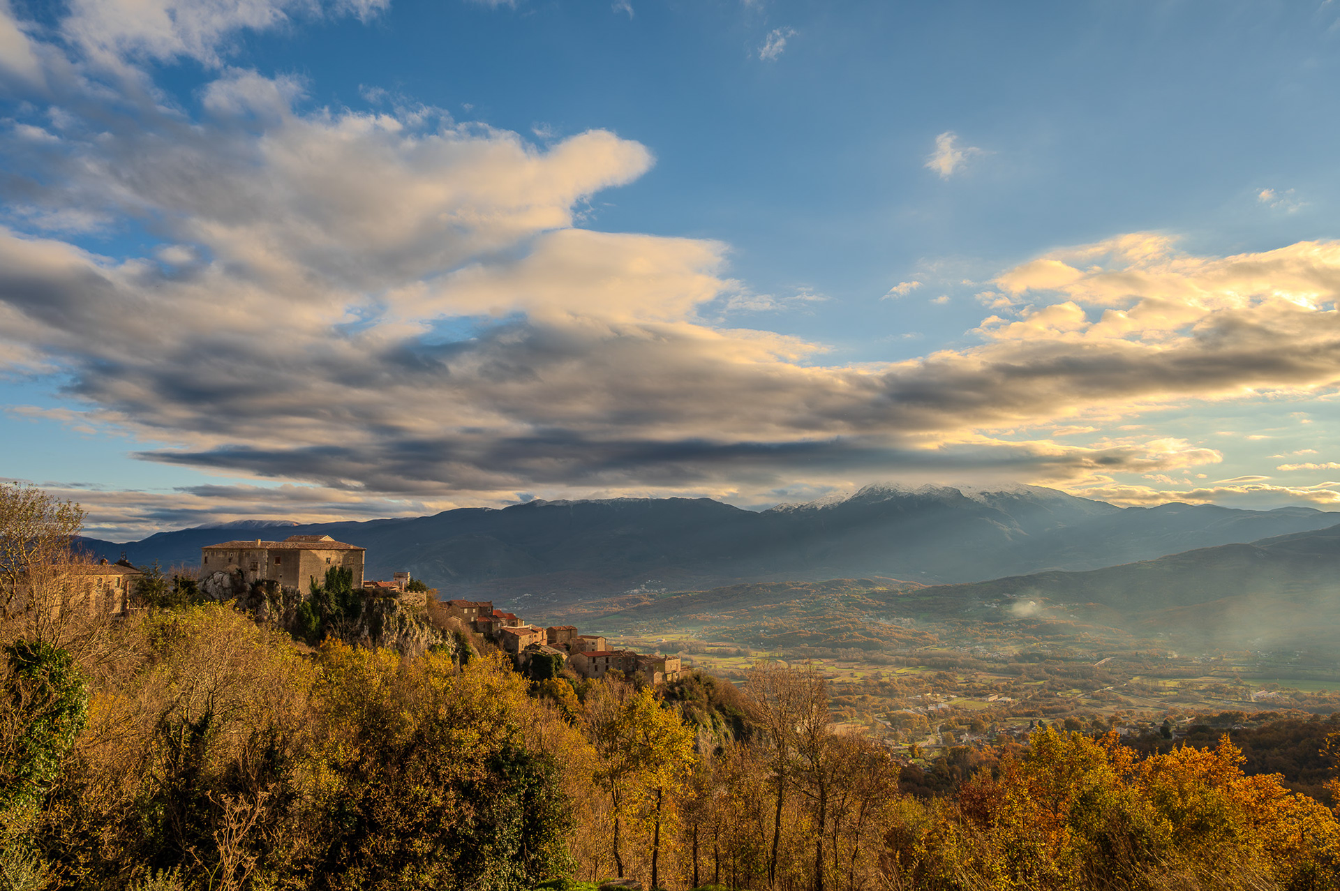
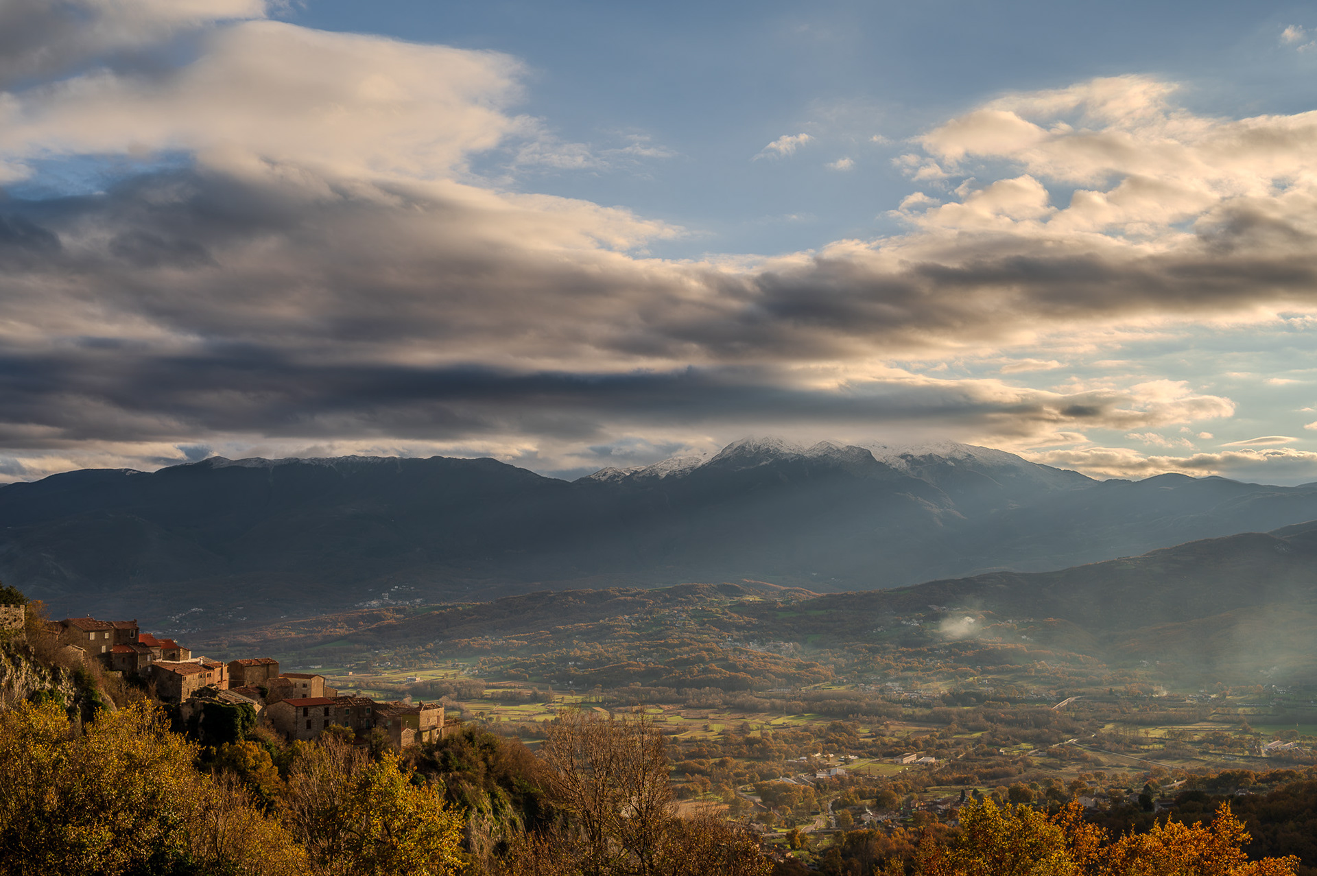
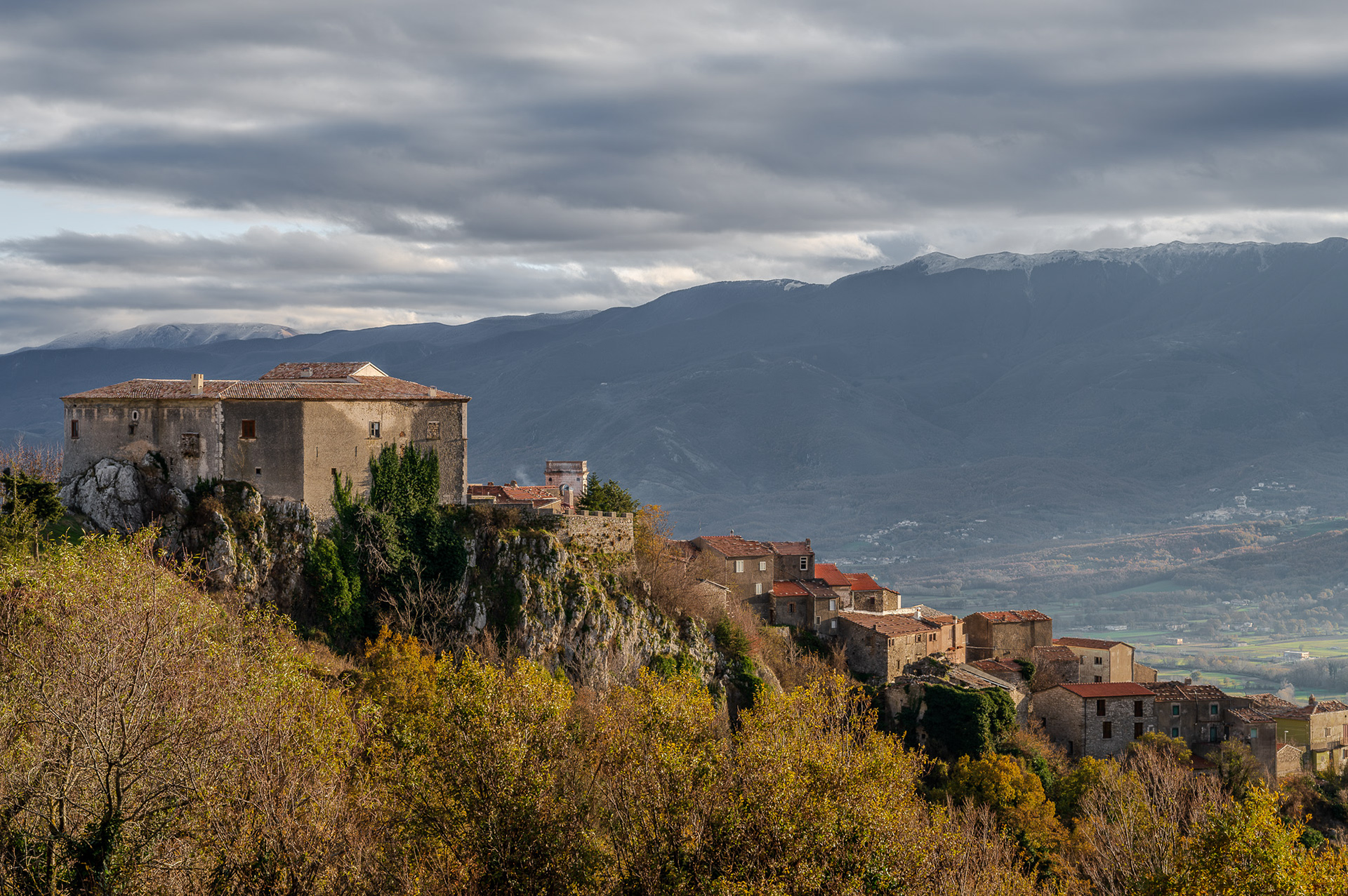
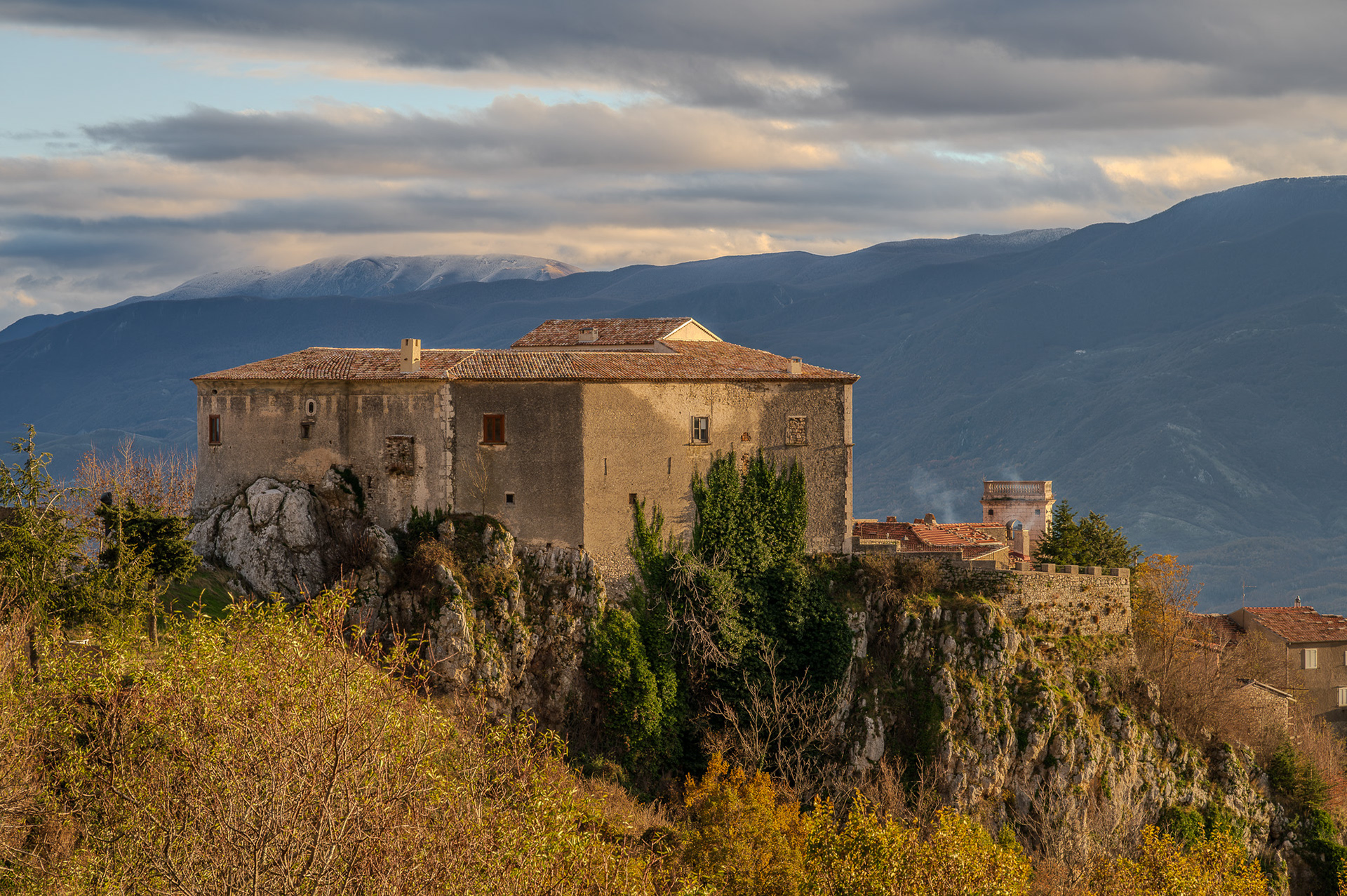
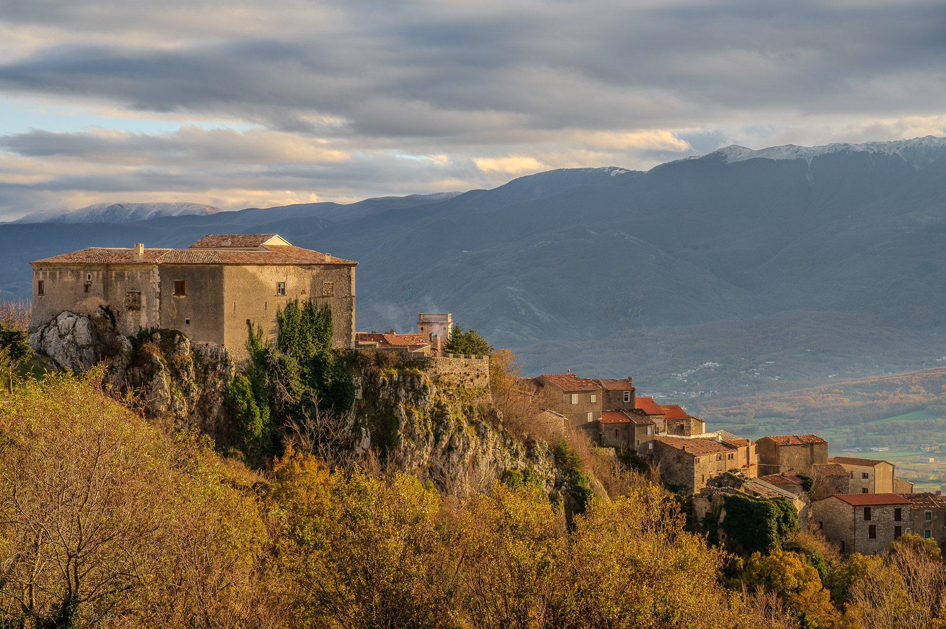
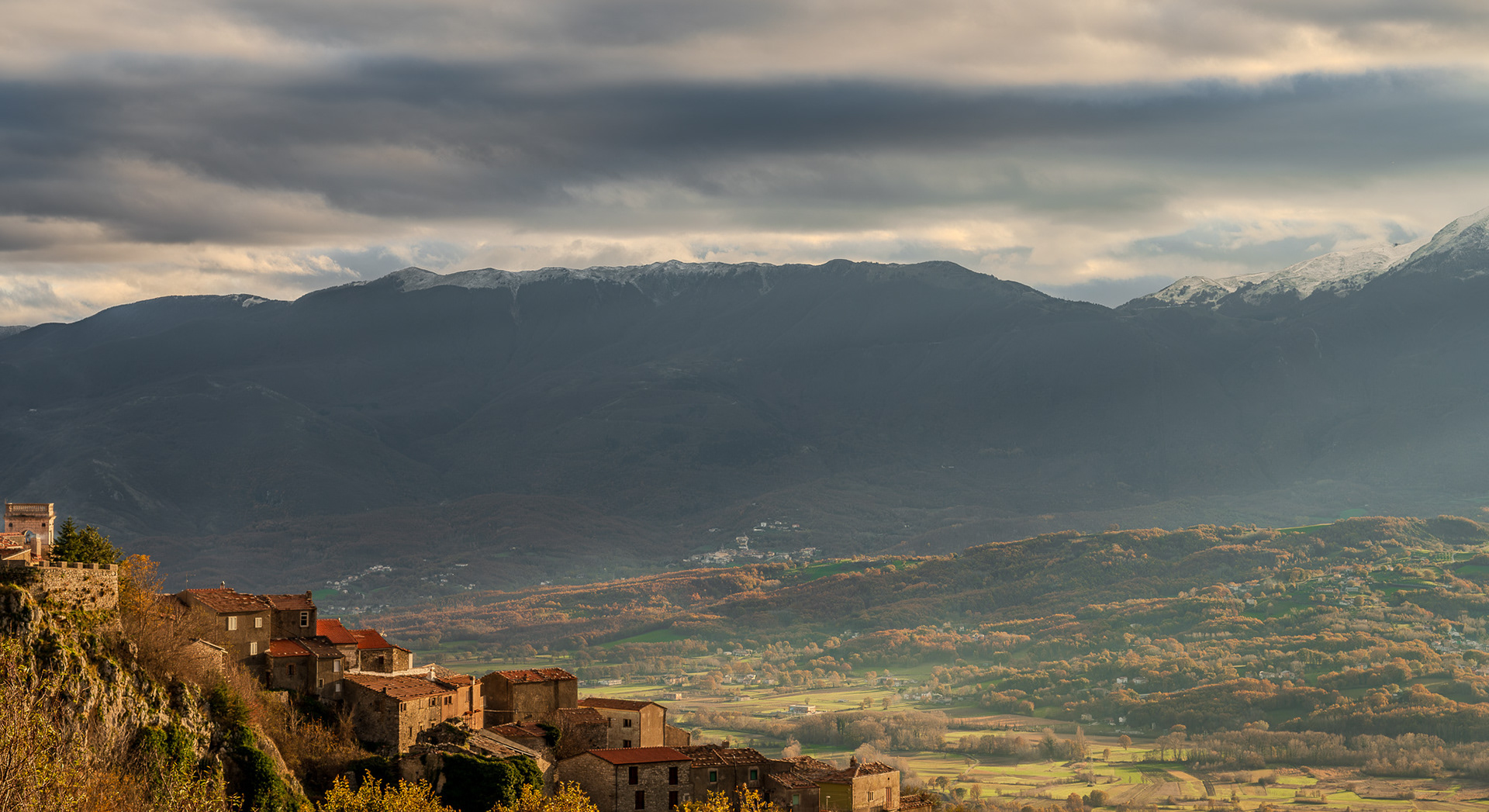
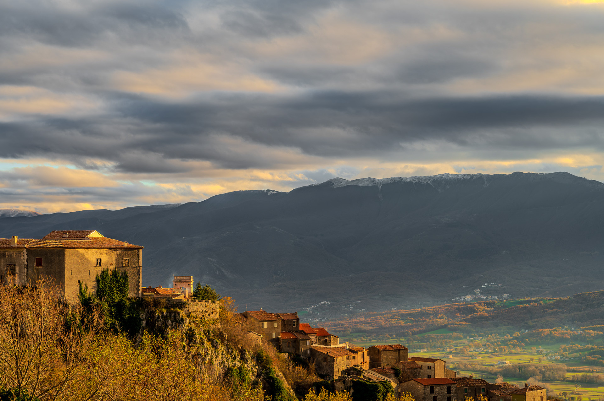
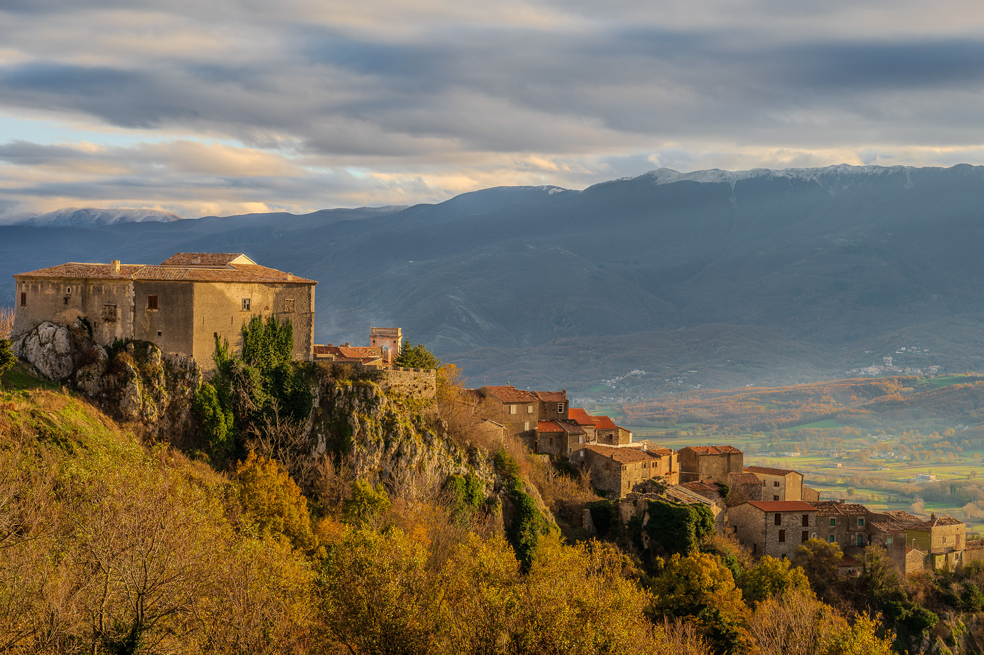
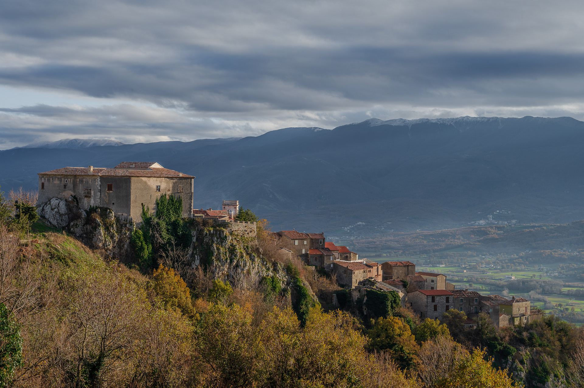
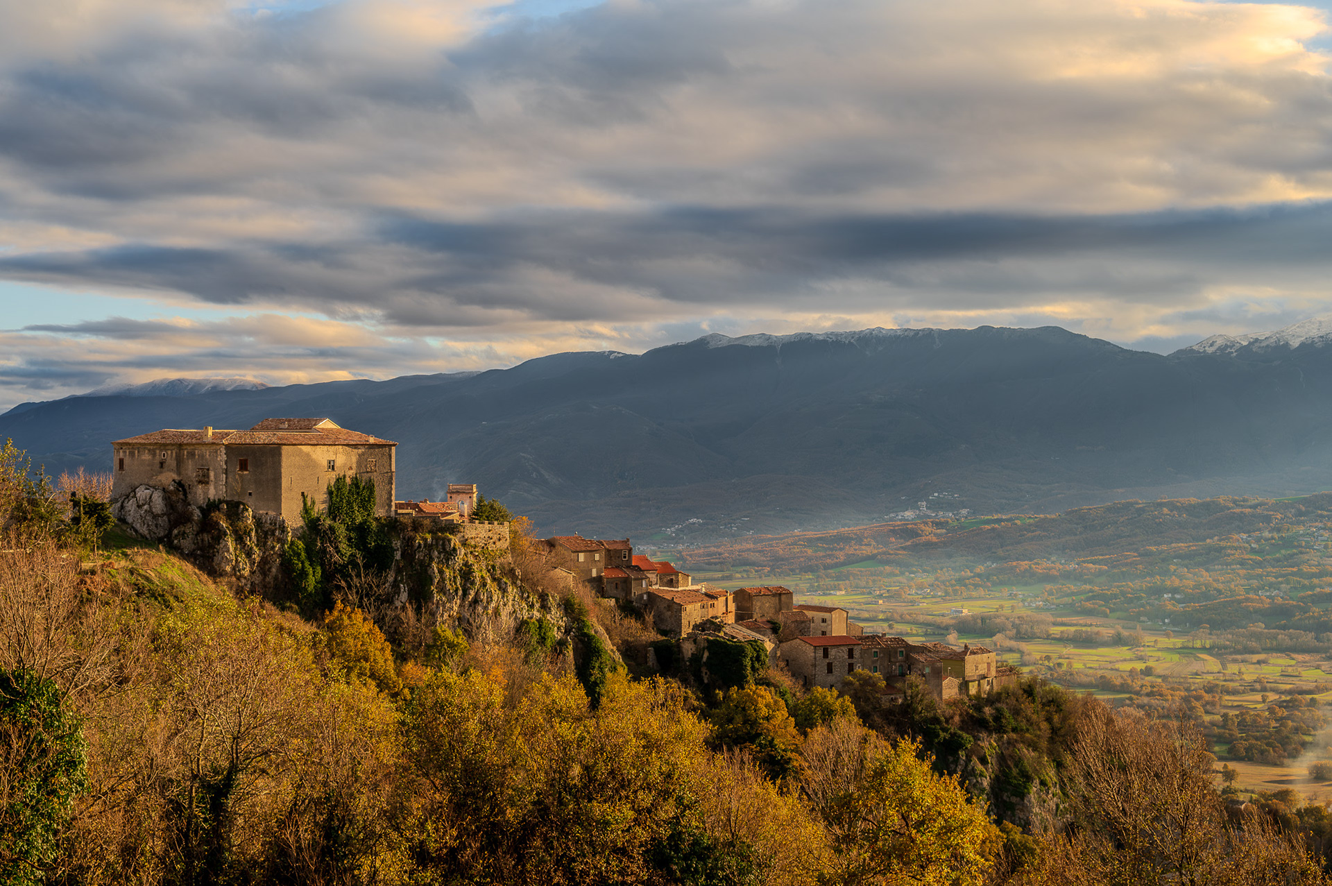
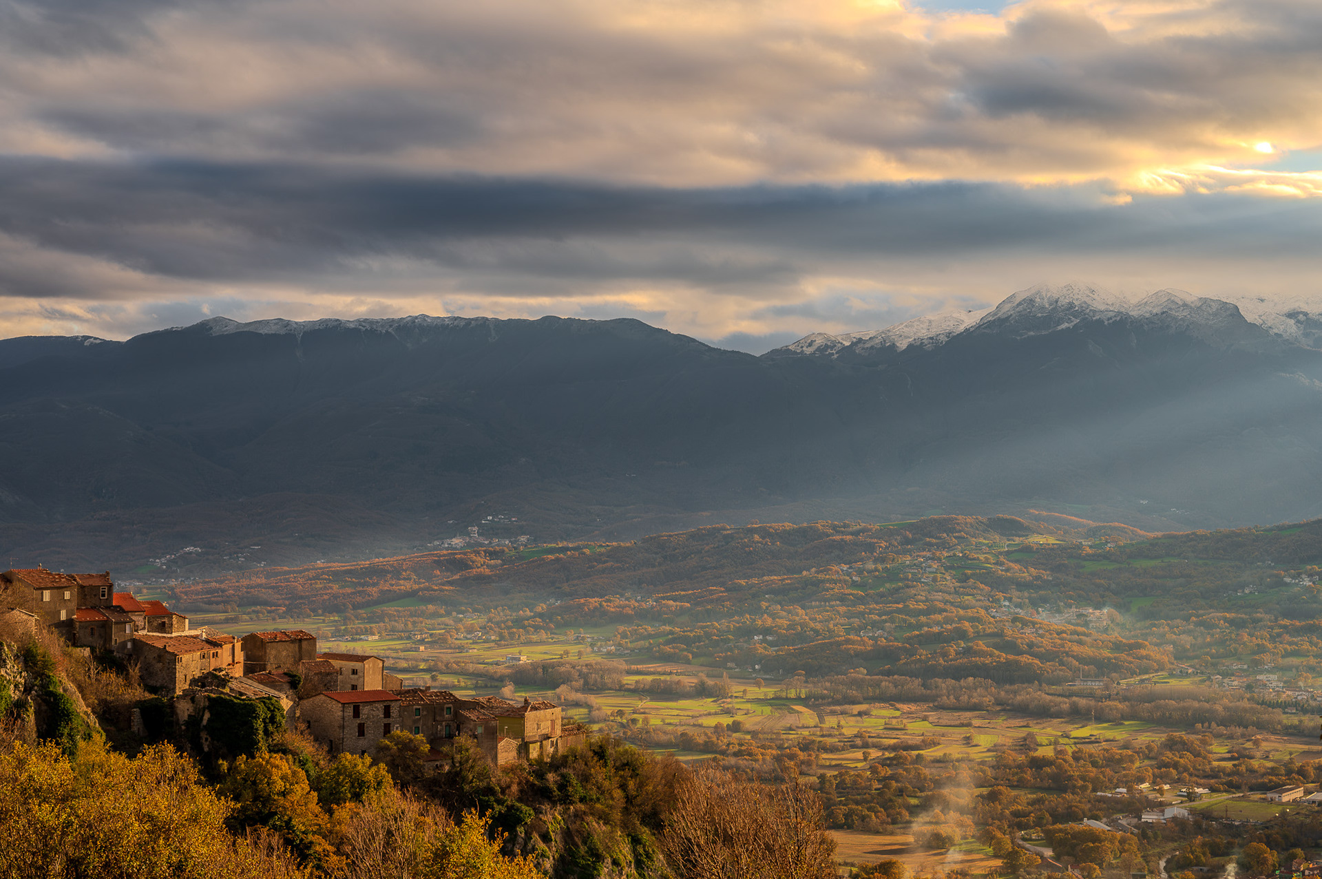
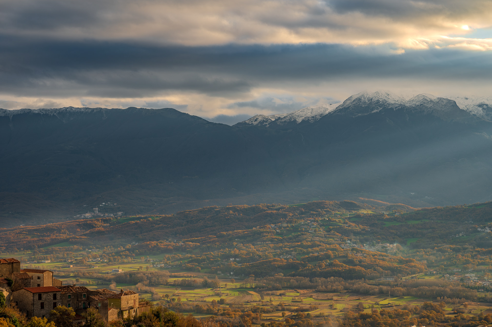
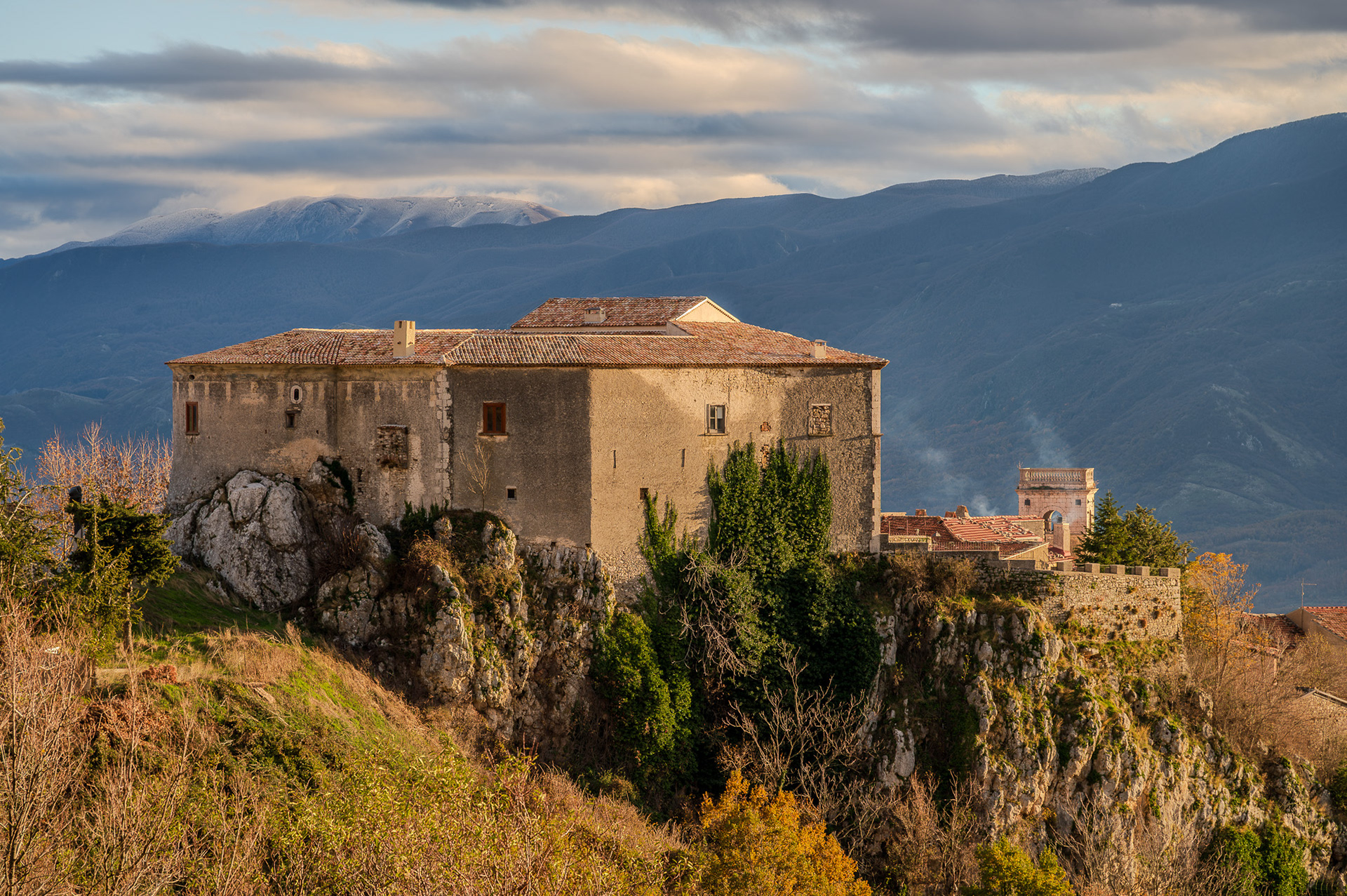
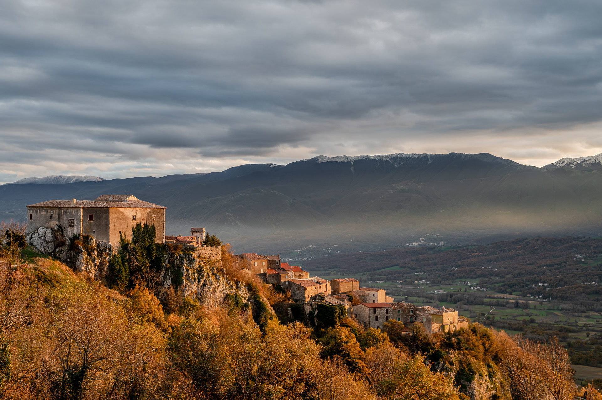
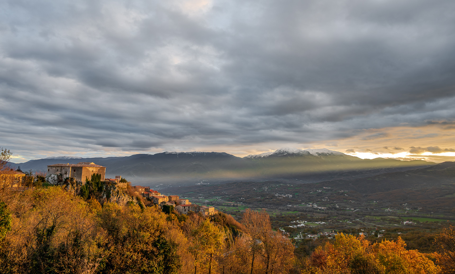
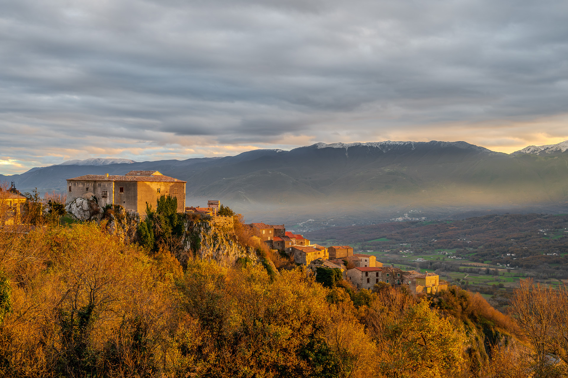
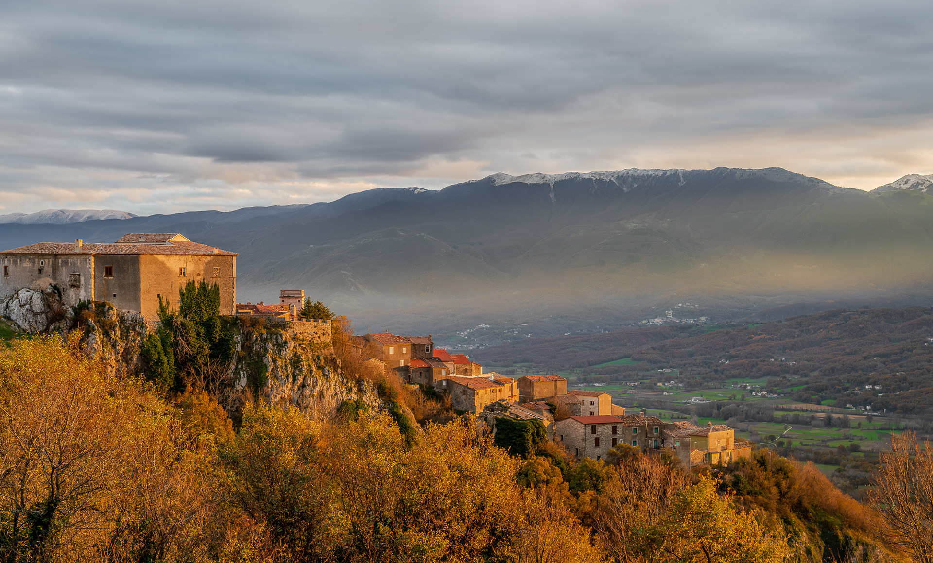
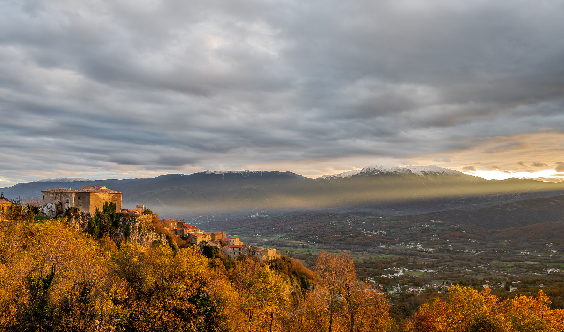
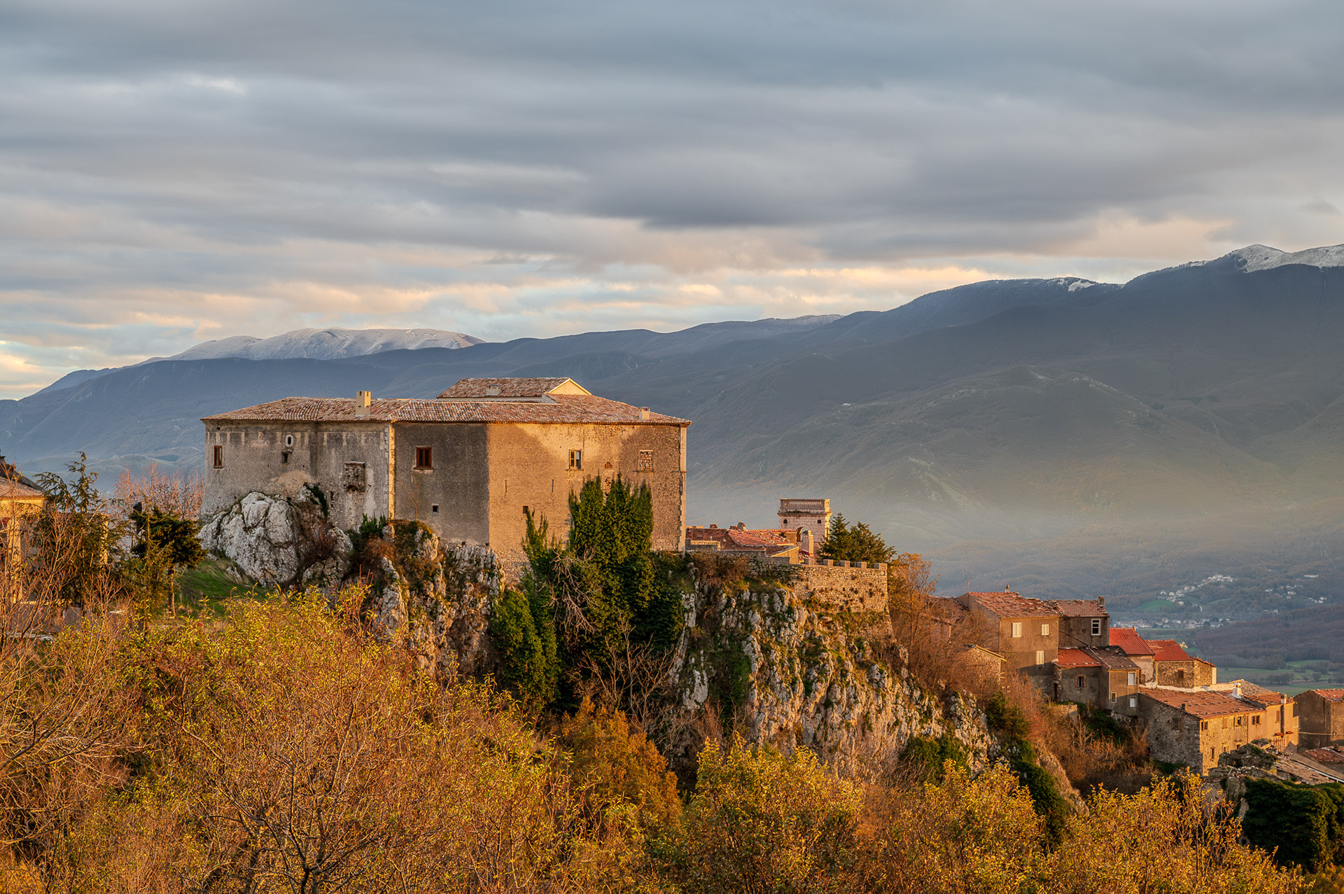
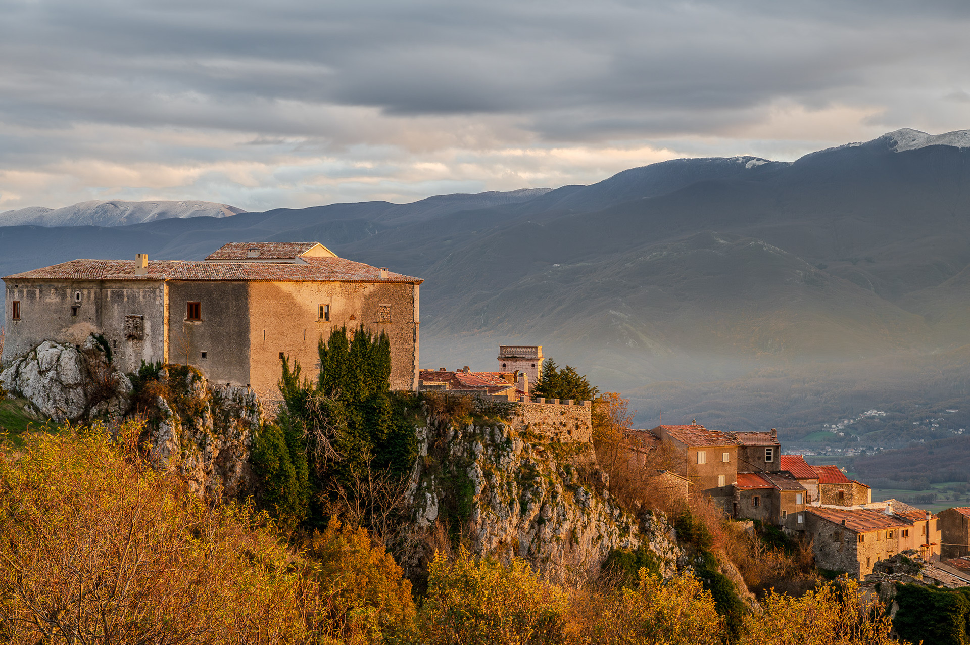
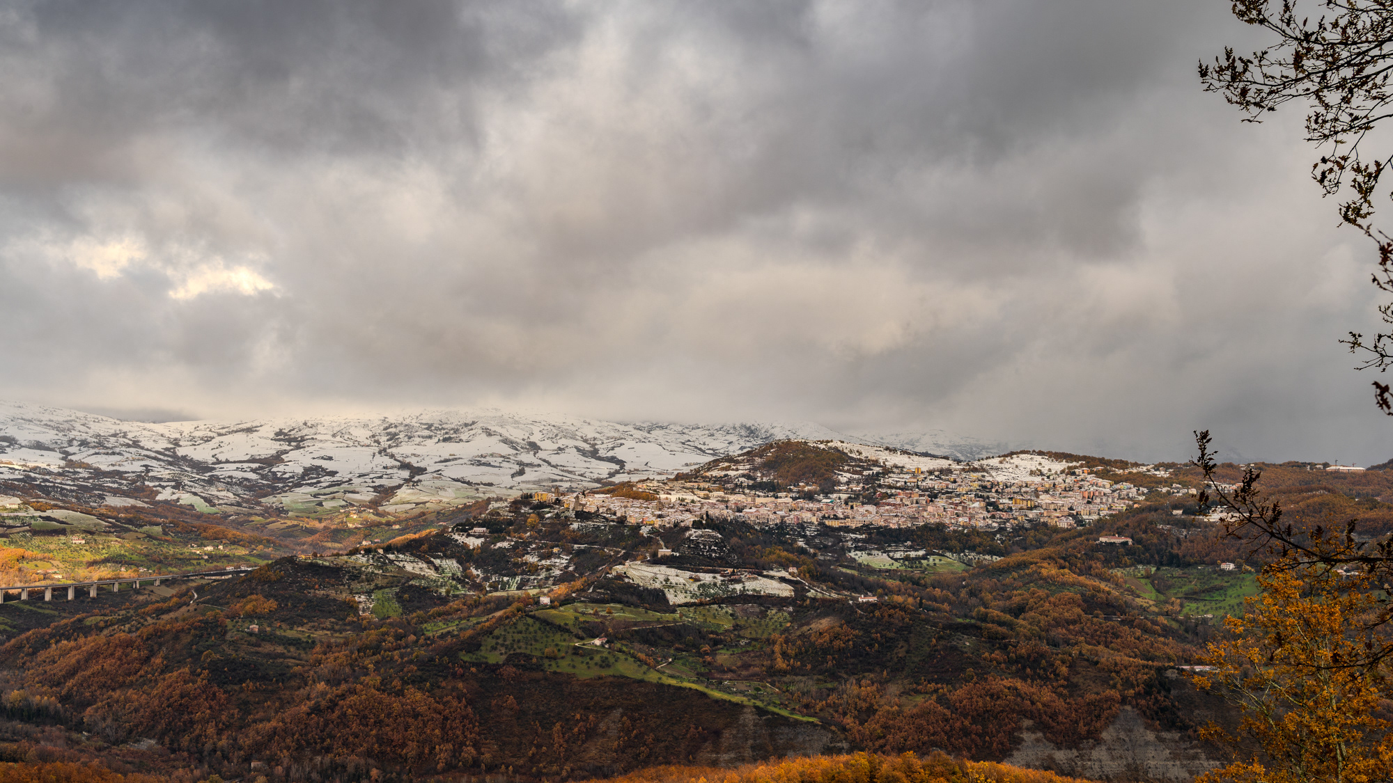
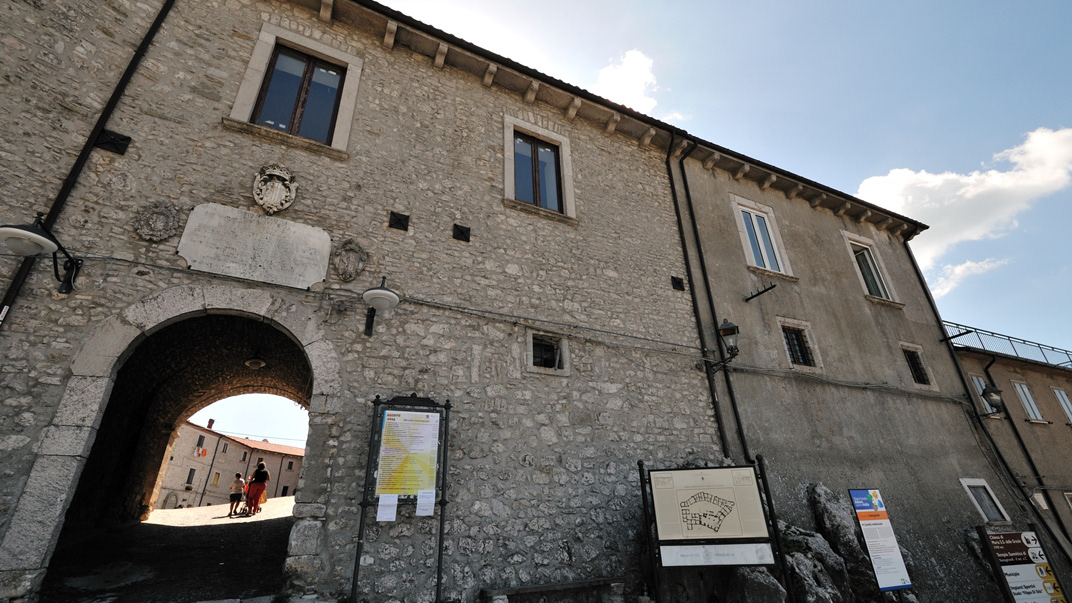
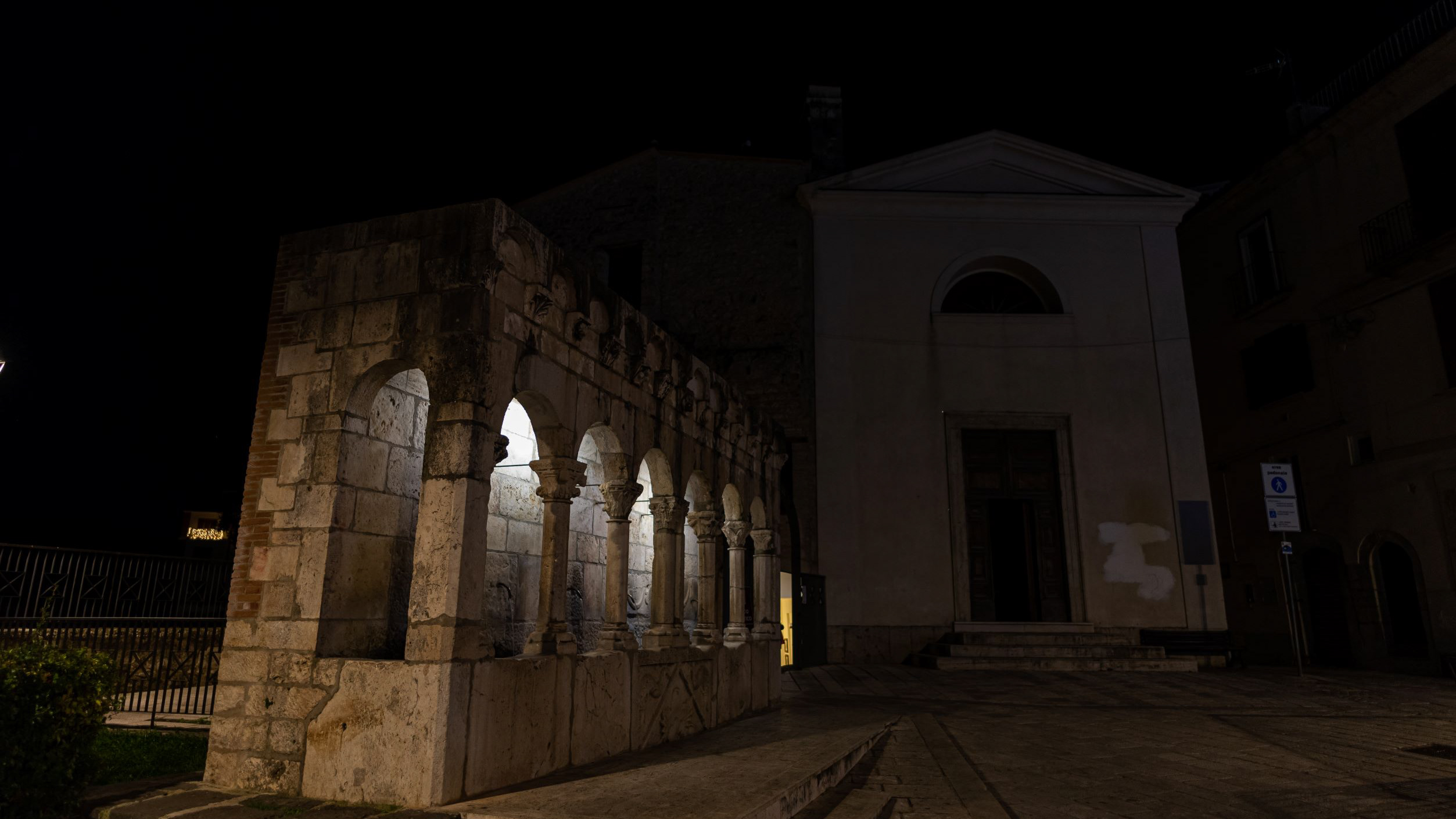
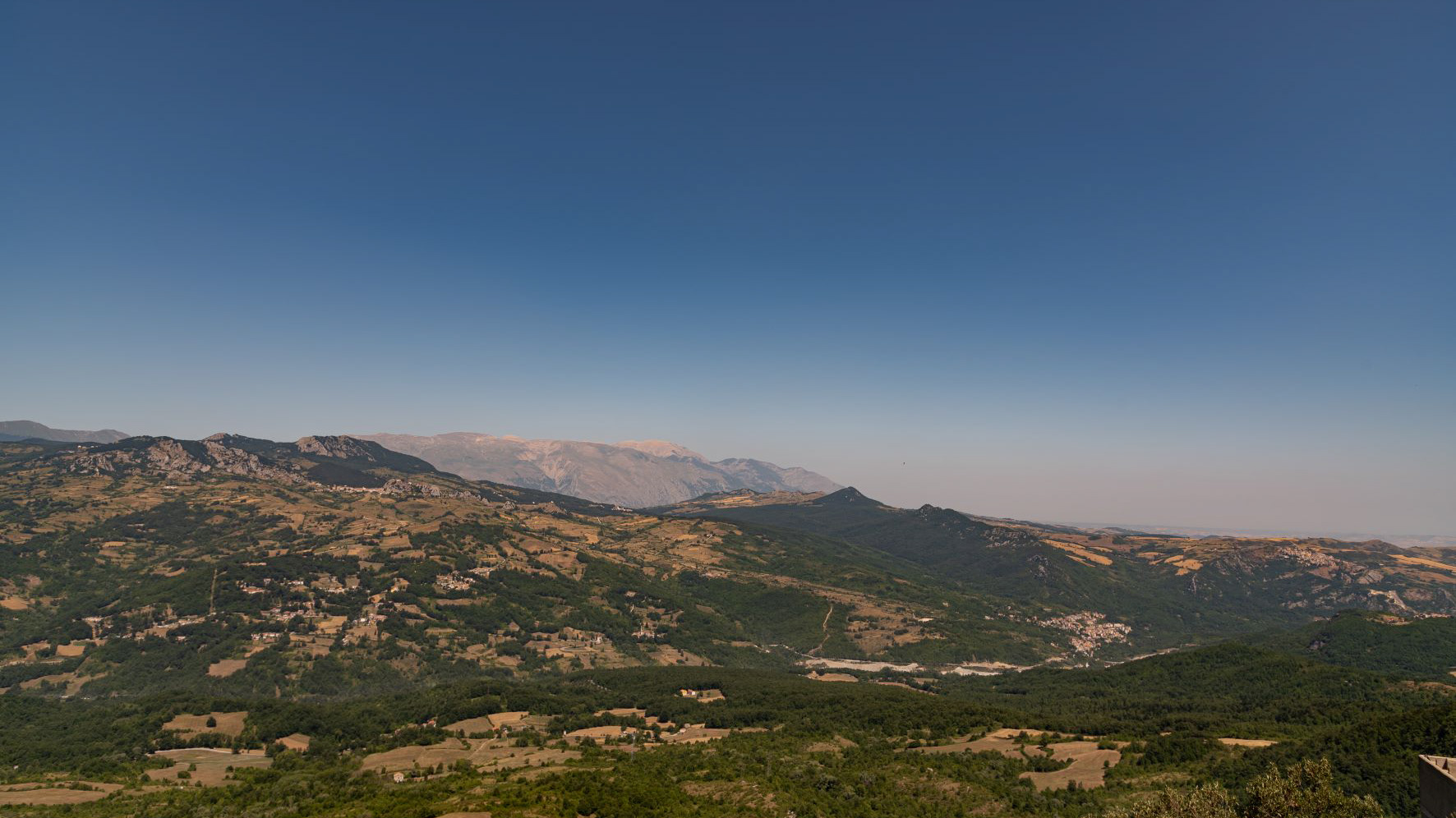
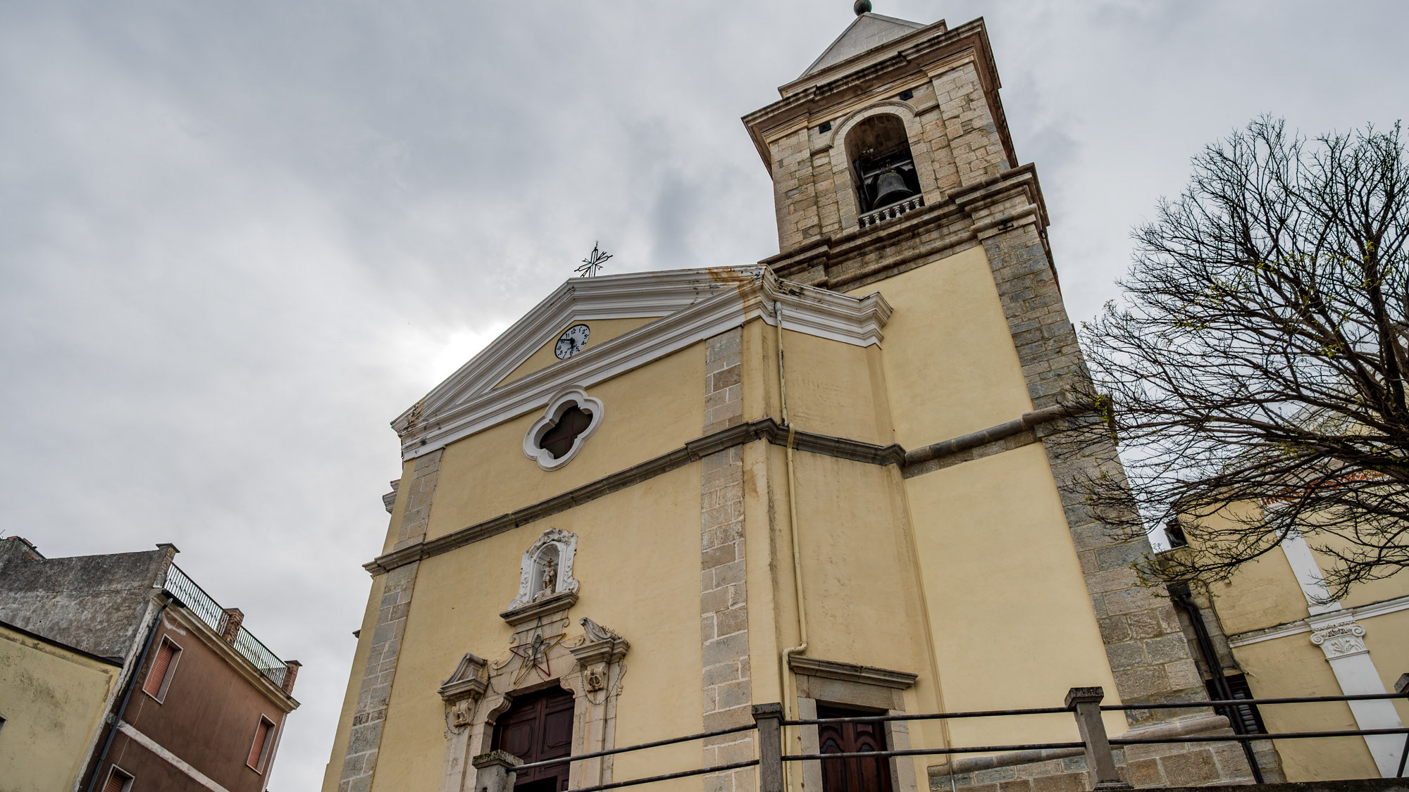
It is located at 1200 m above sea level. in the part of Molise bordering Abruzzo. The territory of Vastogirardi (IS) extends over an area of 60.72 km² and borders the municipalities of Capracotta to the north, San Pietro Avellana, Castel di Sangro (AQ) and Rionero Sannitico to the west, Forlì del Sannio, Roccasicura and Carovilli to the south, Agnone to the east. From a morphological point of view, the territory is separated from that of Capracotta by reliefs of Monte Capraro, which oscillate between 1300 - 1350 m, which descend steeply to Piano S. Angelo and Difesa Grande and Capo di Trigno (ancient lake basin ) at an altitude of 1100 m from which the Trigno river originates, one of the two most important Molise rivers which flows into the Adriatic Sea and gives its name to the road of the same name which reaches up to San Salvo (CH), i.e. the Trignina. To the west are the mountains of Montagnola (1292 m) and Monte Miglio (1350 m), to the south is Monte Pizzi (1373 m), while to the east are the mountains of Montagna Fiorita with Montarone (1278 m). Vastogirardi develops close to a hill at the top of which are the castle and the ecclesiastical complex of San Nicola di Bari. Inside the walls is the village, which appears well preserved in its original defense function, as evidenced by the cylindrical towers incorporated in factories and the supports between building blocks. The result of subsequent expansions, the churches of S. Rocco and S. Maria delle Grazie were built at the beginning of the 18th century and incorporated into the third urban expansion dating back to the 18th - 19th century. Over the course of the last century the town no longer followed the aggregation trend of stepped bands, according to the morphological trend of the site, but developed along via Garibaldi c.da Difensa (towards Castel di Sangro) and via Re d'Italia (direction Isernia). Origins of the name It is assumed that the name Vastogirardi originates from the name of a crusader captain, Giusto Girardi. In the past it also took the name of Castrum Girardi due to the castle (other attested toponyms are Castel Girardo, Rocca Girardo, Guasti Belardi, Guardia Giraldo and Guardia Gerardo) and subsequently its current name, deriving from an alliteration of Lombard jargon.
Back to Top