Poggio Sannita (IS)
2016
Poggio Sannita (Caccavone in dialetto poggese) è un comune italiano di 639 abitanti della provincia di Isernia in Molise.
You may also like
2022
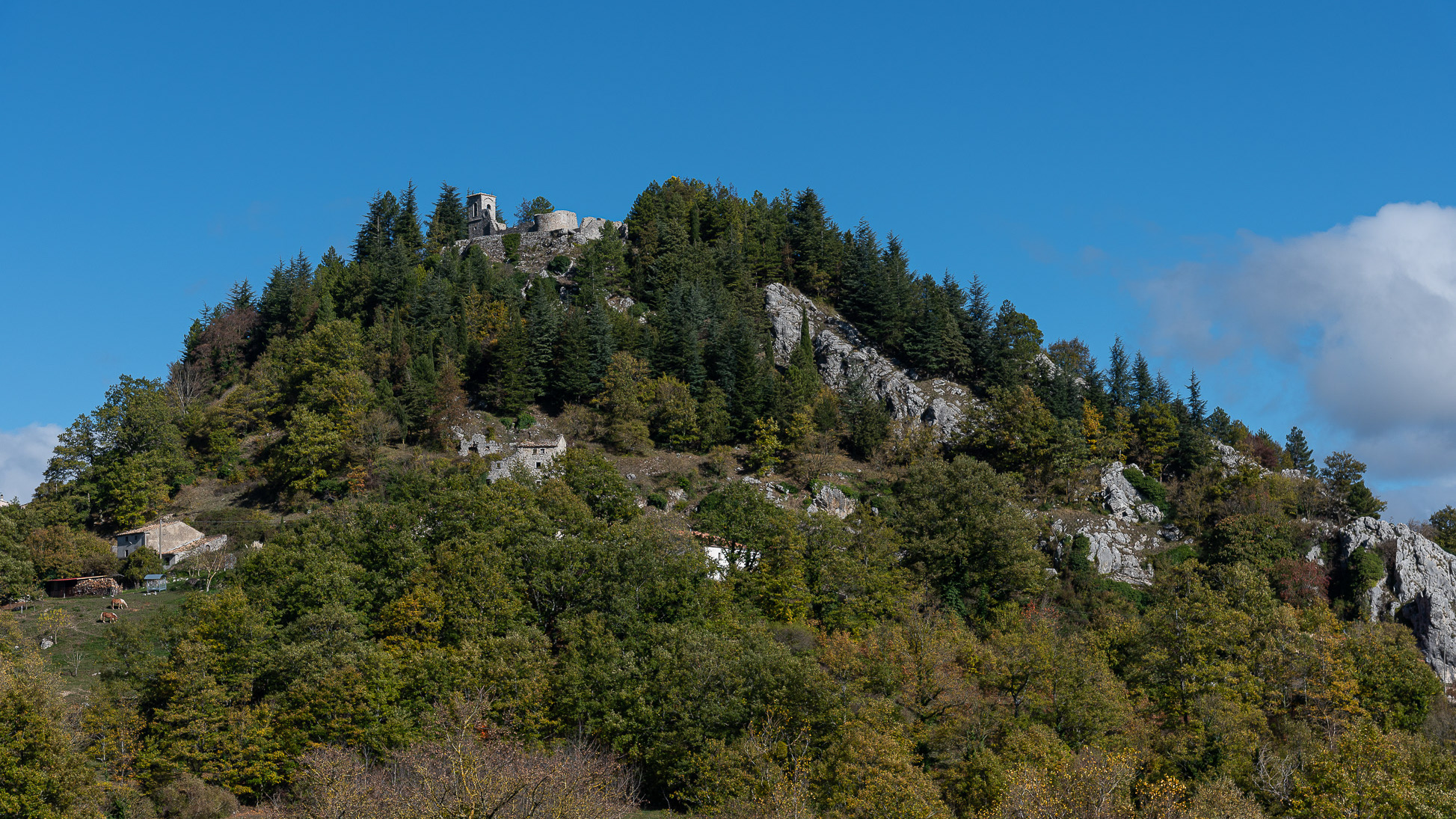
Castiglione di Carovilli. The Ammond church
Ancient church located on the hill, dating back to the fifteenth century, which today, especially in the summer months, hosts theatrical and classical music events.
2015
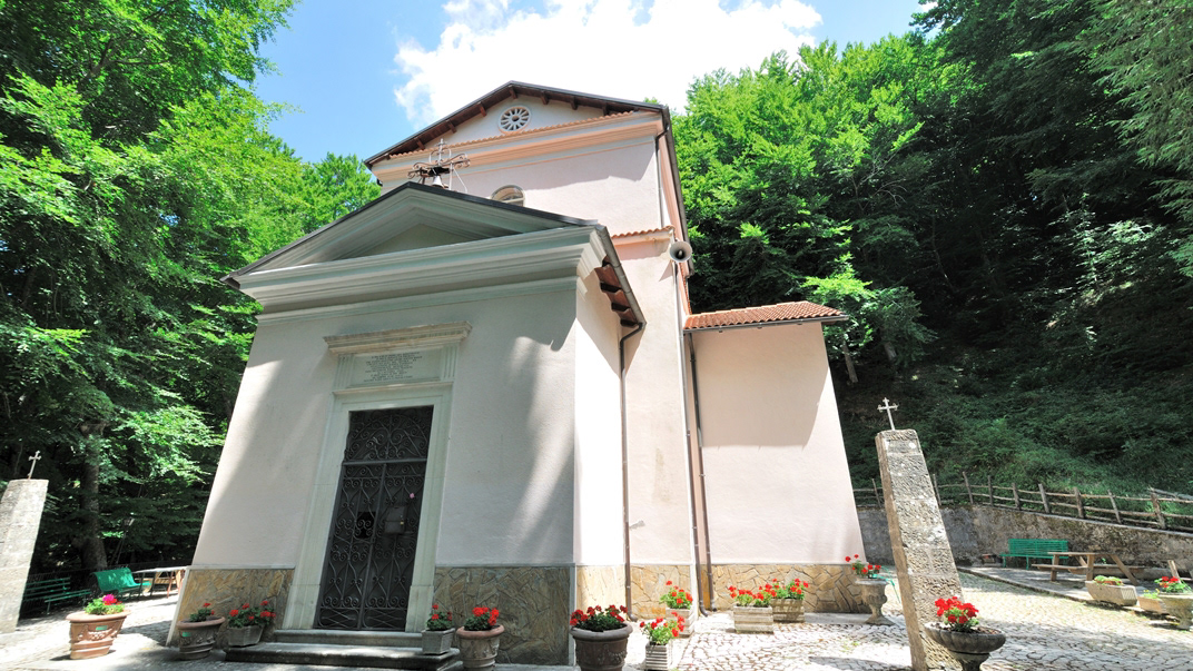
San Pietro Avellana (IS), eremo di S. Amico
2023
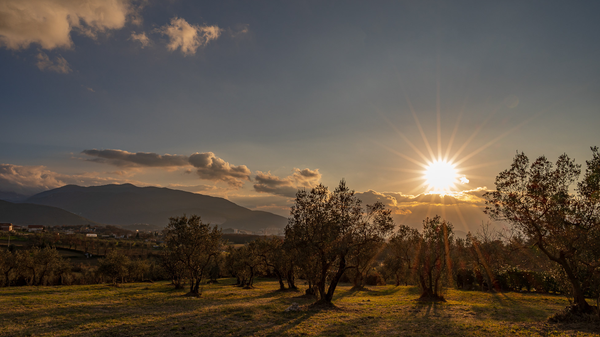
Spectacular photographs of sunsets in Molise
Molise is an Italian region with a stretch of coast overlooking the Adriatic Sea. It includes a part of the Abruzzo National Park in the Appennine mountain range, with a rich wildlife and trails.
2023
Pescolanciano. D’Alessandro Castle
The D'Alessandro castle is a fortified structure in the municipality of Pescolanciano. The castle was built on the rocky spur (peschio) that overlooks the town near a Samnite fortification.
2023
Vastogirardi, novembre 2023
Physical geography
It is located at 1200 m above sea level. in the part of Molise bordering Abruzzo. The territory of Vastogirardi (IS) extends over an area of 60.72 km² and borders the municipalities of Capracotta to the north, San Pietro Avellana, Castel di Sangro (AQ) and Rionero Sannitico to the west, Forlì del Sannio, Roccasicura and Carovilli to the south, Agnone to the east. From a morphological point of view, the territory is separated from that of Capracotta by reliefs of Monte Capraro, which oscillate between 1300 - 1350 m, which descend steeply to Piano S. Angelo and Difesa Grande and Capo di Trigno (ancient lake basin ) at an altitude of 1100 m from which the Trigno river originates, one of the two most important Molise rivers which flows into the Adriatic Sea and gives its name to the road of the same name which reaches up to San Salvo (CH), i.e. the Trignina. To the west are the mountains of Montagnola (1292 m) and Monte Miglio (1350 m), to the south is Monte Pizzi (1373 m), while to the east are the mountains of Montagna Fiorita with Montarone (1278 m). Vastogirardi develops close to a hill at the top of which are the castle and the ecclesiastical complex of San Nicola di Bari. Inside the walls is the village, which appears well preserved in its original defense function, as evidenced by the cylindrical towers incorporated in factories and the supports between building blocks. The result of subsequent expansions, the churches of S. Rocco and S. Maria delle Grazie were built at the beginning of the 18th century and incorporated into the third urban expansion dating back to the 18th - 19th century. Over the course of the last century the town no longer followed the aggregation trend of stepped bands, according to the morphological trend of the site, but developed along via Garibaldi c.da Difensa (towards Castel di Sangro) and via Re d'Italia (direction Isernia).
Origins of the name
It is assumed that the name Vastogirardi originates from the name of a crusader captain, Giusto Girardi. In the past it also took the name of Castrum Girardi due to the castle (other attested toponyms are Castel Girardo, Rocca Girardo, Guasti Belardi, Guardia Giraldo and Guardia Gerardo) and subsequently its current name, deriving from an alliteration of Lombard jargon.
2025
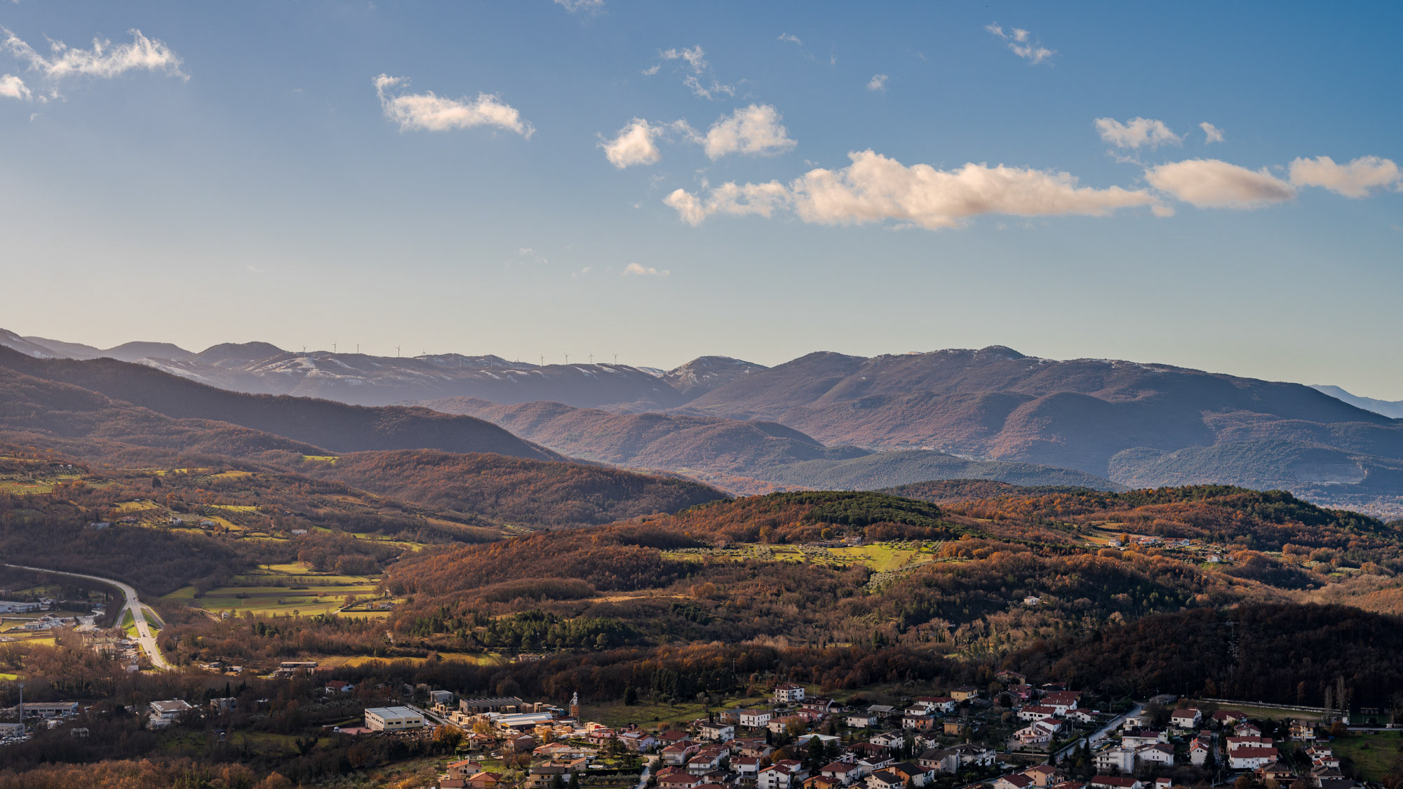
Molise. Winter landscapes from Pesche

2016
Scapoli (IS)
Scapoli (Scapulë in molisano) è un comune italiano di 666 abitanti della provincia di Isernia in Molise. Fino al XV secolo fu parte integrante del Giustizierato d'Abruzzo e dell'Abruzzo Citeriore. Le origini del paese risalgono probabilmente al IX secolo, come risulterebbe da alcuni testi tra i quali il "Chronicon Vulturnense", antico testo redatto intorno al 1130 da un monaco dell'abbazia di San Vincenzo al Volturno di nome Giovanni. Proprio da questo testo risulterebbe che l'insediamento di Scapoli (cd. Castrum Scappili) nacque sulle terre di proprietà dall'abbazia ad opera dei monaci che erano stati cacciati dai Saraceni da Castel San Vincenzo. Dalla sua costituzione Scapoli subì l'influenza di diverse famiglie di origine franco-romana, tra le quali nel 1043 prevalse la famiglia Borrello che aveva sottratto all'abbazia l'intera valle del Volturno. Il paese ritornò nelle mani dell'abbazia grazie all'intervento del Papa Niccolò II per poi esservi di nuovo sottratto ad opera dei Conti dei Marsi. Successivamente dal 1200 passò in mano ai Caldora e nel 1382 il feudo fu venduto ai Pandone. Nel XVI secolo e fino al 1621 fu dei Bucciarelli per poi essere ceduto a Innico di Grazia, barone di Cerro al Volturno, fino ad arrivare ai marchesi Battiloro. Fu annesso al ducato di Terra di Lavoro fino al 1861 quando entrò nel territorio di Campobasso. Durante la seconda guerra mondiale si trovò sulla famosa "Linea Gustav" creata dai Tedeschi per impedire l'avanzamento degli alleati. Molto importante fu infatti la costituzione proprio a Scapoli del Corpo Italiano di Liberazione, protagonista di sanguinose battaglie sul vicino Monte Marrone. Nel 1970 fu annesso alla neonata provincia di Isernia e da 20 anni fa parte del Parco nazionale d'Abruzzo, Lazio e Molise.
2010
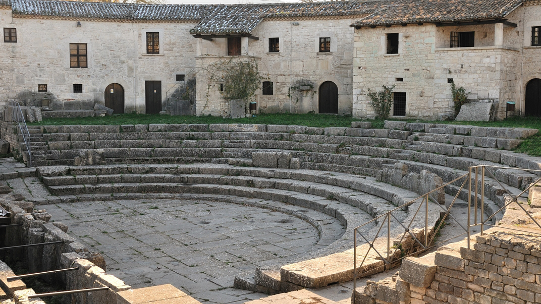
Sepino (CB) - Saepinum

2017
Mainarde - Monte Meta
Il monte Meta (nota anche come la Meta, 2241 m s.l.m) è una delle maggiori cime dell'appennino abruzzese, situata sul confine tra Lazio, Abruzzo e Molise, all'interno del Parco nazionale d'Abruzzo, Lazio e Molise, tra i comuni di Alfedena (AQ), Picinisco (provincia di Frosinone) e Pizzone (provincia di Isernia). Dà il nome all'omonima catena montuosa dei Monti della Meta, compresi all'interno dei Monti Marsicani, che dal valico di Forca d'Acero procede verso la valle di Comino meridionale e digrada nelle valli del Liri e del Volturnoprendendo il nome di Mainarde nelle cime più basse e più meridionali. Ai suoi piedi si trova il passo dei Monaci (1981 m s.l.m.)). La cima del monte Meta era stata interdetta agli escursionisti perché protetta dalla riserva integrale del parco nazionale d'Abruzzo, per le notevoli presenze di camosci d'Abruzzo, recentemente però (estate 2010) è stato momentaneamente aperto un prolungamento del sentiero L1 che porta fino alla cima a 2241 metri. Diversi sentieri portano alla Meta partendo dal Pianoro Le Forme (Pizzone) a 1380 metri. Le montagne più alte oltre al Monte Meta (Monte Petroso 2247 s.l.m., Monte Cavallo 2039 s.l.m., Monte Mare 2020 s.l.m.) presentano vistose tracce di glacialismo quaternario; nelle valli che si sviluppano all'interno della catena montuosa sorgono copiose le acque del fiume Melfa e Mollarino in provincia di Frosinone, del Rio Torto in provincia dell'Aquila. Dalle cime la vista spazia su tutti i Monti Marsicani, la Majella e i Monti del Matese. I rilievi più bassi dello stesso massiccio, al confine tra Lazio e Molise sono storicamente detti Mainarde; sono le montagne in cui la presenza dell'uomo per il clima meno rigido era stanziale (abitazioni e coltivi in quota) e non stagionale e pastorale come per i Monti della Meta. Non è definito un confine geologico preciso tra le due catene montuose: è certo solo che le Mainarde non rientrano nel territorio regionale dell'Abruzzo, ma molti le ritengono del Molise. L'uso tradizionale dell'oronimo è riproposto nelle carte dell'Istituto Geografico Militare che lo applica ai rilievi più esterni dei Monti della Meta, quelli che dal Monte Cavallo e dal Monte Mare degradano progressivamente verso Vallerotonda (FR) e la valle del fiume Rapido-Gari e verso Scapoli (IS) e Filignano (IS) e la valle del fiume Volturno che ivi nasce. Settore Mainarde è il nome che le amministrazioni del Parco nazionale d'Abruzzo, Lazio e Molise danno alla parte del territorio della riserva in provincia di Isernia, che comprende i territori di Castel San Vincenzo, Pizzone, Rocchetta al Volturno, Scapoli, inclusi nel 1990. L'etimologia è oscura, sembra ricordare un nome proprio germanico.
2024
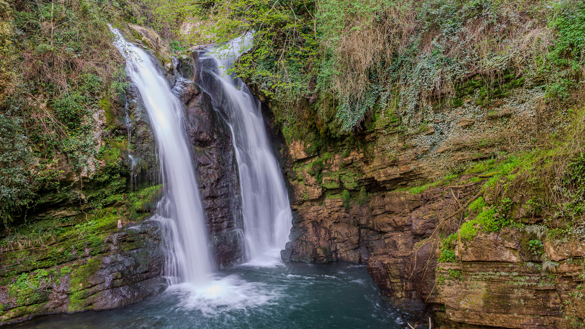
Carpinone. The waterfalls. Spring 2024
In the heart of a very small village in Molise, immersed in an enchanted forest and floral nature, stands the Carpinone waterfall, one of the most fascinating natural spectacles of the place. The rush of foaming water, which rushes downwards, pervades you as soon as you take the path and when you finally reach it you have a fantastic visual effect of light and roar. The Carpinone waterfall is becoming one of the major natural attractions of Molise, thanks also to a group of volunteers who, for some years, have been taking care of its appearance to make it accessible to everyone and not just to the few enthusiasts or those who despise the danger... She's too beautiful to leave there alone! It was born as a gift from nature and can be reached by following various paths, all immersed in the bright greenery of Molise and all marked with hand-made wooden signs, so as not to affect the suggestive panorama. As you walk, you feel a very pleasant emotion thanks to the direct contact with nature, the breathing of healthy, clean air and the sight of wonderful floral species that make everything fairytale-like.
