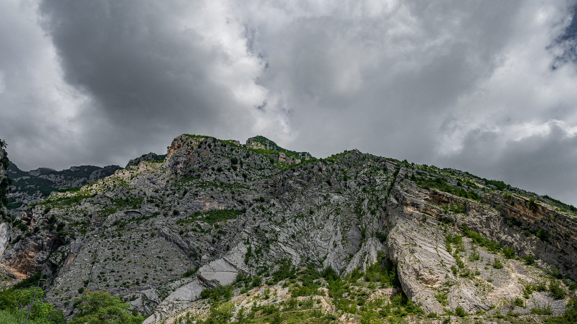
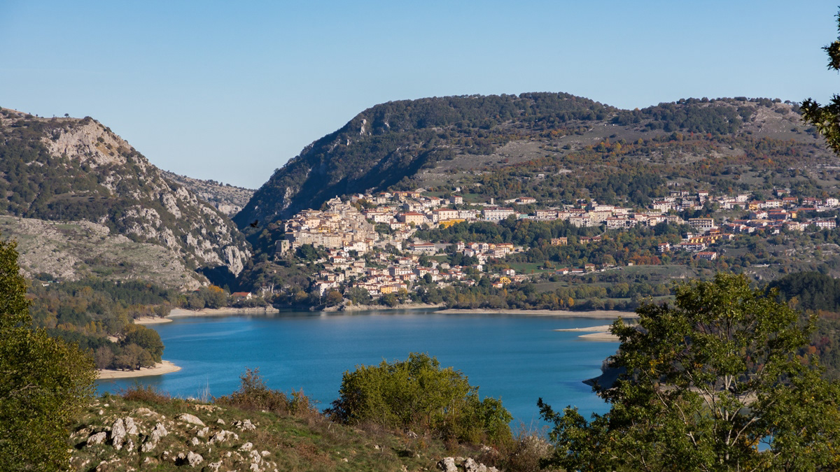
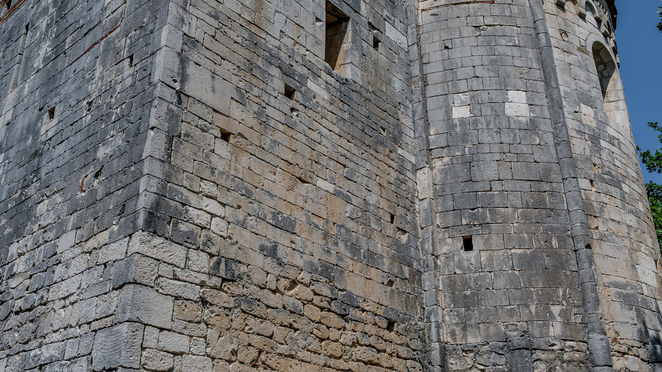
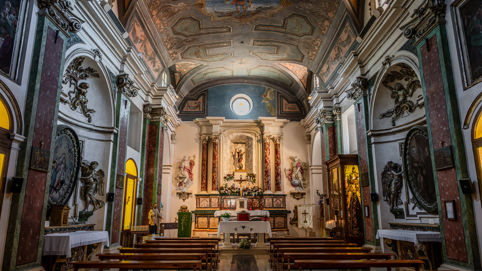
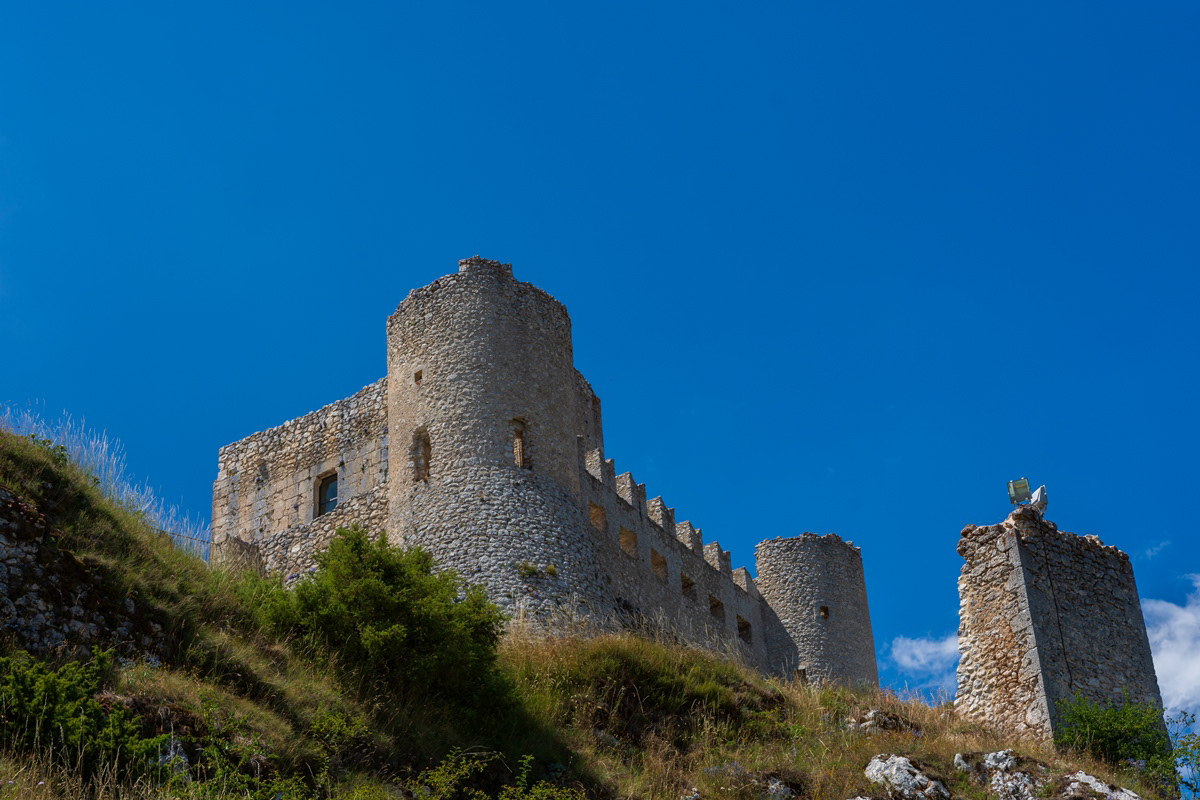
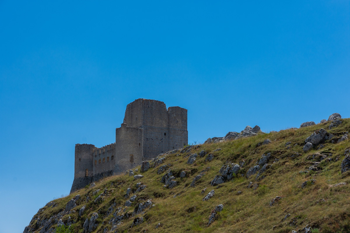
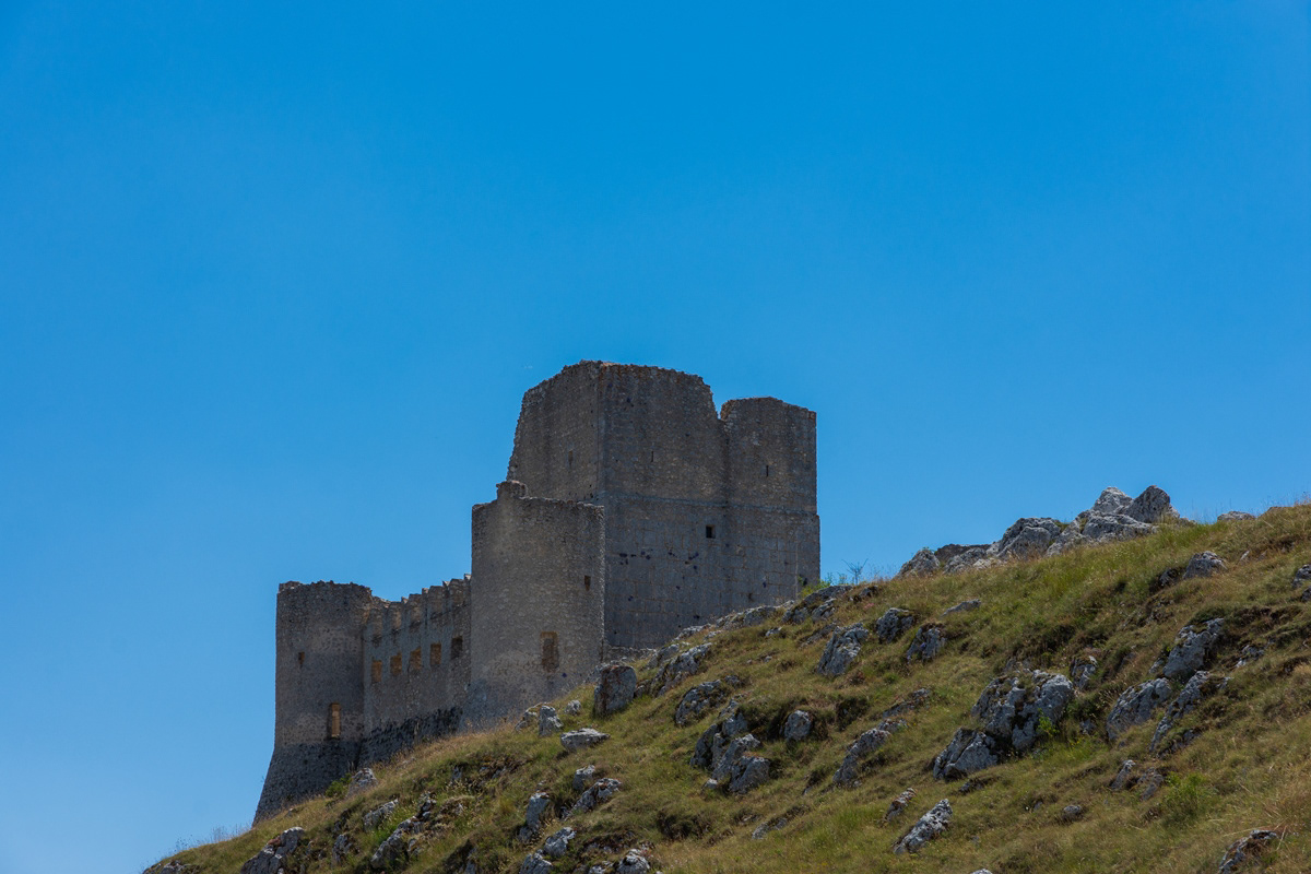
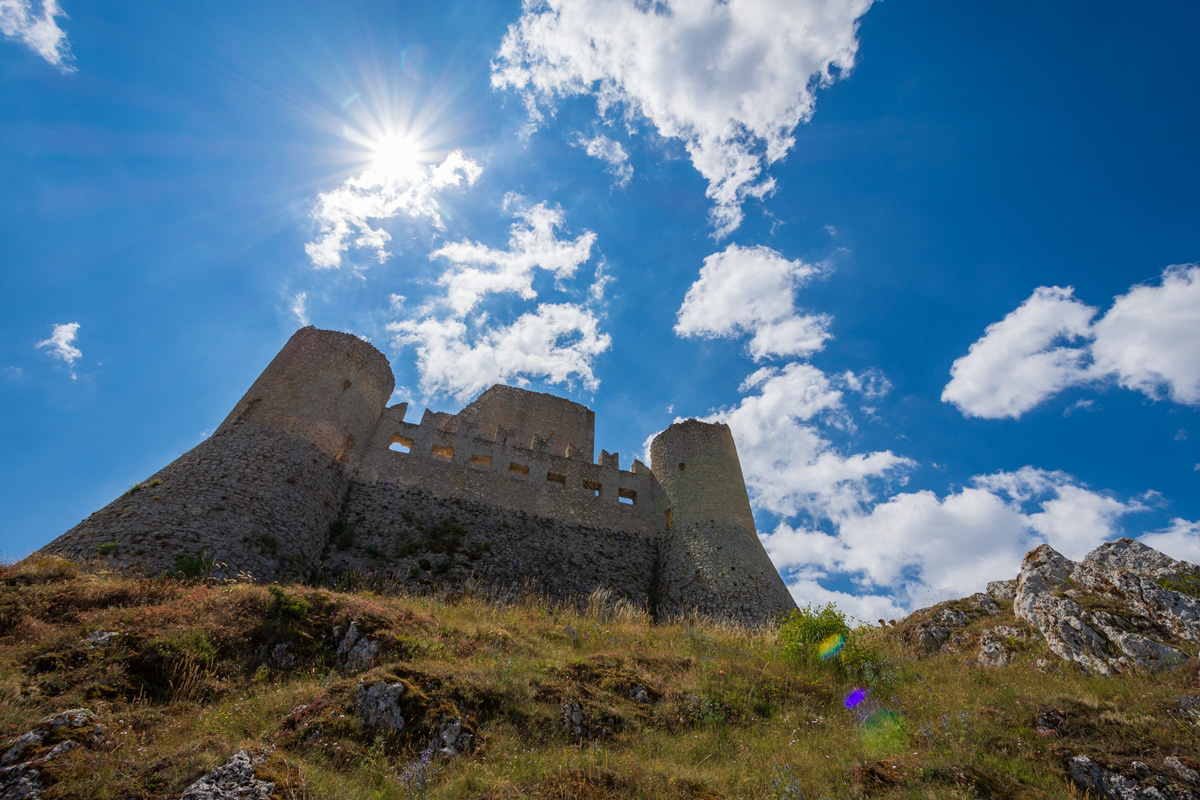
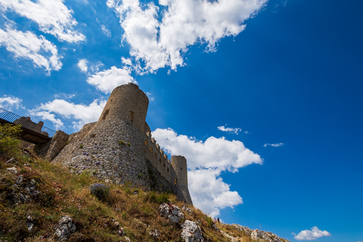
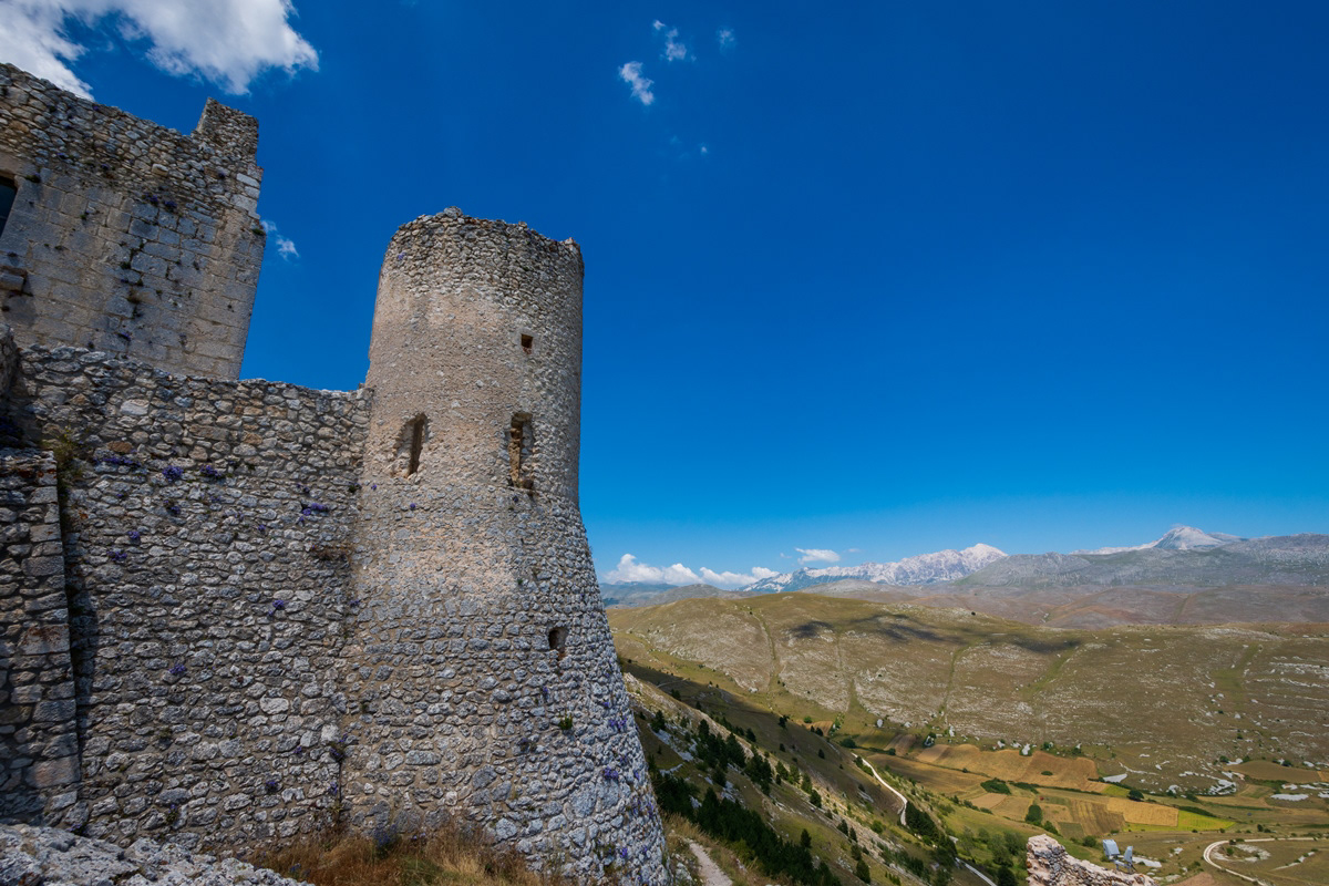
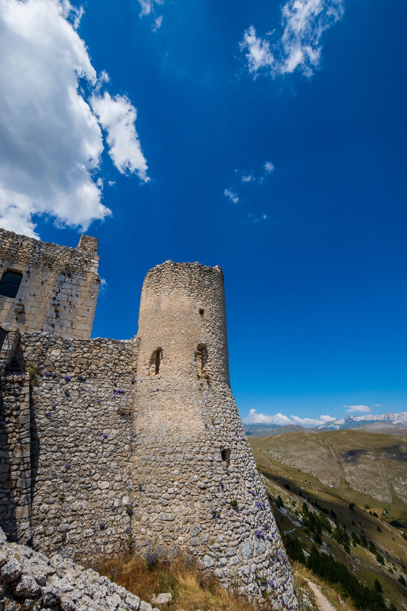
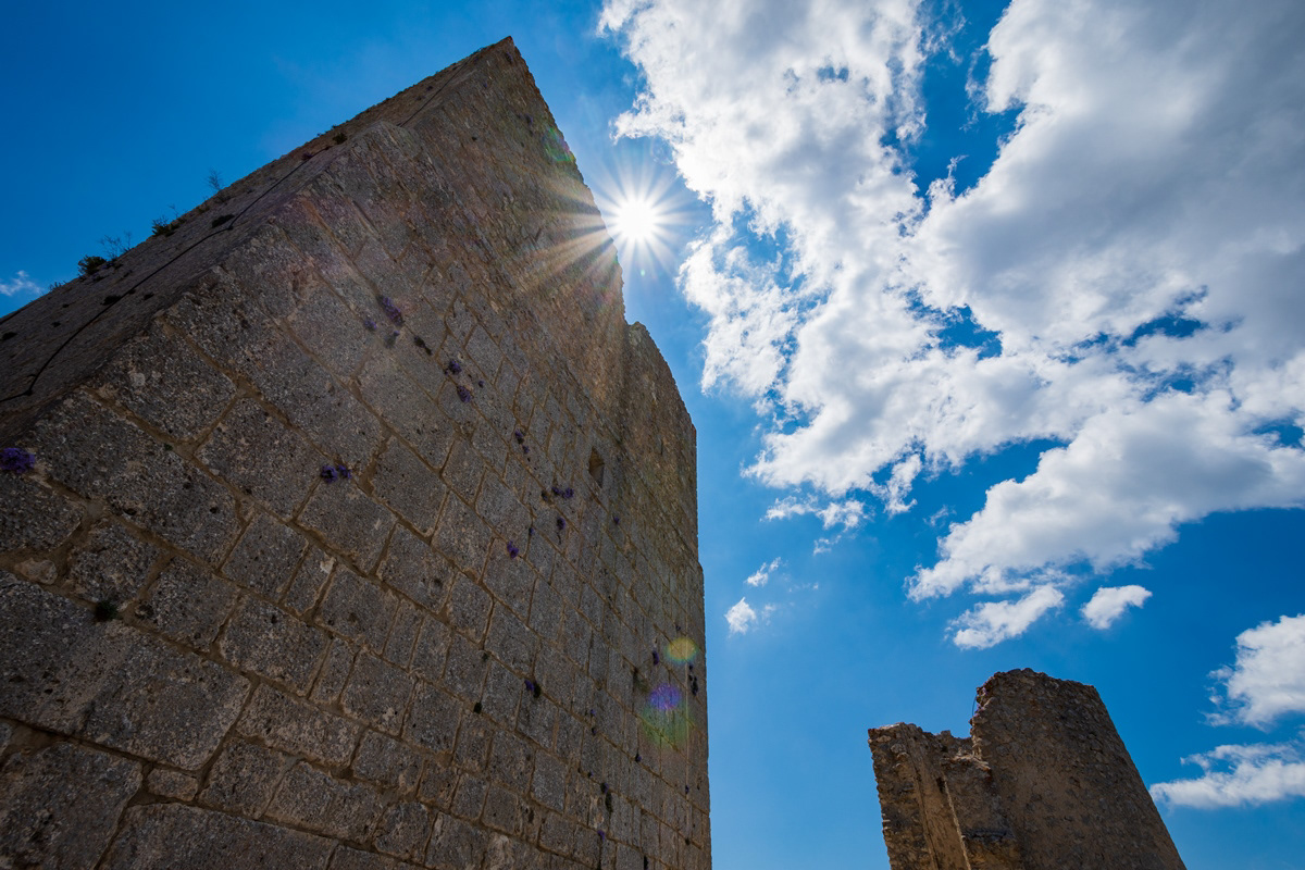
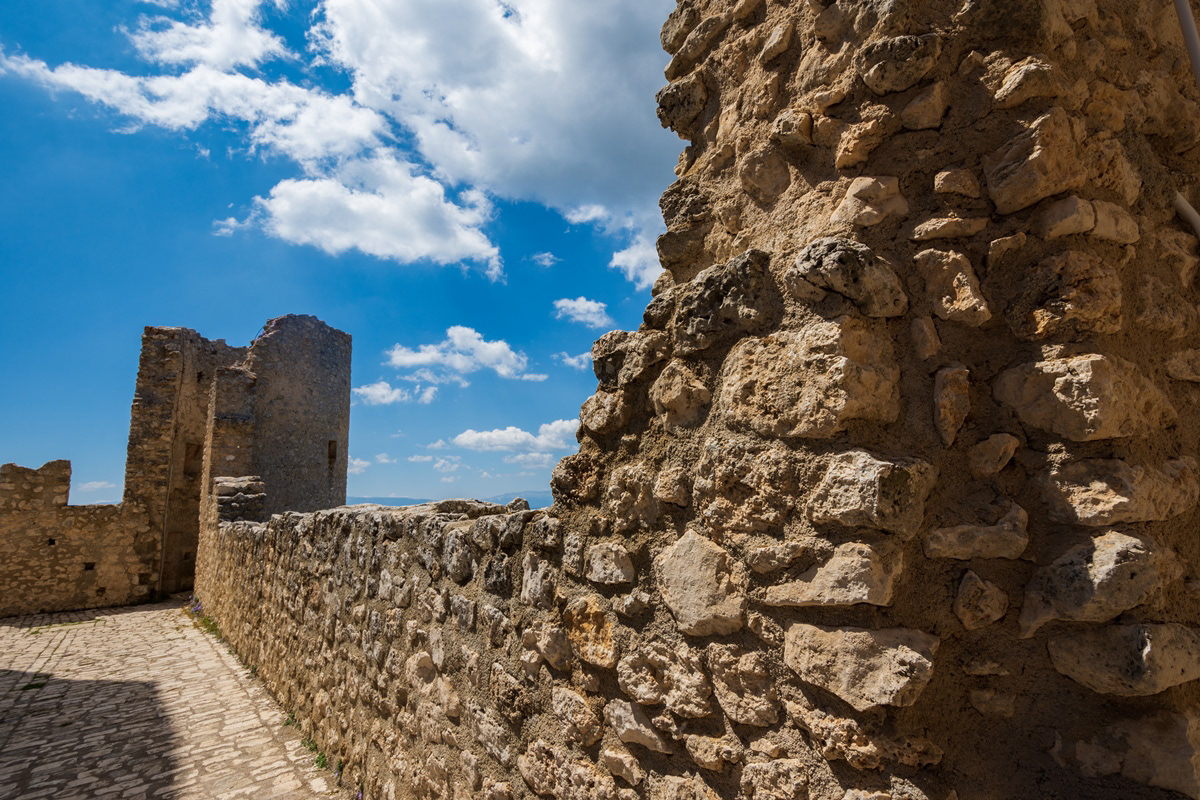
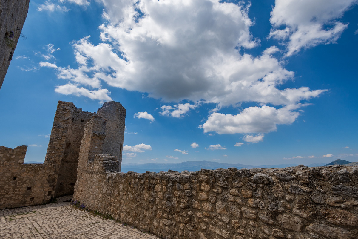
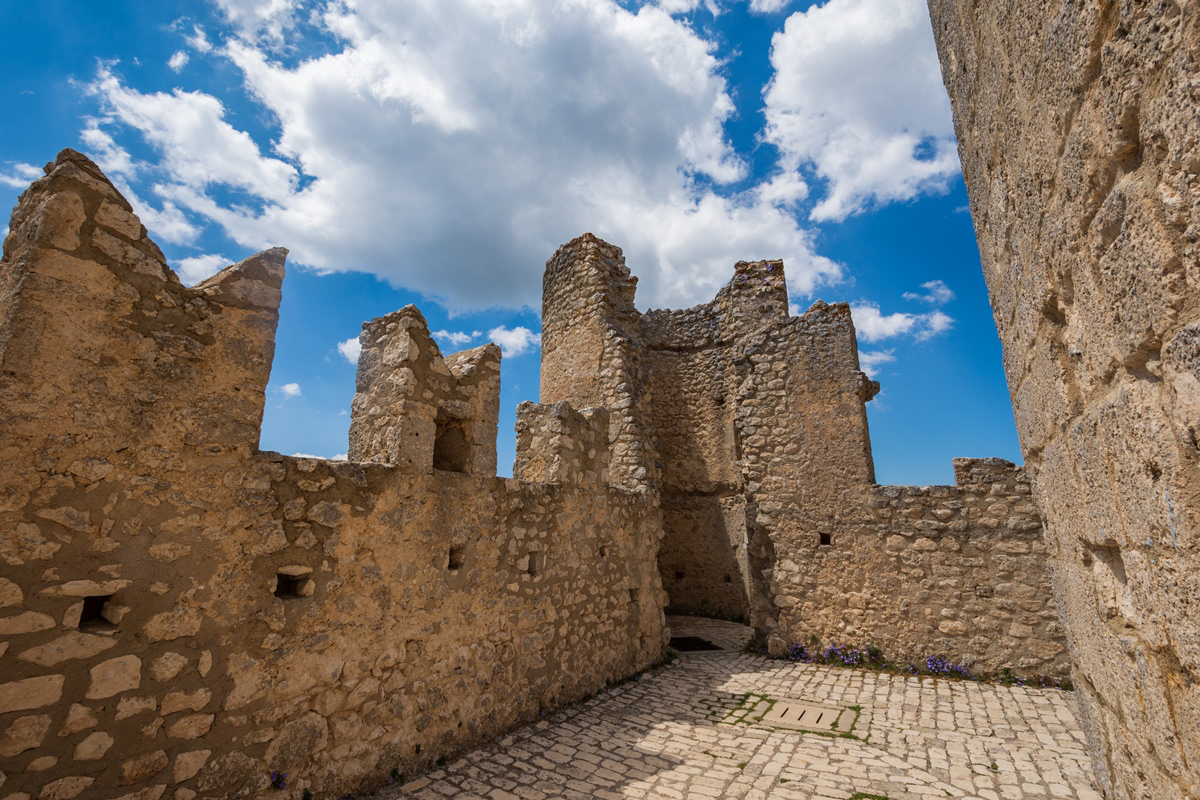
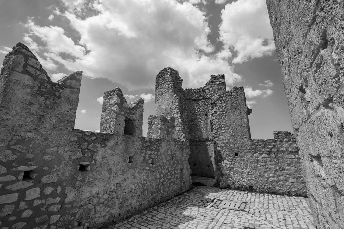
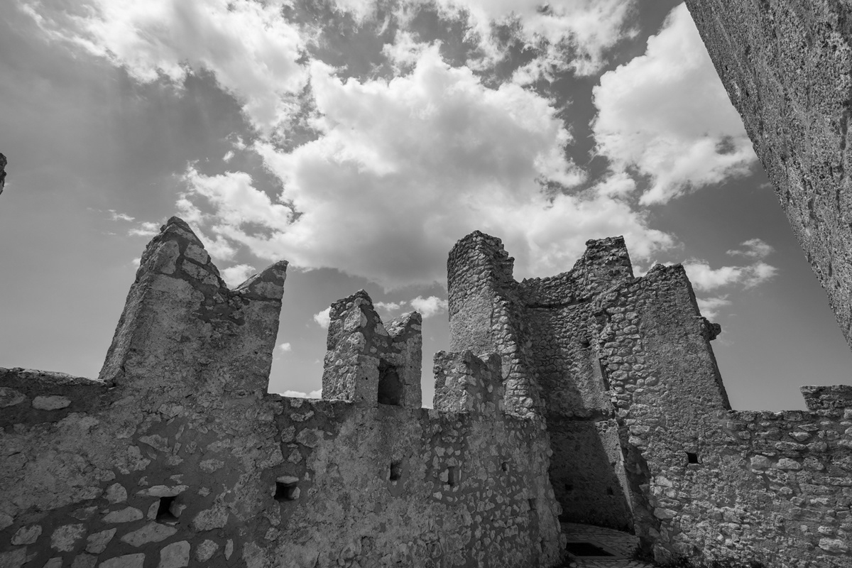
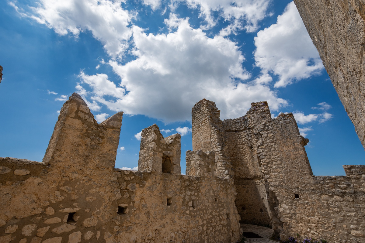
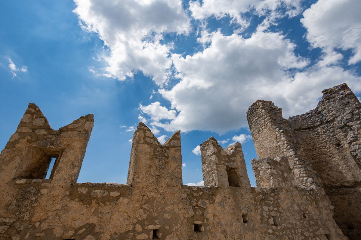
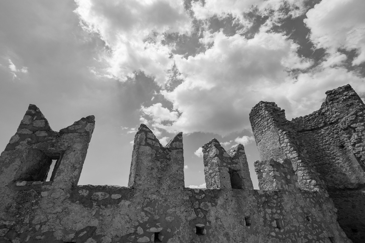
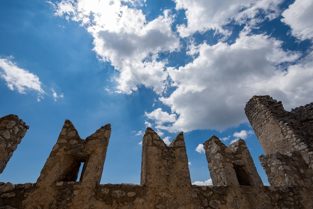
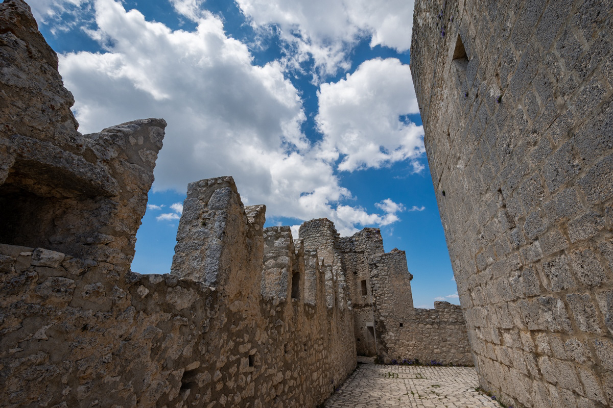
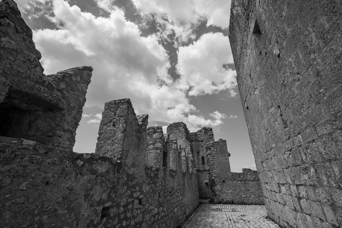
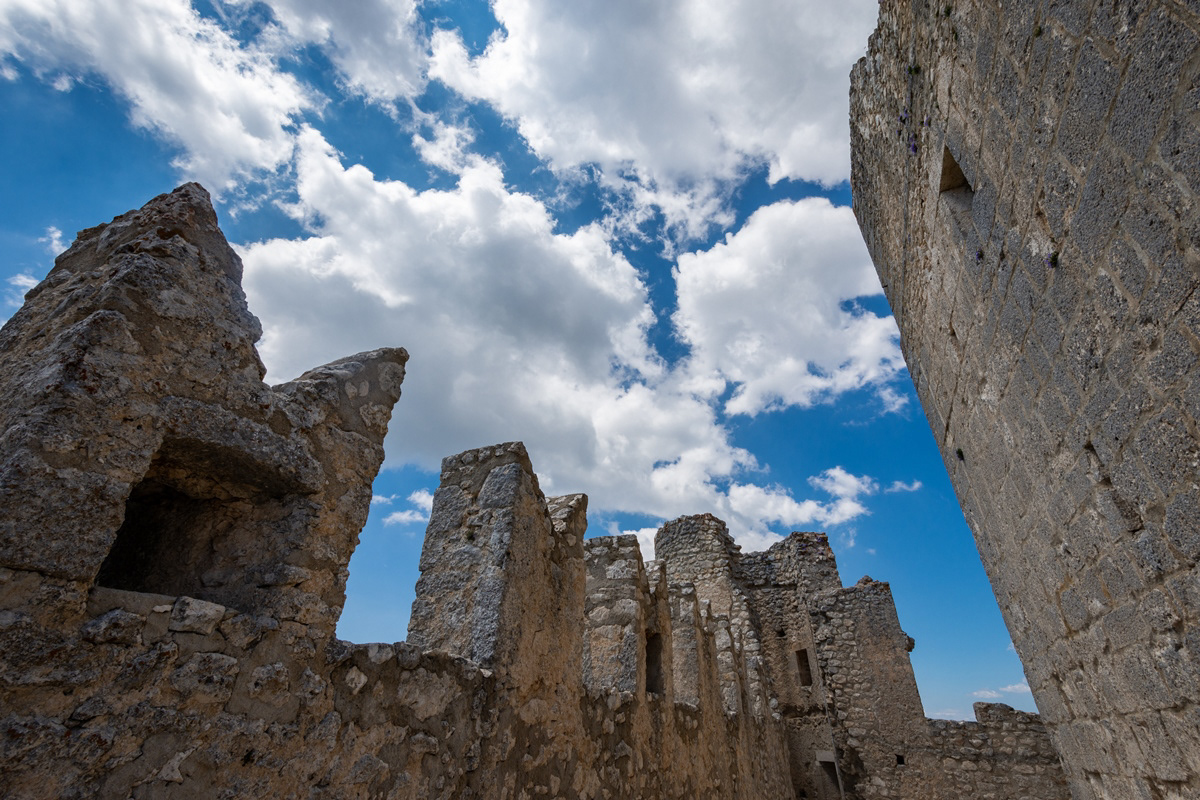
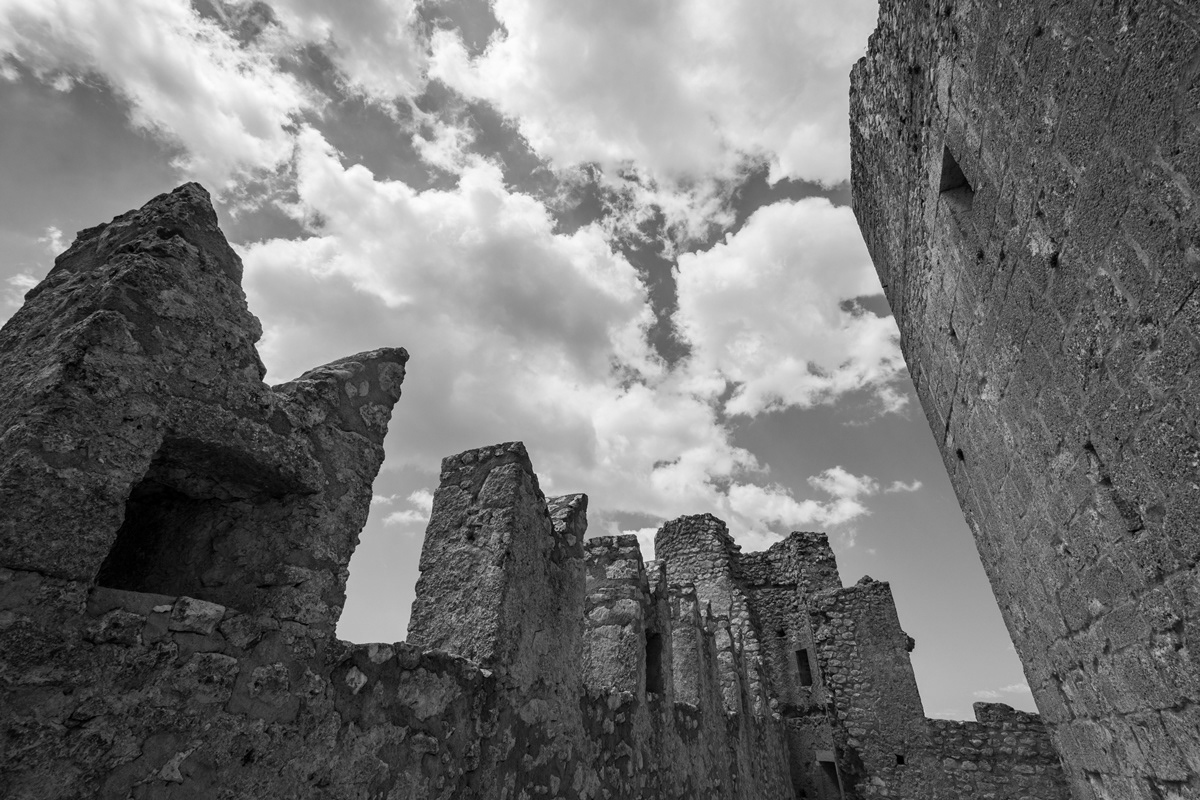
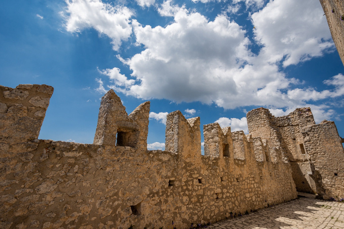
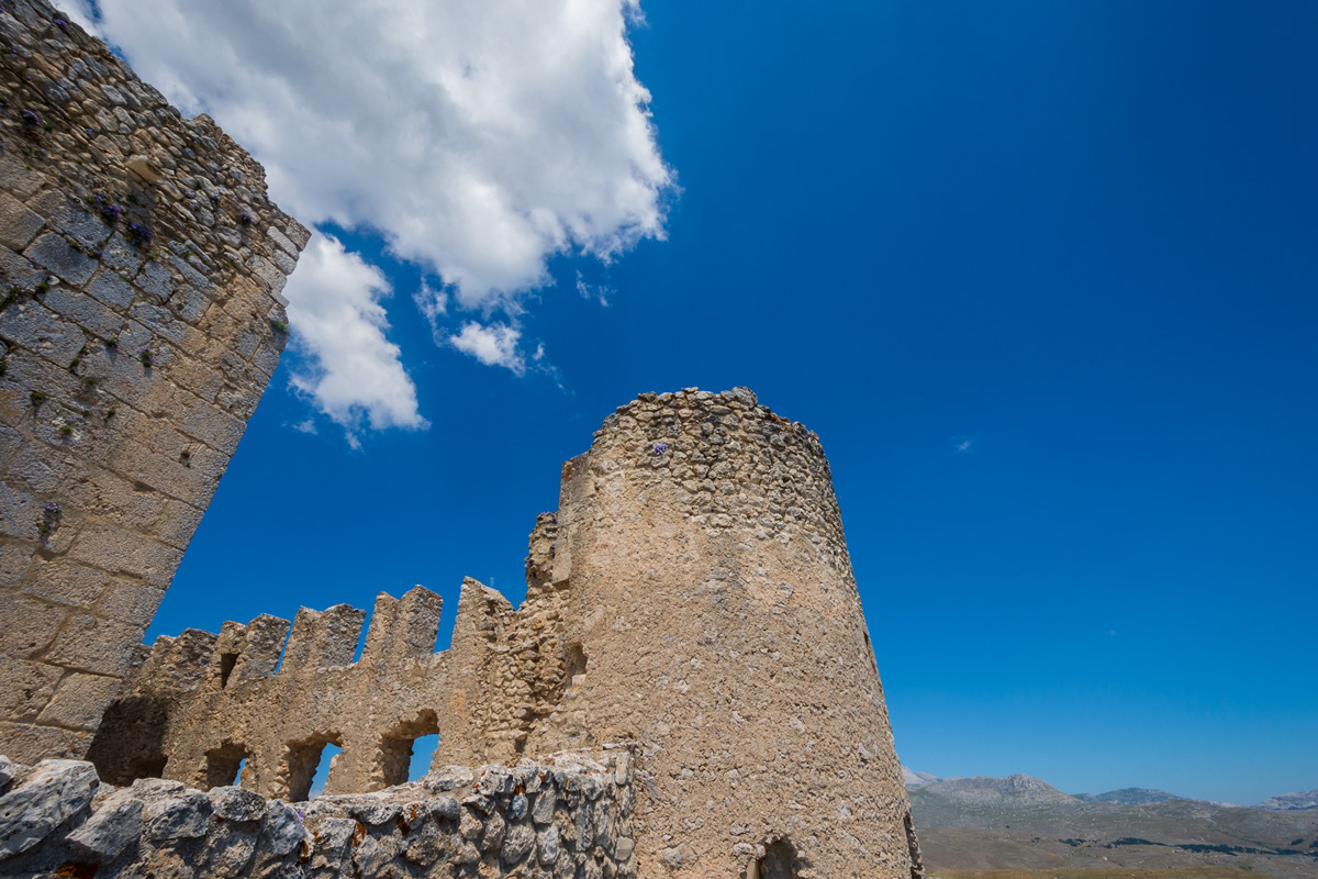
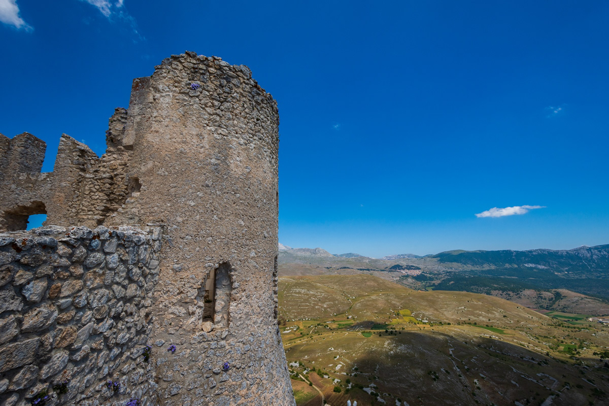
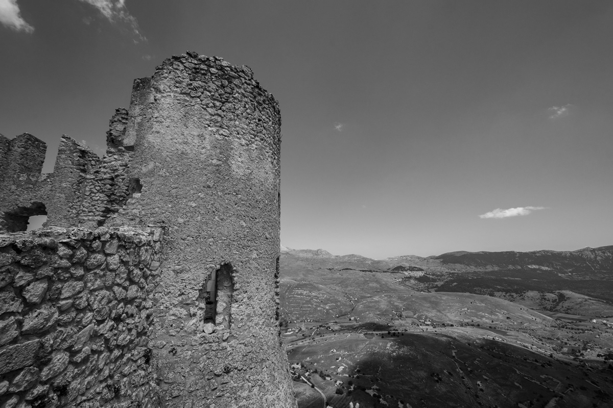
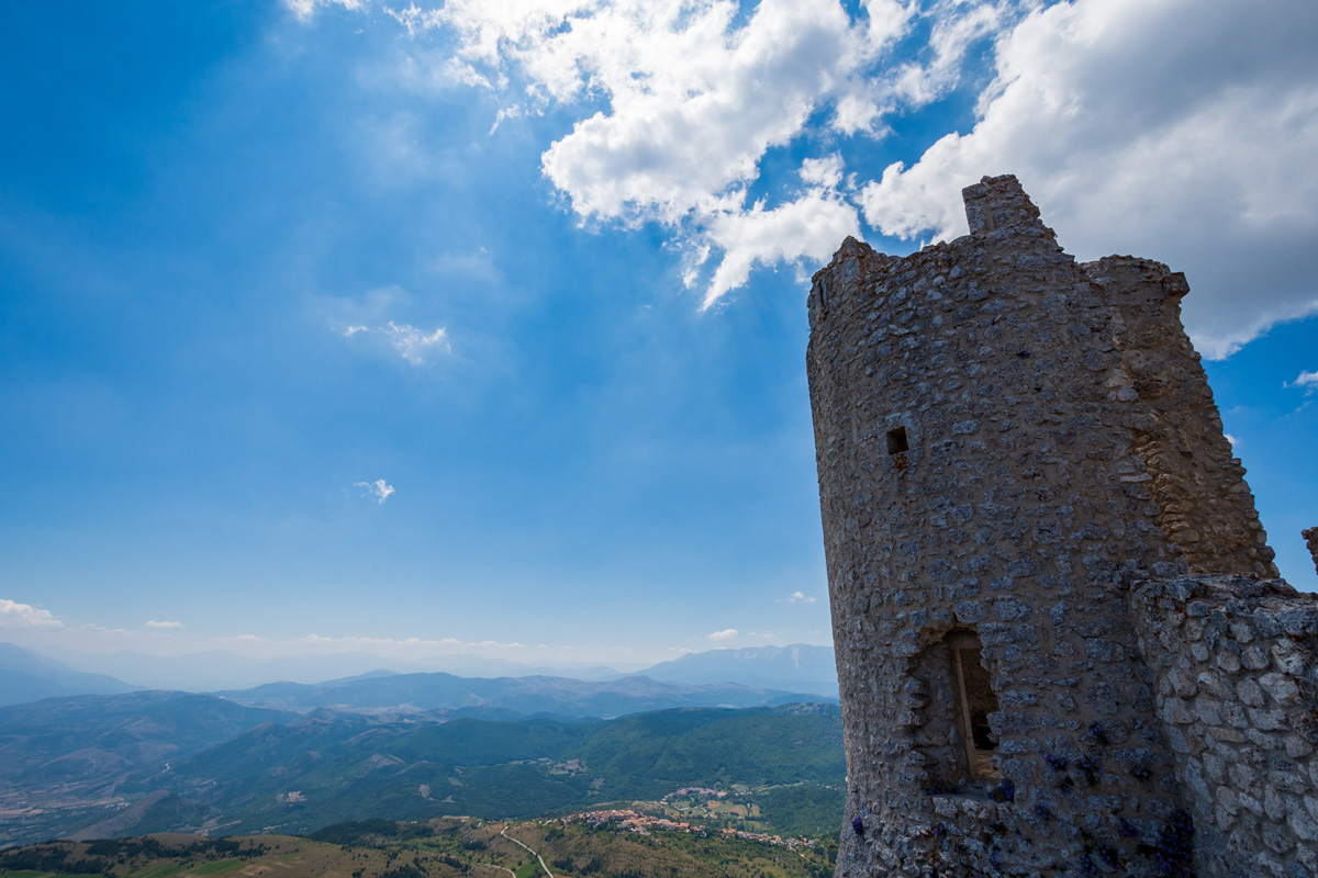
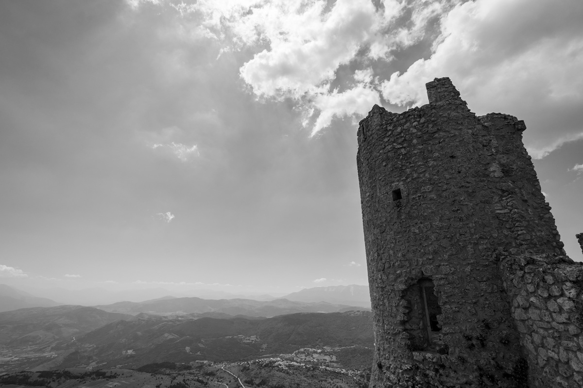
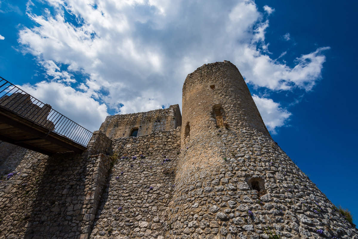
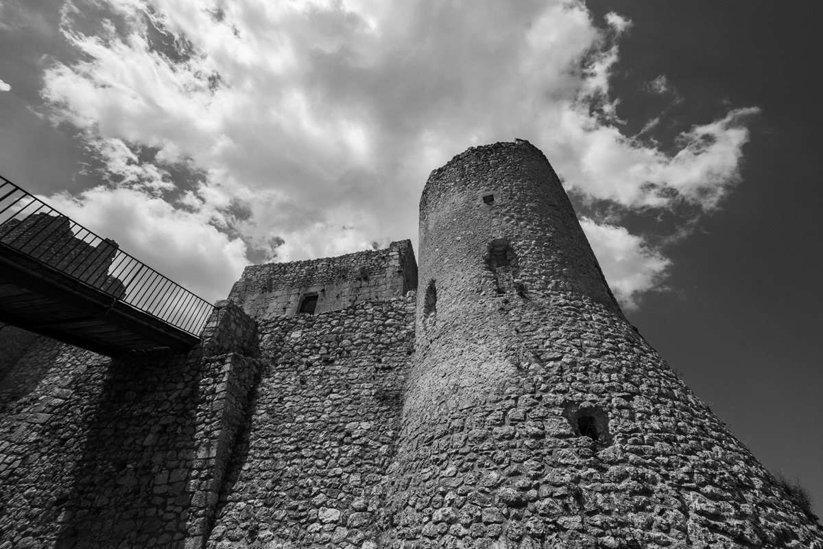
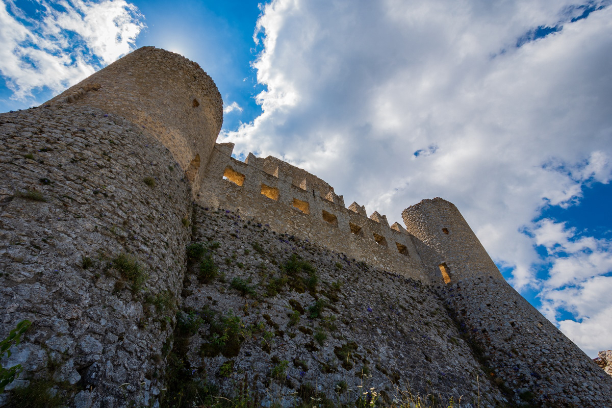
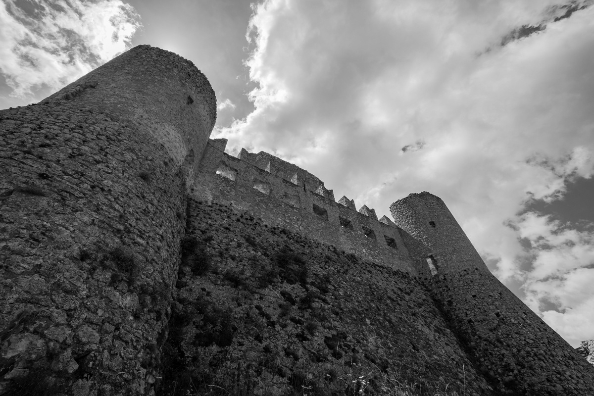
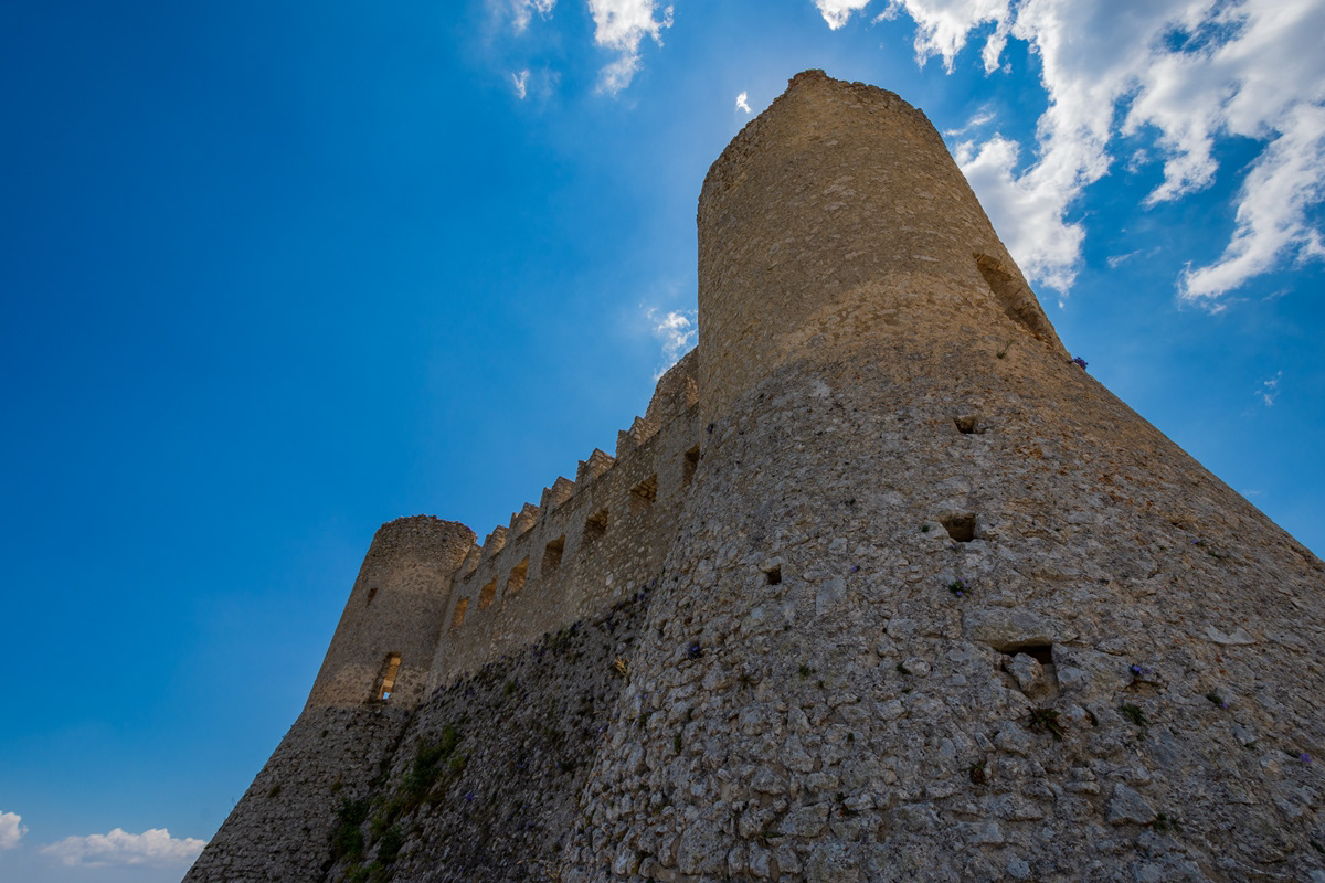
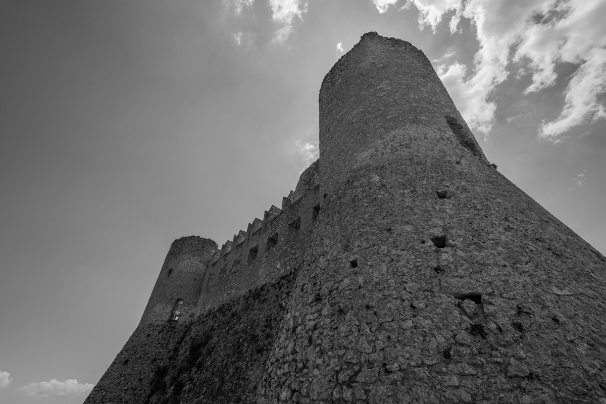
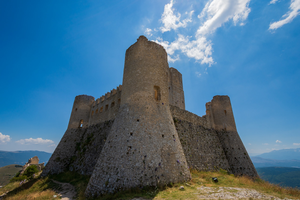
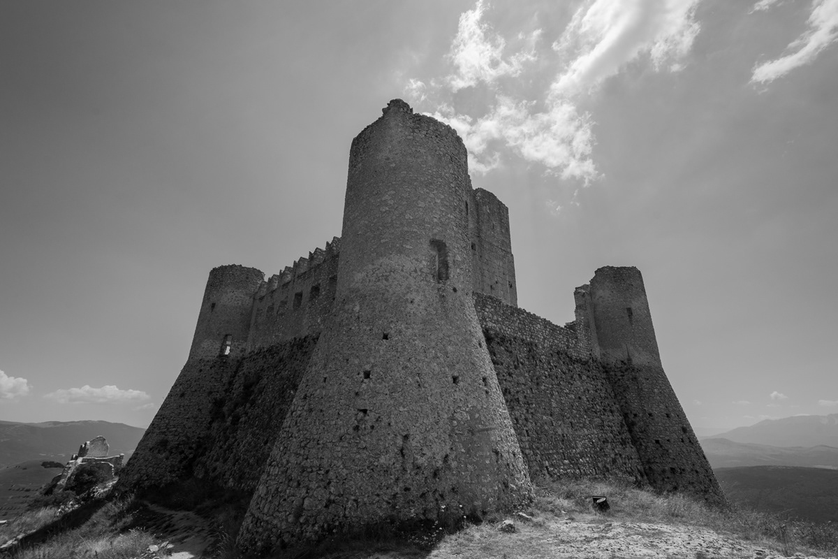
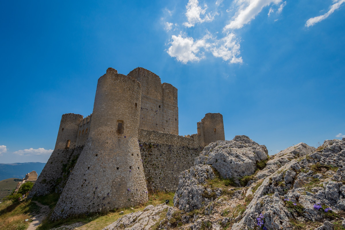
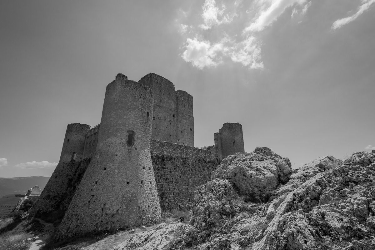
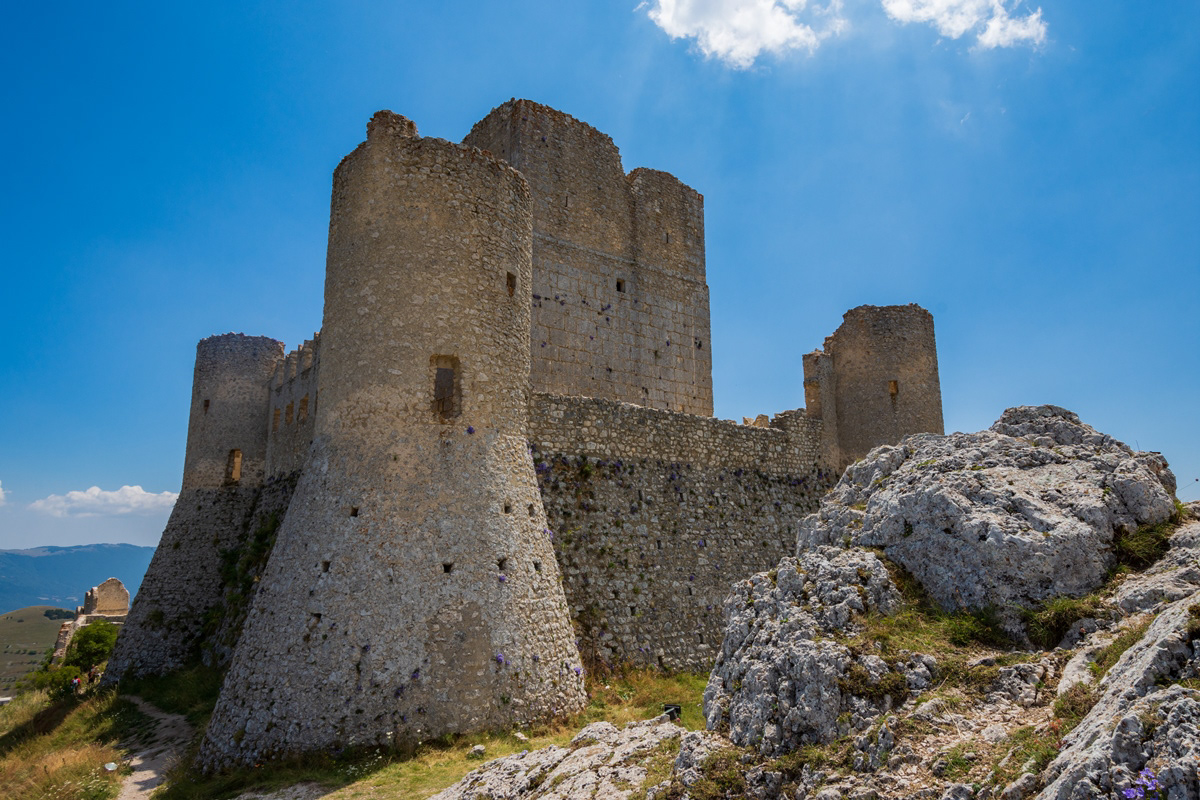
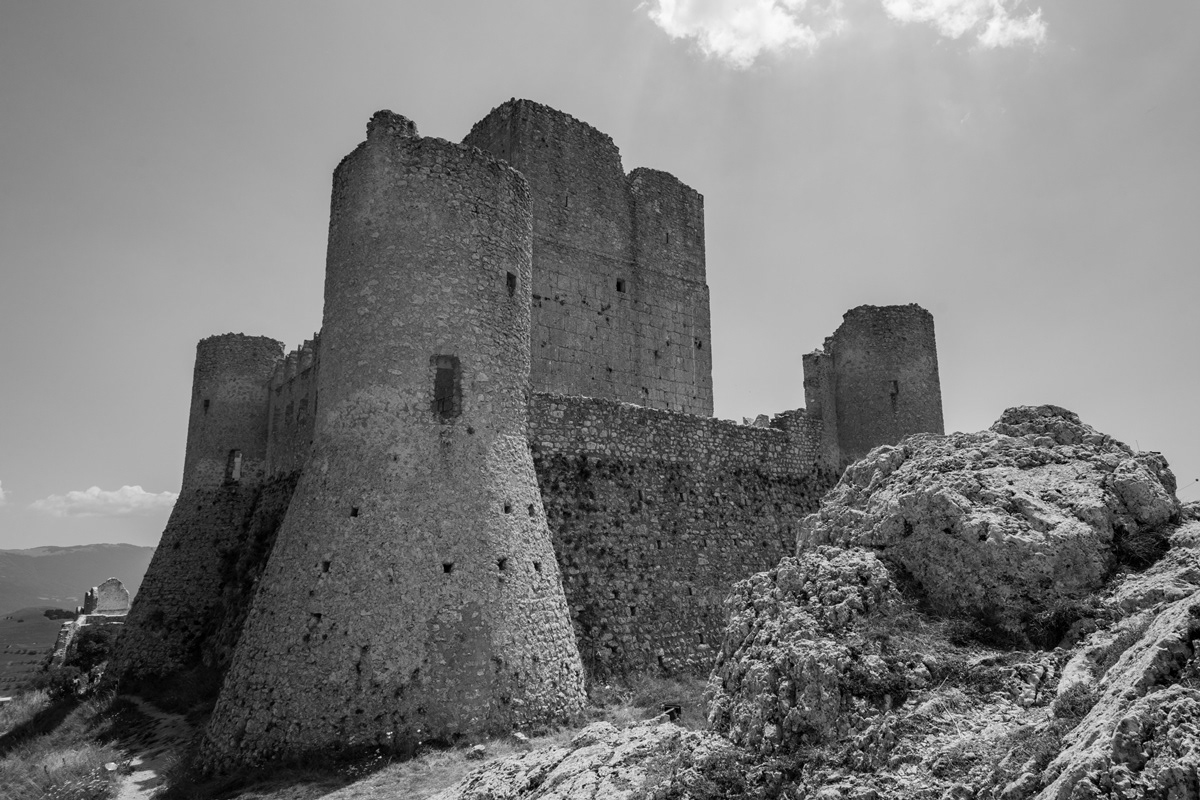
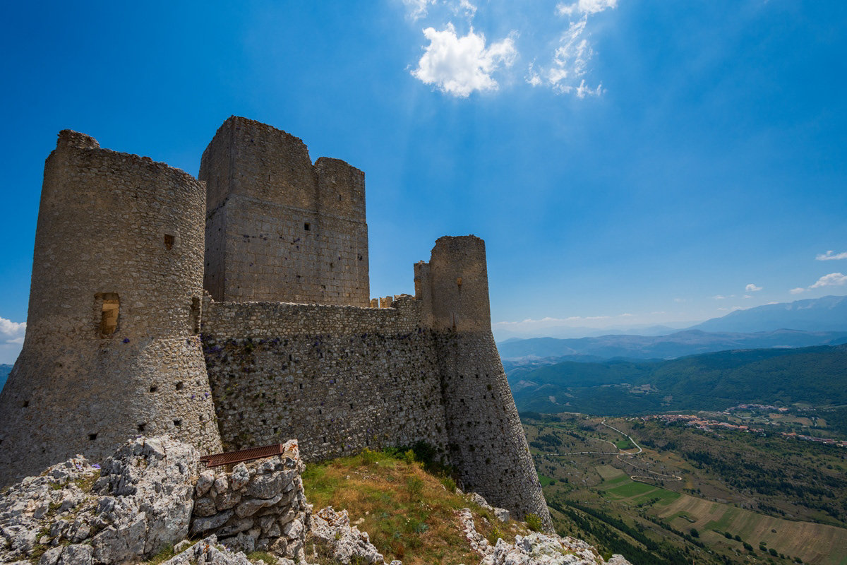
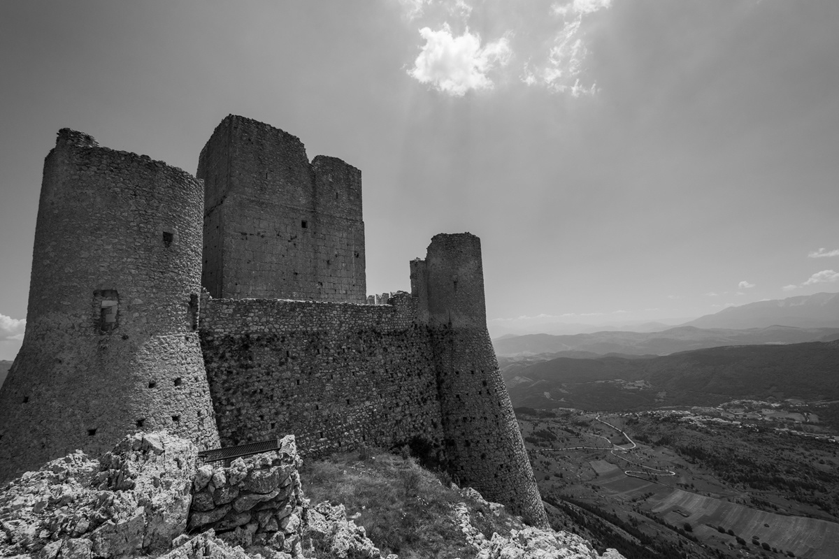
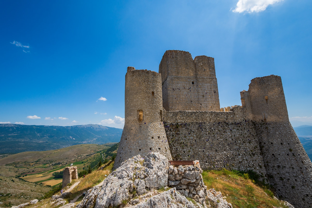
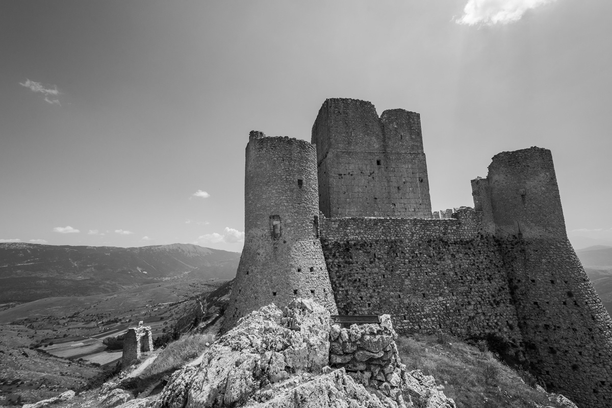
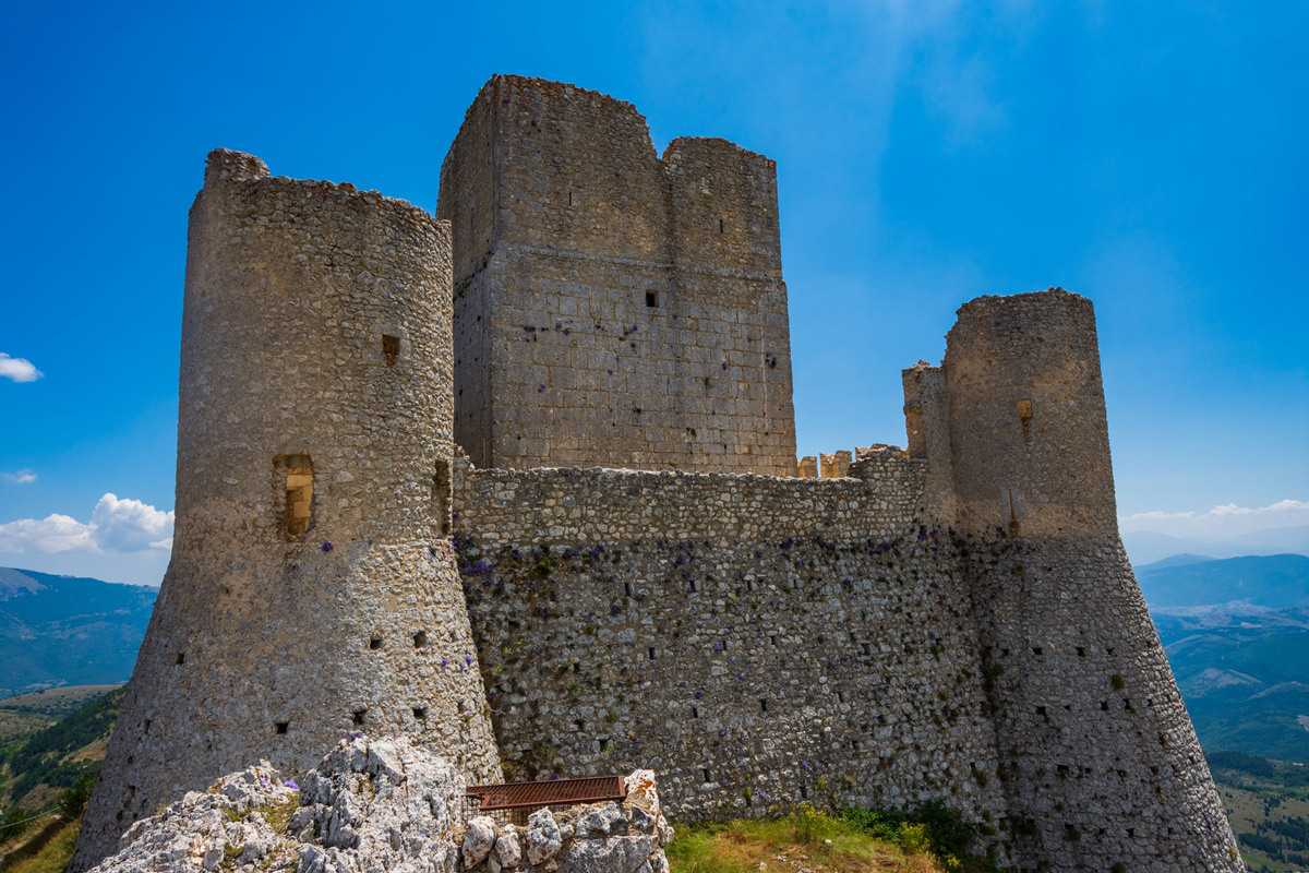
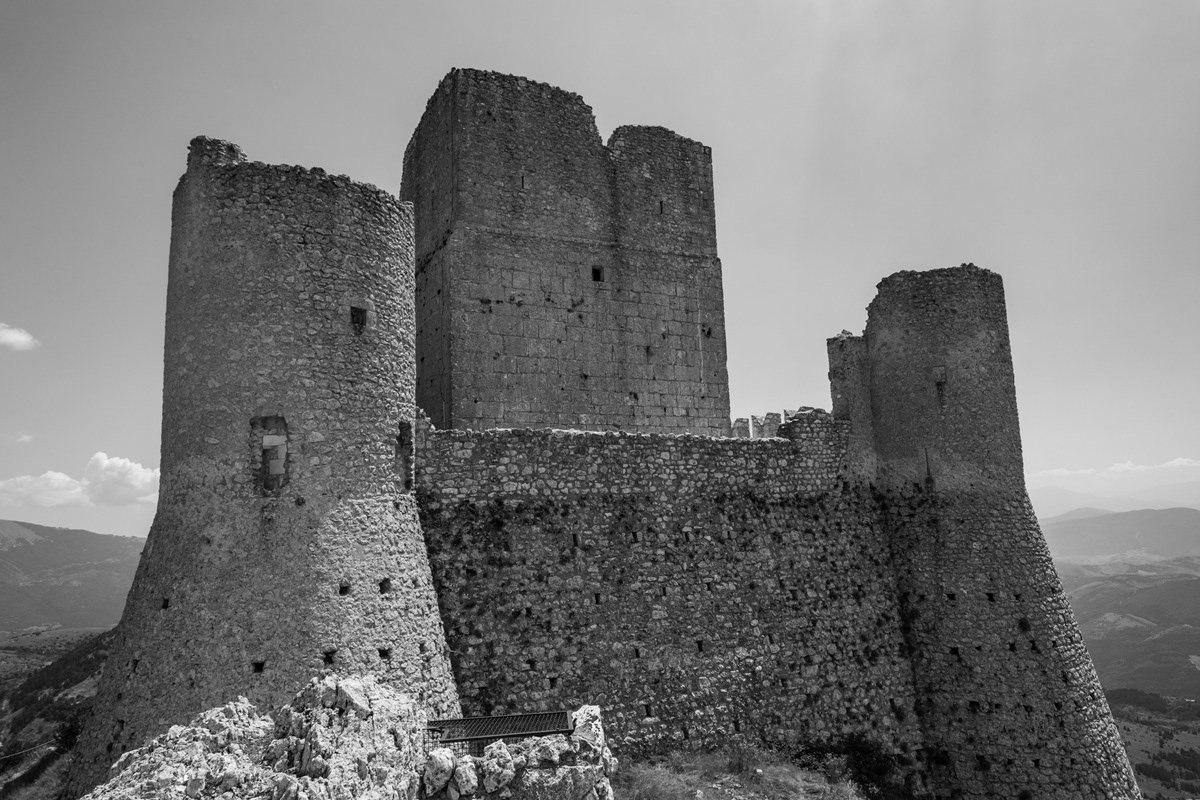
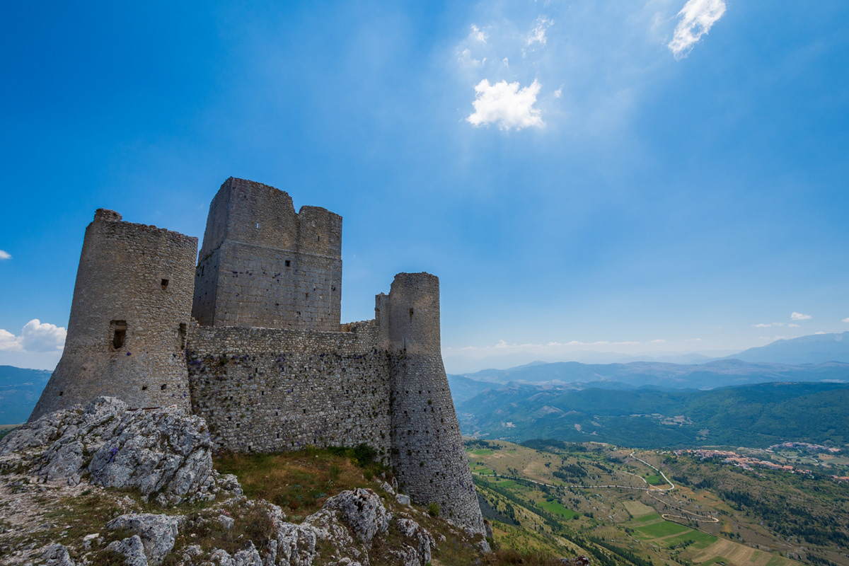
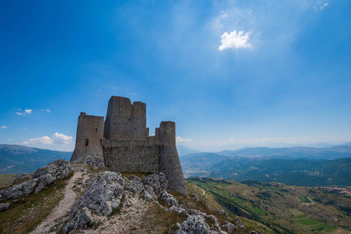
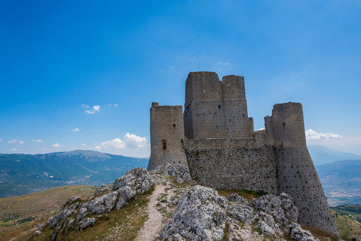
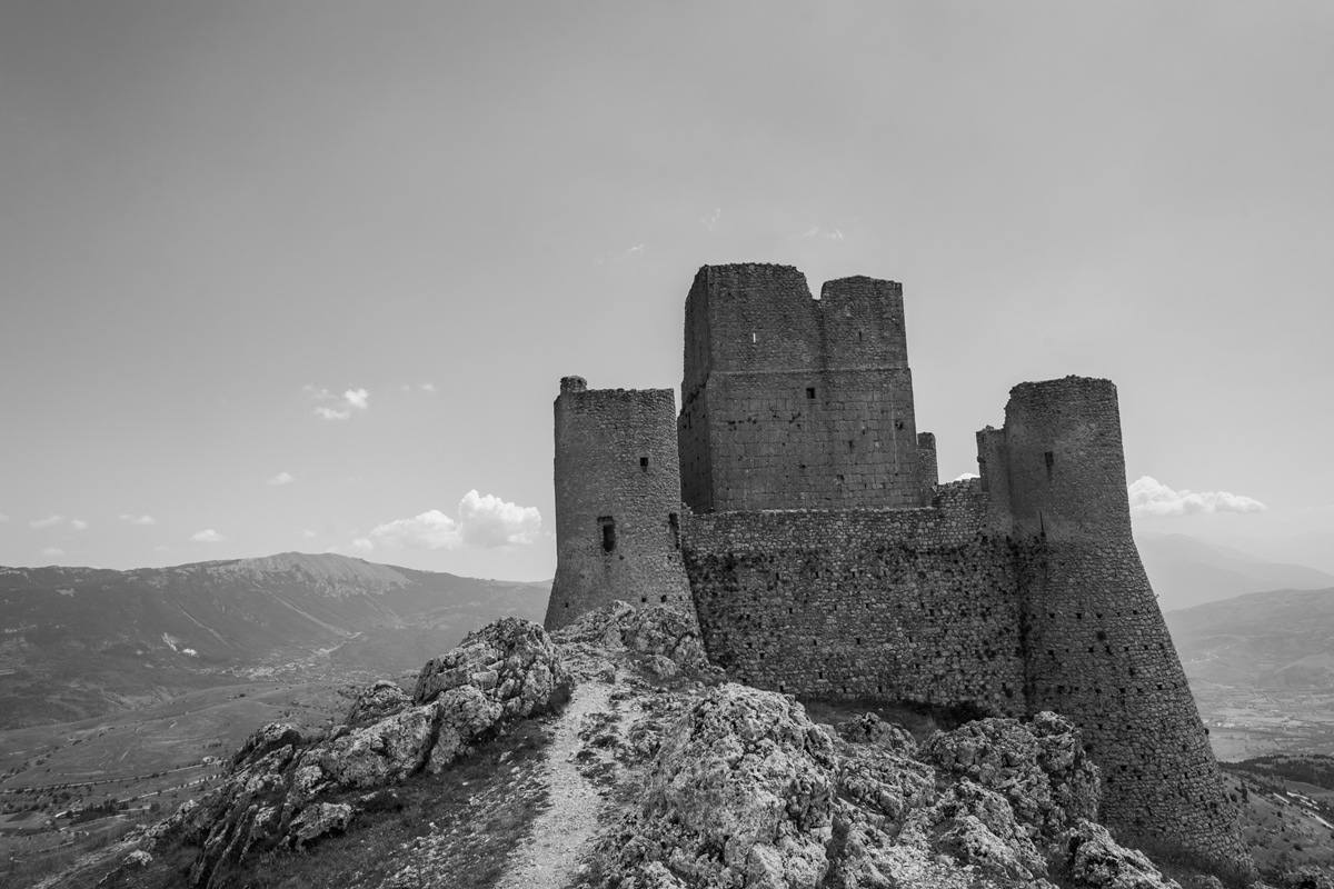
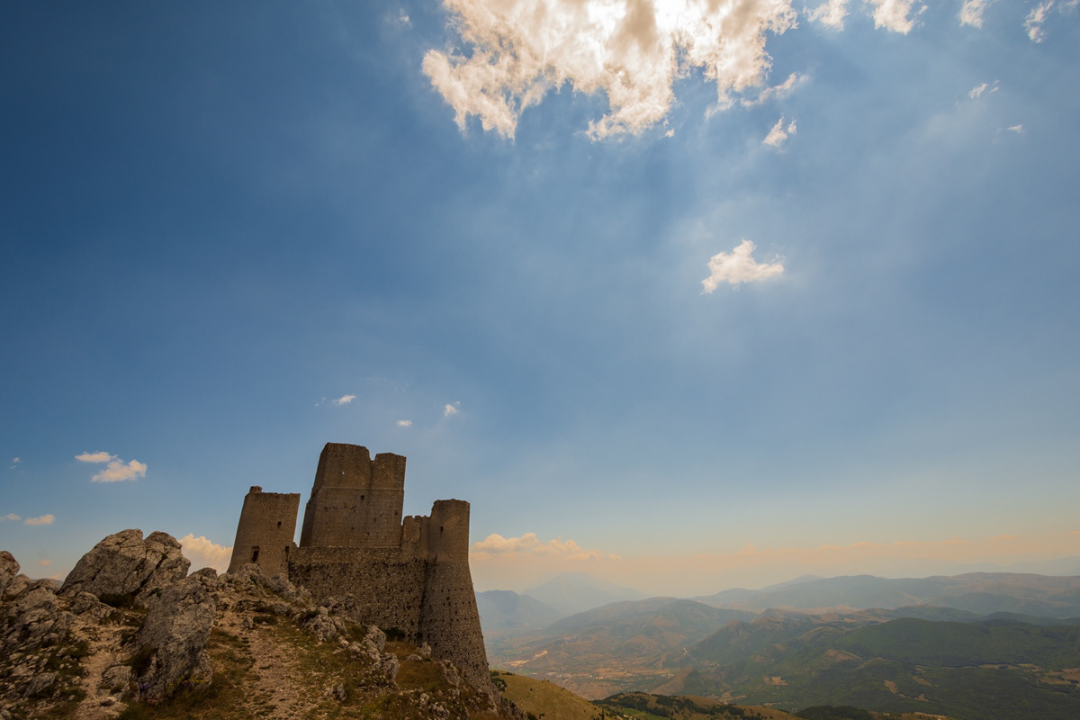
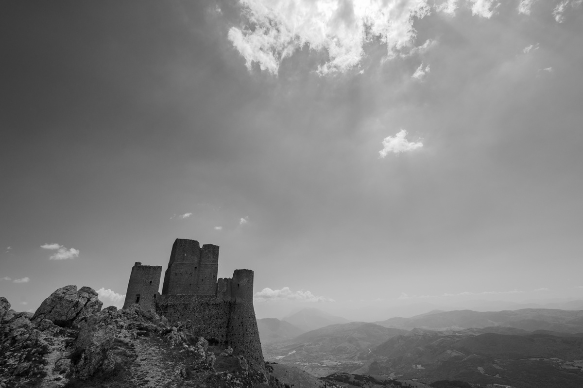
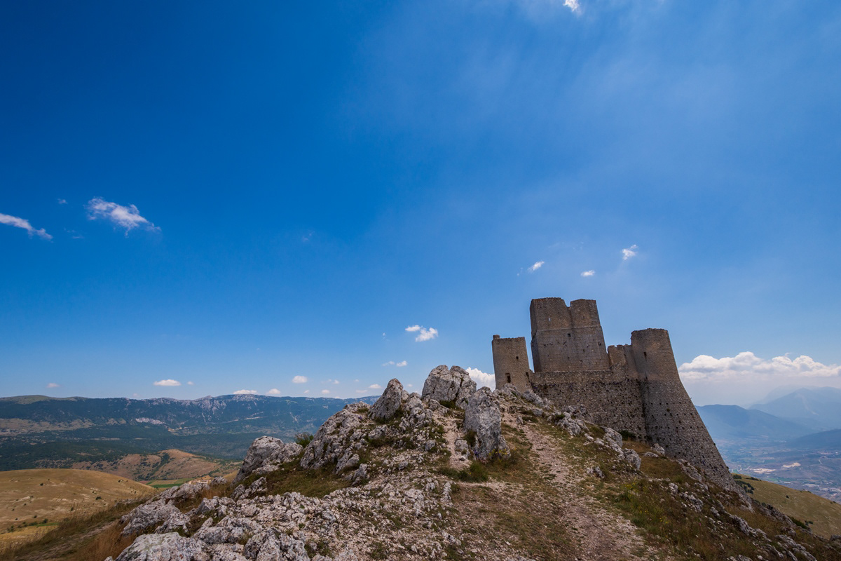
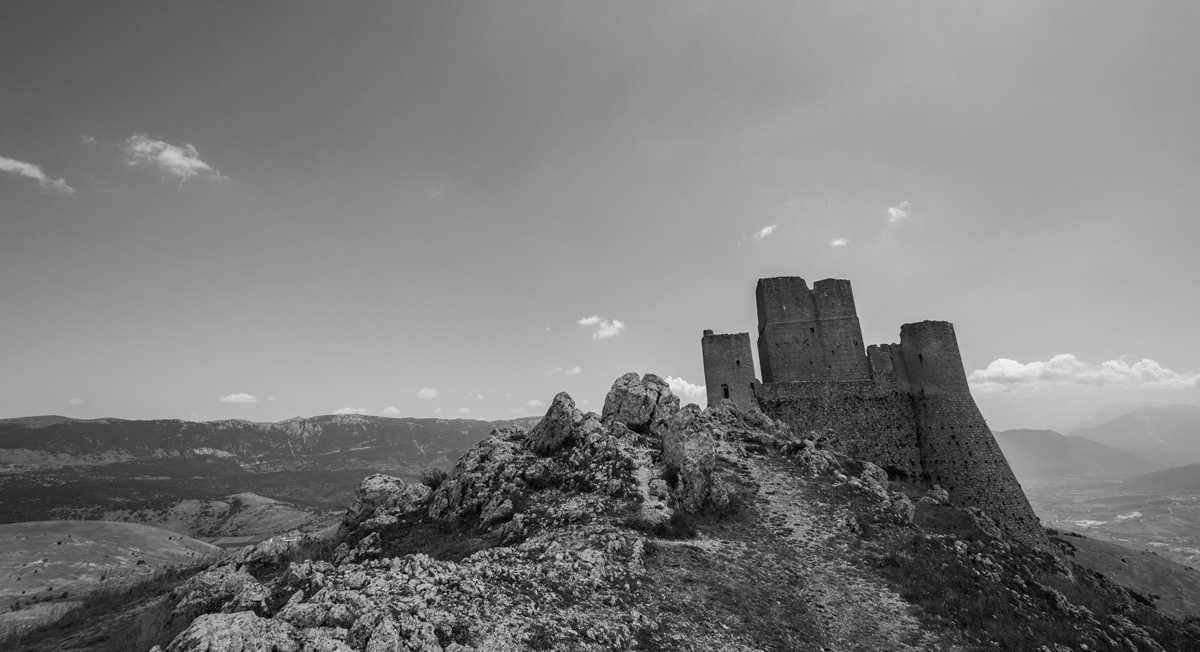
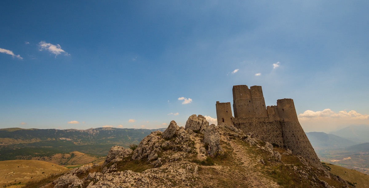
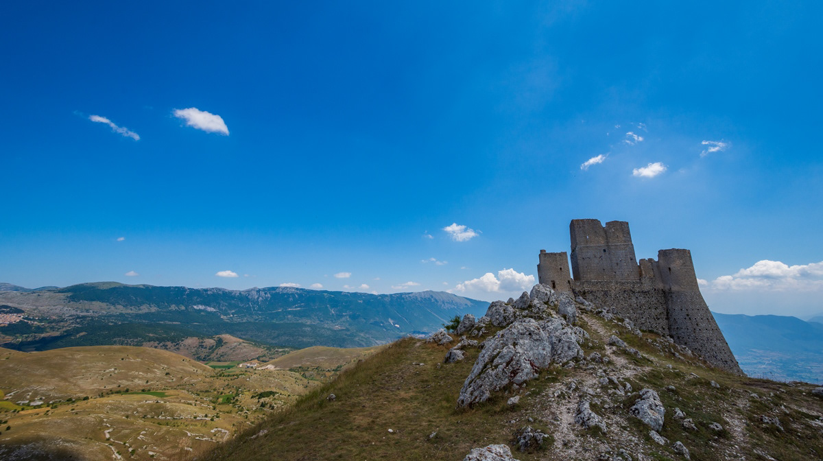
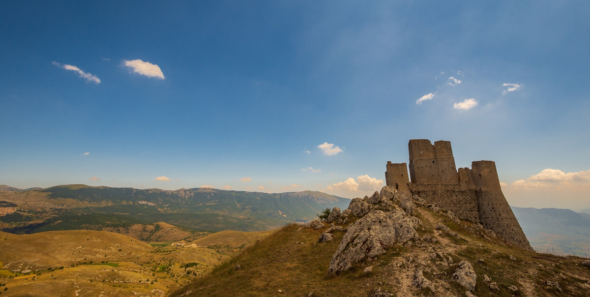
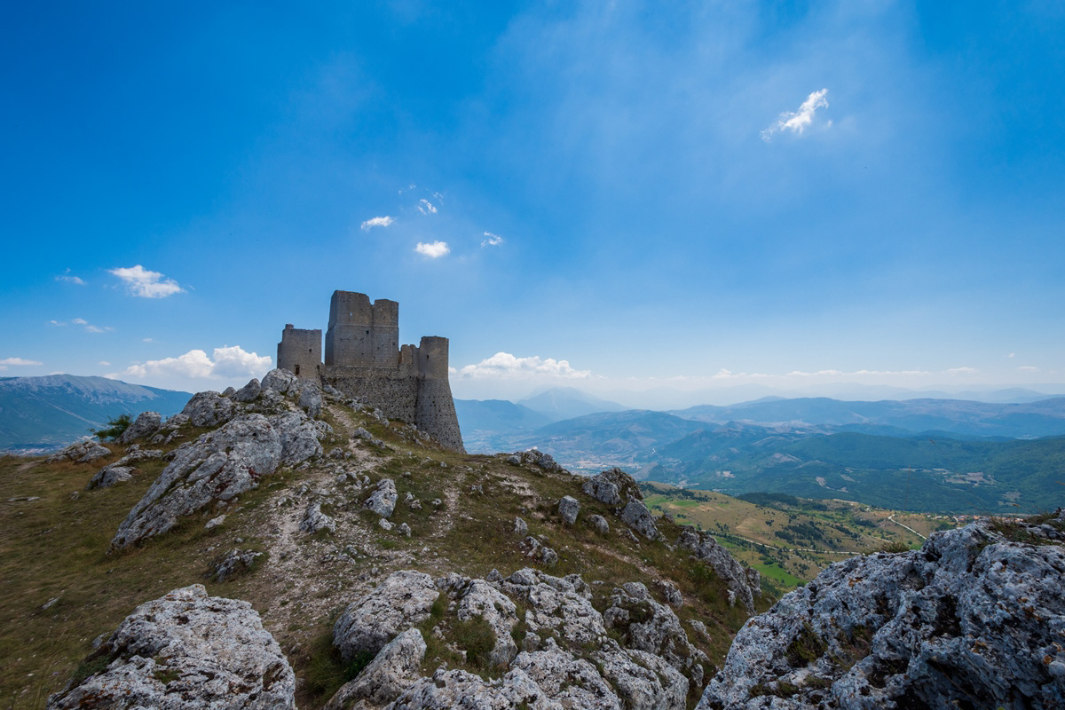
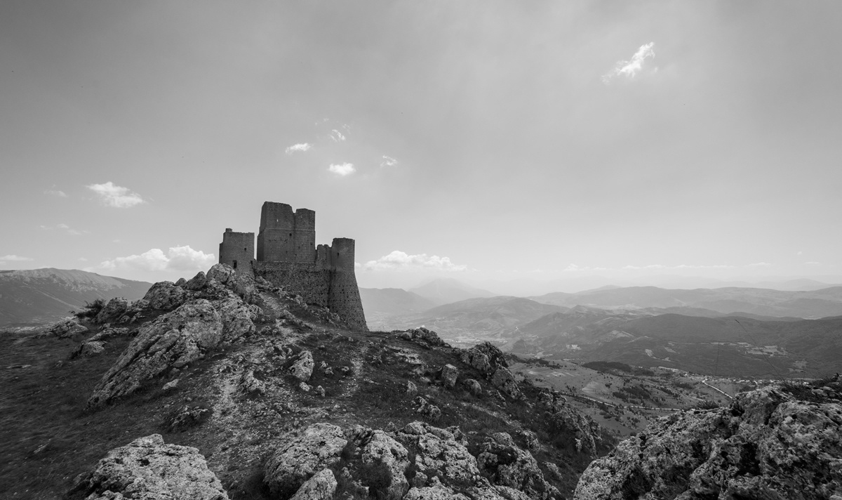
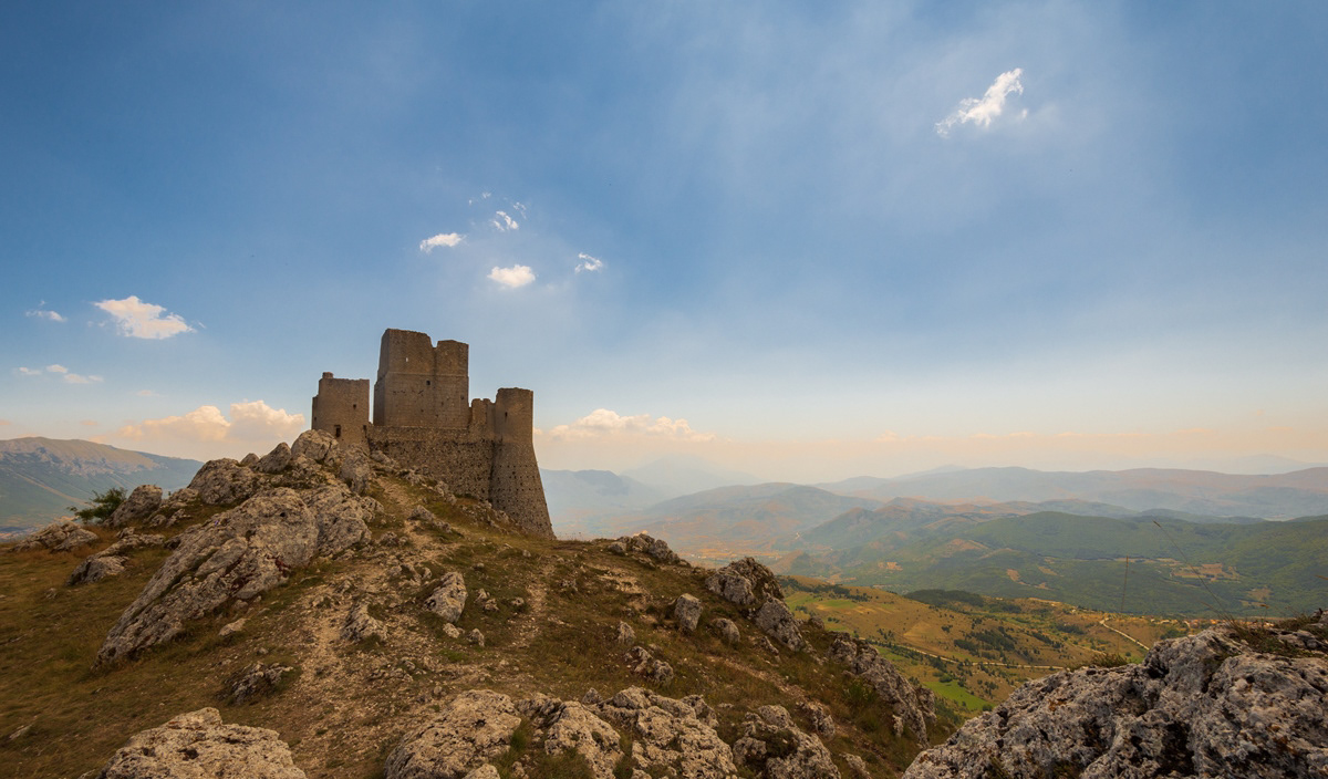
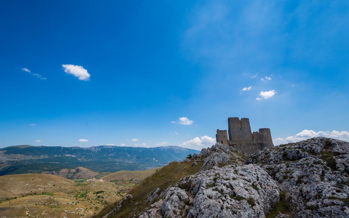
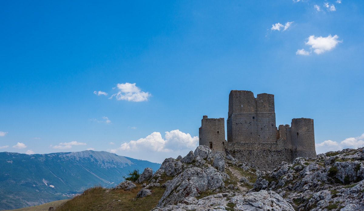
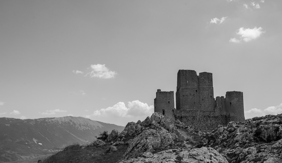
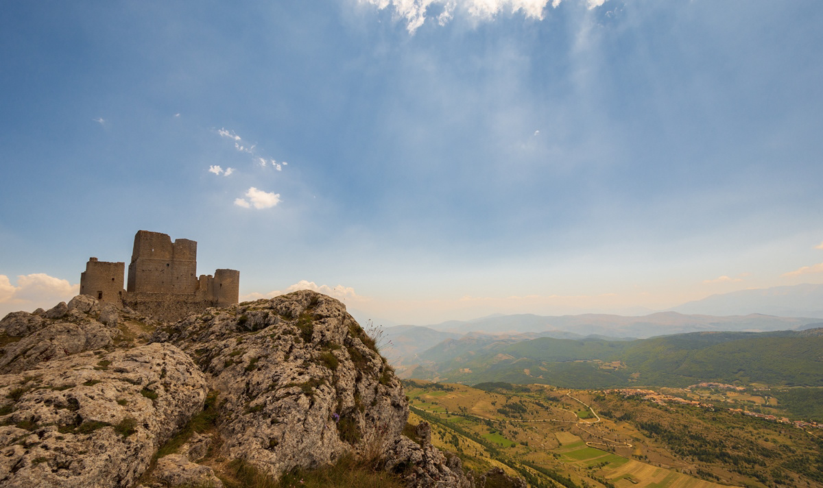
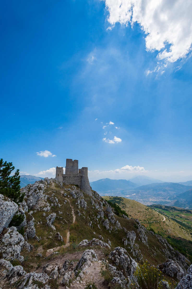
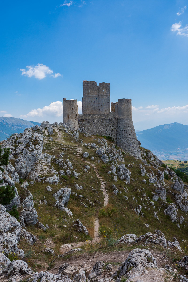
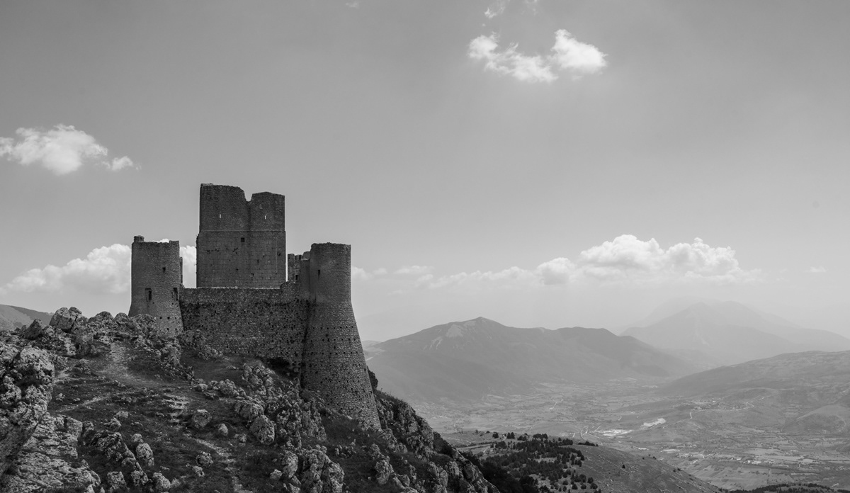
You may also like

2023
Fara San Martino, Chieti. San Martino in Valle Abbey
The abbey of San Martino in Valle is a ruined Benedictine abbey near the Gole di Fara San Martino in Fara San Martino in the province of Chieti. The first historical sources on the Church located inside the Castle of Rocca S. Martino date back to 829 which list it among the possessions of the monastery of Santo Stefano in Lucania of Tornareccio, to which it had been donated by Pepin the Short. In 844 it passed under the control of the bishop of Spoleto and subsequently among the possessions of the abbey of San Liberatore a Majella. In 1044 the Theatine count Credindeo on his deathbed and for the redemption of his soul and his loved ones (recalling the capitulars of the Longobard king Liutprando) donated the church to the venerable priest Isberto so that he could endow it with an independent Benedictine monastery. In 1172 it became part of the diocese of Chieti. In 1222 Pope Honorius II confirmed the donation of Count Credindeo. The monastery was suppressed in 1452 by Pope Nicholas V and united with the Vatican Chapter, to return in 1789 to the archdiocese of Chieti. The definitive abandonment of the monastery took place on 8 September 1818 due to a flood that covered it with debris. The first excavations for its recovery took place in 1891, but only with those of 2009 were the remains of the structure fully brought to light. The remains of the abbey show a gate to an internal courtyard bordered by a three-arched portico, on the north side of which is a bell gable. The interior of the church had to have three naves with stone slab flooring. A wall with three arches separates the central nave from the northern one, from where one enters what must have been the initial nucleus of the church, dug into the rock, which suggests the birth of the place of worship as a hermitage.
2023
Fara San Martino. The Gorges of San Martino
the Gole di San Martino opens with a narrow passage from the high rocky walls on the eastern slope of the Maiella, just outside the town of Fara. This is the beginning of the gorge-like valley that leads to the highest peak of the Maiella, Monte Amaro (2793 m), and includes the wildest territories of the entire massif with a 14 km long route and a difference in height of 2300 m . It can be divided into three parts: the Valle di S. Spirito, the Valle di Macchia Lunga and the Val Cannella. The latter ends with a glacial cirque in the center of which is the Manzini refuge. According to popular tradition, these suggestive gorges, just 2 m wide and about 30 m long, were opened by San Martino with the strength of his arms to allow the people of Fares to access the high pastures of the Majella more quickly. After walking a few meters, you can see the monastery of San Martino in Valle which an archaeological excavation has recently brought to light. In reality, this remarkable scenario was produced by the erosive and incessant action of the torrential waters coming from the melting of the surrounding snowfields during the Quaternary, in particular during the glaciations. With an evident franapoggio stratification that highlights the oldest terms as you go up, the oldest rocks of the Maiella emerge here, represented by beige-hazelnut platform limestones dating back to the lower Cretaceous. They contain fossil remains of algae and benthic foraminifera. Near the monastery, it is possible to observe an outcrop full of rudists, lamellibranchs who build cliffs now extinct but clearly visible in Maiella on Cima Murelle.
2022
Abruzzo, Italy. Spectacular landscapes
Abruzzo is an Italian region located east of Rome, between the Adriatic and the Apennines. The hinterland is mostly made up of national parks and nature reserves. The region also includes medieval and Renaissance villages perched on the hills. The regional capital, L'Aquila, is a city surrounded by walls, damaged by the earthquake of 2009. The Costa dei Trabocchi, with its sandy coves, takes its name from the traditional fishing jetties.
2018
Barrea and its lake (AQ)
Barrea is located in a mountainous area overlooking the Sangro Valley and the Barrea Lake. The inhabited center, located at an altitude of 1,060 m a.s.l., occupies a ledge at the eastern end of the lake enclosed by the steep sides of the Meta mountains to the south and Mount Greco to the north. Its territory is included in the national park of Abruzzo, Lazio and Molise. The lake was formed in 1951 by the damming of the Sangro river and is used for the production of electricity. The Wetland of Lake Barrea, managed by the Abruzzo, Lazio and Molise National Park Authority, has been on the list of areas provided for by the Ramsar Convention since 1976.
2024
Isola del Gran S. The church of S Giovanni ad Insulam
The church of San Giovanni ad Insulam, also known as the church of San Giovanni al Mavone, stands isolated on a small hill that flanks the Mavone river in the valley of the same name.
2024
Celano. Church of San Michele Arcangelo
The construction of the Church of San Michele Arcangelo dates back to the 14th century. At the end of the 14th century the Counts of Celano donated it to the congregation of the Celestine monks
2021
Rio Verde
The Rio Verde was born in Quarto, between Abruzzo and Molise, and after a short path it joins the Sangro with a considerable difference in height (400 m) creating the spectacular waterfalls divided into three consecutive jumps of 200 meters.
2024
Morro D’Oro. Church of SS. Salvatore
At the entrance to the town of Morro D'Oro (Teramo), 210 m above sea level, there is the Church of SS.mo Salvatore. It is also dedicated to St. Nicholas of Bari, patron saint of Morro D'Oro
2023
Palena. The waterfalls of the Aventine river
The Aventine is a 45 km long river in Abruzzo, born from the sources of Capo di Fiume, located within the municipality of Palena, located at 863 m above sea level, downstream of the Cotaio stream.
2023
Abruzzo, Italy. Spectacular autumnal landscapes
Abruzzo is an Italian region located east of Rome, between the Adriatic and the Apennines. The hinterland is mostly made up of national parks and nature reserves. The region also includes medieval and Renaissance villages perched on the hills. The regional capital, L'Aquila, is a city surrounded by walls, damaged by the earthquake of 2009. The Costa dei Trabocchi, with its sandy coves, takes its name from the traditional fishing jetties.
Back to Top