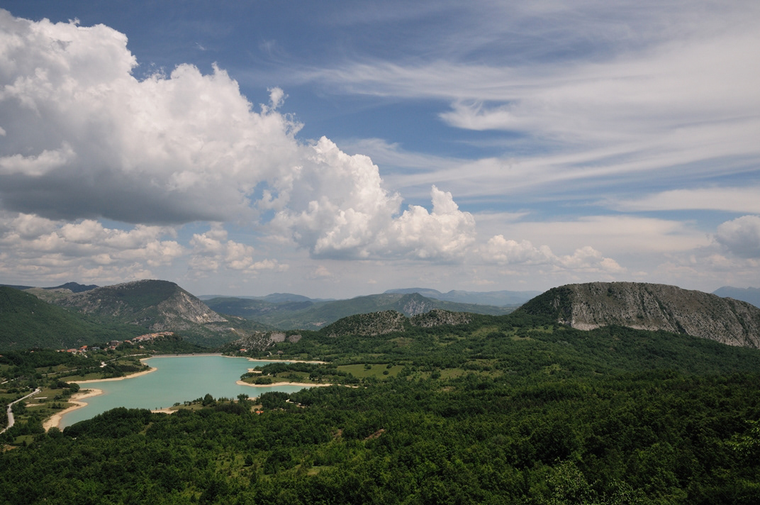
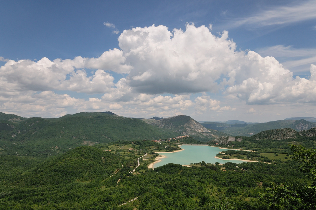
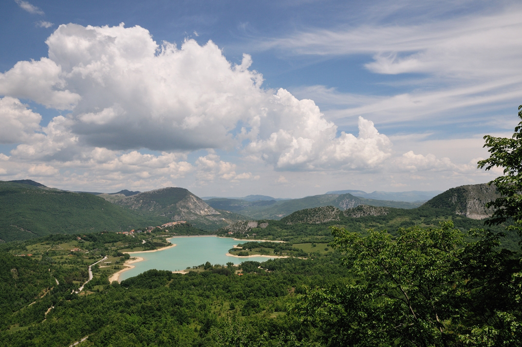
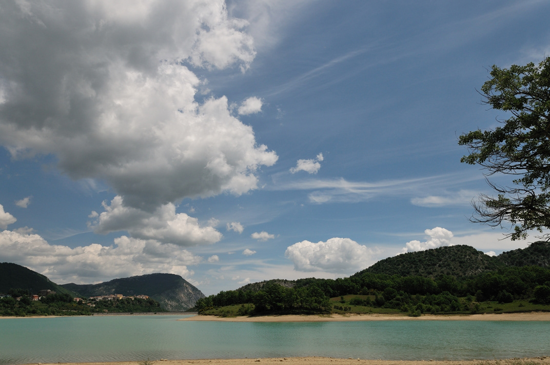
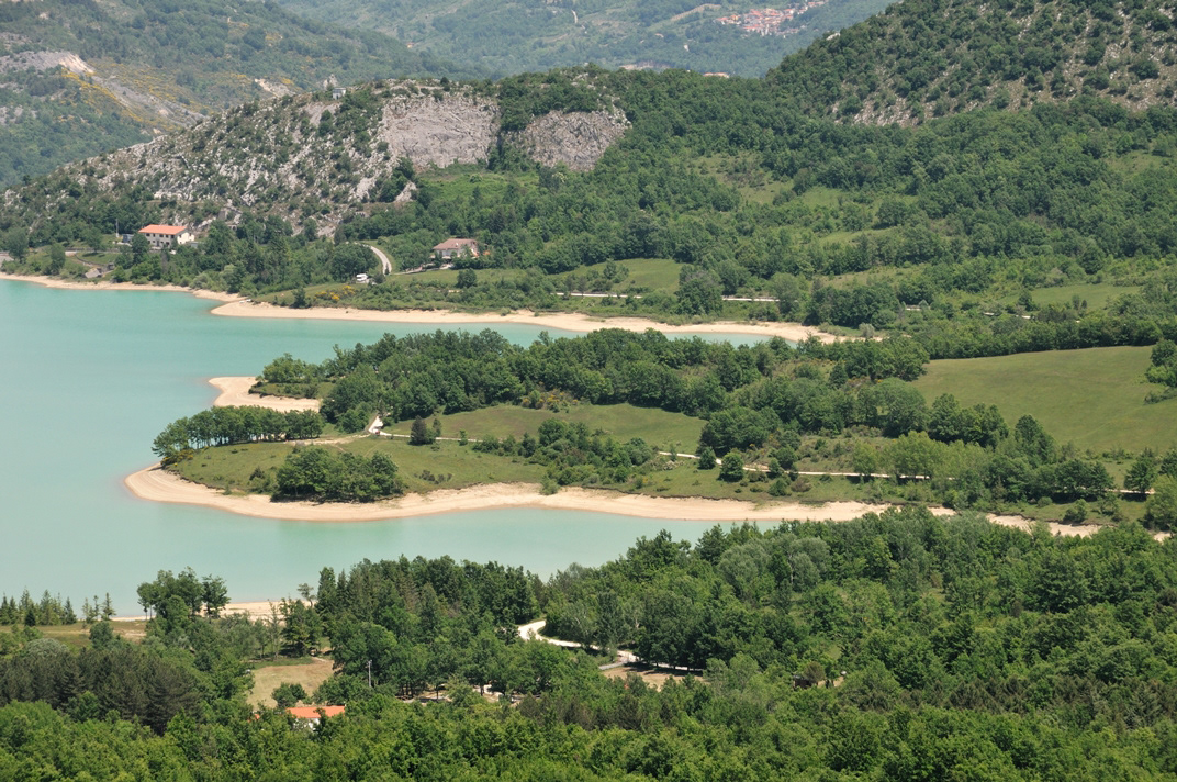
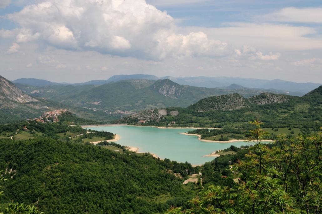
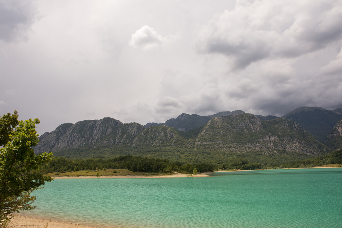
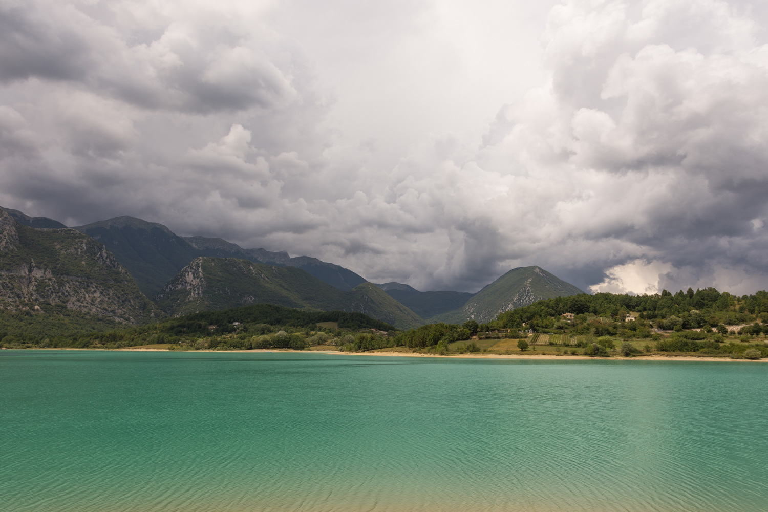
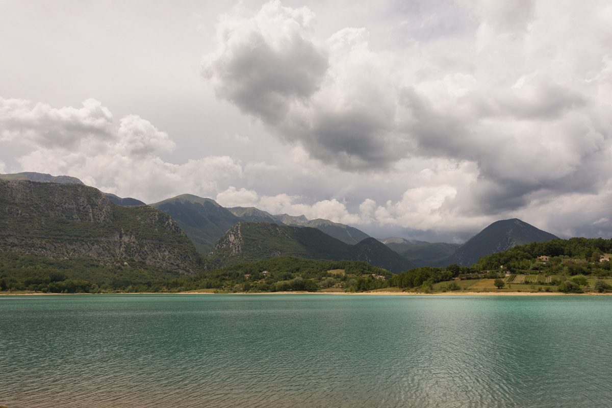
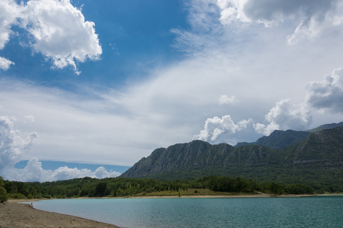
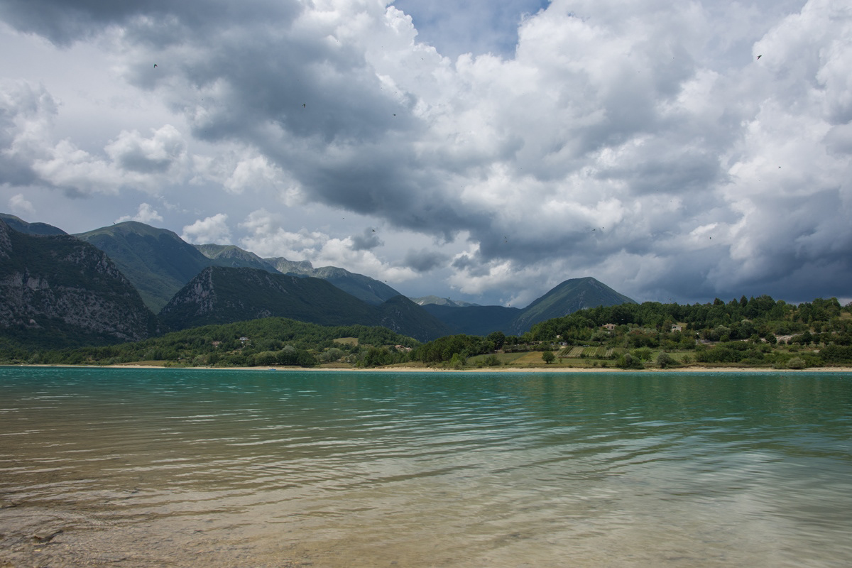
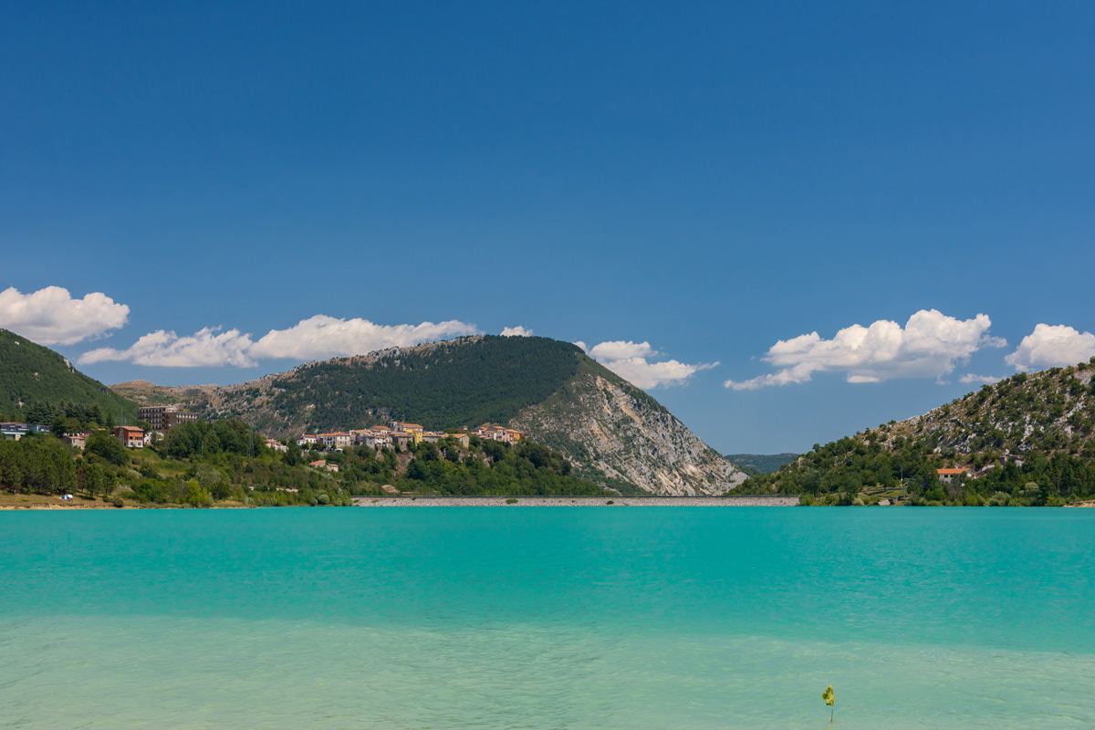
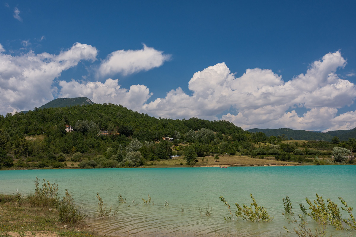
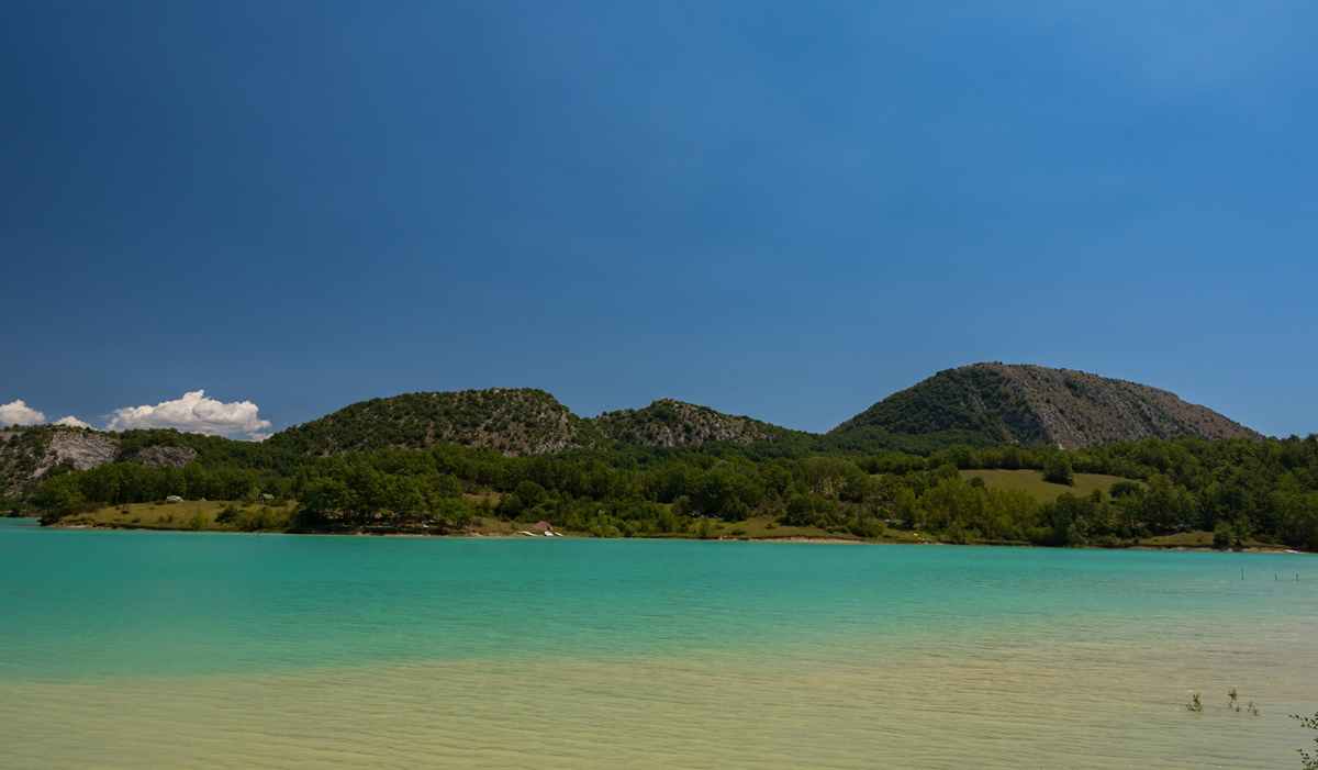
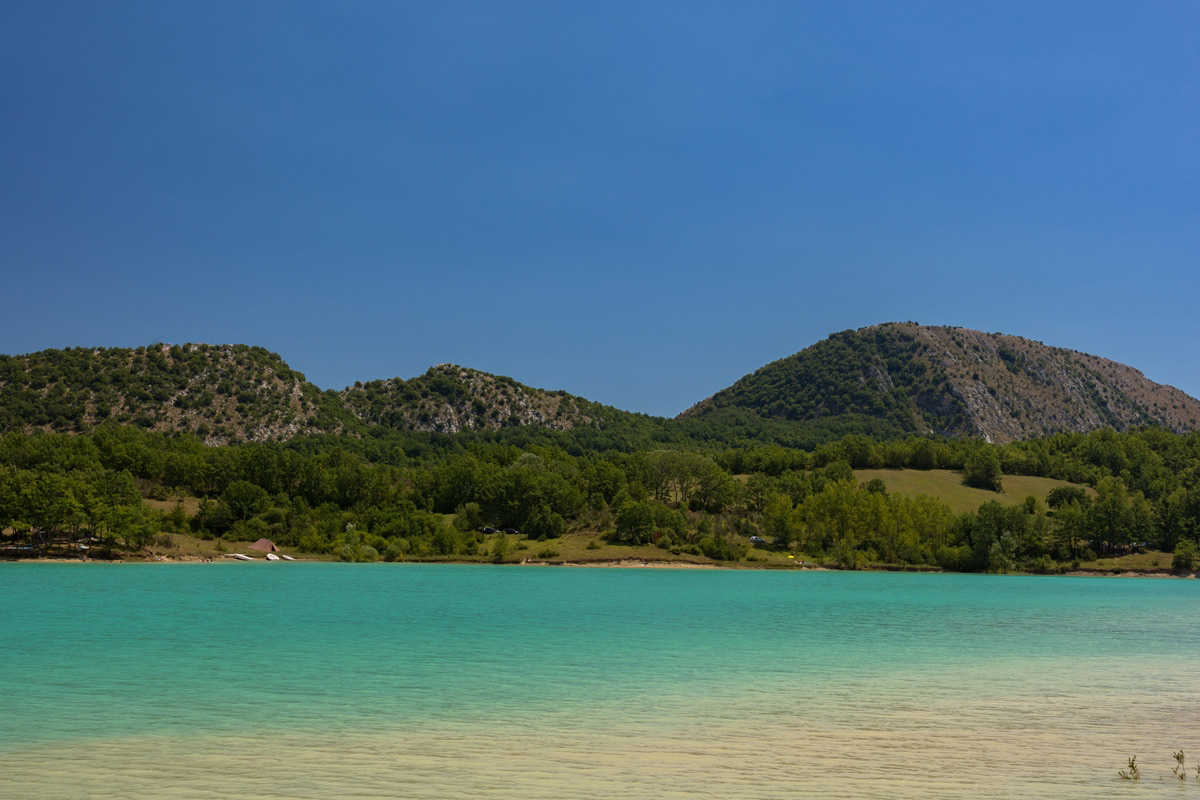
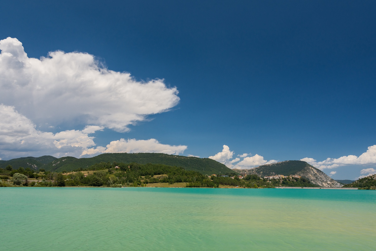
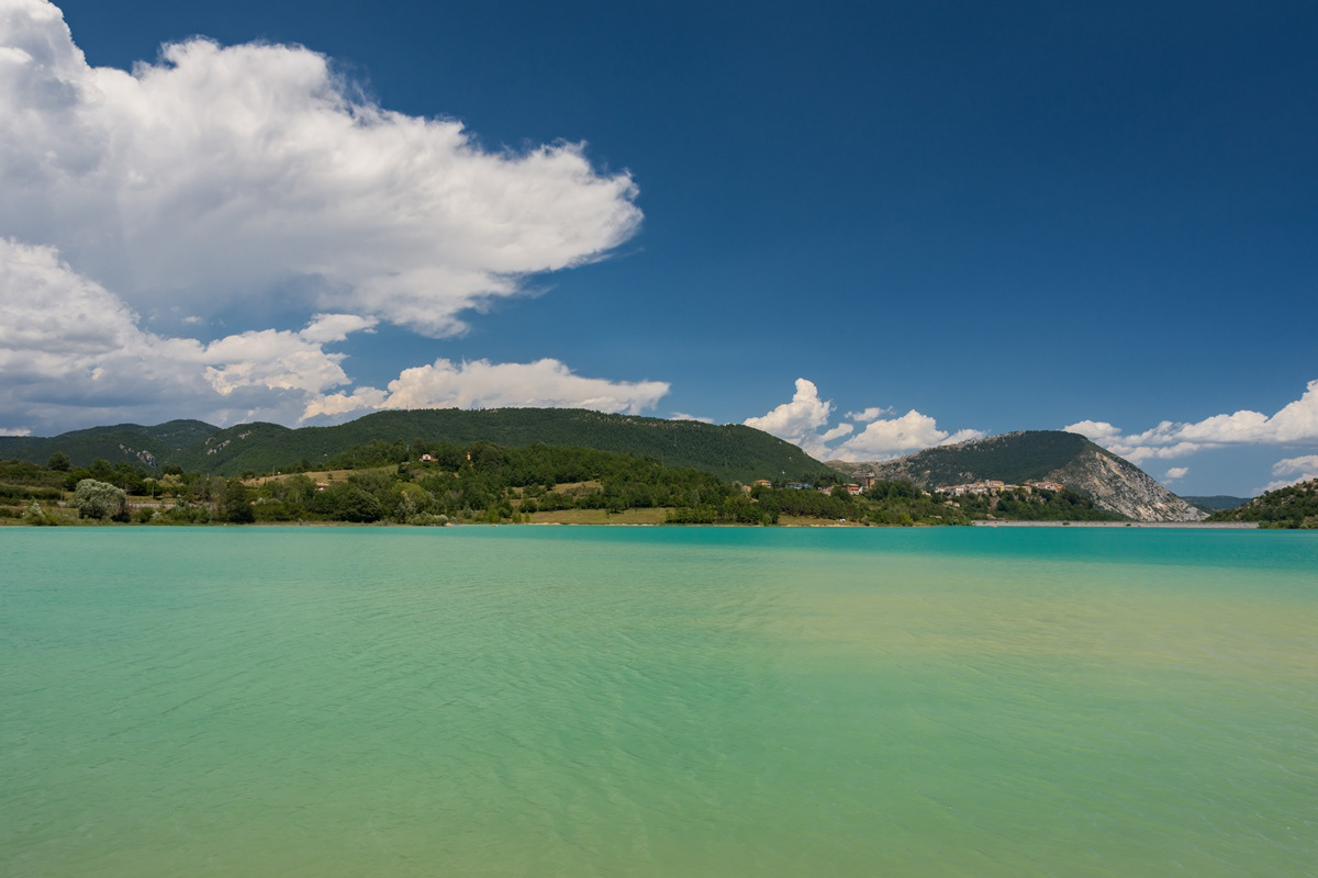
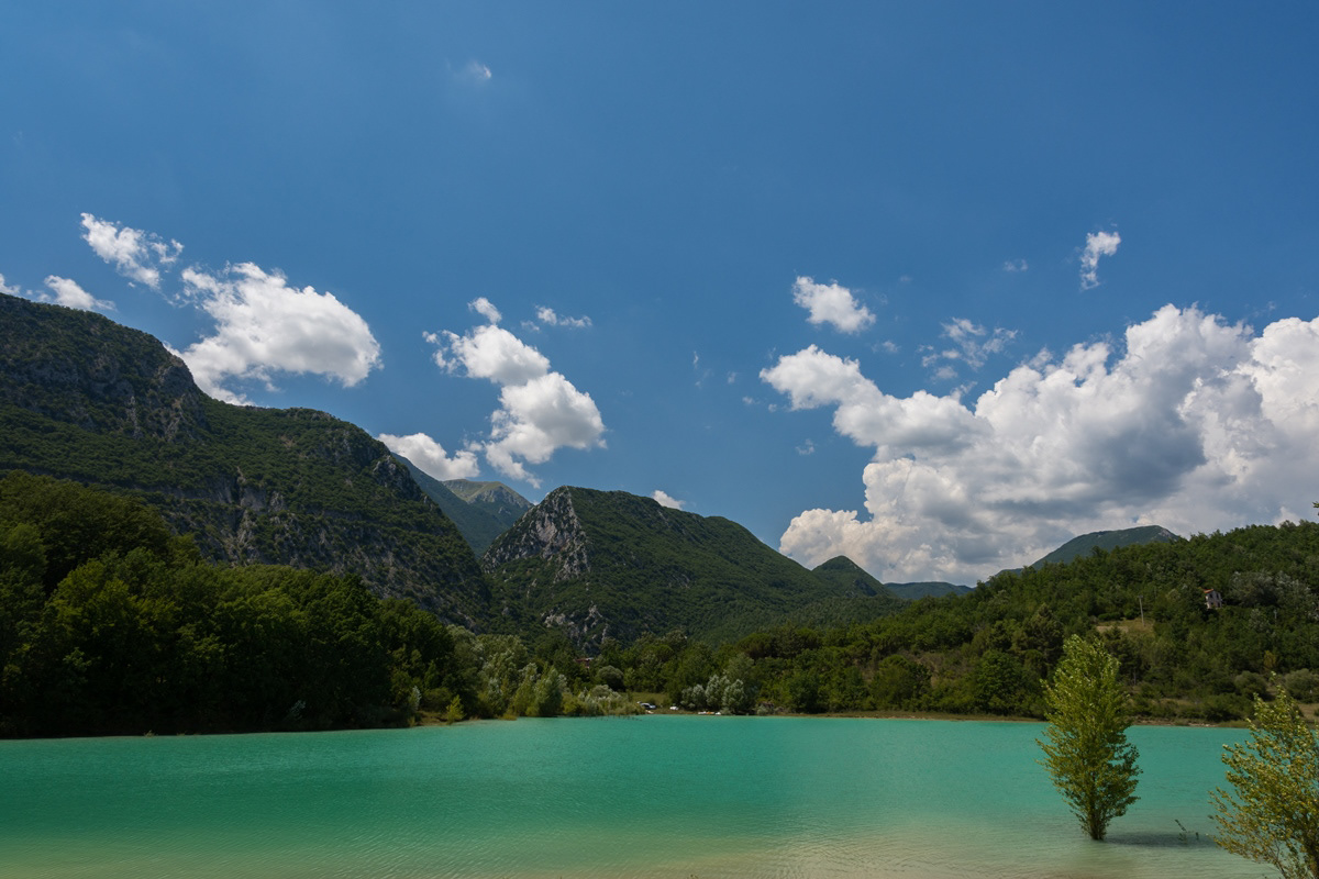
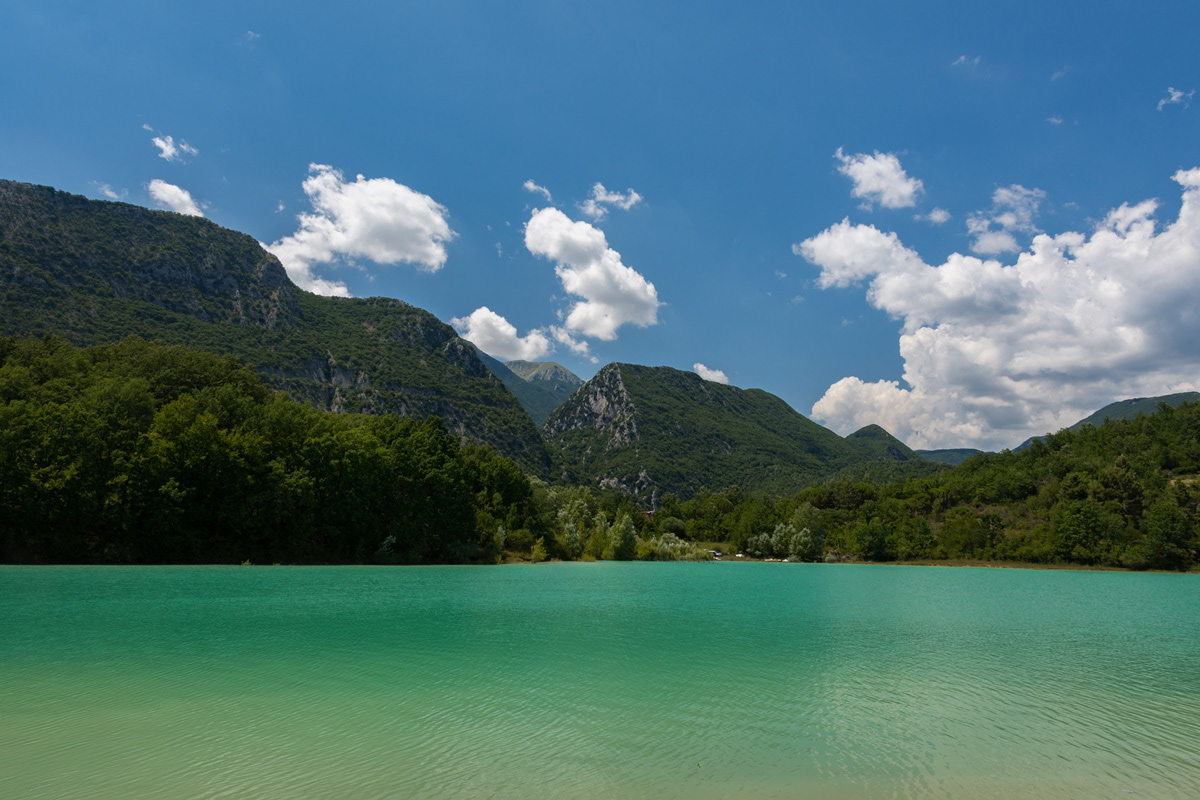
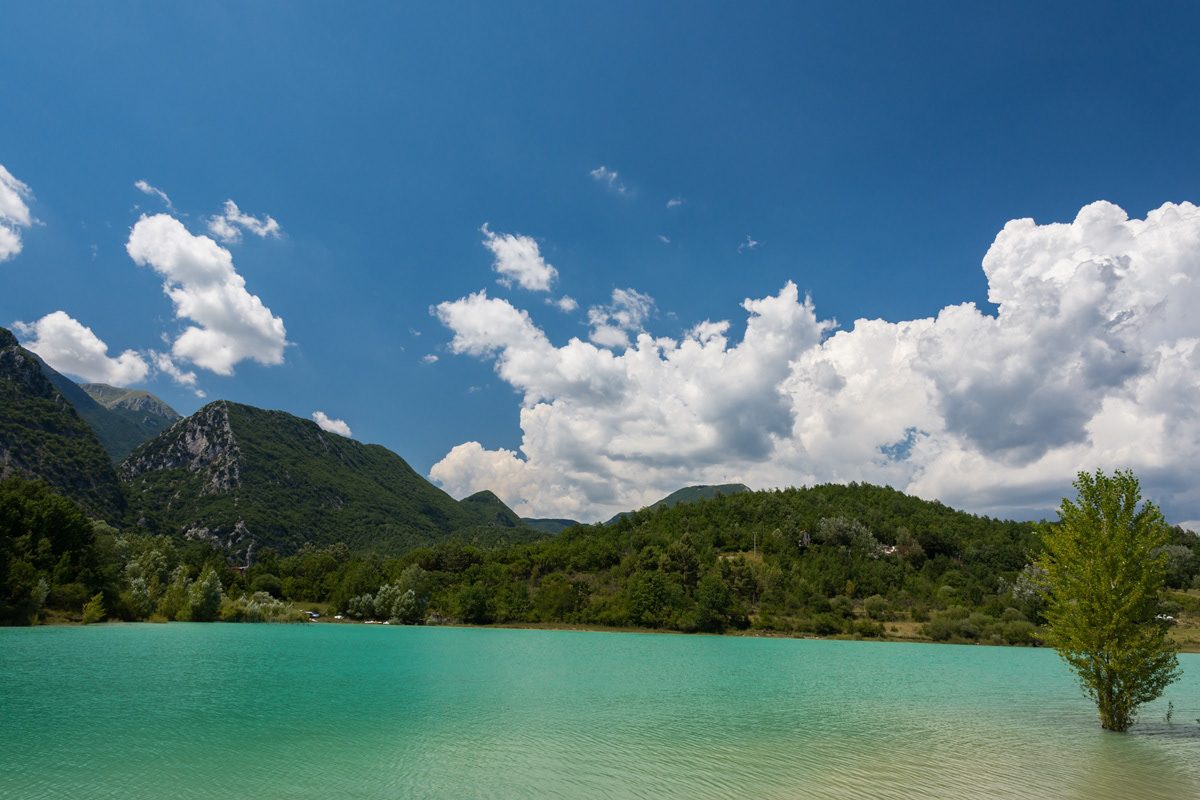
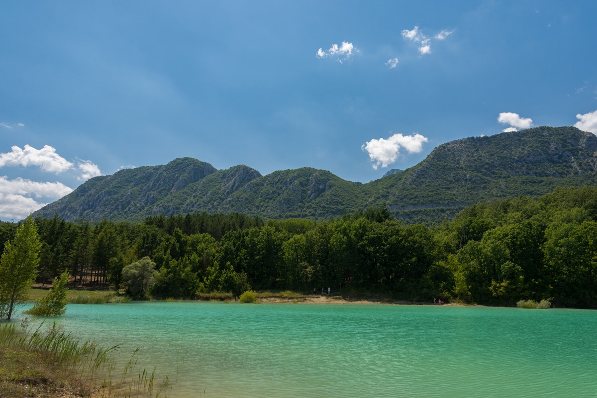
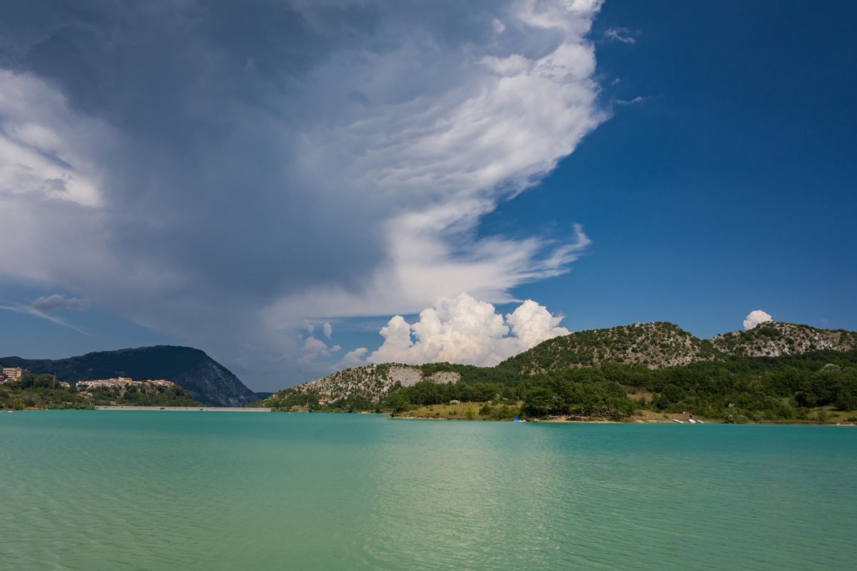
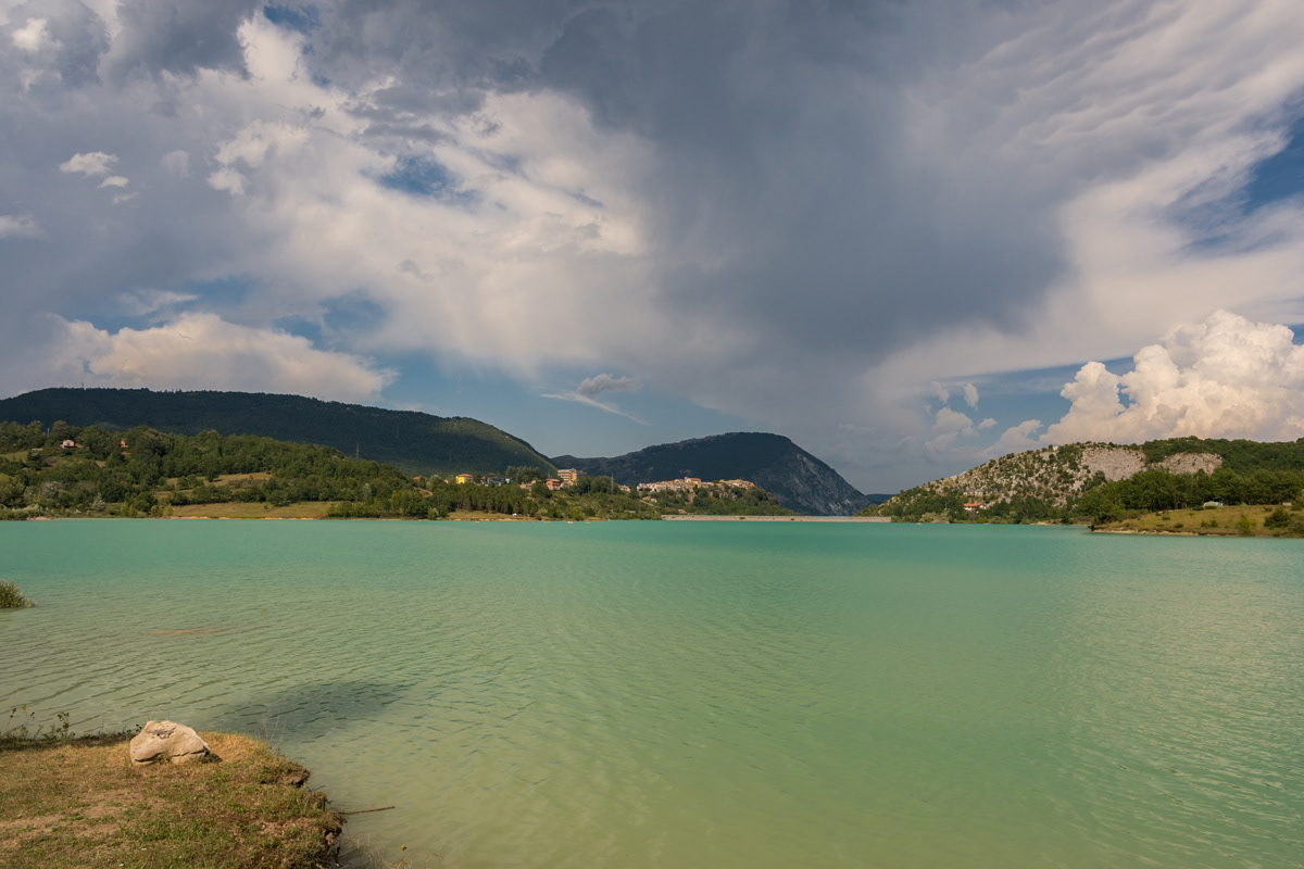
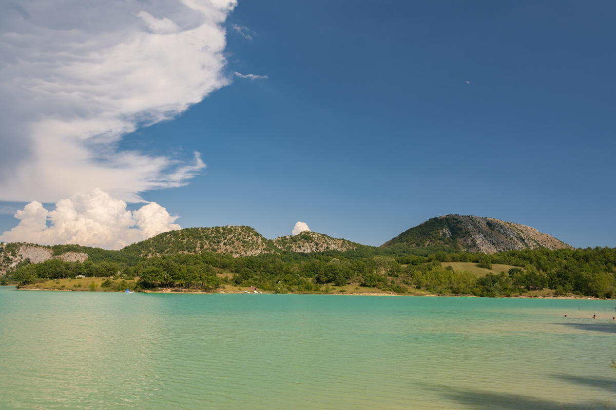
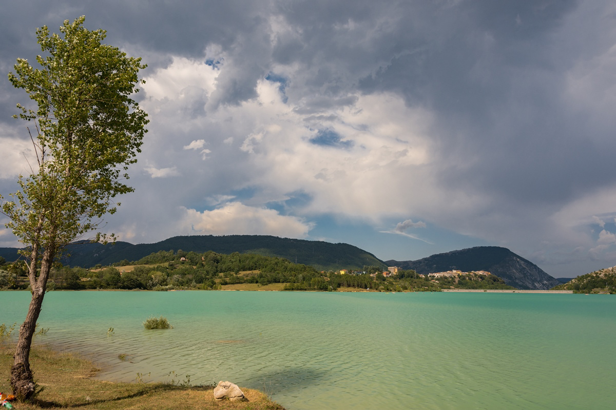
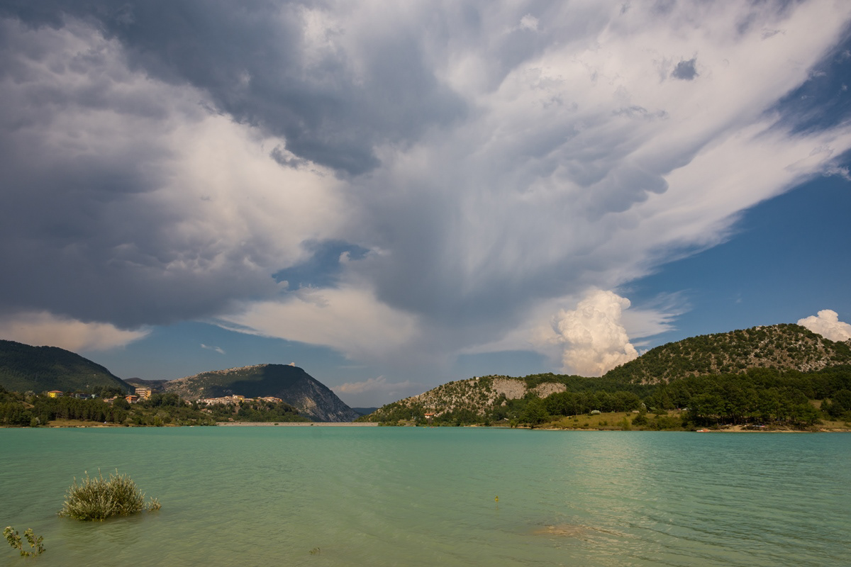
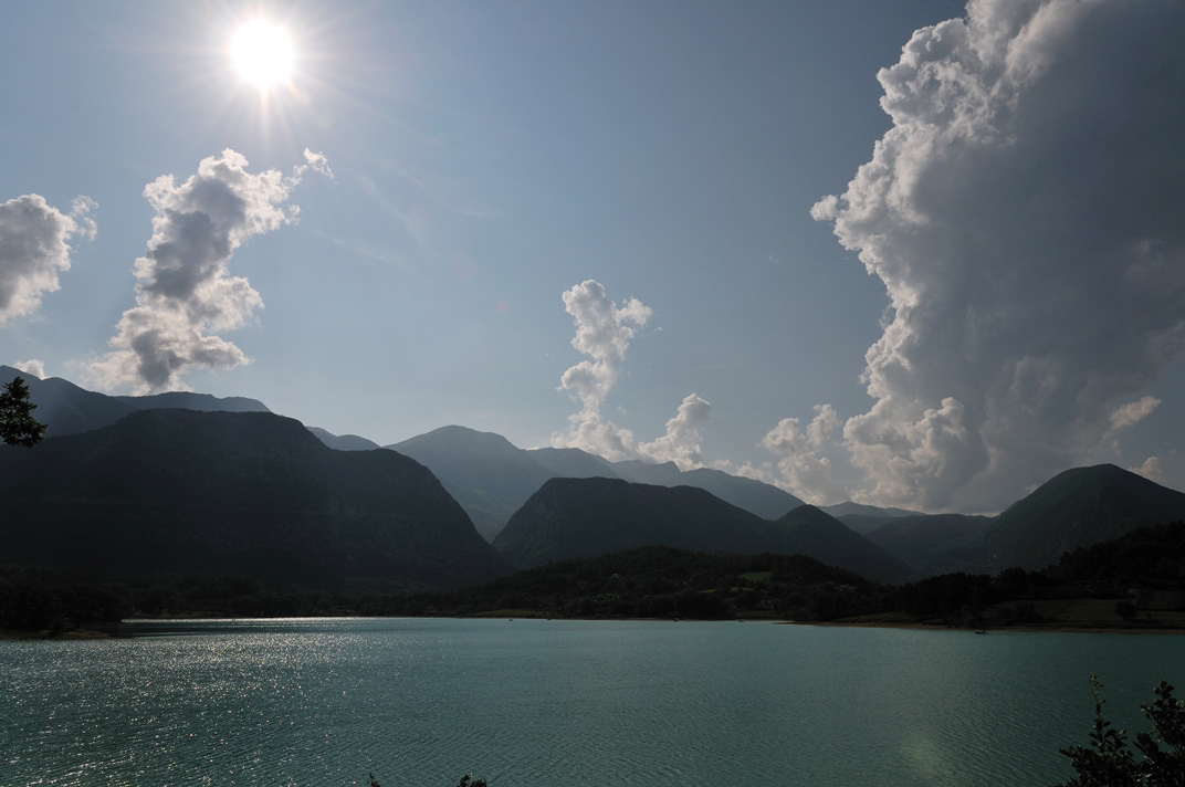
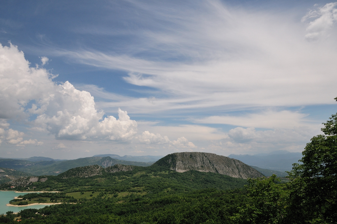
You may also like

2022
The waterfalls of Carpinone
In the heart of a very small village in Molise, immersed in an enchanted forest and floral nature, stands the Carpinone waterfall, one of the most fascinating spectacles of the local nature.
2023
Vastogirardi, novembre 2023
Physical geography It is located at 1200 m above sea level. in the part of Molise bordering Abruzzo. The territory of Vastogirardi (IS) extends over an area of 60.72 km² and borders the municipalities of Capracotta to the north, San Pietro Avellana, Castel di Sangro (AQ) and Rionero Sannitico to the west, Forlì del Sannio, Roccasicura and Carovilli to the south, Agnone to the east. From a morphological point of view, the territory is separated from that of Capracotta by reliefs of Monte Capraro, which oscillate between 1300 - 1350 m, which descend steeply to Piano S. Angelo and Difesa Grande and Capo di Trigno (ancient lake basin ) at an altitude of 1100 m from which the Trigno river originates, one of the two most important Molise rivers which flows into the Adriatic Sea and gives its name to the road of the same name which reaches up to San Salvo (CH), i.e. the Trignina. To the west are the mountains of Montagnola (1292 m) and Monte Miglio (1350 m), to the south is Monte Pizzi (1373 m), while to the east are the mountains of Montagna Fiorita with Montarone (1278 m). Vastogirardi develops close to a hill at the top of which are the castle and the ecclesiastical complex of San Nicola di Bari. Inside the walls is the village, which appears well preserved in its original defense function, as evidenced by the cylindrical towers incorporated in factories and the supports between building blocks. The result of subsequent expansions, the churches of S. Rocco and S. Maria delle Grazie were built at the beginning of the 18th century and incorporated into the third urban expansion dating back to the 18th - 19th century. Over the course of the last century the town no longer followed the aggregation trend of stepped bands, according to the morphological trend of the site, but developed along via Garibaldi c.da Difensa (towards Castel di Sangro) and via Re d'Italia (direction Isernia). Origins of the name It is assumed that the name Vastogirardi originates from the name of a crusader captain, Giusto Girardi. In the past it also took the name of Castrum Girardi due to the castle (other attested toponyms are Castel Girardo, Rocca Girardo, Guasti Belardi, Guardia Giraldo and Guardia Gerardo) and subsequently its current name, deriving from an alliteration of Lombard jargon.
2018
Isernia, Il convento celestino di S. Spirito
2022
Rocchetta a Volturno. Winter 2022
Rocchetta a Volturno is an Italian town of 1 098 inhabitants in the province of Isernia in Molise. The Municipality of Rocchetta al Volturno is made up of two nuclei: the original village, called Rocchetta Alta, or Rocchetta Vecchia, still perched in a defensive position on the mountain, and Rocchetta Nuova, which is located at a lower altitude. The new Rocchetta was born because, at the end of the 19th century, the slope that connected the southern part of the ancient town with the opposite hill was deforested and the land began to show serious subsidence from 1890 due to the progressive sliding of the superimposed layers of clay and sandstone, increased by water infiltrations, both rain and spring. In 1905, following further disastrous events, the population moved for the most part downstream, where there was a hamlet called Case Sparse. The modern town is developed today in the center of a plateau, bordered to the west by the terminal part of the Mainarde chain and to the east by a depression, at the bottom of which the Volturno flows; about two kilometers away are the sources of the river. Its name characterizes the toponyms of other nearby municipalities such as Colli a Volturno and Cerro al Volturno.
2024
Miranda 2024
Miranda is an Italian municipality of 952 inhabitants in the province of Isernia in Molise. A first settlement of the current municipality probably dates back to the 11th century, as evidenced by the Norman facies of the castle that stands on the previous promontory, of which however few survive architectural elements. The original nucleus of the town is structured around it, interspersed with various walls that identify the subsequent residential layers built starting from the primary fortress. The scant documentation relating to the Miranda fiefdom testifies to a frequent transfer of ownership between various noble families, including the Di Somma Neapolitans, whose family coat of arms consisting of two towers standing on the seabed is still the official symbol of the municipality today.
2022
Colli a Volturno. Winter 2022
Colli a Volturno (Cuòglië in Molise) is an Italian town of 1 312 inhabitants in the province of Isernia in Molise. The municipal territory extends into the Volturno Valley on the border with the national park of Abruzzo, Lazio and Molise. Colli a Volturno (also called simply Colli), rises on three wooded hills, at an altitude of about 400 m a.s.l. (max. 1 013, min. 236 a.s.l.). The municipal area borders the municipalities of Fornelli, Rocchetta a Volturno, Montaquila, Scapoli, Cerro al Volturno, Macchia d'Isernia, Filignano and Monteroduni. The Collese area, as the name suggests, is mainly hilly interspersed with wide flat spaces. The climate is mild, the average annual temperature is 18.2 ° C, the average rainfall is 862 mm. Summers are warm and temperate, winters are cold but not particularly harsh, sporadic snowfalls, exceptionally abundant those of February 1956, January 1985 and February 2012. In autumn, rainfall is abundant, in August, the hottest month. of the year, the average temperature is 22.4 ° C; in August 2017, an exceptional heat wave caused the mercury column to reach 43 ° C. January is the coldest month, with an average temperature of 5.4 ° C. The driest month is July with an average of 32mm of rain. The month of November is the one with the highest rainfall, having an average of 118 mm. Gusts of wind are not infrequent, even of particular intensity. Temperatures vary by around 17 ° C throughout the year.
2022
Cerro al Volturno. Winter 2022
Cerro al Volturno (Cièrrë in Molise) is an Italian town of 1 194 inhabitants in the province of Isernia in Molise, about 20 km from the border with Abruzzo. The municipality is also simply called Cerro because of its territory rich in oak woods, among which the Cerro, Quercus cerris, stands out. The Cerrese territory is on the border with the National Park of Abruzzo, Lazio and Molise. The climate is mainly of the Apennine type: cool and rainy autumn, cold and snowy winter and mild summer. The town was founded by the Samnites (III century BC), of which fortifications remain at Mount Santa Croce. In medieval times the hill of the present village was colonized by peasants (9th century), since the fiefdom depended on the nearby Abbey of San Vincenzo al Volturno. The origin of the community itself is linked to the influence of the abbey of San Vincenzo al Volturno, one of the oldest Benedictine monasteries in the Kingdom of Naples and in the land of San Pietro, together with Montecassino and Farfa. Cerro already existed since 899, as evidenced in the Chrnicon Vulturnense, when Roffredo, abbot of San Vincenzo led the first peasant colony to cultivate the lands in the place of Cerrum, from the name of the oak trees. The 11th century Norman castle was later owned by the Filangieri, Borrello and Cantelmo di Popoli family, until the 15th century, when it passed to the Pandone family, who renovated it extensively. In the following centuries the feud belonged to various families, including the Carafa. In 1811 the village passed to the territory of Benevento, and only in 1861 was it included again in Molise, first linked to the territory of Piedimonte Matese, and then to the area of Castellone Volturno, i.e. Castel San Vincenzo. Since 1970 it has been part of the province of Isernia.
2015
Miscellanea
Agnone (Agnèune in dialetto locale) è un comune italiano di 4 957 abitanti della provincia di Isernia in Molise. Fino al 1811, per circa 600 anni, Agnone e il suo circondario sono sempre stati parte integrante del Giustizierato d'Abruzzo e dell'Abruzzo Citra, nel distretto di Lanciano. Antica città sannita, è sede del più antico stabilimento al mondo per la fabbricazione delle campane (Pontificia fonderia di campane Marinelli), fondato intorno all'anno 1000 e tra i pochi che possano fregiarsi dell'onore di utilizzare per i propri prodotti lo stemma pontificio. Agnone è una cittadina di circa 5000 abitanti ubicata nell'Alto Molise. Si trova a 830 m di altitudine sul livello del mare, circondato da un paesaggio montuoso rivestito da boschi e praterie.
2022
Pesche, village in the province of Isernia, in Molise
Pesche, village in the province of Isernia, in Molise, perched along the steep slopes of Mount San Marco, a white spot against the green of the mountain and the gray of the stones.
2025
Sant’Elena Sannita. Spectacular spring views
Back to Top