Landscapes
2020
Molise is an Italian mountainous region with a stretch of coast overlooking the Adriatic Sea. It includes a part of the Abruzzo National Park in the Apennine mountain range, with a rich wildlife and trails. The regional capital, Campobasso, is known for the Monforte Castle, located on a mountain, and for the Romanesque churches. To the north is the archaeological area of Pietrabbondante with an ancient theater and a Samnite temple.
You may also like
2023
Mainarde. Autumn landscape. Foliage
2021
Isernia. S. Spirito railway bridge
2018
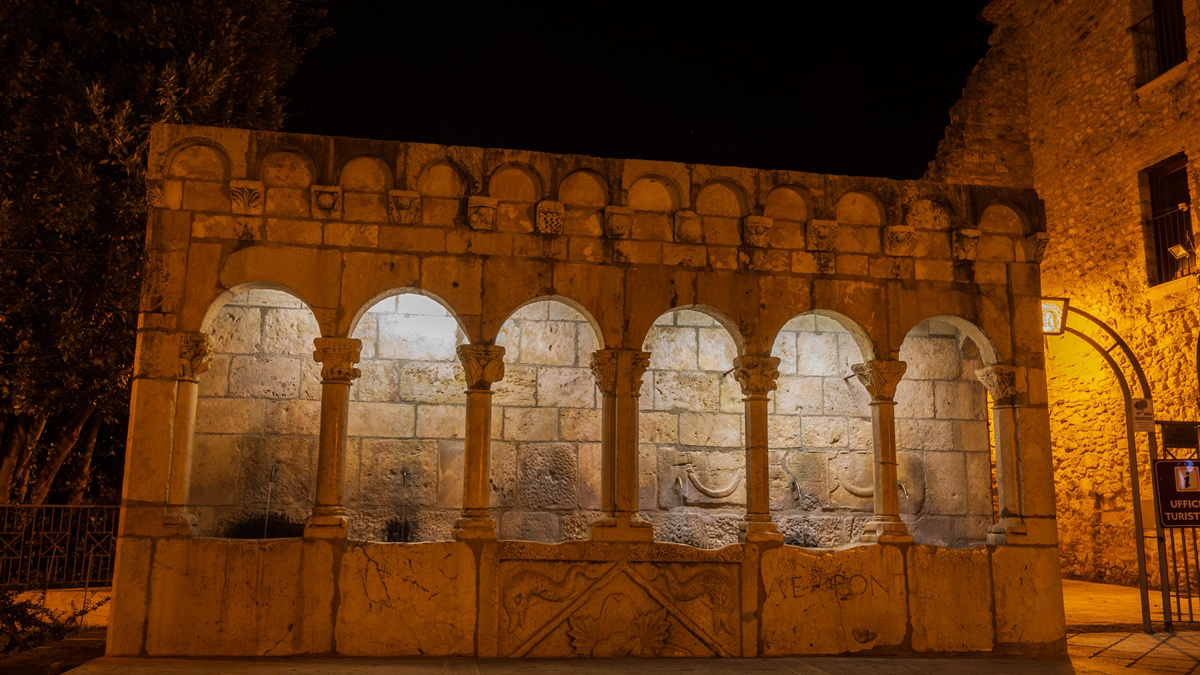
Isernia, Fontana Fraterna, notturne
2015
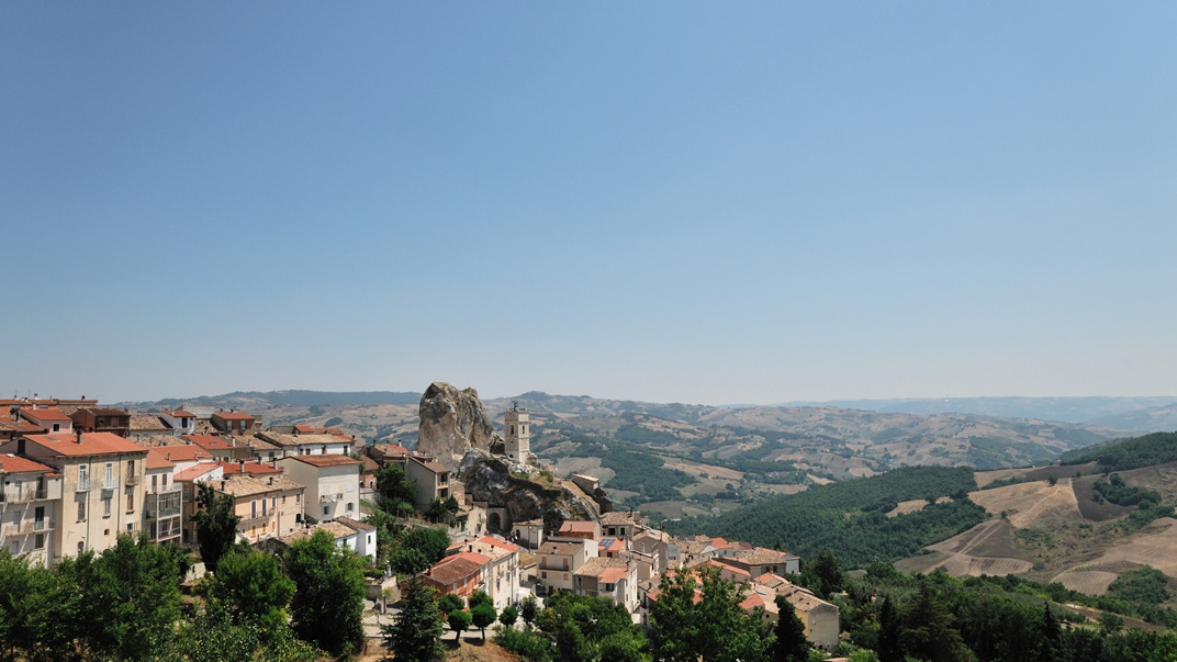
Molise - Pietracupa (CB)
Pietracupa è un comune italiano di 207 abitanti della provincia di Campobasso, in Molise. L'etimologia del nome è un composto di pietra, poiché costruito su un'enorme formazione calcarea, la "Morgia", e dell'aggettivo cupa, che in latino vuol dire "botte", in riferimento ai numerosi insediamenti rupestri ancora visibili in essa. È zona di villeggiatura estiva e di escursionismo.
2015
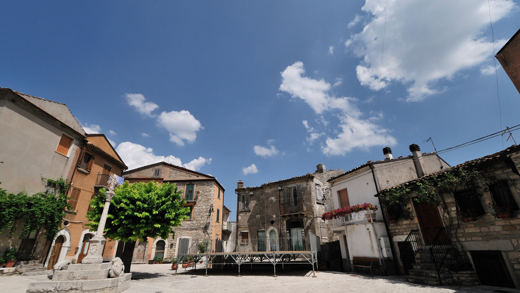
Frosolone (IS)
Frosolone con i suoi 3.250 abitanti circa è situato a m 894 sul livello del mare. Visibili da lontano, mentre continuano a girare, come gigantesche girandole lasciate lì chissà da quali bambini stanchi di giocare, i pali del campo prova eolico annunciano che ci stiamo avvicinando a Frosolone e alla sua montagna. E poi i profumi, il verde, l'aria pura e pungente. L'ambiente montano è un sorprendente "mare di verde", uno scrigno prezioso che raccoglie meraviglie dove alberi secolari, stagni e laghetti, cucuzzoli e paesaggi scoscesi, rocce bianche e rifugi, sanno accogliere sapientemente valori paesaggistici (floristici e faunistici) miracolosamente inviolati fino ai nostri giorni.
Tutti i mesi dell'anno vanno bene e qualsiasi stagione è buona per visitare la montagna di Frosolone, perché ogni periodo dell'anno è buono per fruire e godere delle sue bellezze. Quassù, su questi monti, anche a più di mille metri sono riusciti a vegetare alberi di faggio e la faggeta di Monte Marchetta e di Colle dell'Orso rappresenta uno dei rari esempi in cui questa specie vegetale è riuscita a convivere felicemente con il clima di queste altitudini.
Il più grosso rappresentante vivente è il maestoso faggio del Pedalone, vero e proprio colosso botanico vecchio più di cento anni e alto più di quaranta metri. Proprio in ogni stagione dell'anno, lo spettacolo che offre il Bosco della Grisciata è davvero impareggiabile e ci accompagna fino ai verdi prati e poi alla Valle della Contessa ricoperta di arbusti di uva spina e di siepi di rosa canina.
2022
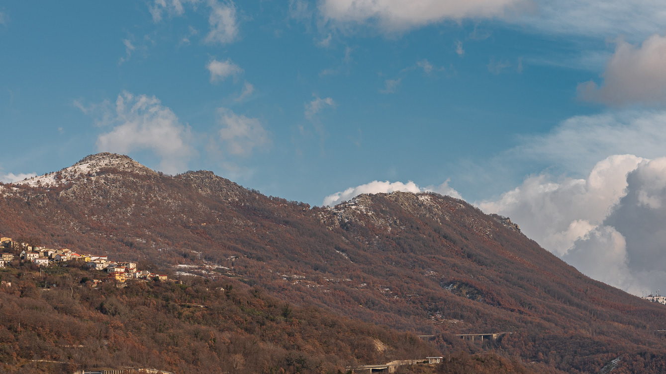
Cerro al Volturno. Winter 2022
Cerro al Volturno (Cièrrë in Molise) is an Italian town of 1 194 inhabitants in the province of Isernia in Molise, about 20 km from the border with Abruzzo. The municipality is also simply called Cerro because of its territory rich in oak woods, among which the Cerro, Quercus cerris, stands out. The Cerrese territory is on the border with the National Park of Abruzzo, Lazio and Molise. The climate is mainly of the Apennine type: cool and rainy autumn, cold and snowy winter and mild summer. The town was founded by the Samnites (III century BC), of which fortifications remain at Mount Santa Croce. In medieval times the hill of the present village was colonized by peasants (9th century), since the fiefdom depended on the nearby Abbey of San Vincenzo al Volturno. The origin of the community itself is linked to the influence of the abbey of San Vincenzo al Volturno, one of the oldest Benedictine monasteries in the Kingdom of Naples and in the land of San Pietro, together with Montecassino and Farfa. Cerro already existed since 899, as evidenced in the Chrnicon Vulturnense, when Roffredo, abbot of San Vincenzo led the first peasant colony to cultivate the lands in the place of Cerrum, from the name of the oak trees. The 11th century Norman castle was later owned by the Filangieri, Borrello and Cantelmo di Popoli family, until the 15th century, when it passed to the Pandone family, who renovated it extensively. In the following centuries the feud belonged to various families, including the Carafa. In 1811 the village passed to the territory of Benevento, and only in 1861 was it included again in Molise, first linked to the territory of Piedimonte Matese, and then to the area of Castellone Volturno, i.e. Castel San Vincenzo. Since 1970 it has been part of the province of Isernia.
2010
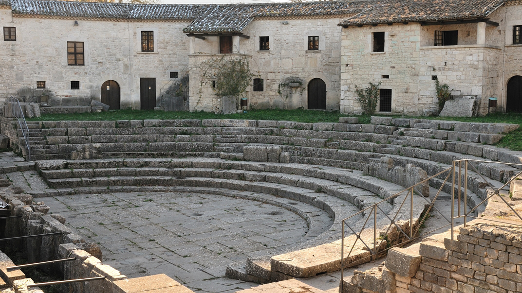
Sepino (CB) - Saepinum
2017
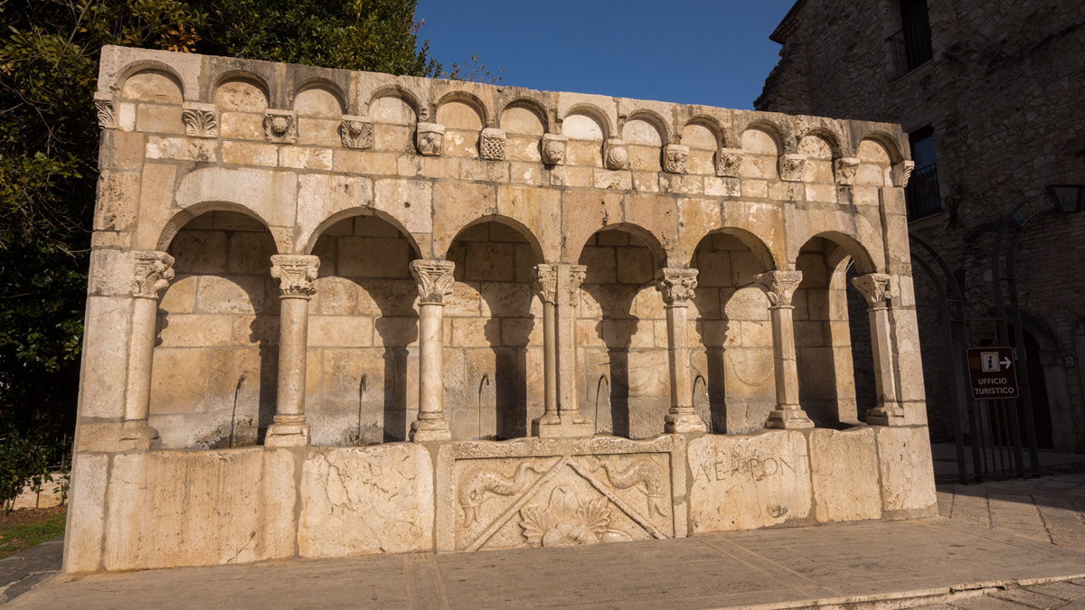
Isernia - Fontana Fraterna
La "fontana Fraterna" (o fontana della Fraterna, fontana della Concezione, fontana delle Sette Cannelle o semplicemente Fraterna) è un'elegante fonte pubblica, nonché simbolo, della città di Isernia. Annoverata dall'Enciclopedia Treccani fra le più belle d'Italia, con sei getti d'acqua, dalle inusuali forme di un loggiato, realizzata con blocchi di pietra calcarea compatta, è una delle opere più significative e più importanti del comune pentro. Anticamente sorgeva in piazza Fraterna, di fronte alla chiesa della Concezione, ma dopo il bombardamento alleato del 1943 è situata in piazza Celestino V (ex largo Concezione), nel cuore del centro storico della città.
2023
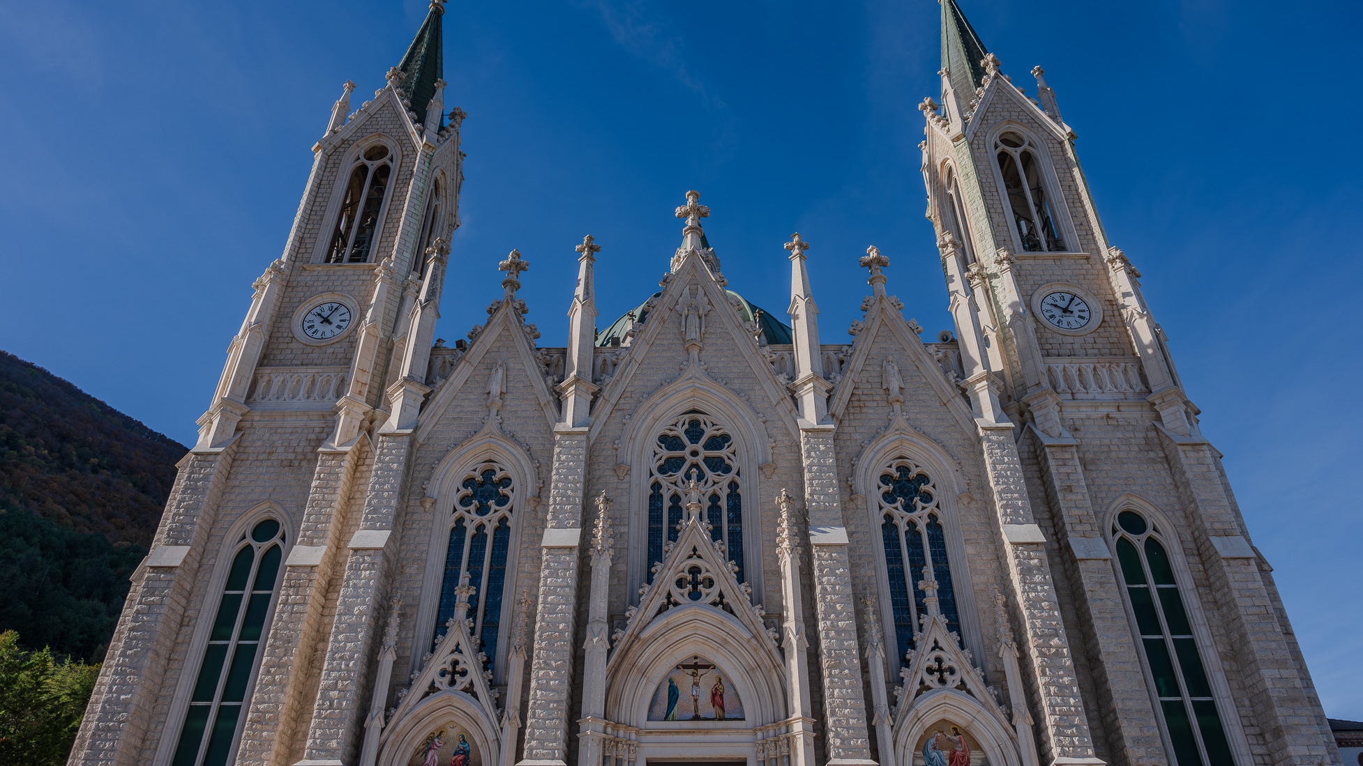
Castelpetroso. Sanctuary of the Madonna Addolorata
The basilica sanctuary of Maria Santissima Addolorata, or simply the Addolorata basilica is an important Catholic place of worship located in the municipality of Castelpetroso, in the province of Isernia, and belonging to the archdiocese of Campobasso-Boiano. According to the testimony of the visionaries, the Virgin Mary appeared for the first time on March 22, 1888 to two shepherdesses named Serafina and Bibiana in the locality of Cesa tra Santi, on the slopes of Mount Patalecchia. This first apparition was followed by others and, following the recognition of this phenomenon, Pope Paul VI proclaimed Maria Santissima Addolorata of Castelpetroso patroness of Molise on 6 December 1973. In the 1890s, it was decided to build a sanctuary near the place of the apparitions, but further downstream from this, so that it would be more easily accessible by pilgrims. The project was entrusted to Giuseppe Gualandi, whose death (1944) was succeeded by his son Francesco. On 28 September 1890 the first stone was laid and construction of the sanctuary began. It proceeded slowly due to economic problems and the two world wars: in 1907 the chapel of the Poles was finished and opened for worship, but the perimeter walls of the church were completed only in 1950, thanks to donations from don Nicolino Passarelli, canon theologian of the cathedral of Venafro, lawyer of the Sacra Rota and professor. In the following decades the sanctuary was completed and consecrated on 21 September 1975 by the bishop of Boiano-Campobasso Alberto Carinci.
2025
The Guardialfiera or Liscione lake
